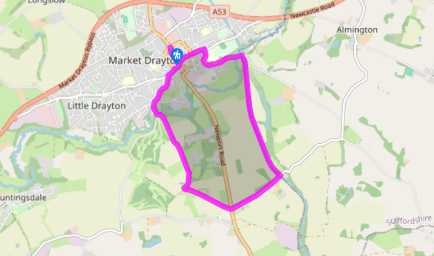
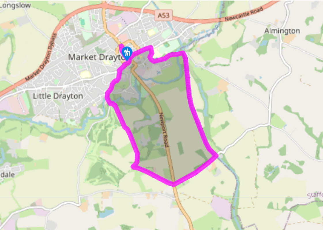
Walk past the bus station, cross at the zebra crossing, then turn left down Queen Street (part pedestrianised) then left on Stafford Street. Go straight on at the first junction, right at the next on to Great Hales Street and then left on Berrisford Road (use the easily missed footway on the left until forced to join the road).
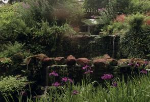
You’ll soon come to Berrisford Bridge, also known as 40 Steps Aqueduct, which carries the Shropshire Union Canal over the road. Go up the steps and turn right on the towpath. This part of the Shroppie system was originally the Birmingham and Liverpool Junction Canal, which went from Autherley to Nantwich. The engineer was Thomas Telford and the boldness of his design is apparent along this stretch, with its massive cuttings and embankments. The deep cutting on the approach to Tyrley Locks has its own microclimate, and positively drips with ferns, mosses and liverworts. The towpath marks the county boundary – this stretch of the canal is in Staffordshire.
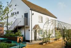
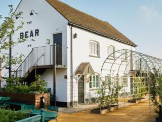
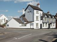
Go under Bridge 60 by Tyrley Wharf then up steps to the lock gate. Turn sharp right to the lane (Tyrley Road) and turn left. This leads to the main road (A529) and a pub called The Four Alls Inn. Cross with care to Sandy Lane.
Sandy Lane comes to a T-junction with a track. Turn right here; it’s still Sandy Lane, but this part is a private road and dogs must be kept on a lead. It heads north towards Drayton, overlooked by Salisbury Hill, where a Yorkist army under the Earl of Salisbury camped in 1459 before heavily defeating a Lancastrian force twice the size.
When you meet a road, turn right to cross the River Tern at Walkmill Bridge (a pack-horse bridge). Cross a wider road and go up Kilnbank Road opposite. Where it ends, turn right. After passing Sandbrook Vaults, onto Cheshire Street, carry on to join Queen Street which leads back to Towers Lawn.
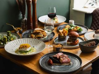
In 1245, at the behest of Abbot Simon of Combermere Abbey, Henry III granted Market Drayton a charter for a Wednesday market and two annual fairs. Marketing has been its main role ever since, serving a large area of rural Shropshire, Staffordshire and Cheshire. Abbot Simon wasn’t just thinking of... the local peasants and farmers – his monks had their own produce to sell. They cultivated vines and kept honeybees, as well as participating in dairy farming, which flourished in the fertile countryside. Food has always been the main focus for Market Drayton’s traders and, even today, the town is full of small, independent shops selling a wide range of locally made produce. Every Wednesday Cheshire Street is still submerged by a flood of colourful stalls heaped high with food, along with goods from the Staffordshire Potteries. So you can buy your cake and the plate to eat it from too. To compete in the modern world, Drayton now markets itself and the theme is still food, as it tries to entice tourists to the ‘home of gingerbread’. First made here in 1817, for many years there were four gingerbread dynasties in town, each with its own secret recipe. People then enjoyed gingerbread in ‘junks as big as my foot’, but nowadays you can buy it fashioned into hearts, teddy bears, sheep or even footballers. Traditionally, Draytonians dunked their gingerbread in port but one of the most popular recipes also used rum. Billington’s gingerbread is still made locally to a secret recipe, but Drayton also boasts plenty of other specialities, such as damson jam, damson cheese and damson gin, which possibly goes down well with a bit of rum-soaked, port-dunked gingerbread. Go into one of the bakers in town and you can choose from other local treats like butter buns, lardy cakes and oven bottoms, while pikelets and oatcakes from the Potteries are popular too. Since the 16th-century, Drayton has been famous for dairy goods. Yogurt is made in a factory on the edge of town, but farm-made yogurts are also on sale in the shops, along with excellent cheeses. It is said that the only un-pasteurised Cheshire cheese still made in England comes from Market Drayton. Robert Clive was born near Market Drayton in 1725 and he terrorised the town as a boy. His despairing family packed him off to India where he achieved great wealth and prestige in the process of establishing British supremacy there. Despite his fame, it’s his culinary contribution they celebrate in Drayton. At the Clive and Coffyne (a coffyne is a pie case) they serve an award-winning Clive of India Pie which is said to be based on a recipe given by Clive in 1768 to the bakers of Pézenas in France.
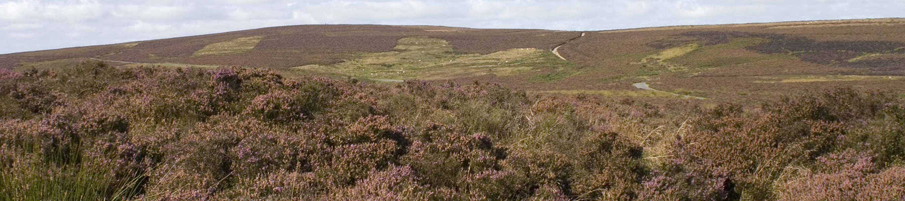
Perhaps nowhere else in England will you find a county so deeply rural and with so much variety as Shropshire. Choose a clear day, climb to the top of The Wrekin, and look down on that ‘land of lost content’ so wistfully evoked by A E Housman.
Walk past the bus station, cross at the zebra crossing, then turn left down Queen Street (part pedestrianised) then left on Stafford Street. Go straight on at the first junction, right at the next on to Great Hales Street and then left on Berrisford Road (use the easily missed footway on the left until forced to join the road).
1 of 5
You’ll soon come to Berrisford Bridge, also known as 40 Steps Aqueduct, which carries the Shropshire Union Canal over the road. Go up the steps and turn right on the towpath. This part of the Shroppie system was originally the Birmingham and Liverpool Junction Canal, which went from Autherley to Nantwich. The engineer was Thomas Telford and the boldness of his design is apparent along this stretch, with its massive cuttings and embankments. The deep cutting on the approach to Tyrley Locks has its own microclimate, and positively drips with ferns, mosses and liverworts. The towpath marks the county boundary – this stretch of the canal is in Staffordshire.
2 of 5
Go under Bridge 60 by Tyrley Wharf then up steps to the lock gate. Turn sharp right to the lane (Tyrley Road) and turn left. This leads to the main road (A529) and a pub called The Four Alls Inn. Cross with care to Sandy Lane.
3 of 5
Sandy Lane comes to a T-junction with a track. Turn right here; it’s still Sandy Lane, but this part is a private road and dogs must be kept on a lead. It heads north towards Drayton, overlooked by Salisbury Hill, where a Yorkist army under the Earl of Salisbury camped in 1459 before heavily defeating a Lancastrian force twice the size.
4 of 5
When you meet a road, turn right to cross the River Tern at Walkmill Bridge (a pack-horse bridge). Cross a wider road and go up Kilnbank Road opposite. Where it ends, turn right. After passing Sandbrook Vaults, onto Cheshire Street, carry on to join Queen Street which leads back to Towers Lawn.
In 1245, at the behest of Abbot Simon of Combermere Abbey, Henry III granted Market Drayton a charter for a Wednesday market and two annual fairs. Marketing has been its main role ever since, serving a large area of rural Shropshire, Staffordshire and Cheshire. Abbot Simon wasn’t just thinking of... the local peasants and farmers – his monks had their own produce to sell. They cultivated vines and kept honeybees, as well as participating in dairy farming, which flourished in the fertile countryside. Food has always been the main focus for Market Drayton’s traders and, even today, the town is full of small, independent shops selling a wide range of locally made produce. Every Wednesday Cheshire Street is still submerged by a flood of colourful stalls heaped high with food, along with goods from the Staffordshire Potteries. So you can buy your cake and the plate to eat it from too. To compete in the modern world, Drayton now markets itself and the theme is still food, as it tries to entice tourists to the ‘home of gingerbread’. First made here in 1817, for many years there were four gingerbread dynasties in town, each with its own secret recipe. People then enjoyed gingerbread in ‘junks as big as my foot’, but nowadays you can buy it fashioned into hearts, teddy bears, sheep or even footballers. Traditionally, Draytonians dunked their gingerbread in port but one of the most popular recipes also used rum. Billington’s gingerbread is still made locally to a secret recipe, but Drayton also boasts plenty of other specialities, such as damson jam, damson cheese and damson gin, which possibly goes down well with a bit of rum-soaked, port-dunked gingerbread. Go into one of the bakers in town and you can choose from other local treats like butter buns, lardy cakes and oven bottoms, while pikelets and oatcakes from the Potteries are popular too. Since the 16th-century, Drayton has been famous for dairy goods. Yogurt is made in a factory on the edge of town, but farm-made yogurts are also on sale in the shops, along with excellent cheeses. It is said that the only un-pasteurised Cheshire cheese still made in England comes from Market Drayton. Robert Clive was born near Market Drayton in 1725 and he terrorised the town as a boy. His despairing family packed him off to India where he achieved great wealth and prestige in the process of establishing British supremacy there. Despite his fame, it’s his culinary contribution they celebrate in Drayton. At the Clive and Coffyne (a coffyne is a pie case) they serve an award-winning Clive of India Pie which is said to be based on a recipe given by Clive in 1768 to the bakers of Pézenas in France.
Perhaps nowhere else in England will you find a county so deeply rural and with so much variety as Shropshire. Choose a clear day, climb to the top of The Wrekin, and look down on that ‘land of lost content’ so wistfully evoked by A E Housman.