"A high-level ridge wander in the western Mendips over a lot of geology to Somerset’s shapeliest summit."
Walk directions
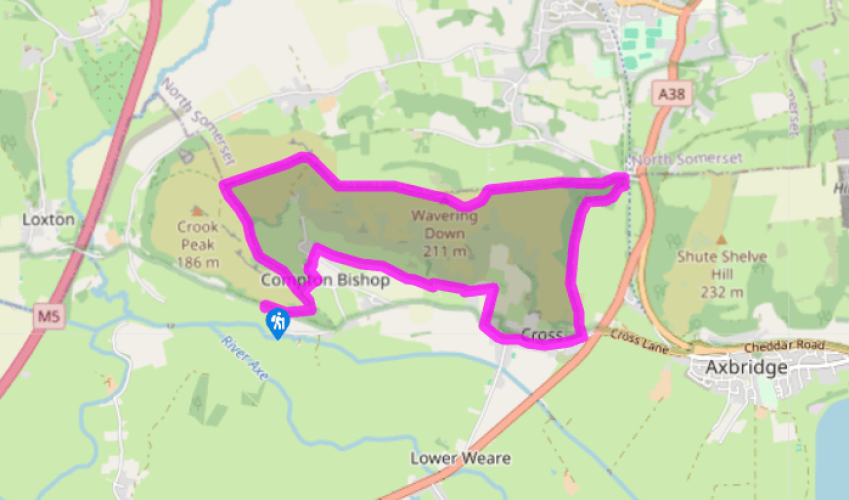
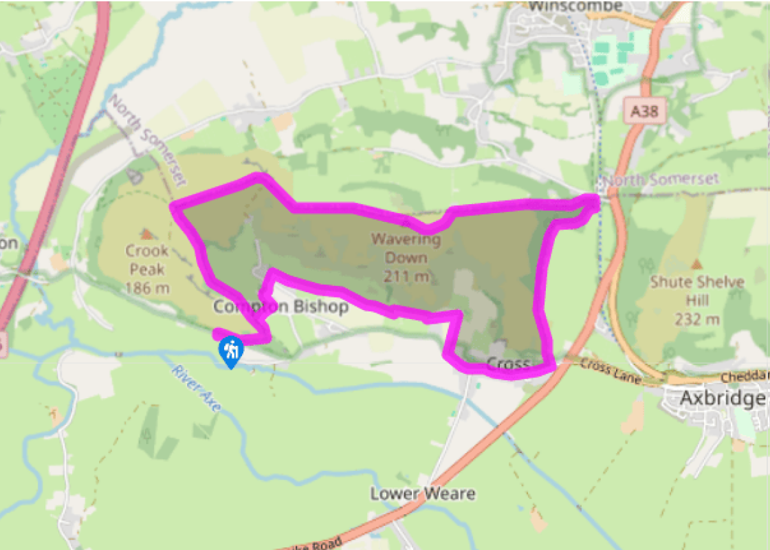
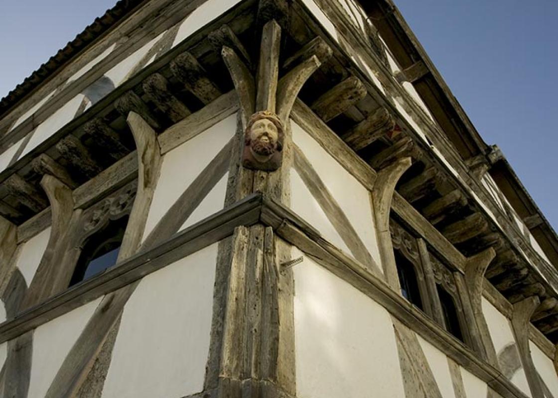
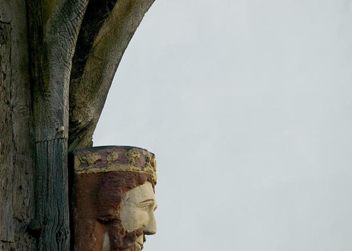
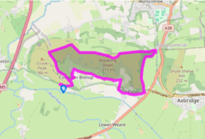
Cross the road to a wide gate on the right (not the small gate ahead). A wide path contours round through brambly scrub, crosses the ridge line and drops through a wood and then along its foot to a gate. Just below, a lane leads down into Compton Bishop. Turn left to the church.
The lane turns down, before the church, to a crossroads. Take the track opposite and follow it round a bend to its end. You will now contour round the base of the high slope of Wavering Down. Cross a stile, pass through a gate into a narrow paddock, and through another gate into a large field; keep along the bottom edge of this. At its corner keep ahead over a stile, then across the foot of three more fields. To avoid a bungalow, move 40yds (37m) uphill around a fence corner to another stile on the same level. Follow the long bottom edge of a field, then cross another under a power line, to a lane and turn right, down to the road. Turn left through Cross village.
At a 'Give Way 150yds' sign (warning of the A38 ahead) turn left up a steep rocky path. Above a small gate it turns right, and slants up between brambles to the top corner of a field. The path runs along the foot of woods, through two gates. Now a wide earth path, it finally emerges at the top of the car park located on Winscombe Hill.
Turn left, away from the car park, on a broad track, uphill. This rises through King's Wood, then dips slightly to pass the pantiled Hill Farm, before rising to the trig point on Wavering Down. Continue with a wall on your right to cross Barton Hill. In the dip below Crook Peak the wall ends. Waymarkers point to left and right, but keep ahead to climb the slightly crag-topped summit.
Turn left and (with the small rocky drop down to your left) head down on to a long gentle ridge – outcrops of limestone poke out through the shallow grass. At a railed barrier turn right on the path back to the car park.
The rock which forms the Mendips, as well as the White Peak and the Yorkshire Dales, used to be known as the Mountain Limestone. This name has sadly been abandoned – perhaps after complaints from the non-Mountain limestones of Everest, the Pyrenees and the Eiger… Now called Carboniferous limestone,... it was laid down at a time when England was under water and drifting slowly north across the Equator. The next rocks to form on top, as the Carboniferous sea became a swampy river-delta, were the coal measures. A thick layer of coal has in fact eroded off the top of the Mendips and, like the Pennines, the Mendips have a coal field next door. Comfort underfoot In the Pennines the limestone is layered with waterproof gritstone so that dry ground alternates with peat bog. The Mendips are limestone all the way down. This gives a very enjoyable form of walking or (perhaps even better) horse-riding. The grass is cropped short by roe deer and rabbits, and bright in spring with lime-loving wild flowers. The sides drop away in hawthorn scrub and the mildest of craggy bits to a wide, fertile plain. The path along the ridge is fast and easy, and every 20 minutes it peeps down into another wooded hollow. The other side of Somerset, the Quantocks, are a different sort of limestone but give the same delightful walking. Sadly, the Quantocks and the Mendips are small in area. Furthermore, elsewhere in England, or even in the world, there isn't very much of this limestone downland at all. Geological crunches Geologists believe that, oddly, this is the second time around for the Mendips. The continental collision nicknamed 'the Africa Crunch' folded the sea-bottom limestones into mountains of about Ben Nevis height (which isn't very high – Ben Nevis in its prime was Everest height). The soft, coal-like stuff was eroded away and the Mendip Mountains wore down to their present shape in the early dinosaur age. Then Britain sank, and the mountain outlines disappeared under thousands of feet (up to 1,000m) of ocean sediments. The next event, 'the Alpine Crunch', lifted everything up again about 50 million years ago, and since then the topping has gradually worn away to reveal the limestone landscape underneath. According to this theory, the limestone gorges around the Mendips have formed twice over. The first time, as wadis or desert valleys scoured by flash floods; the second time, under ice age conditions, with the underground waterways frozen. Thus contradictory geological notice boards explain Burrington Combe (desert wadi) and Cheddar Gorge (Ice Age meltwaters). Given that limestone gorges don't have rivers, they ought not to occur even once; doing it twice, for two different reasons, is good going!
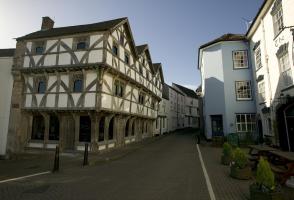
Somerset remains rural and unspoiled, and ever popular areas to visit are the limestone and red sandstone Mendip Hills rising to over 1,000 feet, and by complete contrast, to the south and southwest, the flat landscape of the Somerset Levels. Another popular spot, the Quantocks, once the haunt of poets Coleridge and Wordsworth, are noted for their gentle slopes, heather-covered moorland expanses and red deer.
"A high-level ridge wander in the western Mendips over a lot of geology to Somerset’s shapeliest summit."
Walk details
3hrs
Difficulty:
Medium
Gradient:
Moderate
Distance:
6 miles (9.7kms)
Ascent:
900ft (274m)
Walk directions
Cross the road to a wide gate on the right (not the small gate ahead). A wide path contours round through brambly scrub, crosses the ridge line and drops through a wood and then along its foot to a gate. Just below, a lane leads down into Compton Bishop. Turn left to the church.
1 of 5
The lane turns down, before the church, to a crossroads. Take the track opposite and follow it round a bend to its end. You will now contour round the base of the high slope of Wavering Down. Cross a stile, pass through a gate into a narrow paddock, and through another gate into a large field; keep along the bottom edge of this. At its corner keep ahead over a stile, then across the foot of three more fields. To avoid a bungalow, move 40yds (37m) uphill around a fence corner to another stile on the same level. Follow the long bottom edge of a field, then cross another under a power line, to a lane and turn right, down to the road. Turn left through Cross village.
2 of 5
At a 'Give Way 150yds' sign (warning of the A38 ahead) turn left up a steep rocky path. Above a small gate it turns right, and slants up between brambles to the top corner of a field. The path runs along the foot of woods, through two gates. Now a wide earth path, it finally emerges at the top of the car park located on Winscombe Hill.
3 of 5
Turn left, away from the car park, on a broad track, uphill. This rises through King's Wood, then dips slightly to pass the pantiled Hill Farm, before rising to the trig point on Wavering Down. Continue with a wall on your right to cross Barton Hill. In the dip below Crook Peak the wall ends. Waymarkers point to left and right, but keep ahead to climb the slightly crag-topped summit.
4 of 5
Turn left and (with the small rocky drop down to your left) head down on to a long gentle ridge – outcrops of limestone poke out through the shallow grass. At a railed barrier turn right on the path back to the car park.
The rock which forms the Mendips, as well as the White Peak and the Yorkshire Dales, used to be known as the Mountain Limestone. This name has sadly been abandoned – perhaps after complaints from the non-Mountain limestones of Everest, the Pyrenees and the Eiger… Now called Carboniferous limestone,... it was laid down at a time when England was under water and drifting slowly north across the Equator. The next rocks to form on top, as the Carboniferous sea became a swampy river-delta, were the coal measures. A thick layer of coal has in fact eroded off the top of the Mendips and, like the Pennines, the Mendips have a coal field next door. Comfort underfoot In the Pennines the limestone is layered with waterproof gritstone so that dry ground alternates with peat bog. The Mendips are limestone all the way down. This gives a very enjoyable form of walking or (perhaps even better) horse-riding. The grass is cropped short by roe deer and rabbits, and bright in spring with lime-loving wild flowers. The sides drop away in hawthorn scrub and the mildest of craggy bits to a wide, fertile plain. The path along the ridge is fast and easy, and every 20 minutes it peeps down into another wooded hollow. The other side of Somerset, the Quantocks, are a different sort of limestone but give the same delightful walking. Sadly, the Quantocks and the Mendips are small in area. Furthermore, elsewhere in England, or even in the world, there isn't very much of this limestone downland at all. Geological crunches Geologists believe that, oddly, this is the second time around for the Mendips. The continental collision nicknamed 'the Africa Crunch' folded the sea-bottom limestones into mountains of about Ben Nevis height (which isn't very high – Ben Nevis in its prime was Everest height). The soft, coal-like stuff was eroded away and the Mendip Mountains wore down to their present shape in the early dinosaur age. Then Britain sank, and the mountain outlines disappeared under thousands of feet (up to 1,000m) of ocean sediments. The next event, 'the Alpine Crunch', lifted everything up again about 50 million years ago, and since then the topping has gradually worn away to reveal the limestone landscape underneath. According to this theory, the limestone gorges around the Mendips have formed twice over. The first time, as wadis or desert valleys scoured by flash floods; the second time, under ice age conditions, with the underground waterways frozen. Thus contradictory geological notice boards explain Burrington Combe (desert wadi) and Cheddar Gorge (Ice Age meltwaters). Given that limestone gorges don't have rivers, they ought not to occur even once; doing it twice, for two different reasons, is good going!
Somerset remains rural and unspoiled, and ever popular areas to visit are the limestone and red sandstone Mendip Hills rising to over 1,000 feet, and by complete contrast, to the south and southwest, the flat landscape of the Somerset Levels. Another popular spot, the Quantocks, once the haunt of poets Coleridge and Wordsworth, are noted for their gentle slopes, heather-covered moorland expanses and red deer.