"A walk around the delightful estate village designed by a flamboyant Victorian railway magnate."
Walk directions
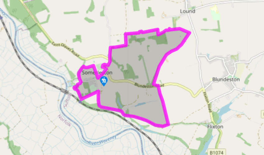
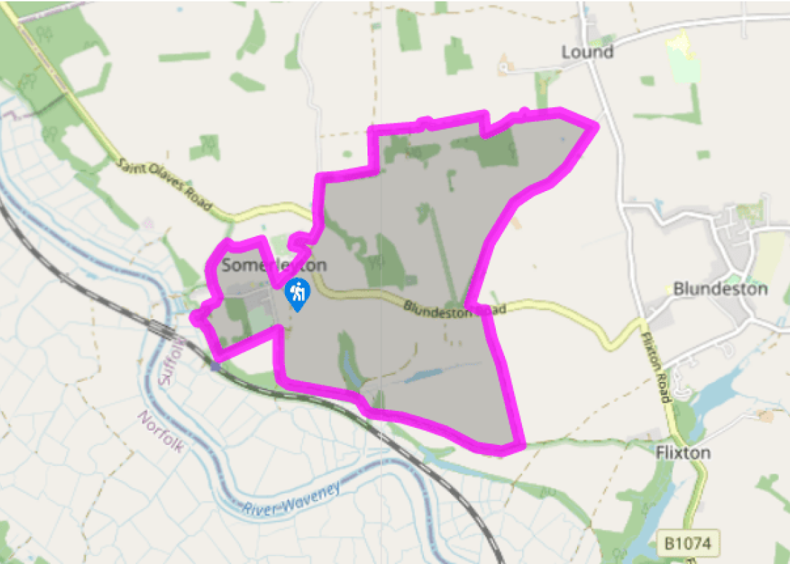
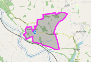
With the post office behind you, turn left and walk past estate cottages towards the village green. Look out to your right for the column erected in 2010 to commemorate the invention by Christopher Cockerell in 1955 of the hovercraft, testing for which took place on the River Waveney. Turn left to walk around the green and continue around the outside of the school. Return to the road, turn left and walk along the pavement opposite the red-brick wall of Somerleyton Park.
Follow this road round to the left and turn right on a lane signposted 'Ashby'. There are glimpses of Somerleyton Hall across parkland to your right. After 300yds (274m), turn right past a thatched lodge at the pedestrian entrance to Somerleyton Hall. Pass through the gates and keep on this lane for 400yds (366m), then turn left on to a field-edge path.
After 300yds (274m), turn right on to a farm track. Stay on this waymarked path as it swings left through the farmyard and continues alongside two fields, then turns sharp right towards a wood. Turn left to walk along the edge of the wood and keep to the path as it bends around a pond and enters a small belt of woodland. Keep right through the woods and pass next to a stile (there’s no need to cross it), then look for the second gap in the hedge to your right and bear half left on a crossfield path to reach a hedge and lane on the other side.
Turn right and stay on this lane for 1 mile (1.6km). Just before a road junction, take the field-edge path to your left and follow this round to a gap in the wall. Cross the B1074 and climb a stile to keep straight ahead on a field-edge path for almost 0.75 mile (1.2km).
Turn right at the end of this track along Waddling Lane. The path drops down towards the water-meadows with the railway and River Waveney to your left. When the path divides, fork left to climb around the edge of Waddling Wood. Keep straight ahead when a track joins from the left to head uphill and away from the woods.
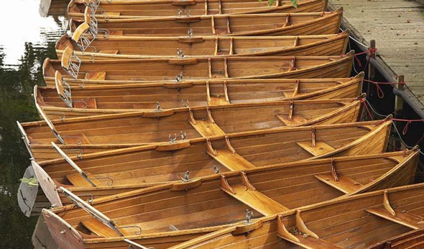
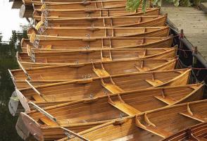
Turn left opposite Waveney Grange Farm and walk down towards the station. Turn right opposite the station entrance on a wide track. When the track bends right, keep left on a grassy path to drop down to a boatyard. Turn left around the boatyard buildings to reach a marina, then turn right past the marina and climb the access drive to a road.
Turn left and walk along the pavement as far as the Duke's Head pub. Stay on this road as it bends to the right with views of round-towered Herringfleet church over the hedge to your left. At the next bend, by the black railings of a cottage, turn right on a waymarked path. Follow this path along the edge of the field and turn right beyond a telegraph pole, towards a row of houses. At the end, turn left to return to the start of the walk.
The story book of Suffolk is filled with interesting characters but few had a more colourful life than Sir Samuel Morton Peto (1809-89) of Somerleyton Hall. At the age of 21, he took over his uncle's building business and he went on to become one of the great Victorian entrepreneurs. Together with... his cousin, Thomas Grissel, he was responsible for many of the most familiar public buildings in London, including Nelson's Column, the Houses of Parliament, several theatres, hospitals, prisons and even the brick sewers that are still in use today. Great Victorian entrepreneur Despite this, his first love was railways and he is best remembered as one of the pioneers of steam locomotion. During his lifetime he built more than 750 miles (1,206km) of railway line in Britain and 2,300 miles (3,700km) abroad, in Canada, Russia and Australia. During the Crimean War (1854-56), he built the world's first military railway at Balaclava, completely without profit, an act for which he was rewarded with a knighthood. He is also remembered locally as the father of modern Lowestoft. It was he who turned a small fishing village into a busy port with the construction of a harbour for 1,000 boats, and he built seaside hotels and a holiday resort on deserted marshes and scrubland. He built the railway link from Lowestoft to Norwich, opening up the town's fishing trade and fulfilling his promise that the morning catch from Lowestoft would arrive in Manchester in time for tea. The railway line still survives and there is still a station at Somerleyton, the village he made his own. Somerleyton Hall In 1843, Sir Morton Peto purchased Somerleyton Hall. He proceeded to rebuild this Jacobean mansion in the Anglo-Italian style favoured by wealthy Victorians and transformed the parkland. At the same time, he built the thatched red-brick estate cottages for his workers which contribute so much to the village's charm. He also provided the village with an unusual thatched school, which must be the prettiest school in Suffolk. The village as you see it today is almost totally the creation of Sir Morton Peto and his eccentric tastes in architecture. Sir Morton also found time to be the Liberal MP for Norwich for 20 years. However, in the best tradition of flamboyant entrepreneurs, it all went wrong in the end. In 1866, he was declared bankrupt with unpaid debts of one million pounds. Somerleyton Hall was bought by the carpet manufacturer Sir Francis Crossley, whose son became the first Lord Somerleyton. His great-grandson, the present Lord Somerleyton, still lives in the hall and can often be seen riding around his estate.
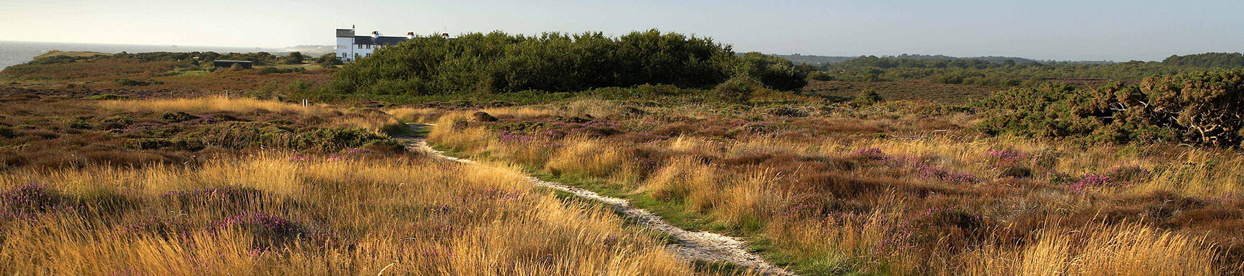
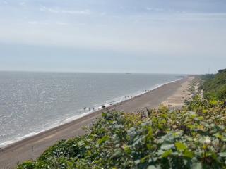
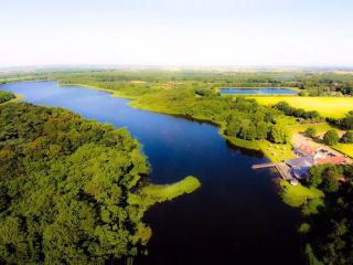
Suffolk is Constable country, where the county’s crumbling, time-ravaged coastline spreads itself under wide skies to convey a wonderful sense of remoteness and solitude. Highly evocative and atmospheric, this is where rivers wind lazily to the sea and notorious 18th-century smugglers hid from the excise men.
"A walk around the delightful estate village designed by a flamboyant Victorian railway magnate."
Walk details
2hrs 30min
Difficulty:
Medium
Gradient:
Gentle
Distance:
6.25 miles (10.1kms)
Ascent:
131ft (40m)
Walk directions
With the post office behind you, turn left and walk past estate cottages towards the village green. Look out to your right for the column erected in 2010 to commemorate the invention by Christopher Cockerell in 1955 of the hovercraft, testing for which took place on the River Waveney. Turn left to walk around the green and continue around the outside of the school. Return to the road, turn left and walk along the pavement opposite the red-brick wall of Somerleyton Park.
1 of 7
Follow this road round to the left and turn right on a lane signposted 'Ashby'. There are glimpses of Somerleyton Hall across parkland to your right. After 300yds (274m), turn right past a thatched lodge at the pedestrian entrance to Somerleyton Hall. Pass through the gates and keep on this lane for 400yds (366m), then turn left on to a field-edge path.
2 of 7
After 300yds (274m), turn right on to a farm track. Stay on this waymarked path as it swings left through the farmyard and continues alongside two fields, then turns sharp right towards a wood. Turn left to walk along the edge of the wood and keep to the path as it bends around a pond and enters a small belt of woodland. Keep right through the woods and pass next to a stile (there’s no need to cross it), then look for the second gap in the hedge to your right and bear half left on a crossfield path to reach a hedge and lane on the other side.
3 of 7
Turn right and stay on this lane for 1 mile (1.6km). Just before a road junction, take the field-edge path to your left and follow this round to a gap in the wall. Cross the B1074 and climb a stile to keep straight ahead on a field-edge path for almost 0.75 mile (1.2km).
4 of 7
Turn right at the end of this track along Waddling Lane. The path drops down towards the water-meadows with the railway and River Waveney to your left. When the path divides, fork left to climb around the edge of Waddling Wood. Keep straight ahead when a track joins from the left to head uphill and away from the woods.
5 of 7
Turn left opposite Waveney Grange Farm and walk down towards the station. Turn right opposite the station entrance on a wide track. When the track bends right, keep left on a grassy path to drop down to a boatyard. Turn left around the boatyard buildings to reach a marina, then turn right past the marina and climb the access drive to a road.
6 of 7
Turn left and walk along the pavement as far as the Duke's Head pub. Stay on this road as it bends to the right with views of round-towered Herringfleet church over the hedge to your left. At the next bend, by the black railings of a cottage, turn right on a waymarked path. Follow this path along the edge of the field and turn right beyond a telegraph pole, towards a row of houses. At the end, turn left to return to the start of the walk.
The story book of Suffolk is filled with interesting characters but few had a more colourful life than Sir Samuel Morton Peto (1809-89) of Somerleyton Hall. At the age of 21, he took over his uncle's building business and he went on to become one of the great Victorian entrepreneurs. Together with... his cousin, Thomas Grissel, he was responsible for many of the most familiar public buildings in London, including Nelson's Column, the Houses of Parliament, several theatres, hospitals, prisons and even the brick sewers that are still in use today. Great Victorian entrepreneur Despite this, his first love was railways and he is best remembered as one of the pioneers of steam locomotion. During his lifetime he built more than 750 miles (1,206km) of railway line in Britain and 2,300 miles (3,700km) abroad, in Canada, Russia and Australia. During the Crimean War (1854-56), he built the world's first military railway at Balaclava, completely without profit, an act for which he was rewarded with a knighthood. He is also remembered locally as the father of modern Lowestoft. It was he who turned a small fishing village into a busy port with the construction of a harbour for 1,000 boats, and he built seaside hotels and a holiday resort on deserted marshes and scrubland. He built the railway link from Lowestoft to Norwich, opening up the town's fishing trade and fulfilling his promise that the morning catch from Lowestoft would arrive in Manchester in time for tea. The railway line still survives and there is still a station at Somerleyton, the village he made his own. Somerleyton Hall In 1843, Sir Morton Peto purchased Somerleyton Hall. He proceeded to rebuild this Jacobean mansion in the Anglo-Italian style favoured by wealthy Victorians and transformed the parkland. At the same time, he built the thatched red-brick estate cottages for his workers which contribute so much to the village's charm. He also provided the village with an unusual thatched school, which must be the prettiest school in Suffolk. The village as you see it today is almost totally the creation of Sir Morton Peto and his eccentric tastes in architecture. Sir Morton also found time to be the Liberal MP for Norwich for 20 years. However, in the best tradition of flamboyant entrepreneurs, it all went wrong in the end. In 1866, he was declared bankrupt with unpaid debts of one million pounds. Somerleyton Hall was bought by the carpet manufacturer Sir Francis Crossley, whose son became the first Lord Somerleyton. His great-grandson, the present Lord Somerleyton, still lives in the hall and can often be seen riding around his estate.
Suffolk is Constable country, where the county’s crumbling, time-ravaged coastline spreads itself under wide skies to convey a wonderful sense of remoteness and solitude. Highly evocative and atmospheric, this is where rivers wind lazily to the sea and notorious 18th-century smugglers hid from the excise men.