"An unavoidably long and strenuous day across the lonely moor initially following a disused trackbed, then across pathless moorland and tracks to the tranquil village of Holne"
Walk directions
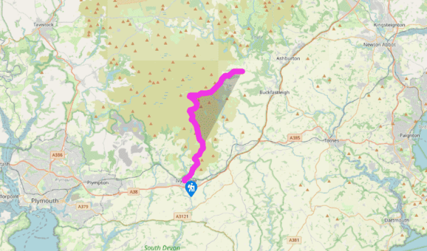
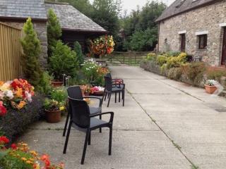
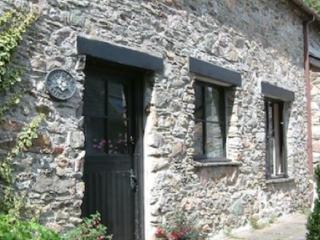
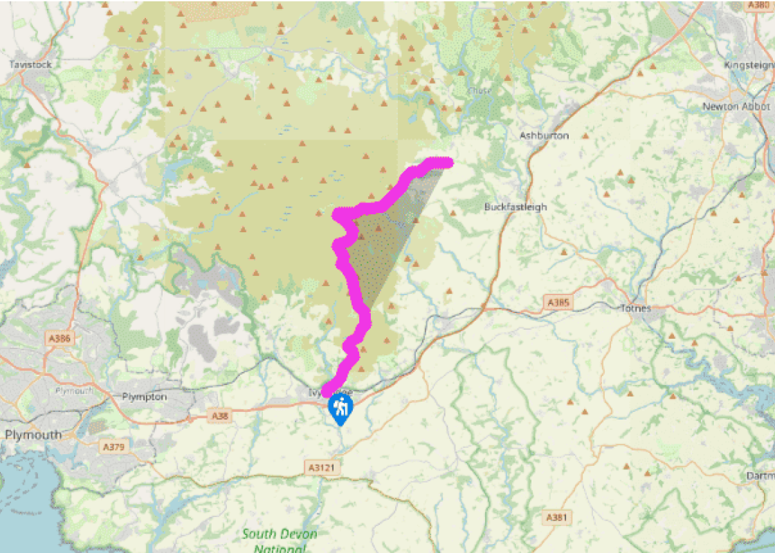
From The Watermark follow the signed path north to cross the road and follow the Erme briefly. Keep ahead up Harford Road to pass the former paper mill and school, to reach Stowford Bridge over the railway, where an engraved stone marks the Two Moors Way.
Continue straight ahead for a few hundred yards and turn right along a lane signposted ‘Bridleway to the moor’. A left turn takes you up a track to reach the moor gate.
Continue ahead along a broad grassy path, bearing half right, to reach an obvious track, the bed of a tramway used between 1910 and 1932 by the isolated Redlake china clay works, 6 miles (9.6km) further north. There are views left to the huge modern china clay works at Headon and Lee Moor. Follow the track up to Spurrell’s Cross on the ridge. Although it has been restored, only the head of the cross remains. Most such crosses are medieval and mark routes over the moors uses by local abbeys.
From Spurrell’s Cross return to the tramway and continue north along it. Running alongside to the left is one of Dartmoor’s longest stone rows, over 1.5 miles (2.5km) long. Hobajon’s Cross is inscribed on one of its stones, although the name may refer to a former cross. The purpose of most Bronze Age stone rows is unclear. This one is extended by more recent boundary stones, dividing Ugborough from Harford Commons.
The route passes the flooded pit of Leftlake china clay works, closed in the 1920s.
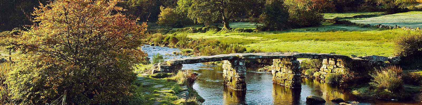
After a sharp right-hand bend leave the tramway by some ruins (a granite boulder is inscribed with an arrow right) and continues ahead on the Abbot’s Way, down the Avon Valley to Huntingdon Warren. Drop steeply into the valley to meet the river then turn left to find the medieval clapper bridge. Huntingdon Warren above was a rabbit enclosure with many ‘pillow mounds’ in which the rabbits burrowed. Turn right along the north bank (rough ground) to find 16th-century Huntingdon Cross tucked in behind a wall near the river.
Cross the Western Wella Brook ahead and ascend Hickaton Hill; where the ground levels meet a track by a low boundary wall and turn right, downhill, below and to the right of Pupers Rock. The route starts to descend; at a vague fork bear left around the slopes of Buckfastleigh Moor. Descend into the valley of River Mardle, crossing it by a footbridge at Chalk Ford.
Follow the track uphill; eventually this becomes a long green lane descending into the centre of Scorriton, a small farming community with a chapel built in 1904.
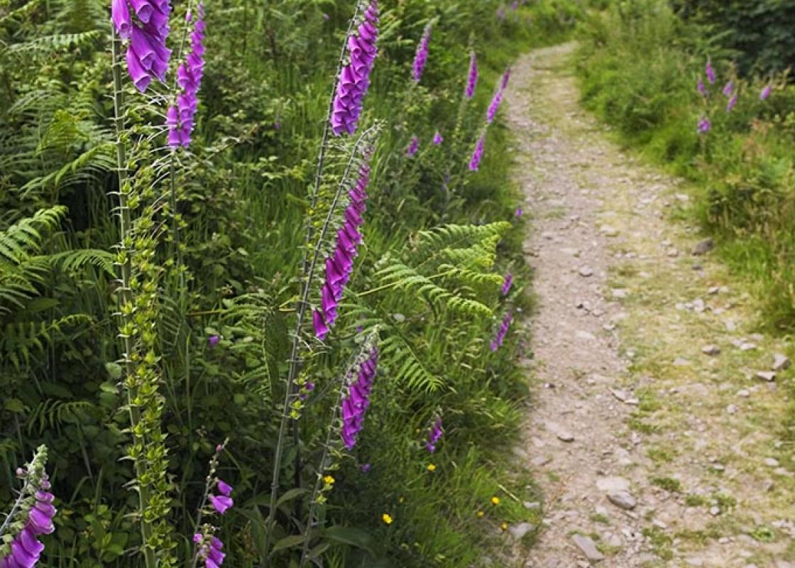
Despite the fact that the route of the Two Moors Way misses the highest parts of the moor (on the northwestern edge), and although the first few miles of this stage are along an obvious track, this is not an easy walk. The route is very exposed, particularly bleak in a strong westerly wind, and... very wet underfoot in places. Proper equipment and a decent pair of boots are essential, and a good knowledge of map and compass; if you are unsure of your navigational skills do not attempt this stage in bad weather. By complete contrast to Stages 1 and 2, this moorland section of the route is unsigned. This stage starts from Ivybridge, originally a small hamlet around its 13th-century packhorse bridge – the inspiration for the painting ‘The Ivy Bridge’ by J M W Turner – and later a staging post on the London to Plymouth road. In the latter half of the 19th century it increased in size with the development of mills along the Erme and the coming of the railway (in 1848). Its church was built in 1882. Bypassed by the A38 in 1973 – and designated officially as a town only four years later – the town is by far the biggest settlement encountered on the Two Moors Way. The route passes above Piles Copse in the Erme Valley, stunted oaks covered in ferns, mosses and lichens and one of only three remaining relics of Dartmoor’s prehistoric forest cover.
Devon sums up all that is best about the British landscape, with its magnificent coastlines, two historic cities, the world-famous Dartmoor National Park and south Devon’s glorious English Riviera. A fashionable and much-loved holiday destination, hiking and cycling in the National Parks is extremely popular among visitors, with a great choice of off-road routes.
"An unavoidably long and strenuous day across the lonely moor initially following a disused trackbed, then across pathless moorland and tracks to the tranquil village of Holne"
Walk details
7hrs
Difficulty:
Hard
Gradient:
Moderate
Distance:
13 miles (21kms)
Ascent:
1604ft (489m)
Walk directions
From The Watermark follow the signed path north to cross the road and follow the Erme briefly. Keep ahead up Harford Road to pass the former paper mill and school, to reach Stowford Bridge over the railway, where an engraved stone marks the Two Moors Way.
1 of 8
Continue straight ahead for a few hundred yards and turn right along a lane signposted ‘Bridleway to the moor’. A left turn takes you up a track to reach the moor gate.
2 of 8
Continue ahead along a broad grassy path, bearing half right, to reach an obvious track, the bed of a tramway used between 1910 and 1932 by the isolated Redlake china clay works, 6 miles (9.6km) further north. There are views left to the huge modern china clay works at Headon and Lee Moor. Follow the track up to Spurrell’s Cross on the ridge. Although it has been restored, only the head of the cross remains. Most such crosses are medieval and mark routes over the moors uses by local abbeys.
3 of 8
From Spurrell’s Cross return to the tramway and continue north along it. Running alongside to the left is one of Dartmoor’s longest stone rows, over 1.5 miles (2.5km) long. Hobajon’s Cross is inscribed on one of its stones, although the name may refer to a former cross. The purpose of most Bronze Age stone rows is unclear. This one is extended by more recent boundary stones, dividing Ugborough from Harford Commons.
4 of 8
The route passes the flooded pit of Leftlake china clay works, closed in the 1920s.
5 of 8
After a sharp right-hand bend leave the tramway by some ruins (a granite boulder is inscribed with an arrow right) and continues ahead on the Abbot’s Way, down the Avon Valley to Huntingdon Warren. Drop steeply into the valley to meet the river then turn left to find the medieval clapper bridge. Huntingdon Warren above was a rabbit enclosure with many ‘pillow mounds’ in which the rabbits burrowed. Turn right along the north bank (rough ground) to find 16th-century Huntingdon Cross tucked in behind a wall near the river.
6 of 8
Cross the Western Wella Brook ahead and ascend Hickaton Hill; where the ground levels meet a track by a low boundary wall and turn right, downhill, below and to the right of Pupers Rock. The route starts to descend; at a vague fork bear left around the slopes of Buckfastleigh Moor. Descend into the valley of River Mardle, crossing it by a footbridge at Chalk Ford.
7 of 8
Follow the track uphill; eventually this becomes a long green lane descending into the centre of Scorriton, a small farming community with a chapel built in 1904.
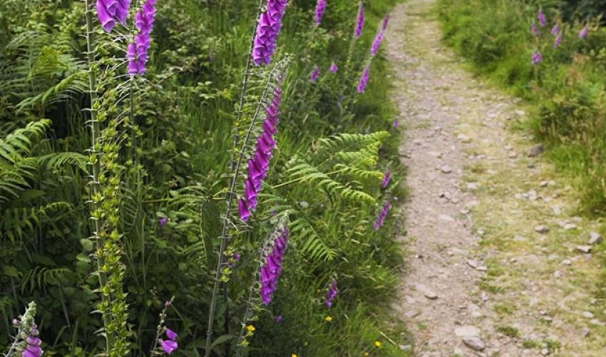
Despite the fact that the route of the Two Moors Way misses the highest parts of the moor (on the northwestern edge), and although the first few miles of this stage are along an obvious track, this is not an easy walk. The route is very exposed, particularly bleak in a strong westerly wind, and... very wet underfoot in places. Proper equipment and a decent pair of boots are essential, and a good knowledge of map and compass; if you are unsure of your navigational skills do not attempt this stage in bad weather. By complete contrast to Stages 1 and 2, this moorland section of the route is unsigned. This stage starts from Ivybridge, originally a small hamlet around its 13th-century packhorse bridge – the inspiration for the painting ‘The Ivy Bridge’ by J M W Turner – and later a staging post on the London to Plymouth road. In the latter half of the 19th century it increased in size with the development of mills along the Erme and the coming of the railway (in 1848). Its church was built in 1882. Bypassed by the A38 in 1973 – and designated officially as a town only four years later – the town is by far the biggest settlement encountered on the Two Moors Way. The route passes above Piles Copse in the Erme Valley, stunted oaks covered in ferns, mosses and lichens and one of only three remaining relics of Dartmoor’s prehistoric forest cover.
Devon sums up all that is best about the British landscape, with its magnificent coastlines, two historic cities, the world-famous Dartmoor National Park and south Devon’s glorious English Riviera. A fashionable and much-loved holiday destination, hiking and cycling in the National Parks is extremely popular among visitors, with a great choice of off-road routes.