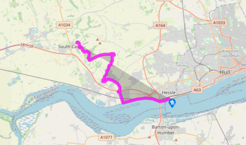
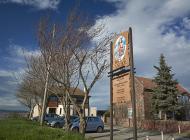
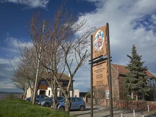
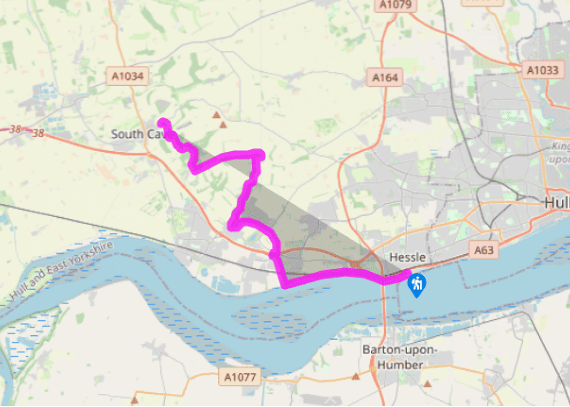
Cross over the road from the San Luca Restaurant and take the gravel path. This turns right along the riverbank and heads towards the Humber Bridge. (To reach the start from Hessle station, use a footbridge a short way east to cross the busy main road. At the end turn left along Livingstone Road to the San Luca.)
Continue for 2.5 miles (4km) beside the River Humber. The route here is shared with the Trans-Pennine Trail, a 215 mile (346km) multi–user route from Southport on the west coast to Hornsea on the east. On the approach to North Ferriby, pass a former brickyard pond that is now a conservation area.
Soon steps lead down to the foreshore. However, if the tide is high, follow signs indicating an alternative route (in essence, follow the Trans-Pennine Trail). If you proceed along the shore and then decide the tide seems too high after all, there’s another ‘escape route’ after about 0.25 miles (400m), where another set of steps leads into a car-park; go straight up the road, past Ferriby station and turn left on the B1231 to regain the Trans-Pennine Trail. Normally the tide will be low enough and you can continue along the shore for a further 0.25 miles (400m).
Another set of steps gives access into Long Plantation. Continue through the plantation to the B1231– A63 junction, where all the route options reunite. Follow the signed route to reach and cross the road bridge over the A63. Take care crossing slip-roads before escaping into a plantation. Climb gradually, pass a Scout camp and emerge to a road.
Bear right to a metal gate near quarry buildings. Skirt the large quarry complex, with views over the Humber. When you reach a lane, turn left and descend into Welton, a pleasant village with a duckpond.
Take the first turn right up Dale Road, which leads into Welton Dale, the first of many attractive Wolds valleys. After 1.75 miles (2.75km) the path emerges from a wood. Cross the concrete road and turn right along the field side, then left to Wauldby Manor Farm. This is the site of a deserted village, one of a number on the Wolds, but only the farm and church remain.
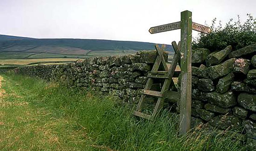
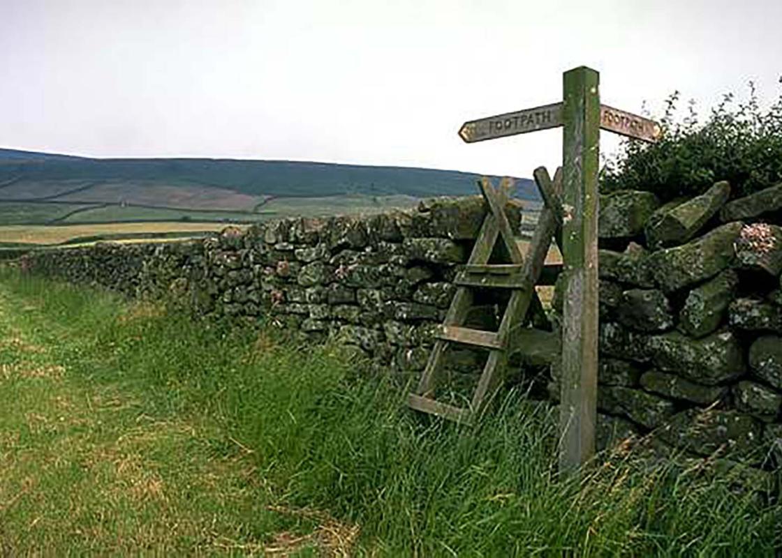
Follow the signposted bridleway, finally emerging at a road junction. Take the road opposite. When it turns left, carry on along a green lane, which eventually becomes a surfaced road. Approaching Brantingham village there are extensive views over the plain and the River Humber. For the Yorkshire Wolds Way, watch for a fingerpost that indicates a right turn, and descend the field to Brantingham Church.
Walk up the dale for nearly 0.5 miles (800m), then turn left up a track into the wood. Descend a track then turn right by a screen of conifers around a house. Climb to Mount Airy Farm and take the access lane down to the road, where you turn left to South Cave. If you’re not stopping in South Cave, the Yorkshire Wolds Way turns right 100yds (90m) down the road.
The Yorkshire Wolds Way National Trail starts at Hessle Haven, one of a number of places from which ferry boats used to cross to the southern side of the Humber. Across the creek which forms Hessle Haven there is still shipbuilding, which has gone on here for over 400 years. On 30 March 1693, John... Frame launched the 80-gun warship Humber at Hessle. The Humber Bridge dominates the early stages. The towers which support the suspension wires are 533ft (162m) high and the span between them was, at 4,626ft (1,410m), the longest in the world when it was built. After passing under the bridge look for an old whiting mill on the right, in the Humber Bridge Country Park. It was built in the early 19th century to replace a horse-powered mill and was wind-powered until 1925, when a gas engine was installed. Chalk was quarried near by, crushed at the mill and passed through settling pits. The resultant whiting was used in the manufacture of paints and putty. The mudflats beside the River Humber are a rich feeding ground for wildfowl and waders in winter, and for birds in passage in spring and autumn. The infamous Dick Turpin was captured at the Green Dragon pub, Welton. Most of Turpin’s crimes were committed in the London area, where he had been a cattle thief, smuggler and robber. With a price on his head, he headed north, changed his name and took up horse dealing. He was apprehended after threatening to shoot someone. Eventually his identity was discovered and he was hanged at Tyburn, York in 1739.
Yorkshire’s East Riding is the only one left of a trio of ‘ridings’ which existed up until 1974. The North and West are gone, to be replaced by North, South and West Yorkshires.
Cross over the road from the San Luca Restaurant and take the gravel path. This turns right along the riverbank and heads towards the Humber Bridge. (To reach the start from Hessle station, use a footbridge a short way east to cross the busy main road. At the end turn left along Livingstone Road to the San Luca.)
1 of 8
Continue for 2.5 miles (4km) beside the River Humber. The route here is shared with the Trans-Pennine Trail, a 215 mile (346km) multi–user route from Southport on the west coast to Hornsea on the east. On the approach to North Ferriby, pass a former brickyard pond that is now a conservation area.
2 of 8
Soon steps lead down to the foreshore. However, if the tide is high, follow signs indicating an alternative route (in essence, follow the Trans-Pennine Trail). If you proceed along the shore and then decide the tide seems too high after all, there’s another ‘escape route’ after about 0.25 miles (400m), where another set of steps leads into a car-park; go straight up the road, past Ferriby station and turn left on the B1231 to regain the Trans-Pennine Trail. Normally the tide will be low enough and you can continue along the shore for a further 0.25 miles (400m).
3 of 8
Another set of steps gives access into Long Plantation. Continue through the plantation to the B1231– A63 junction, where all the route options reunite. Follow the signed route to reach and cross the road bridge over the A63. Take care crossing slip-roads before escaping into a plantation. Climb gradually, pass a Scout camp and emerge to a road.
4 of 8
Bear right to a metal gate near quarry buildings. Skirt the large quarry complex, with views over the Humber. When you reach a lane, turn left and descend into Welton, a pleasant village with a duckpond.
5 of 8
Take the first turn right up Dale Road, which leads into Welton Dale, the first of many attractive Wolds valleys. After 1.75 miles (2.75km) the path emerges from a wood. Cross the concrete road and turn right along the field side, then left to Wauldby Manor Farm. This is the site of a deserted village, one of a number on the Wolds, but only the farm and church remain.
6 of 8
Follow the signposted bridleway, finally emerging at a road junction. Take the road opposite. When it turns left, carry on along a green lane, which eventually becomes a surfaced road. Approaching Brantingham village there are extensive views over the plain and the River Humber. For the Yorkshire Wolds Way, watch for a fingerpost that indicates a right turn, and descend the field to Brantingham Church.
7 of 8
Walk up the dale for nearly 0.5 miles (800m), then turn left up a track into the wood. Descend a track then turn right by a screen of conifers around a house. Climb to Mount Airy Farm and take the access lane down to the road, where you turn left to South Cave. If you’re not stopping in South Cave, the Yorkshire Wolds Way turns right 100yds (90m) down the road.
The Yorkshire Wolds Way National Trail starts at Hessle Haven, one of a number of places from which ferry boats used to cross to the southern side of the Humber. Across the creek which forms Hessle Haven there is still shipbuilding, which has gone on here for over 400 years. On 30 March 1693, John... Frame launched the 80-gun warship Humber at Hessle. The Humber Bridge dominates the early stages. The towers which support the suspension wires are 533ft (162m) high and the span between them was, at 4,626ft (1,410m), the longest in the world when it was built. After passing under the bridge look for an old whiting mill on the right, in the Humber Bridge Country Park. It was built in the early 19th century to replace a horse-powered mill and was wind-powered until 1925, when a gas engine was installed. Chalk was quarried near by, crushed at the mill and passed through settling pits. The resultant whiting was used in the manufacture of paints and putty. The mudflats beside the River Humber are a rich feeding ground for wildfowl and waders in winter, and for birds in passage in spring and autumn. The infamous Dick Turpin was captured at the Green Dragon pub, Welton. Most of Turpin’s crimes were committed in the London area, where he had been a cattle thief, smuggler and robber. With a price on his head, he headed north, changed his name and took up horse dealing. He was apprehended after threatening to shoot someone. Eventually his identity was discovered and he was hanged at Tyburn, York in 1739.
Yorkshire’s East Riding is the only one left of a trio of ‘ridings’ which existed up until 1974. The North and West are gone, to be replaced by North, South and West Yorkshires.