"Beautiful countryside around the birthplace of Stan Laurel"
Walk directions
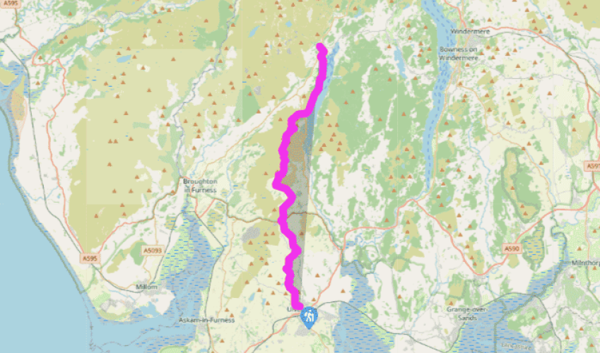
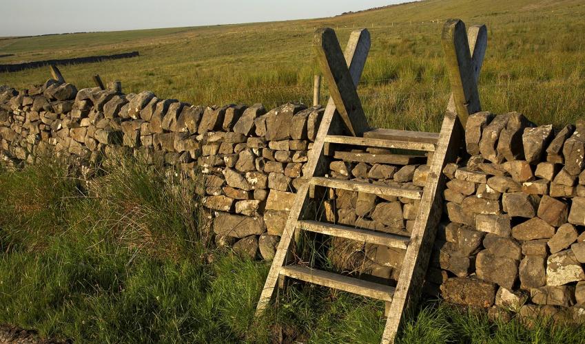
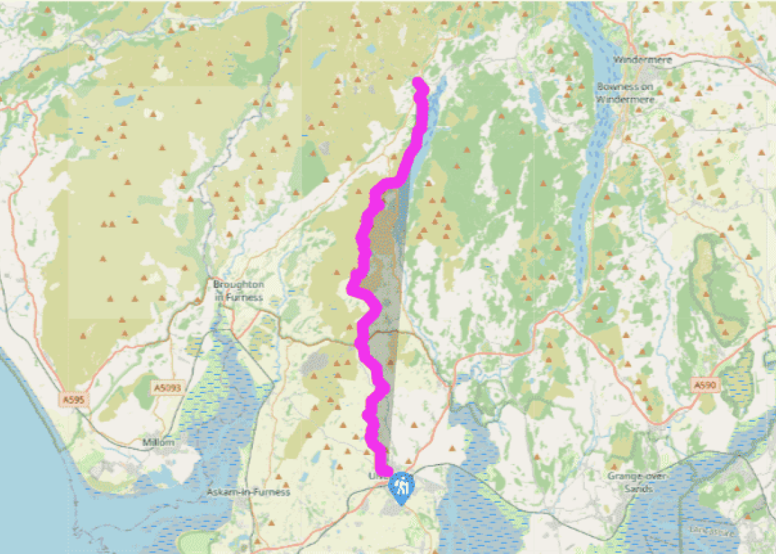
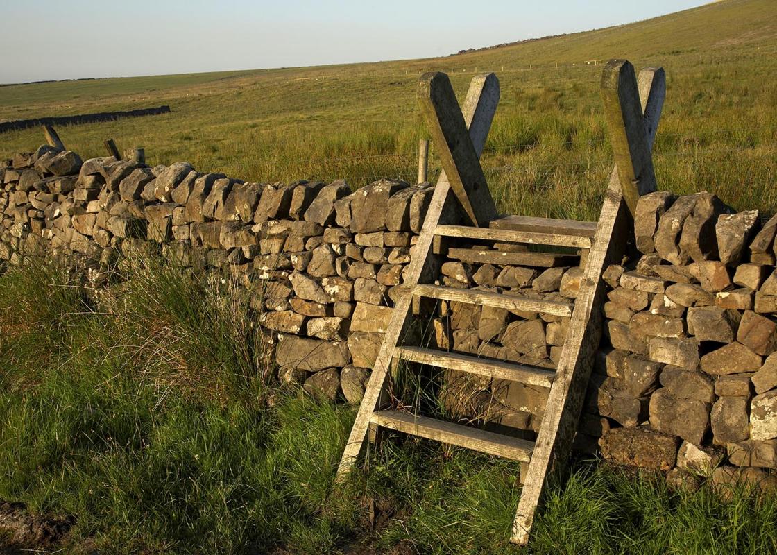
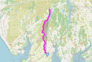
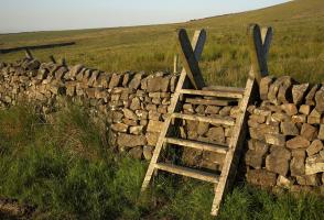
Follow the path alongside The Gill beck. After about 0.25 mile (400m), cross the beck and climb a walled path. At its end turn right through fields and along a track to Old Hall Farm. Go through the farmyard, pass the farmhouse and immediately enter a gate on your left. After the garden, cross a stile on your left and go diagonally right, then climb near the edge of a wood. Go right then bear left to pass left of a prominent house. Climb in a small wood then bear right, cross a beck and follow waymarked stiles to a hill top.
Cross a field to a road at Higher Lath. Turn right, downhill, to Windy Ash, and follow a Cumbria Way signpost along a short, grassy track to houses. Continue along a surfaced road. When it turns right, leave it through a gate and head across fields. Follow waymarks left of a farm (Stony Crag). Continue along a wall, change sides where it becomes a hedge and continue alongside a beck to Hollowmire.
Turn right, through the farmyard, follow a farm road to a junction and turn left for 200yds (183m), then right through a kissing-gate. Take the field path to St John’s Church and turn right, along a road. Turn left on the B5281 then right to Broughton Beck. Bear left in the hamlet and along a track. Cross a slab bridge and take the left gate. Cross a stile near the top of the field, skirt the beck and cross a stile and gate. Follow the beck through the next field and continue upstream, using a series of stiles, then follow a wall and vague track.
Join a very rough lane, pass houses and keep right at a Y-junction. Go left at a grassy triangle to a large gateway and along the track. Approaching Keldray Farm, turn left up steps, over a stile, then bear right to a wall-stile above Keldray. Continue, roughly following power-lines, then cross the A5092 to Gawthwaite.
In the hamlet, bear right then left on a lane signed ‘Public Way Gawthwaite Land’. At the third gate, fork right and descend to High Stennerley. Skirt the buildings and follow the drive to a minor road. Turn right for 35yds (32m) then go left on a field-path. At a minor road, go left. At a sharp bend (grid ref. SD 277 871) continue ahead to Kiln Bank. Take the track left of the farm, pass a ruin then fork right and follow the track, vague in places, to a surfaced road and go left.
Just before Tottlebank, turn right at a footpath sign, along a rising green track through bracken. It soon descends to meet a bridleway. Soon leave this as it bends left. Descend through trees to a packhorse bridge and climb the fellside ahead along a clear, meandering track to lonely Beacon Tarn.
Follow its western shore, crossing some marshy areas, to cross a low pass beyond the head of the tarn. Descend steeply to a marshy area. Descend again and curve eastwards, skirting Stable Harvey Moss, to join a minor road at a bend. Turn left along it, uphill, for 125yds (115m) to a bridleway going left.
After 0.5 miles (800m), go left at a waymark post, then right at a second to cross a beck and follow a clear path down the western side of the valley to cross first a footbridge and then the A5084. Follow the track signposted ‘Coniston via Lakeshore’, which leads to the lake.
Follow the partly wooded shoreline. Walk through a campsite and pass Coniston Hall, with its splendid chimneys. Follow a well-used track and field path to the road and turn right, into Coniston.
Terrain
- ield paths, tracks and quiet lanes; later, hill paths, becoming quite rocky in places
Landscape
- rolling hills with views back to Morecambe Bay; low fells, but rugged and rocky, then the shores of Coniston Water
Dog friendliness
- Good chance to run free (and swim!) along the lake-shore
Parking
- The Gill car-park, Ulverston; Coniston, next to TIC
Toilets en route
- Ulverston; Coniston, next to TIC
About the walk
When Rennie built a canal connecting it with the sea, Ulverston became a port for the Furness iron industry. The town thrived and by 1840 its population numbered over 5,000. The advent of the railway in 1850, however, and the discovery of the famous Park iron ore deposits, led to the rapid... expansion of nearby Barrow, while Ulverston’s industry declined. Ulverston’s once-important blast furnaces were demolished and replaced by a penicillin factory, and today this grey and white town remains astonishingly unsullied. A unique attraction is the Laurel and Hardy Museum. Stan Laurel was born Arthur Stanley Jefferson in Ulverston in 1890. He moved to America in 1910 and was eventually paired with Oliver Hardy in over 100 films. Their story is told here, in a museum which started as a private collection. The prominent monument seen on Hoad Hill, overlooking Ulverston, is a 100ft (30.5m) replica of the Eddystone Lighthouse, erected in 1850 to commemorate Ulverston-born John Barrow; writer, traveller, Arctic explorer and, for 40 years, Secretary of the Admiralty. He was born in 1764. Before the halfway mark, the walks crosses the A5092 to enter the Lake District National Park. In the next few miles you begin to feel that you are coming into the ‘real’ Lake District, with rough fells, dashed with rocks and cloaked in bracken, lively becks and a placid tarn, Beacon Tarn, mirroring the high Coniston Fells. The Way continues down an empty valley, then around Stable Harvey Moss and down beside a tumbling stream. The paths are typical of Lakeland fell-country; sometimes smooth and grassy, sometimes rough and rocky. After crossing the A5084, a short descent leads to a gorgeous walk along the west shore of Coniston Water. Make the most of it, as this is the longest and best bit of lakeside walking on the Way. The route then passes Coniston Hall, with its splendid chimneys, and leads nicely along a well-used track into Coniston. This is quite a long stage; if you need to split it, the best way to do so is by diverting into Torver, about 1.25 miles (2km) away, by staying on the bridleway instead of following the footpath at Point 8.
"Beautiful countryside around the birthplace of Stan Laurel"
Walk details
5hrs
Difficulty:
Hard
Gradient:
Moderate
Distance:
15.4 miles (24.8kms)
Ascent:
1752ft (534m)
Walk directions
Follow the path alongside The Gill beck. After about 0.25 mile (400m), cross the beck and climb a walled path. At its end turn right through fields and along a track to Old Hall Farm. Go through the farmyard, pass the farmhouse and immediately enter a gate on your left. After the garden, cross a stile on your left and go diagonally right, then climb near the edge of a wood. Go right then bear left to pass left of a prominent house. Climb in a small wood then bear right, cross a beck and follow waymarked stiles to a hill top.
1 of 9
Cross a field to a road at Higher Lath. Turn right, downhill, to Windy Ash, and follow a Cumbria Way signpost along a short, grassy track to houses. Continue along a surfaced road. When it turns right, leave it through a gate and head across fields. Follow waymarks left of a farm (Stony Crag). Continue along a wall, change sides where it becomes a hedge and continue alongside a beck to Hollowmire.
2 of 9
Turn right, through the farmyard, follow a farm road to a junction and turn left for 200yds (183m), then right through a kissing-gate. Take the field path to St John’s Church and turn right, along a road. Turn left on the B5281 then right to Broughton Beck. Bear left in the hamlet and along a track. Cross a slab bridge and take the left gate. Cross a stile near the top of the field, skirt the beck and cross a stile and gate. Follow the beck through the next field and continue upstream, using a series of stiles, then follow a wall and vague track.
3 of 9
Join a very rough lane, pass houses and keep right at a Y-junction. Go left at a grassy triangle to a large gateway and along the track. Approaching Keldray Farm, turn left up steps, over a stile, then bear right to a wall-stile above Keldray. Continue, roughly following power-lines, then cross the A5092 to Gawthwaite.
4 of 9
In the hamlet, bear right then left on a lane signed ‘Public Way Gawthwaite Land’. At the third gate, fork right and descend to High Stennerley. Skirt the buildings and follow the drive to a minor road. Turn right for 35yds (32m) then go left on a field-path. At a minor road, go left. At a sharp bend (grid ref. SD 277 871) continue ahead to Kiln Bank. Take the track left of the farm, pass a ruin then fork right and follow the track, vague in places, to a surfaced road and go left.
5 of 9
Just before Tottlebank, turn right at a footpath sign, along a rising green track through bracken. It soon descends to meet a bridleway. Soon leave this as it bends left. Descend through trees to a packhorse bridge and climb the fellside ahead along a clear, meandering track to lonely Beacon Tarn.
6 of 9
Follow its western shore, crossing some marshy areas, to cross a low pass beyond the head of the tarn. Descend steeply to a marshy area. Descend again and curve eastwards, skirting Stable Harvey Moss, to join a minor road at a bend. Turn left along it, uphill, for 125yds (115m) to a bridleway going left.
7 of 9
After 0.5 miles (800m), go left at a waymark post, then right at a second to cross a beck and follow a clear path down the western side of the valley to cross first a footbridge and then the A5084. Follow the track signposted ‘Coniston via Lakeshore’, which leads to the lake.
8 of 9
Follow the partly wooded shoreline. Walk through a campsite and pass Coniston Hall, with its splendid chimneys. Follow a well-used track and field path to the road and turn right, into Coniston.
Terrain
- ield paths, tracks and quiet lanes; later, hill paths, becoming quite rocky in places
Landscape
- rolling hills with views back to Morecambe Bay; low fells, but rugged and rocky, then the shores of Coniston Water
Dog friendliness
- Good chance to run free (and swim!) along the lake-shore
Parking
- The Gill car-park, Ulverston; Coniston, next to TIC
Toilets en route
- Ulverston; Coniston, next to TIC
About the walk
When Rennie built a canal connecting it with the sea, Ulverston became a port for the Furness iron industry. The town thrived and by 1840 its population numbered over 5,000. The advent of the railway in 1850, however, and the discovery of the famous Park iron ore deposits, led to the rapid... expansion of nearby Barrow, while Ulverston’s industry declined. Ulverston’s once-important blast furnaces were demolished and replaced by a penicillin factory, and today this grey and white town remains astonishingly unsullied. A unique attraction is the Laurel and Hardy Museum. Stan Laurel was born Arthur Stanley Jefferson in Ulverston in 1890. He moved to America in 1910 and was eventually paired with Oliver Hardy in over 100 films. Their story is told here, in a museum which started as a private collection. The prominent monument seen on Hoad Hill, overlooking Ulverston, is a 100ft (30.5m) replica of the Eddystone Lighthouse, erected in 1850 to commemorate Ulverston-born John Barrow; writer, traveller, Arctic explorer and, for 40 years, Secretary of the Admiralty. He was born in 1764. Before the halfway mark, the walks crosses the A5092 to enter the Lake District National Park. In the next few miles you begin to feel that you are coming into the ‘real’ Lake District, with rough fells, dashed with rocks and cloaked in bracken, lively becks and a placid tarn, Beacon Tarn, mirroring the high Coniston Fells. The Way continues down an empty valley, then around Stable Harvey Moss and down beside a tumbling stream. The paths are typical of Lakeland fell-country; sometimes smooth and grassy, sometimes rough and rocky. After crossing the A5084, a short descent leads to a gorgeous walk along the west shore of Coniston Water. Make the most of it, as this is the longest and best bit of lakeside walking on the Way. The route then passes Coniston Hall, with its splendid chimneys, and leads nicely along a well-used track into Coniston. This is quite a long stage; if you need to split it, the best way to do so is by diverting into Torver, about 1.25 miles (2km) away, by staying on the bridleway instead of following the footpath at Point 8.