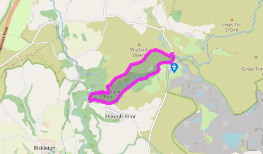
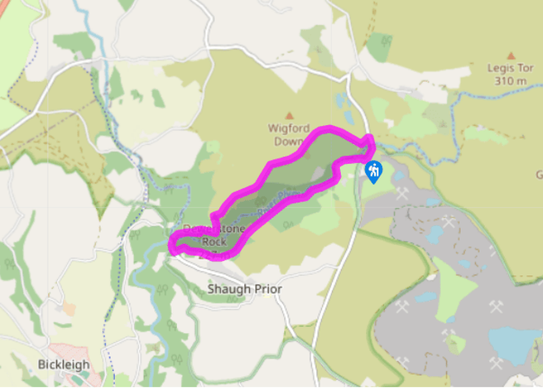
From the car park, walk away from Cadover Bridge, with the river on your right. Pass through a kissing gate and through a small group of willows into woodland. The river below is quite delightful, and you’ll find masses of great picnic spots along the bank.
Two gates lead to a stile and footbridge into North Wood. Keep ahead on the rocky path which follows the course of a large pipe, which appears above ground intermittently.
Leave North Wood over a stile. Follow the path through open bracken on West Down; the Plym is below right. Note the dramatic Dewerstone Crags ahead on the other side of the valley. The path leads into silver birch and oak past a settling tank, where it forks. Take the right fork downhill to a path junction and gate.
Keep inside the wire fence, following the footpath sign ‘Shaugh Bridge’. Stay within the woods as the yellow-waymarked path twists downhill: you can hear the river below to the right. The path leads over a stile to pass settling tanks (right), and eventually meets a road.
Bear immediately right and follow the narrow path on and eventually down steps leading into Shaugh Bridge car park. Turn right to walk through the car park towards the river.
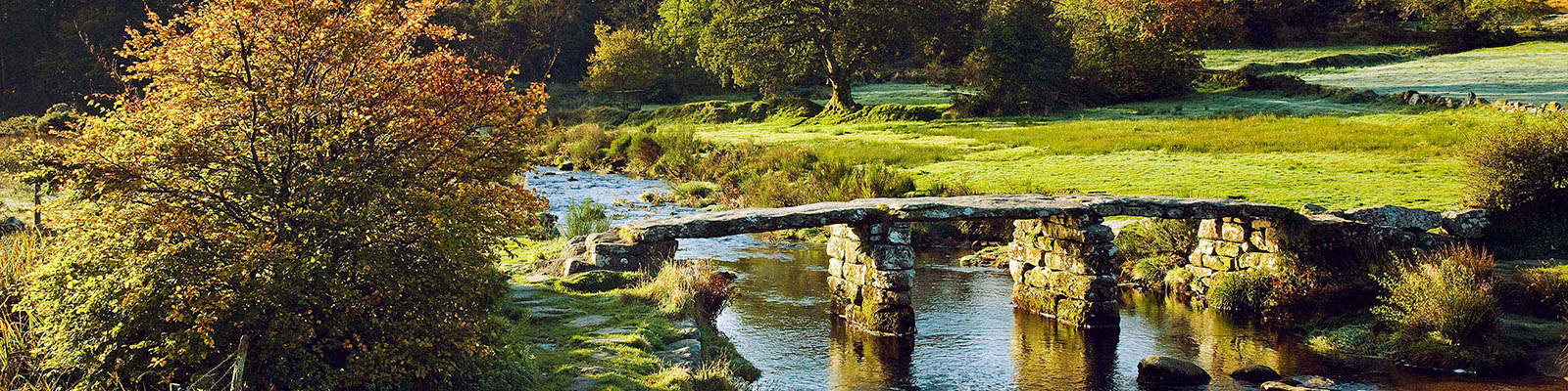
Cross the river via the railed wooden footbridge to enter Dewerstone Wood (National Trust); look left to see Shaugh Bridge and the confluence of the Plym and Meavy rivers. Follow the path right. It becomes a restored rocky track leading above the river and winds steeply uphill so take your time. After a sharp left bend take the next path right (narrower but still paved). Continue uphill until you are level with the top of granite buttresses (part of Dewerstone Crags) ahead and right, and where the path forks.
Bear left and scramble steeply uphill, passing more buttresses (right), eventually to leave the woods and enter open moorland to reach Dewerstone Rock, with glorious views.
Turn 90 degrees right at the rock and follow the right-hand grassy path along the edge of the valley to pass Oxen Tor and over Wigford Down, keeping Cadworthy Wood and the Plym Valley on your right. Keep straight on to the boundary wall of the wood, then follow the wall around fields. Eventually the wall bears right and you walk downhill past Cadover Cross with views of the china clay works beyond. Bear left at the cross to head towards the bridge, cross over on the road and walk back to your car.
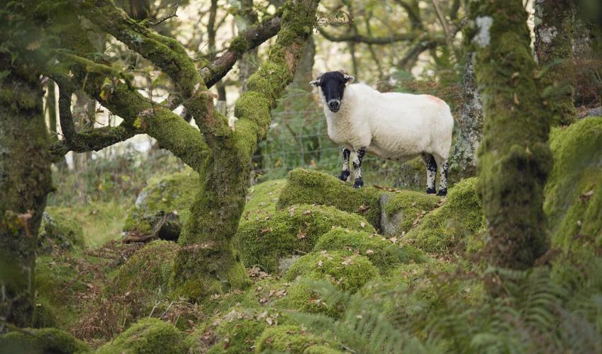
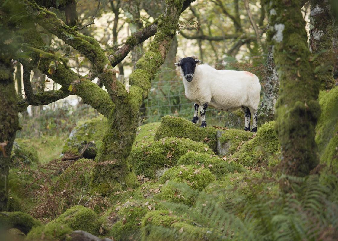
This is a popular walk, not only because of its proximity to Plymouth, but also because of the wealth of obvious industrial archaeological interest. The best way to experience this is to start from Cadover Bridge, on the edge of the open moor towards the Lee Moor China Clay Works. You follow the... route of the pipeline that carried the china clay in suspension from the works to the drying kilns at Shaugh Bridge (seen in the car park), via settling tanks, the remains of which are passed on the walk. The area around Shaugh Bridge is a Site of Special Scientific Interest (SSSI), nationally important for plants and wildlife, and there is a constant conservation programme going on here. The bridge itself dates from the late 1820s, and replaces one that was badly damaged in January 1823. Cadover Bridge was named in a charter of 1291 as ‘ponta de Cada worth’, so its name probably derives from cad, Celtic for ‘skirmish’. The Plym is also referred to as Plymma, from the Celtic pilim, ‘to roll’. This is definitely not the place to be on a black winter’s night – the Devil (locally known as ‘Dewer’) has long been associated with the Dewerstone. The Devil’s fearsome pack of ghost hounds are said to roam the desolate moors at night, seeking unrepentant sinners, whom they drive over the edge of the crags to the Devil waiting below. One of the more unpleasant legends associated with this distinctive granite formation tells of how an old farmer met the Devil carrying a sack near the rock and, not recognising him, asked if he’d had a good day’s hunting. The Devil is said to have laughed, and to have given the farmer the sack. The farmer, delighted, rushed home – only to find that the sack contained the body of his son. And beware, the woods near the Dewerstone are said to be haunted at night by a huge, evil dog with red eyes. Such stories are common in moorland areas, and perhaps date back to a time when wolves still inhabited the more remote parts of the country. Their eventual extinction in Britain was largely due to this process of demonisation. There are Bronze Age hut circles and cairns on Wigford Down, dating to at least 1000 bc, and Iron Age fortifications protecting the summit of the ridge. Cadover Cross, near the start/end of the walk, is an ancient restored cross – the modern shaft is made of red granite – set on the line of the Monastic Way between Plympton and Tavistock. It was found lying recumbent in 1873 and re-erected, only to fall and be put up again in 1915, set in a large socket stone. It stands over 7ft 6in (2m) tall.
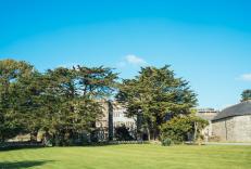
Devon sums up all that is best about the British landscape, with its magnificent coastlines, two historic cities, the world-famous Dartmoor National Park and south Devon’s glorious English Riviera. A fashionable and much-loved holiday destination, hiking and cycling in the National Parks is extremely popular among visitors, with a great choice of off-road routes.
From the car park, walk away from Cadover Bridge, with the river on your right. Pass through a kissing gate and through a small group of willows into woodland. The river below is quite delightful, and you’ll find masses of great picnic spots along the bank.
1 of 8
Two gates lead to a stile and footbridge into North Wood. Keep ahead on the rocky path which follows the course of a large pipe, which appears above ground intermittently.
2 of 8
Leave North Wood over a stile. Follow the path through open bracken on West Down; the Plym is below right. Note the dramatic Dewerstone Crags ahead on the other side of the valley. The path leads into silver birch and oak past a settling tank, where it forks. Take the right fork downhill to a path junction and gate.
3 of 8
Keep inside the wire fence, following the footpath sign ‘Shaugh Bridge’. Stay within the woods as the yellow-waymarked path twists downhill: you can hear the river below to the right. The path leads over a stile to pass settling tanks (right), and eventually meets a road.
4 of 8
Bear immediately right and follow the narrow path on and eventually down steps leading into Shaugh Bridge car park. Turn right to walk through the car park towards the river.
5 of 8
Cross the river via the railed wooden footbridge to enter Dewerstone Wood (National Trust); look left to see Shaugh Bridge and the confluence of the Plym and Meavy rivers. Follow the path right. It becomes a restored rocky track leading above the river and winds steeply uphill so take your time. After a sharp left bend take the next path right (narrower but still paved). Continue uphill until you are level with the top of granite buttresses (part of Dewerstone Crags) ahead and right, and where the path forks.
6 of 8
Bear left and scramble steeply uphill, passing more buttresses (right), eventually to leave the woods and enter open moorland to reach Dewerstone Rock, with glorious views.
7 of 8
Turn 90 degrees right at the rock and follow the right-hand grassy path along the edge of the valley to pass Oxen Tor and over Wigford Down, keeping Cadworthy Wood and the Plym Valley on your right. Keep straight on to the boundary wall of the wood, then follow the wall around fields. Eventually the wall bears right and you walk downhill past Cadover Cross with views of the china clay works beyond. Bear left at the cross to head towards the bridge, cross over on the road and walk back to your car.
This is a popular walk, not only because of its proximity to Plymouth, but also because of the wealth of obvious industrial archaeological interest. The best way to experience this is to start from Cadover Bridge, on the edge of the open moor towards the Lee Moor China Clay Works. You follow the... route of the pipeline that carried the china clay in suspension from the works to the drying kilns at Shaugh Bridge (seen in the car park), via settling tanks, the remains of which are passed on the walk. The area around Shaugh Bridge is a Site of Special Scientific Interest (SSSI), nationally important for plants and wildlife, and there is a constant conservation programme going on here. The bridge itself dates from the late 1820s, and replaces one that was badly damaged in January 1823. Cadover Bridge was named in a charter of 1291 as ‘ponta de Cada worth’, so its name probably derives from cad, Celtic for ‘skirmish’. The Plym is also referred to as Plymma, from the Celtic pilim, ‘to roll’. This is definitely not the place to be on a black winter’s night – the Devil (locally known as ‘Dewer’) has long been associated with the Dewerstone. The Devil’s fearsome pack of ghost hounds are said to roam the desolate moors at night, seeking unrepentant sinners, whom they drive over the edge of the crags to the Devil waiting below. One of the more unpleasant legends associated with this distinctive granite formation tells of how an old farmer met the Devil carrying a sack near the rock and, not recognising him, asked if he’d had a good day’s hunting. The Devil is said to have laughed, and to have given the farmer the sack. The farmer, delighted, rushed home – only to find that the sack contained the body of his son. And beware, the woods near the Dewerstone are said to be haunted at night by a huge, evil dog with red eyes. Such stories are common in moorland areas, and perhaps date back to a time when wolves still inhabited the more remote parts of the country. Their eventual extinction in Britain was largely due to this process of demonisation. There are Bronze Age hut circles and cairns on Wigford Down, dating to at least 1000 bc, and Iron Age fortifications protecting the summit of the ridge. Cadover Cross, near the start/end of the walk, is an ancient restored cross – the modern shaft is made of red granite – set on the line of the Monastic Way between Plympton and Tavistock. It was found lying recumbent in 1873 and re-erected, only to fall and be put up again in 1915, set in a large socket stone. It stands over 7ft 6in (2m) tall.
Devon sums up all that is best about the British landscape, with its magnificent coastlines, two historic cities, the world-famous Dartmoor National Park and south Devon’s glorious English Riviera. A fashionable and much-loved holiday destination, hiking and cycling in the National Parks is extremely popular among visitors, with a great choice of off-road routes.