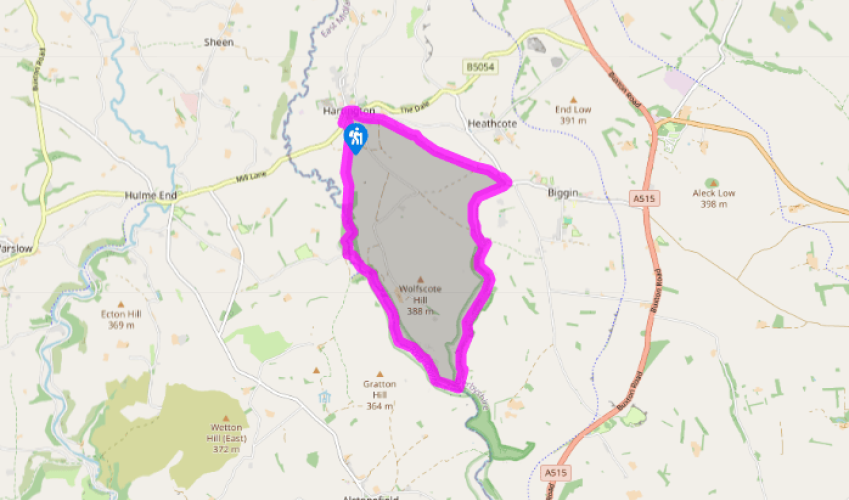
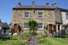
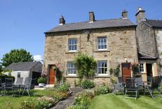
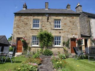
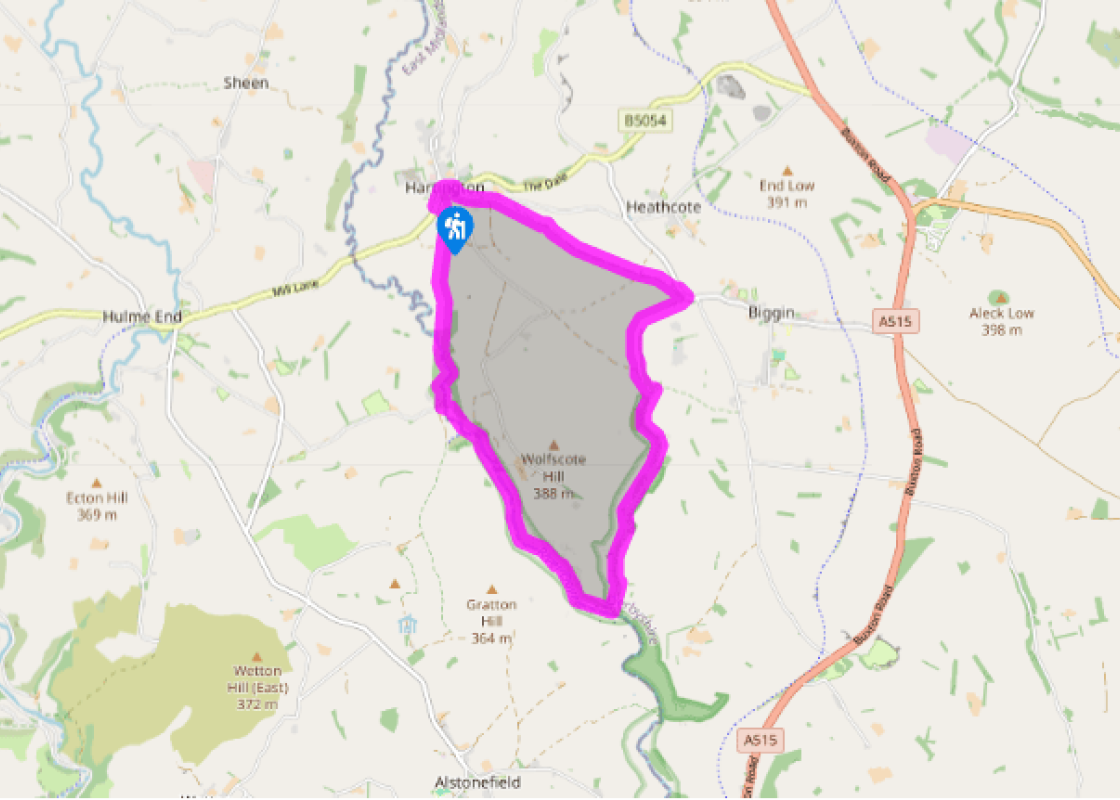
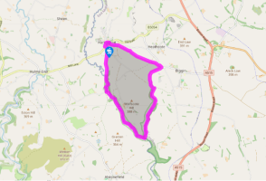
From the car park turn left and walk along through the village, past the pubs and tea rooms, following the main road as it curves right. Turn right by the war memorial into Hall Bank and go steeply up past the youth hostel. About 150yds (137m) further on go right on to the unsurfaced and walled Highfield Lane, signposted ‘Biggin’, which climbs steadily over the fields in a southeasterly direction.
At the far end it dips down to meet a road by buildings. Go right for 100yds (91m) then right again through a gate for a track into Biggin Dale. Walk along the wide grassy bottom, through a gate and on past a path junction, still following signs for Biggin Dale.
Where the dale opens out take the path around the foot of the slope on the left. Go through a gate and turn right, signposted ‘Wolfscote Dale’, past a partly walled dew pond. The wall-side path continues down the dale bottom, which becomes wooded and stonier underfoot for a while before opening out once more beneath screes and crags.
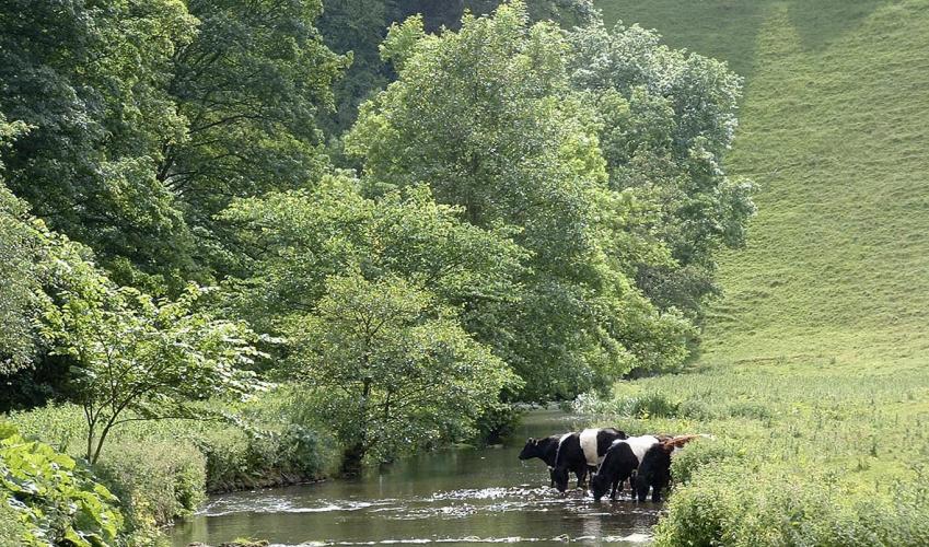
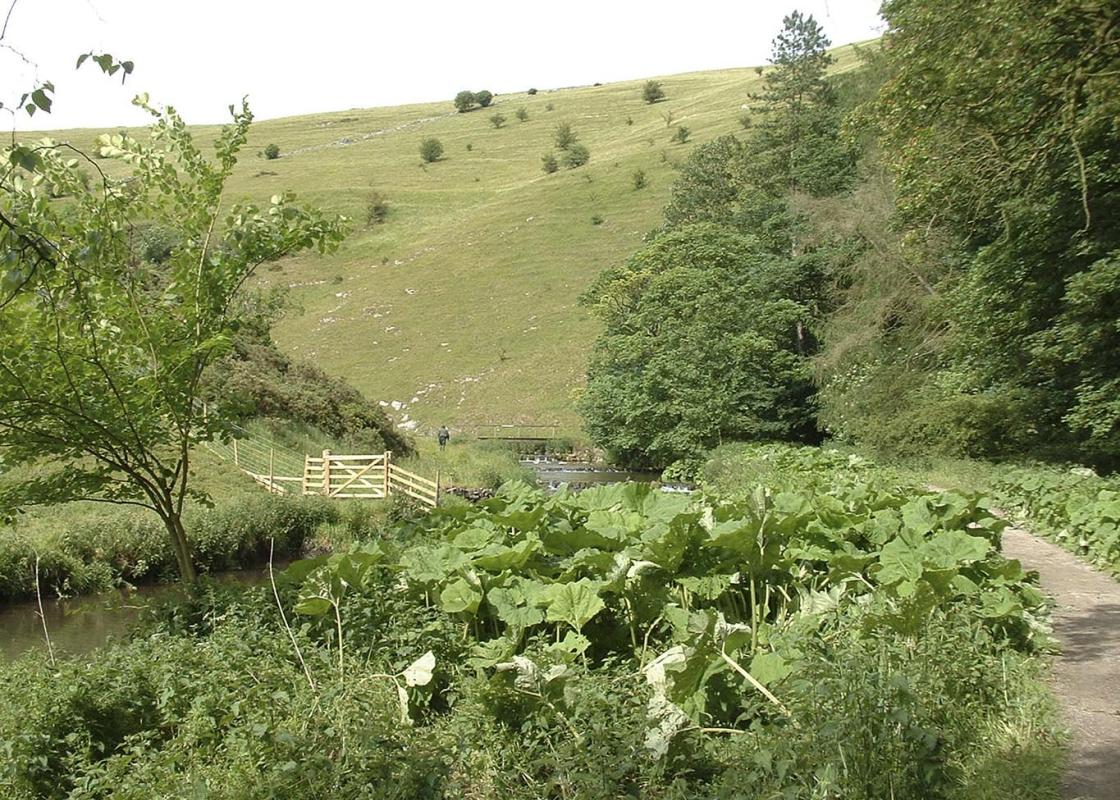
At the very far end the path meets the main track alongside the River Dove in Wolfscote Dale. Turn right on to this wide and popular route, which you will probably share with walkers and anglers. Just after passing the cave high up on the right at Frank i’ the Rocks, you reach a gate, with a footbridge on the left.
Don’t cross the bridge but go straight ahead, over a path and through a gate, then another gate, and on along the eastern banks of the river through a wide meadow. At the very far end go over a narrow footbridge and turn right to follow the riverside path through leafy Beresford Dale. The path switches banks once more and eventually reaches a gate on the far side of a small wood.
Cross the field ahead, with a small hill on the right and the Dove meandering on the left through what is now a shallow and open valley. Keep to the low shoulder of the hill through several more fields and across a green lane before eventually arriving back at Hartington next to the public toilets. Turn left for the car park or right for village amenities.
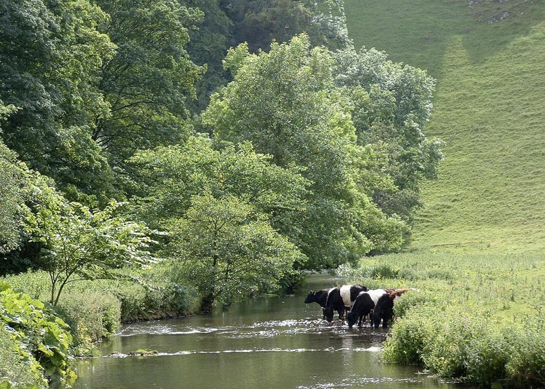
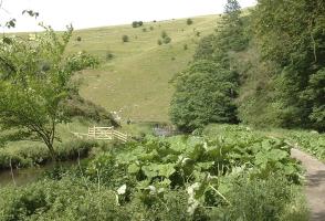
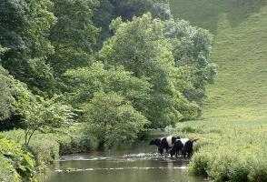
Like many of the upland streams and rivers that flow over the limestone of the White Peak, the River Dove has long been celebrated for the purity of its water. This, of course, encourages all manner of wildlife, but in particular a healthy and thriving fish population. Compleat Angler The stretch... of the Dove south of Hartington through Beresford Dale was a favourite of Charles Cotton, a 17th-century poet born in nearby Beresford Hall. Cotton, an enthusiastic young angler, introduced his great friend, Izaak Walton, to the area and taught him the art of fly-fishing. Together they built a fishing temple or shelter in the nearby woods of Beresford Dale (in private grounds) and also wrote The Compleat Angler, a classic collection of fishing stories, which was published in 1651. Through a discourse between two companions, Piscator and Viator, it describes in both prose and verse the practicalities of fly-fishing, including how to make artificial flies, which bait to use and the best way to cook fish. But at the same time it was a reflective and philosophical work and provides a window on 17th-century life in rural England. The Compleat Angler ran to numerous editions and became one of the mostly widely printed books of its time that is still in print today. Sadly Cotton inherited a mountain of debts from his father, who although wealthy was extravagant and spent too much time on leisure pursuits such as fishing, so that Charles was forced to sell Beresford Hall in 1681. It was demolished 150 years later and just a few ruins remain. A Dry Valley Through Beresford Dale the tree-lined River Dove tumbles over weirs and through pools, including Pike Pool, which is actually mentioned in The Compleat Angler. It’s a quiet and enclosed stretch, tucked away from the rest of the valley. However, further downstream, in Wolfscote Dale, the valley is more open and dramatic with bare crags and scree. Before you reach either of these two dales you make your way down Biggin Dale. In the summer months this secluded side dale is often completely dry and traditionally drinking water for livestock has been kept in purpose-built dew ponds, a couple of which you can see towards the top end of the dale. After winter rainfall an underground spring emerges and forms a stream that runs along the lower part of the dale and into the River Dove, at which times you might reluctantly have to share your path.
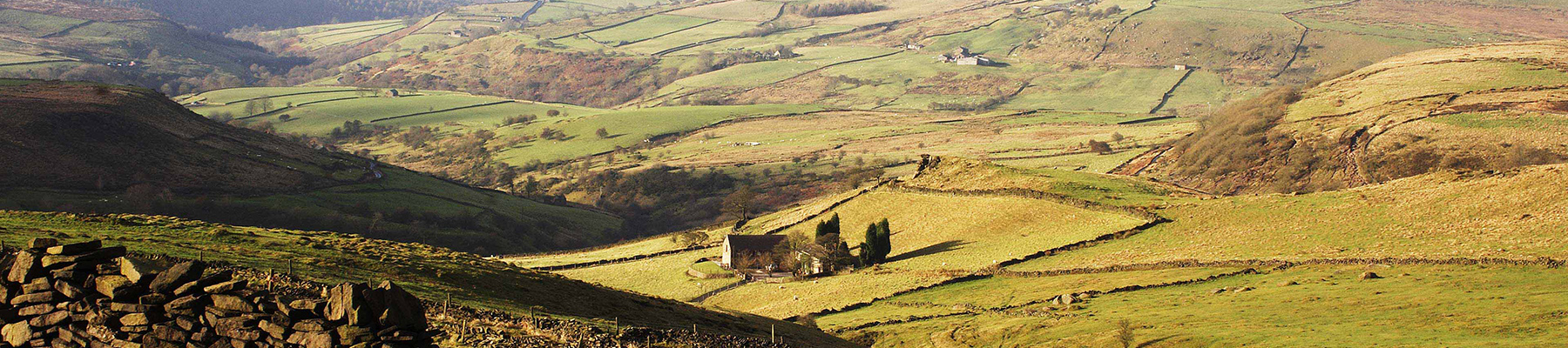
Staffordshire features lofty moors, deep dales and tremendous views of both. Further south are the six sprawling towns that make up Stoke-on-Trent, which historically have had such an impact on Staffordshire’s fortunes, not to mention its culture and countryside.
From the car park turn left and walk along through the village, past the pubs and tea rooms, following the main road as it curves right. Turn right by the war memorial into Hall Bank and go steeply up past the youth hostel. About 150yds (137m) further on go right on to the unsurfaced and walled Highfield Lane, signposted ‘Biggin’, which climbs steadily over the fields in a southeasterly direction.
1 of 6
At the far end it dips down to meet a road by buildings. Go right for 100yds (91m) then right again through a gate for a track into Biggin Dale. Walk along the wide grassy bottom, through a gate and on past a path junction, still following signs for Biggin Dale.
2 of 6
Where the dale opens out take the path around the foot of the slope on the left. Go through a gate and turn right, signposted ‘Wolfscote Dale’, past a partly walled dew pond. The wall-side path continues down the dale bottom, which becomes wooded and stonier underfoot for a while before opening out once more beneath screes and crags.
3 of 6
At the very far end the path meets the main track alongside the River Dove in Wolfscote Dale. Turn right on to this wide and popular route, which you will probably share with walkers and anglers. Just after passing the cave high up on the right at Frank i’ the Rocks, you reach a gate, with a footbridge on the left.
4 of 6
Don’t cross the bridge but go straight ahead, over a path and through a gate, then another gate, and on along the eastern banks of the river through a wide meadow. At the very far end go over a narrow footbridge and turn right to follow the riverside path through leafy Beresford Dale. The path switches banks once more and eventually reaches a gate on the far side of a small wood.
5 of 6
Cross the field ahead, with a small hill on the right and the Dove meandering on the left through what is now a shallow and open valley. Keep to the low shoulder of the hill through several more fields and across a green lane before eventually arriving back at Hartington next to the public toilets. Turn left for the car park or right for village amenities.
Like many of the upland streams and rivers that flow over the limestone of the White Peak, the River Dove has long been celebrated for the purity of its water. This, of course, encourages all manner of wildlife, but in particular a healthy and thriving fish population. Compleat Angler The stretch... of the Dove south of Hartington through Beresford Dale was a favourite of Charles Cotton, a 17th-century poet born in nearby Beresford Hall. Cotton, an enthusiastic young angler, introduced his great friend, Izaak Walton, to the area and taught him the art of fly-fishing. Together they built a fishing temple or shelter in the nearby woods of Beresford Dale (in private grounds) and also wrote The Compleat Angler, a classic collection of fishing stories, which was published in 1651. Through a discourse between two companions, Piscator and Viator, it describes in both prose and verse the practicalities of fly-fishing, including how to make artificial flies, which bait to use and the best way to cook fish. But at the same time it was a reflective and philosophical work and provides a window on 17th-century life in rural England. The Compleat Angler ran to numerous editions and became one of the mostly widely printed books of its time that is still in print today. Sadly Cotton inherited a mountain of debts from his father, who although wealthy was extravagant and spent too much time on leisure pursuits such as fishing, so that Charles was forced to sell Beresford Hall in 1681. It was demolished 150 years later and just a few ruins remain. A Dry Valley Through Beresford Dale the tree-lined River Dove tumbles over weirs and through pools, including Pike Pool, which is actually mentioned in The Compleat Angler. It’s a quiet and enclosed stretch, tucked away from the rest of the valley. However, further downstream, in Wolfscote Dale, the valley is more open and dramatic with bare crags and scree. Before you reach either of these two dales you make your way down Biggin Dale. In the summer months this secluded side dale is often completely dry and traditionally drinking water for livestock has been kept in purpose-built dew ponds, a couple of which you can see towards the top end of the dale. After winter rainfall an underground spring emerges and forms a stream that runs along the lower part of the dale and into the River Dove, at which times you might reluctantly have to share your path.
Staffordshire features lofty moors, deep dales and tremendous views of both. Further south are the six sprawling towns that make up Stoke-on-Trent, which historically have had such an impact on Staffordshire’s fortunes, not to mention its culture and countryside.