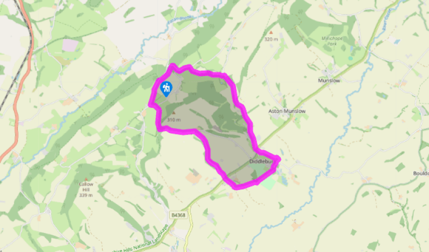
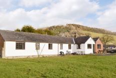
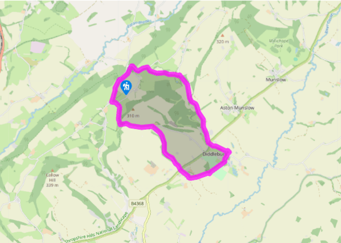
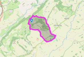
Turn left out of the car park along the lane. When you come to a junction, turn sharp left again, signposted ‘Middlehope’. Keep straight on at the next, signed ‘Upper Westhope Farm’. Where the track bends left to the farm, go slightly right to a gate and join a grassy bridleway that soon enters woodland. Keep straight on at two cross paths.
The bridleway emerges into pasture; keep straight on along to the corner. Go through a gate and turn right on a field-edge path, which soon becomes a wide track.
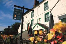
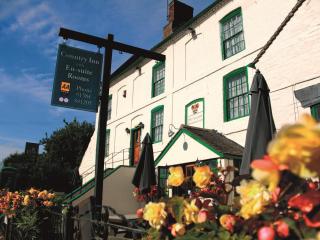
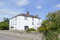
After passing a cottage, and with a group of barns ahead, look for blue arrows that direct you sharp right through a gate. Turn immediately left and walk above Corfton Bache, a deep valley. Pass above a group of houses then zigzag down a green track. Continue down the valley to the B4368 at Corfton and cross to a lane opposite.
The lane forks at Karray Cottage. Go through two iron kissing gates then bear left across a field to a prominent stile at the far side. Cross a farm track and walk to the far right corner of an arable field.
Go through a gap, then a little way along the left-hand edge of another field until a gate gives access to parkland. Head in the direction indicated by the waymarker. St Peter’s Church at Diddlebury soon comes into view, providing an infallible guide.
Cross two stiles (one very rickety) at the far side of the park and go straight on down. Cross a track to find a footbridge and a path into Diddlebury. Turn right at the road, then left by the church. Join a footpath starting to the right of the village hall, then skirt around the school, to a gate and a stile immediately right of the buildings. Cross fields to the B4368. Cross to the lane almost opposite, and keep right after a few paces.
Climb steadily up the narrow, sunken lane. At the top, by the entrance to Aston Top, keep left, still on the lane. Descend to the valley bottom.
Turn left on a stony track, Dunstan’s Lane, soon reaching a ford. When the main track bends right, follow waymarks straight ahead up a narrow hedged track to a lane and turn left. Keep straight on at a Y-junction. Turn left on a footpath with a Shropshire Way sign. The sometimes muddy path leads through the woods back to the car park.
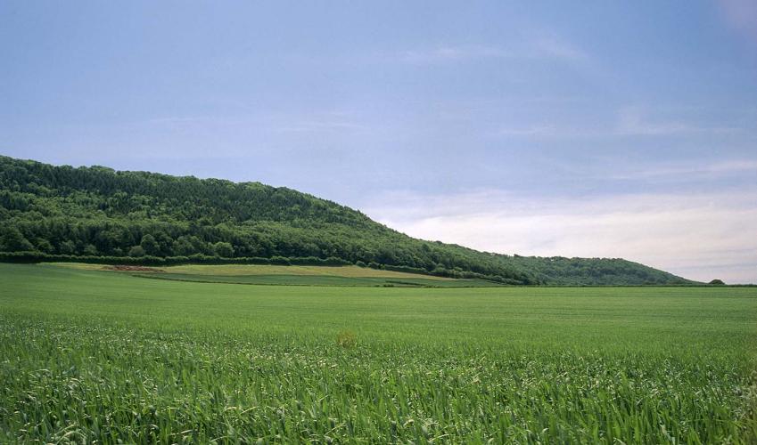
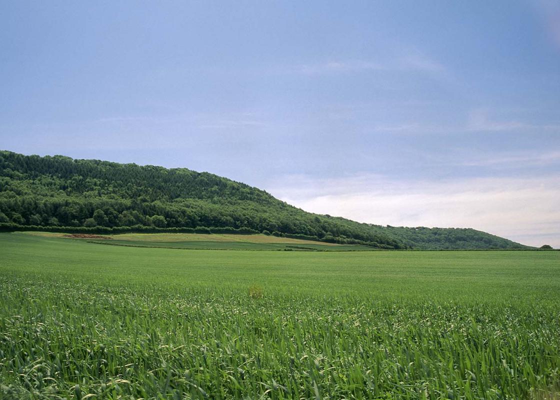
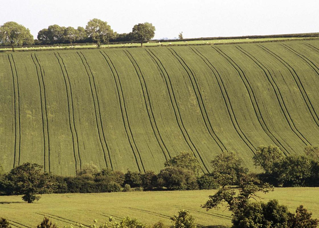
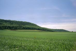
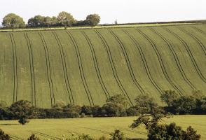
Wenlock Edge needs a book to itself, so all you will get here is the merest glimpse, but it should whet your appetite for more. This great tree-clad escarpment is one of Shropshire’s most famous landscape features, partly because it plays a role in A E Housman’s collection of poems entitled A... Shropshire Lad, some of which were set to music by the composer Vaughan Williams. It is best seen from the west, appearing as an unbroken escarpment running from the Severn Gorge to Craven Arms. From the east it is more elusive, rising almost imperceptibly. Within a basic ridge structure, it seems to form a series of waves or steps and consists for part of its length of two parallel edges, divided by Hope Dale. Wenlock Edge is composed of Silurian limestone formed about 420 million years ago. Developing as a barrier reef in a tropical sea on the edge of a continental shelf, it was built up from the accumulation of sediments and the skeletons of marine creatures such as corals, brachiopods and crinoids. Earth movements and erosion then sculpted it into the escarpment. Most of it is wooded, and much of this is ancient woodland, growing on steep slopes where there has been continuous tree cover since the end of the last ice age. The dominant species is ash, which has a special affinity with limestone, but many other types are present. Beneath the trees are limeloving shrubs such as spurge laurel, spindle and dogwood. The ground flora is rich and varied, especially along the rides and in newly coppiced areas, where flowers respond to the increased light by growing more profusely and attracting many butterflies. In the past, the Edge was always seen as a valuable resource to be exploited. Timber provided building materials, tools and charcoal for iron smelting. Limestone was used for building, for making lime, for iron smelting and, more recently, as an aggregate. This latter use still continues and there are unsightly quarries between Presthope and Much Wenlock, where you can walk the ridge and look down on the unedifying spectacle of monstrous machines digging up Shropshire so that heavy lorries can carry it away. There’s nothing like that on this walk, where the quarries you pass are small ones, long since abandoned and now transformed by nature into mossy, fern-filled caverns of green.
Perhaps nowhere else in England will you find a county so deeply rural and with so much variety as Shropshire. Choose a clear day, climb to the top of The Wrekin, and look down on that ‘land of lost content’ so wistfully evoked by A E Housman.
Turn left out of the car park along the lane. When you come to a junction, turn sharp left again, signposted ‘Middlehope’. Keep straight on at the next, signed ‘Upper Westhope Farm’. Where the track bends left to the farm, go slightly right to a gate and join a grassy bridleway that soon enters woodland. Keep straight on at two cross paths.
1 of 8
The bridleway emerges into pasture; keep straight on along to the corner. Go through a gate and turn right on a field-edge path, which soon becomes a wide track.
2 of 8
After passing a cottage, and with a group of barns ahead, look for blue arrows that direct you sharp right through a gate. Turn immediately left and walk above Corfton Bache, a deep valley. Pass above a group of houses then zigzag down a green track. Continue down the valley to the B4368 at Corfton and cross to a lane opposite.
3 of 8
The lane forks at Karray Cottage. Go through two iron kissing gates then bear left across a field to a prominent stile at the far side. Cross a farm track and walk to the far right corner of an arable field.
4 of 8
Go through a gap, then a little way along the left-hand edge of another field until a gate gives access to parkland. Head in the direction indicated by the waymarker. St Peter’s Church at Diddlebury soon comes into view, providing an infallible guide.
5 of 8
Cross two stiles (one very rickety) at the far side of the park and go straight on down. Cross a track to find a footbridge and a path into Diddlebury. Turn right at the road, then left by the church. Join a footpath starting to the right of the village hall, then skirt around the school, to a gate and a stile immediately right of the buildings. Cross fields to the B4368. Cross to the lane almost opposite, and keep right after a few paces.
6 of 8
Climb steadily up the narrow, sunken lane. At the top, by the entrance to Aston Top, keep left, still on the lane. Descend to the valley bottom.
7 of 8
Turn left on a stony track, Dunstan’s Lane, soon reaching a ford. When the main track bends right, follow waymarks straight ahead up a narrow hedged track to a lane and turn left. Keep straight on at a Y-junction. Turn left on a footpath with a Shropshire Way sign. The sometimes muddy path leads through the woods back to the car park.
Wenlock Edge needs a book to itself, so all you will get here is the merest glimpse, but it should whet your appetite for more. This great tree-clad escarpment is one of Shropshire’s most famous landscape features, partly because it plays a role in A E Housman’s collection of poems entitled A... Shropshire Lad, some of which were set to music by the composer Vaughan Williams. It is best seen from the west, appearing as an unbroken escarpment running from the Severn Gorge to Craven Arms. From the east it is more elusive, rising almost imperceptibly. Within a basic ridge structure, it seems to form a series of waves or steps and consists for part of its length of two parallel edges, divided by Hope Dale. Wenlock Edge is composed of Silurian limestone formed about 420 million years ago. Developing as a barrier reef in a tropical sea on the edge of a continental shelf, it was built up from the accumulation of sediments and the skeletons of marine creatures such as corals, brachiopods and crinoids. Earth movements and erosion then sculpted it into the escarpment. Most of it is wooded, and much of this is ancient woodland, growing on steep slopes where there has been continuous tree cover since the end of the last ice age. The dominant species is ash, which has a special affinity with limestone, but many other types are present. Beneath the trees are limeloving shrubs such as spurge laurel, spindle and dogwood. The ground flora is rich and varied, especially along the rides and in newly coppiced areas, where flowers respond to the increased light by growing more profusely and attracting many butterflies. In the past, the Edge was always seen as a valuable resource to be exploited. Timber provided building materials, tools and charcoal for iron smelting. Limestone was used for building, for making lime, for iron smelting and, more recently, as an aggregate. This latter use still continues and there are unsightly quarries between Presthope and Much Wenlock, where you can walk the ridge and look down on the unedifying spectacle of monstrous machines digging up Shropshire so that heavy lorries can carry it away. There’s nothing like that on this walk, where the quarries you pass are small ones, long since abandoned and now transformed by nature into mossy, fern-filled caverns of green.
Perhaps nowhere else in England will you find a county so deeply rural and with so much variety as Shropshire. Choose a clear day, climb to the top of The Wrekin, and look down on that ‘land of lost content’ so wistfully evoked by A E Housman.