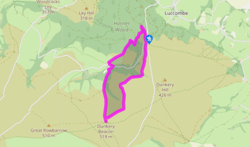
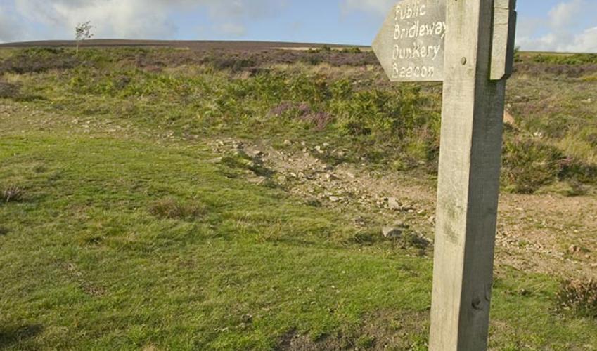
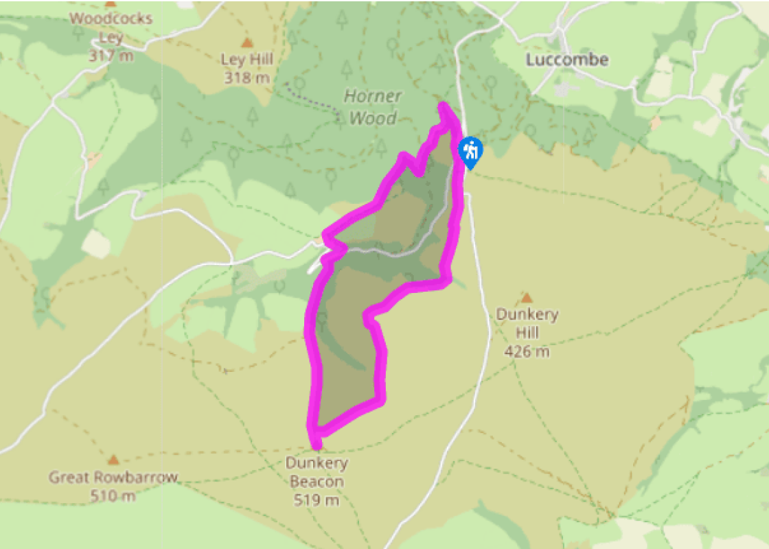
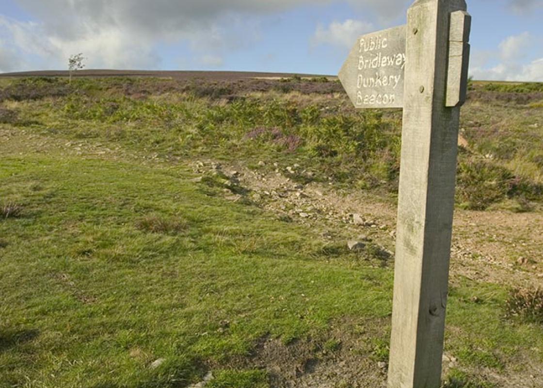
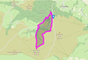
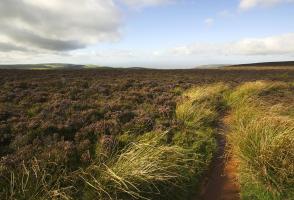
Begin along an 'easy access' path, which leaves by the car park entrance. Branch left at a fork, soon meeting a crossing bridleway. Signed left to Stoke Pero, it drops steeply into the wooded valley. Ignore a path off right and, at the bottom, go left to cross a footbridge spanning East Water.
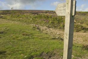
Head briefly upstream to a waypost and double back right to climb steeply away. Higher up, swing left to a junction and go right towards Cloutsham. A short pull leads to a crossing track. Walk left to a fork and branch right across the flank of Cloutsham Ball. Rejoining the bridleway higher up, follow it right across more open ground, where a bench beneath a pine tree signals a view across the valley. Carry on with the bridleway, shortly leaving the heath to continue above pasture. Emerging onto a track, follow it left to a lane opposite Cloutsham Farm.
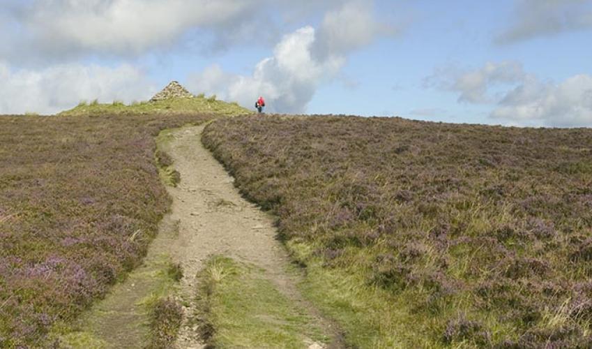
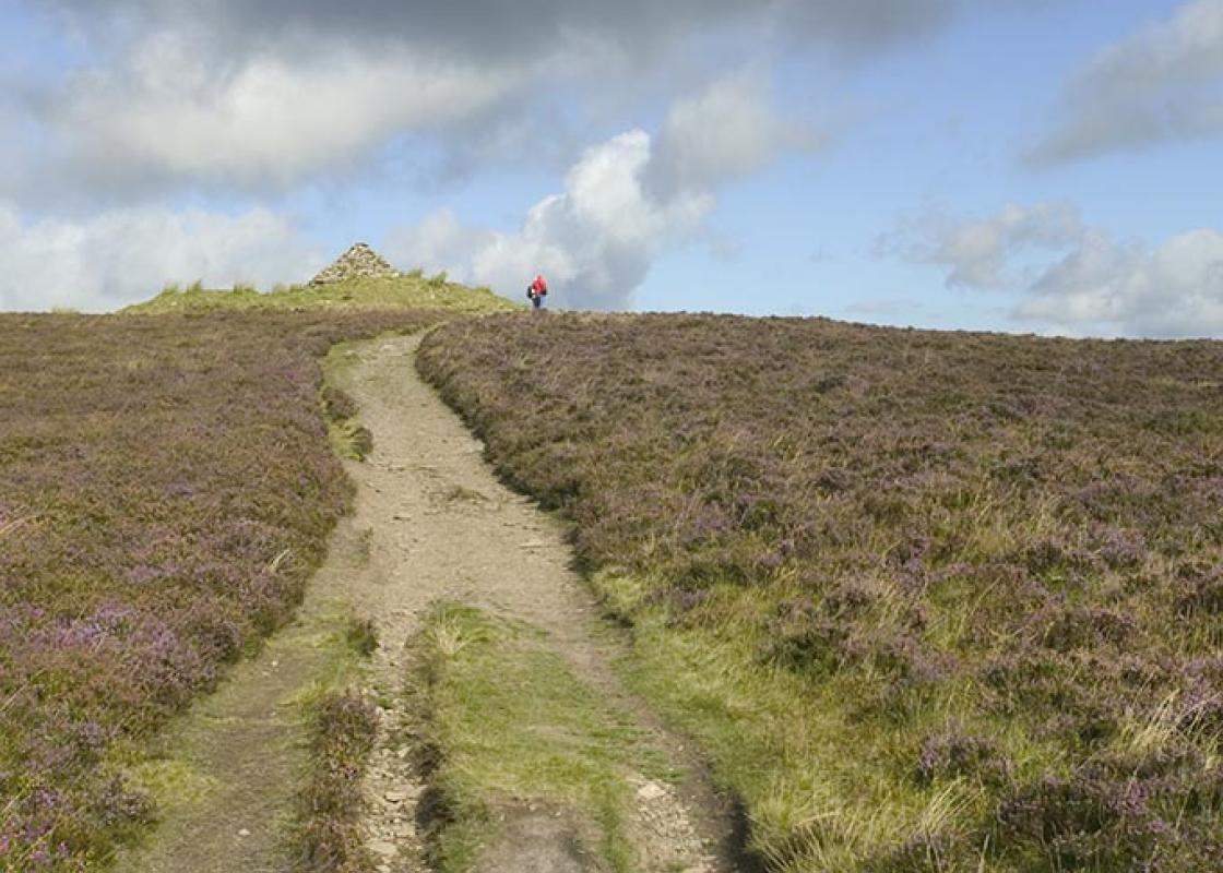
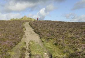
Go left to a sharp bend, from which a narrow track zigzags downhill. Rejoining the lane, walk right above a riverside meadow, passing a footbridge before leaving through a gap in the left verge, some 30yds (27m) beyond. Ford the stream and follow a broad, climbing path up a wooded spur above Aller Combe. Higher up, fork right through a gate and carry on through thinning wood to a second gate. Beyond it, stay by the left fence to a final gate, which opens onto the moor. Walk forward to cross Dicky's Path and continue straight on up the hillside for another 0.5 mile (800m). Approaching the top, watch for a path off left, which is the way back to the car park. However, first continue to the summit of Dunkery Beacon.
Briefly retrace your steps down to the path noted earlier and follow it right, gradually losing height across the flank of Dunkery Hill. Some 25yds (21m) after crossing the head of Aller Combe, bear left at a fork to head more steeply downhill, eventually passing a clump of hawthorn before meeting Dicky's Path once more.
Follow it right, now descending more gently towards the deep fold of Hollow Combe. The path contours between trees around the steep slope before climbing onto more open ground beyond. Carry on for another 0.25 mile (400m) to reach a fork. Branch left and, ignoring crossing tracks, walk back the car park, which now appears ahead.
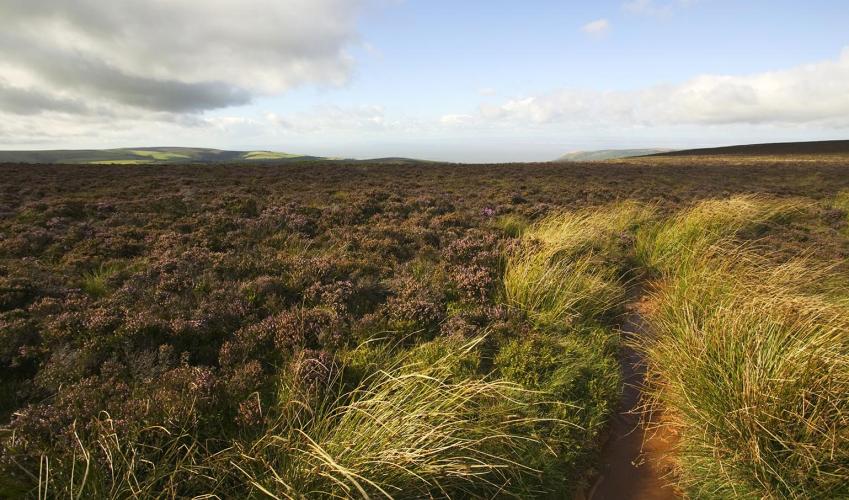
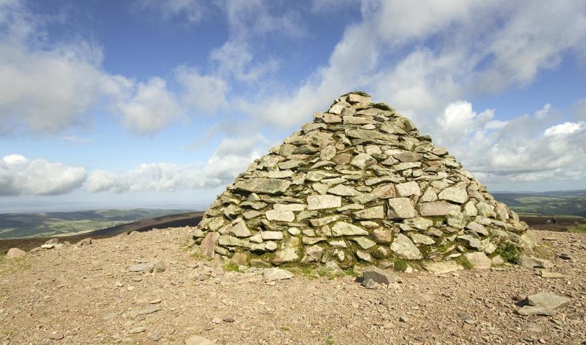
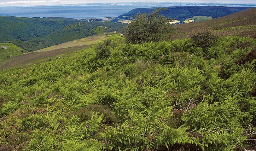
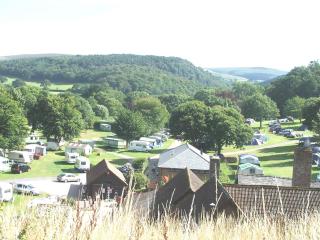
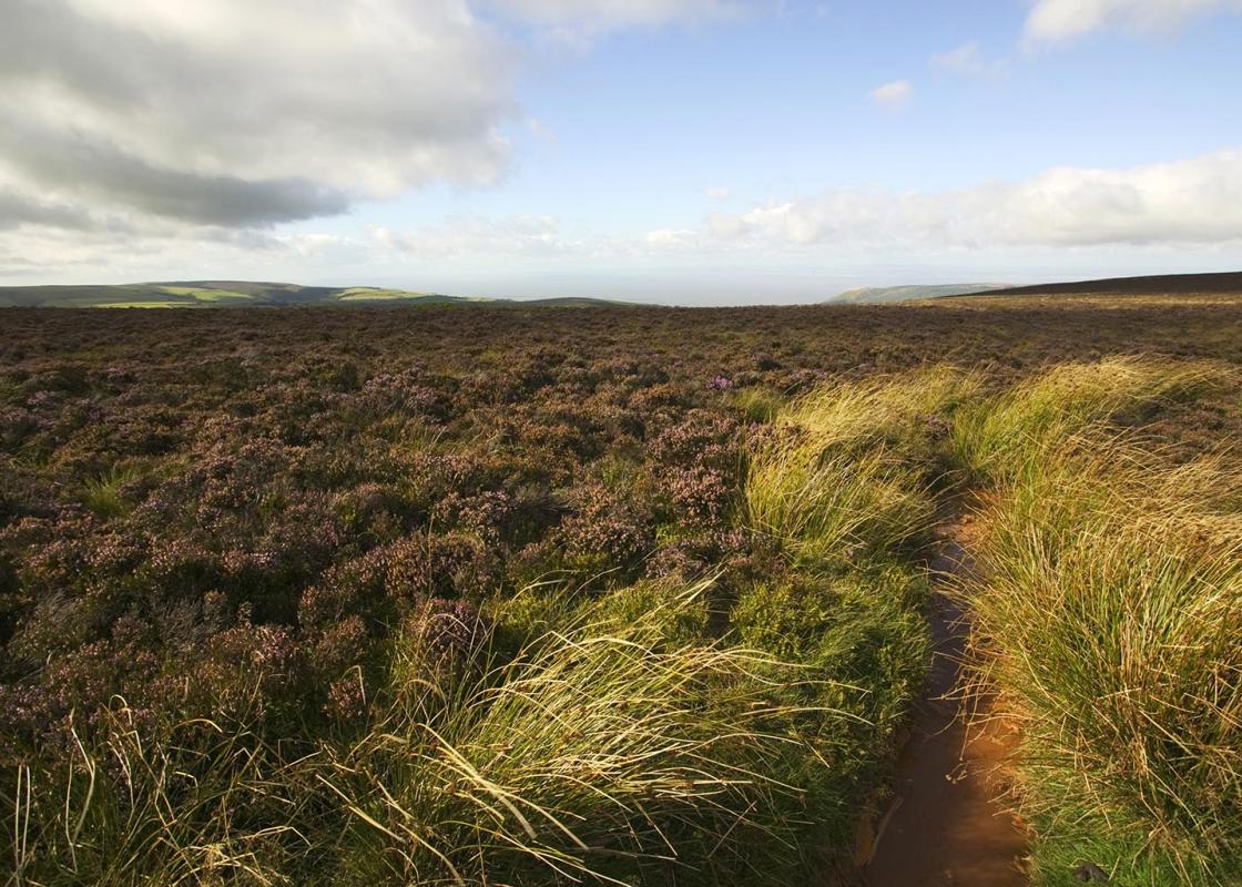
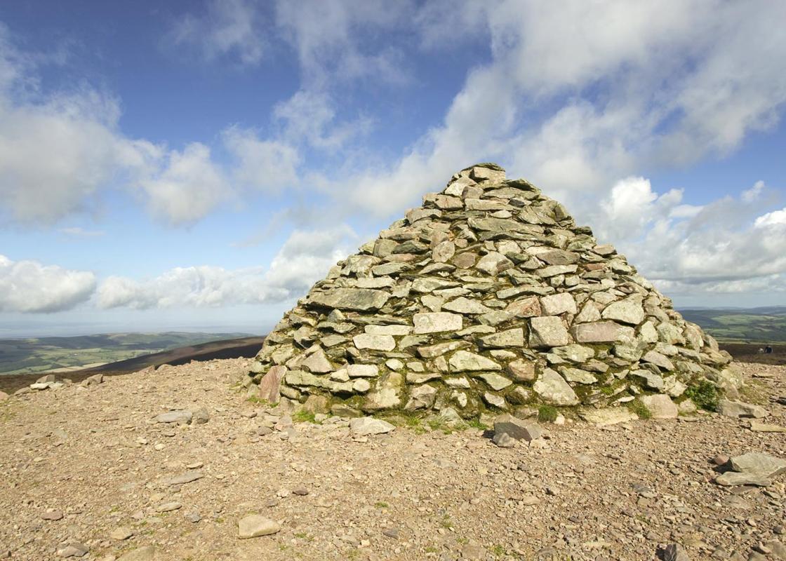
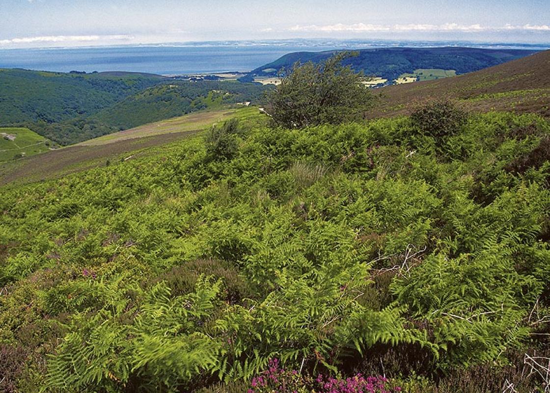
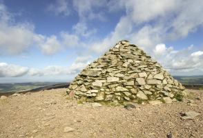
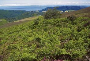
The walk lies within the Dunkery and Horner Wood National Nature Reserve, part of the vast Holnicote estate managed by the National Trust. It is a place of stunning beauty, with immense variety in both the landscape and the flora and fauna it supports. The moorland came to the Trust in 1917 under... a 500-year lease from Sir Thomas Dyke Acland, the 12th baronet whose family had been at Killerton since the 16th century. The two estates came together in 1745 with the marriage of the 7th baronet Acland to Elizabeth Dyke and Holnicote became a much-loved holiday retreat, despite the loss of the big house to fire in 1779. The Aclands had a long tradition of stag hunting but, during the 19th century, turned their attentions to agricultural improvement and the preservation of the Exmoor ponies, a hardy, native breed roaming the moor in semi-feral freedom. They teetered on extinction after the Second World War, when soldiers used them for target practice and poachers sold the meat, but breeding programmes now help their survival. Small herds wander the hills and are used across the country to control unwanted scrub in specialist habitats. Less often seen are red deer. Unlike their Scottish cousins, who decamp to the open highlands after winter, the deer here seek daytime cover in deep, wooded valleys. Sensitive hearing and a good sense of smell means they usually spot you first and slink into the undergrowth where they are well camouflaged. The best time to see them in the open is early or late in the day. Valley woodland The valley woodland has evolved from the primeval forest cover. Mainly sessile oak, the trees have been managed for centuries to provide small wood, some timber and bark for the tanning industry, the continuous tree cover maintained by pollarding and coppicing rather than wholesale felling. The undisturbed ground supports a profusion of wild flowers, particularly during spring before the leaf canopy develops. Damp conditions support many mosses, lichens and ferns and, come autumn, there is an abundance of fungi. All this is food for insects that support birds and mammals in a complex food chain. The open moor is equally prolific, with ling, bilberry, crowberry and cranberry covering huge swathes of the hillside. Somerset's highest point At 1,703ft (519m), Dunkery Beacon is the highest point on Dunkery Hill and Somerset's highest point; it gives a view to both the Bristol and English channels. On a clear day, Dartmoor, the Brecon Beacons of Wales and Cleave Hill in distant Gloucestershire can all be seen. Such prominence has not been ignored and the multiple tops of the sprawling hill are littered with Bronze Age burial cairns. The summit has also been the site of signal beacons, possibly since prehistoric times and the remains of at least four hearths have been identified.
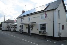
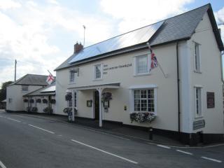
Somerset remains rural and unspoiled, and ever popular areas to visit are the limestone and red sandstone Mendip Hills rising to over 1,000 feet, and by complete contrast, to the south and southwest, the flat landscape of the Somerset Levels. Another popular spot, the Quantocks, once the haunt of poets Coleridge and Wordsworth, are noted for their gentle slopes, heather-covered moorland expanses and red deer.
Begin along an 'easy access' path, which leaves by the car park entrance. Branch left at a fork, soon meeting a crossing bridleway. Signed left to Stoke Pero, it drops steeply into the wooded valley. Ignore a path off right and, at the bottom, go left to cross a footbridge spanning East Water.
1 of 5
Head briefly upstream to a waypost and double back right to climb steeply away. Higher up, swing left to a junction and go right towards Cloutsham. A short pull leads to a crossing track. Walk left to a fork and branch right across the flank of Cloutsham Ball. Rejoining the bridleway higher up, follow it right across more open ground, where a bench beneath a pine tree signals a view across the valley. Carry on with the bridleway, shortly leaving the heath to continue above pasture. Emerging onto a track, follow it left to a lane opposite Cloutsham Farm.
2 of 5
Go left to a sharp bend, from which a narrow track zigzags downhill. Rejoining the lane, walk right above a riverside meadow, passing a footbridge before leaving through a gap in the left verge, some 30yds (27m) beyond. Ford the stream and follow a broad, climbing path up a wooded spur above Aller Combe. Higher up, fork right through a gate and carry on through thinning wood to a second gate. Beyond it, stay by the left fence to a final gate, which opens onto the moor. Walk forward to cross Dicky's Path and continue straight on up the hillside for another 0.5 mile (800m). Approaching the top, watch for a path off left, which is the way back to the car park. However, first continue to the summit of Dunkery Beacon.
3 of 5
Briefly retrace your steps down to the path noted earlier and follow it right, gradually losing height across the flank of Dunkery Hill. Some 25yds (21m) after crossing the head of Aller Combe, bear left at a fork to head more steeply downhill, eventually passing a clump of hawthorn before meeting Dicky's Path once more.
4 of 5
Follow it right, now descending more gently towards the deep fold of Hollow Combe. The path contours between trees around the steep slope before climbing onto more open ground beyond. Carry on for another 0.25 mile (400m) to reach a fork. Branch left and, ignoring crossing tracks, walk back the car park, which now appears ahead.
The walk lies within the Dunkery and Horner Wood National Nature Reserve, part of the vast Holnicote estate managed by the National Trust. It is a place of stunning beauty, with immense variety in both the landscape and the flora and fauna it supports. The moorland came to the Trust in 1917 under... a 500-year lease from Sir Thomas Dyke Acland, the 12th baronet whose family had been at Killerton since the 16th century. The two estates came together in 1745 with the marriage of the 7th baronet Acland to Elizabeth Dyke and Holnicote became a much-loved holiday retreat, despite the loss of the big house to fire in 1779. The Aclands had a long tradition of stag hunting but, during the 19th century, turned their attentions to agricultural improvement and the preservation of the Exmoor ponies, a hardy, native breed roaming the moor in semi-feral freedom. They teetered on extinction after the Second World War, when soldiers used them for target practice and poachers sold the meat, but breeding programmes now help their survival. Small herds wander the hills and are used across the country to control unwanted scrub in specialist habitats. Less often seen are red deer. Unlike their Scottish cousins, who decamp to the open highlands after winter, the deer here seek daytime cover in deep, wooded valleys. Sensitive hearing and a good sense of smell means they usually spot you first and slink into the undergrowth where they are well camouflaged. The best time to see them in the open is early or late in the day. Valley woodland The valley woodland has evolved from the primeval forest cover. Mainly sessile oak, the trees have been managed for centuries to provide small wood, some timber and bark for the tanning industry, the continuous tree cover maintained by pollarding and coppicing rather than wholesale felling. The undisturbed ground supports a profusion of wild flowers, particularly during spring before the leaf canopy develops. Damp conditions support many mosses, lichens and ferns and, come autumn, there is an abundance of fungi. All this is food for insects that support birds and mammals in a complex food chain. The open moor is equally prolific, with ling, bilberry, crowberry and cranberry covering huge swathes of the hillside. Somerset's highest point At 1,703ft (519m), Dunkery Beacon is the highest point on Dunkery Hill and Somerset's highest point; it gives a view to both the Bristol and English channels. On a clear day, Dartmoor, the Brecon Beacons of Wales and Cleave Hill in distant Gloucestershire can all be seen. Such prominence has not been ignored and the multiple tops of the sprawling hill are littered with Bronze Age burial cairns. The summit has also been the site of signal beacons, possibly since prehistoric times and the remains of at least four hearths have been identified.
Somerset remains rural and unspoiled, and ever popular areas to visit are the limestone and red sandstone Mendip Hills rising to over 1,000 feet, and by complete contrast, to the south and southwest, the flat landscape of the Somerset Levels. Another popular spot, the Quantocks, once the haunt of poets Coleridge and Wordsworth, are noted for their gentle slopes, heather-covered moorland expanses and red deer.