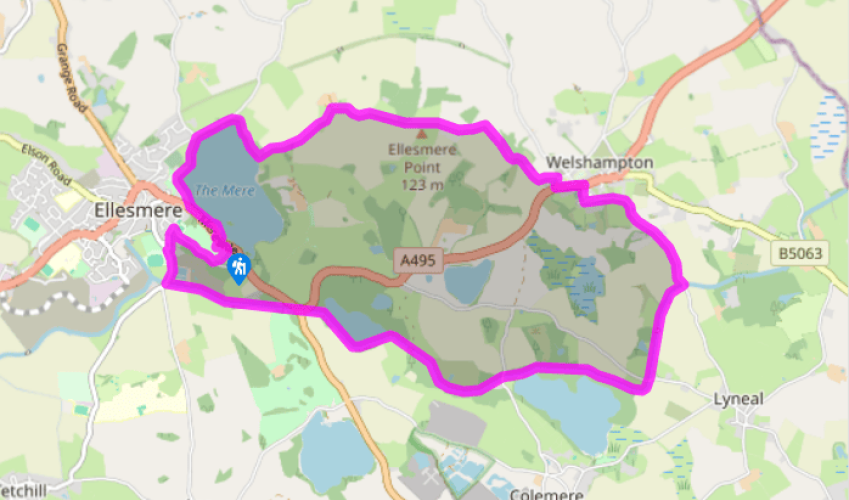
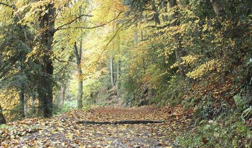
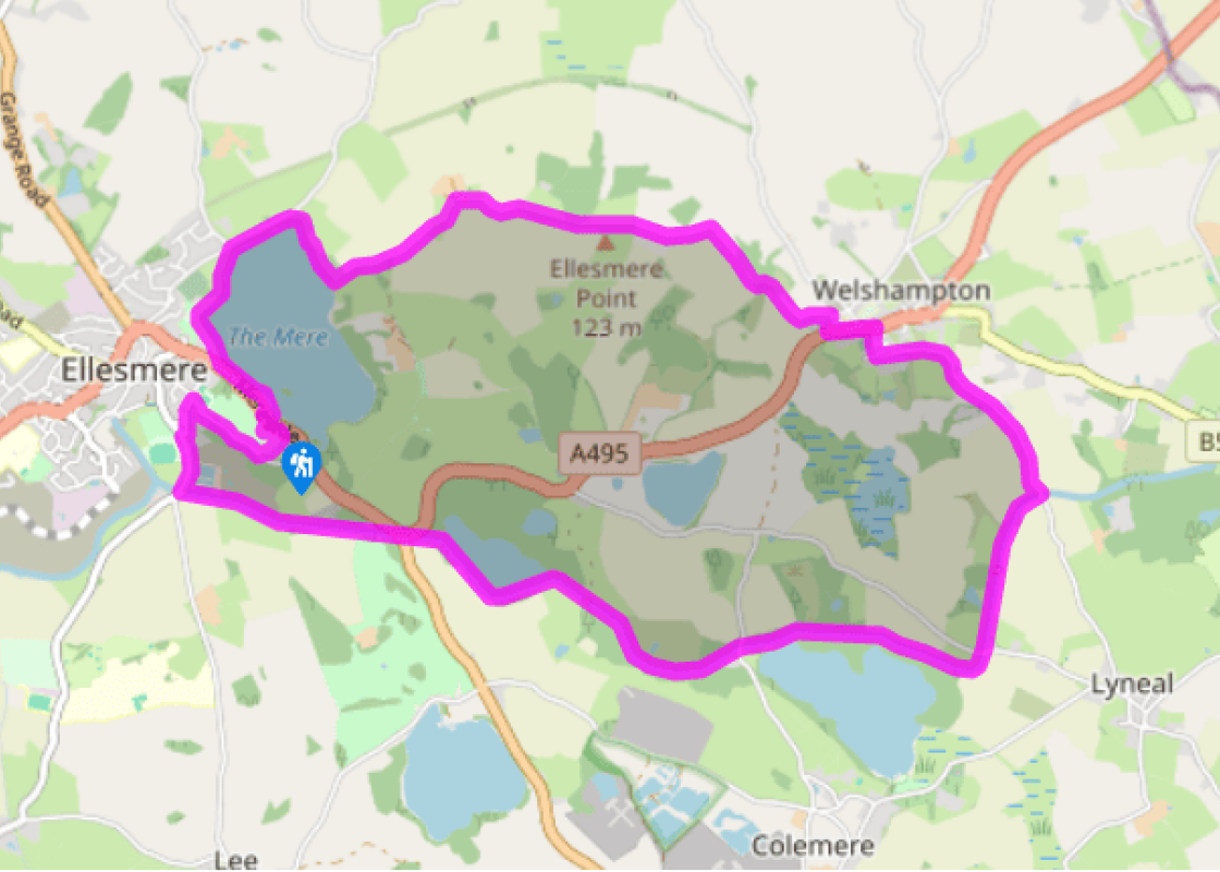
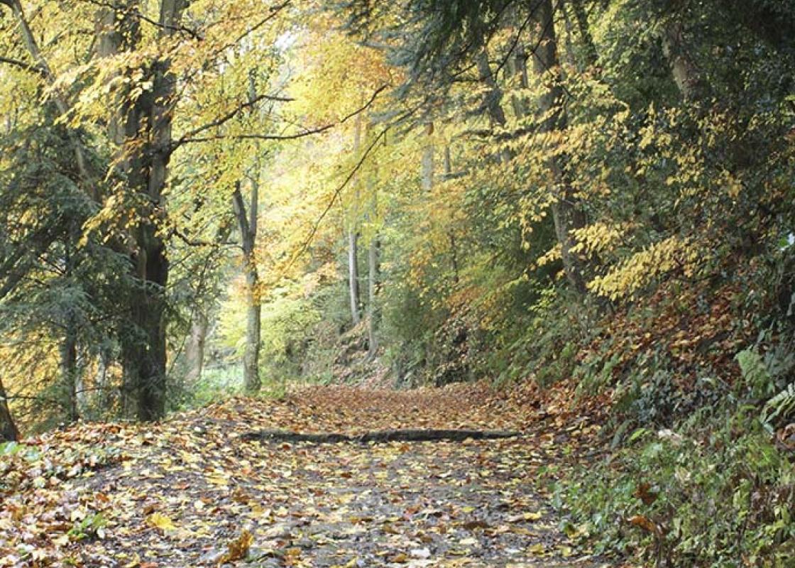
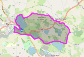
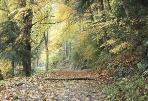
Cross to The Mere and turn left. Pass The Boathouse and walk towards town, until you come to Cremorne Gardens. Join a path signed ‘Woodland Walk’ that runs through trees close by the water’s edge for about 0.75 miles (1.2km).
Ignore paths going left until you meet one signposted ‘Welshampton’. The fenced path soon joins a track. Ignore a turn to the right, marked ‘Private Road’. Just before Crimps Farm turn right on another track.
The track leads into pasture. Go straight on, guided by waymarkers and gates. Go through a field with a vegetation-choked pool in it and then aim for three prominent trees close together at the far side. As you approach them, bear left into the field corner..
Go through a gate and descend by the right-hand hedge. When it turns a corner, go with it, to the right. Skirt a marshy pool then keep right to a kissing gate in the hedge (easily missed). Follow the hedge left and soon join a clear track. This leads to a farm where you join a road.
Turn left into Welshampton. Go past a church and turn immediately right on Lyneal Lane. Follow it to a bridge over the Llangollen Canal. Descend steps to the towpath and turn right, passing under the bridge. Pass Lyneal Wharf, Cole Mere, Yell Wood and Blake Mere, then go through Ellesmere Tunnel. Beyond this are three footpaths signposted to The Mere. Take any of these short cuts if you wish, but to see a bit more of the canal, including the visitor moorings and marina, stay on the towpath.
Arriving at Bridge 58, further choices present themselves. You could extend this walk to include the signposted Wharf Circular Walk (recommended) or to explore the town (also recommended): just follow the signs. To return directly to The Mere, however, go up to the road and turn right.
Fork right on a road marked ‘Unsuitable for HGV’. Turn right at the top, then soon left at Rose Bank, up steps. Walk across the earthworks of the long-gone Ellesmere Castle and follow signs for The Mere or the car park.
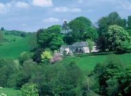
Ellesmere is a delightful little Shropshire town. It’s well worth devoting some time to exploring it. But Ellesmere’s biggest asset must be The Mere, the largest of all the meres that grace north Shropshire and south Cheshire. It attracts water birds and is important for winter migrants such as... wigeon, pochard, goosander and teal. It also has a large heronry occupied by breeding birds in spring and early summer. On this walk you will explore about half of The Mere’s shoreline and follow the towpath of the Llangollen Canal past Cole Mere and Blake Mere. Cole Mere is included within a country park and there is access from the towpath at Yell Bridge (No. 54). To explore Cole Mere, walk all the way round it. Blake Mere is particularly lovely; it’s separated from the towpath only by a narrow strip of woodland, but there is no other access to it. Mere is an Anglo-Saxon word for a lake. Unlike a normal lake, however, these meres have no stream flowing in or out of them. So how were they formed? What follows here is a simplified version. During the last ice age, the landscape was scoured by glaciers and when they retreated between 10,000 to 12,000 years ago, they left clay-lined hollows which retained melting ice, forming some of the meres. Others filled up later because they lay below the level of the water table. Water levels are maintained by natural drainage (groundwater percolation) from the surrounding countryside. The landscape is composed of gentle hills that, with the meres, form a pleasing scene. It consists of glacial drift, a mixture of clays, sands and gravels originally scoured from rocks by the glaciers and then deposited in banks and mounds known as moraines as the glaciers retreated. In places, you can identify the origins of the glacial drift. Blue-black pebbles are slates from Snowdonia or Cumbria, and pale, speckled stones are granites from Cumbria or Scotland, while pink pebbles are from the local sandstone. These glacial meres are unique in this country and rare in global terms North Shropshire is also renowned for its mosses, which were created by the glaciers too, but they are filled with peat rather than water. The wonderful moss at Whixall is well known, but there are several small mosses around Ellesmere too, though none with public access. The meres and mosses together form a wetland complex which, ecologically, is of national if not international significance.
Perhaps nowhere else in England will you find a county so deeply rural and with so much variety as Shropshire. Choose a clear day, climb to the top of The Wrekin, and look down on that ‘land of lost content’ so wistfully evoked by A E Housman.
Cross to The Mere and turn left. Pass The Boathouse and walk towards town, until you come to Cremorne Gardens. Join a path signed ‘Woodland Walk’ that runs through trees close by the water’s edge for about 0.75 miles (1.2km).
1 of 7
Ignore paths going left until you meet one signposted ‘Welshampton’. The fenced path soon joins a track. Ignore a turn to the right, marked ‘Private Road’. Just before Crimps Farm turn right on another track.
2 of 7
The track leads into pasture. Go straight on, guided by waymarkers and gates. Go through a field with a vegetation-choked pool in it and then aim for three prominent trees close together at the far side. As you approach them, bear left into the field corner..
3 of 7
Go through a gate and descend by the right-hand hedge. When it turns a corner, go with it, to the right. Skirt a marshy pool then keep right to a kissing gate in the hedge (easily missed). Follow the hedge left and soon join a clear track. This leads to a farm where you join a road.
4 of 7
Turn left into Welshampton. Go past a church and turn immediately right on Lyneal Lane. Follow it to a bridge over the Llangollen Canal. Descend steps to the towpath and turn right, passing under the bridge. Pass Lyneal Wharf, Cole Mere, Yell Wood and Blake Mere, then go through Ellesmere Tunnel. Beyond this are three footpaths signposted to The Mere. Take any of these short cuts if you wish, but to see a bit more of the canal, including the visitor moorings and marina, stay on the towpath.
5 of 7
Arriving at Bridge 58, further choices present themselves. You could extend this walk to include the signposted Wharf Circular Walk (recommended) or to explore the town (also recommended): just follow the signs. To return directly to The Mere, however, go up to the road and turn right.
6 of 7
Fork right on a road marked ‘Unsuitable for HGV’. Turn right at the top, then soon left at Rose Bank, up steps. Walk across the earthworks of the long-gone Ellesmere Castle and follow signs for The Mere or the car park.
Ellesmere is a delightful little Shropshire town. It’s well worth devoting some time to exploring it. But Ellesmere’s biggest asset must be The Mere, the largest of all the meres that grace north Shropshire and south Cheshire. It attracts water birds and is important for winter migrants such as... wigeon, pochard, goosander and teal. It also has a large heronry occupied by breeding birds in spring and early summer. On this walk you will explore about half of The Mere’s shoreline and follow the towpath of the Llangollen Canal past Cole Mere and Blake Mere. Cole Mere is included within a country park and there is access from the towpath at Yell Bridge (No. 54). To explore Cole Mere, walk all the way round it. Blake Mere is particularly lovely; it’s separated from the towpath only by a narrow strip of woodland, but there is no other access to it. Mere is an Anglo-Saxon word for a lake. Unlike a normal lake, however, these meres have no stream flowing in or out of them. So how were they formed? What follows here is a simplified version. During the last ice age, the landscape was scoured by glaciers and when they retreated between 10,000 to 12,000 years ago, they left clay-lined hollows which retained melting ice, forming some of the meres. Others filled up later because they lay below the level of the water table. Water levels are maintained by natural drainage (groundwater percolation) from the surrounding countryside. The landscape is composed of gentle hills that, with the meres, form a pleasing scene. It consists of glacial drift, a mixture of clays, sands and gravels originally scoured from rocks by the glaciers and then deposited in banks and mounds known as moraines as the glaciers retreated. In places, you can identify the origins of the glacial drift. Blue-black pebbles are slates from Snowdonia or Cumbria, and pale, speckled stones are granites from Cumbria or Scotland, while pink pebbles are from the local sandstone. These glacial meres are unique in this country and rare in global terms North Shropshire is also renowned for its mosses, which were created by the glaciers too, but they are filled with peat rather than water. The wonderful moss at Whixall is well known, but there are several small mosses around Ellesmere too, though none with public access. The meres and mosses together form a wetland complex which, ecologically, is of national if not international significance.
Perhaps nowhere else in England will you find a county so deeply rural and with so much variety as Shropshire. Choose a clear day, climb to the top of The Wrekin, and look down on that ‘land of lost content’ so wistfully evoked by A E Housman.