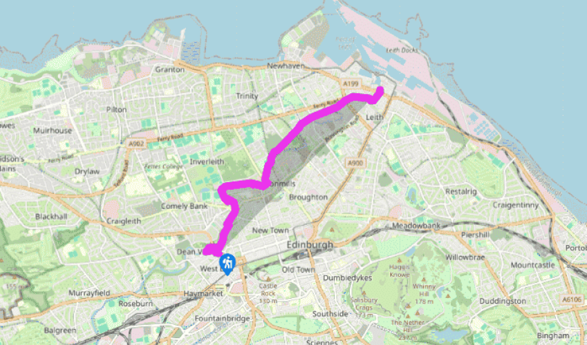
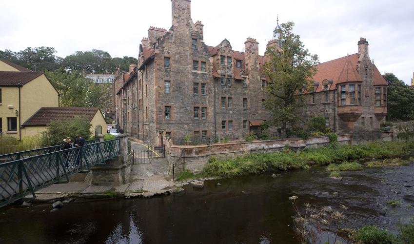
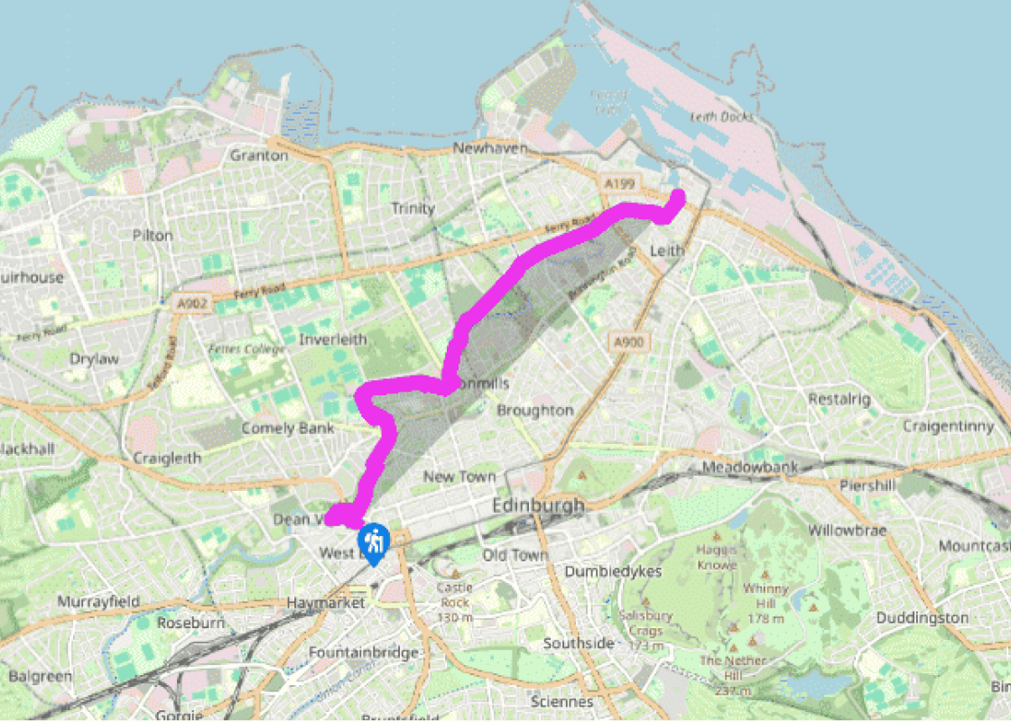
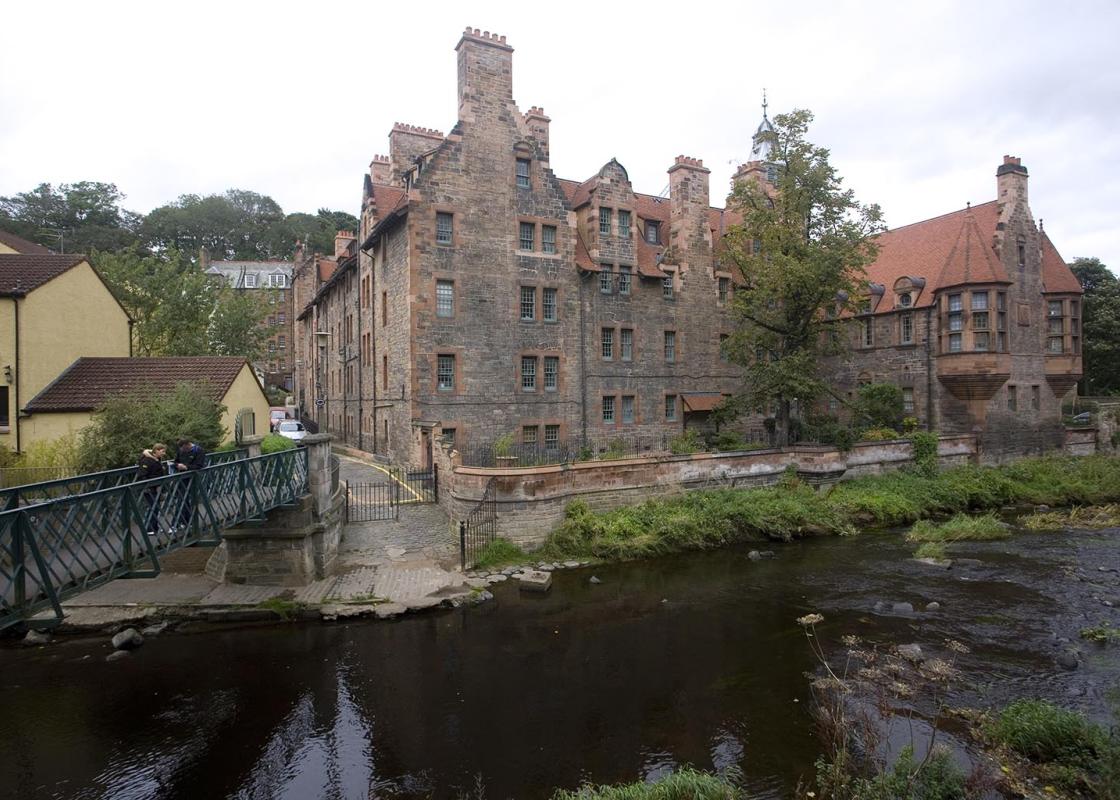
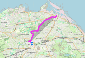
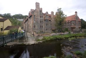
From the junction of the Dean Bridge and Queensferry Street, turn left to walk down Bell's Brae. You are now in the Dean Village, which dates back to 1128. It was once a milling centre and had 11 watermills producing all the meal for Edinburgh. At the bottom, turn right into Miller Row.
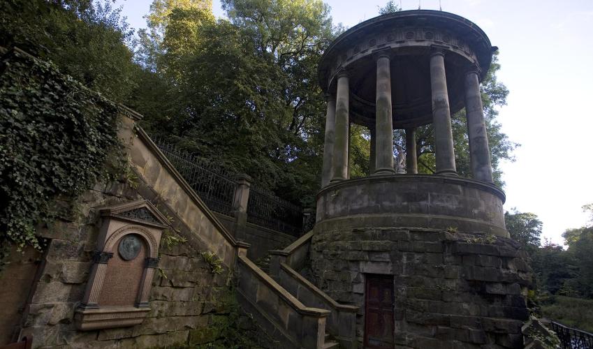
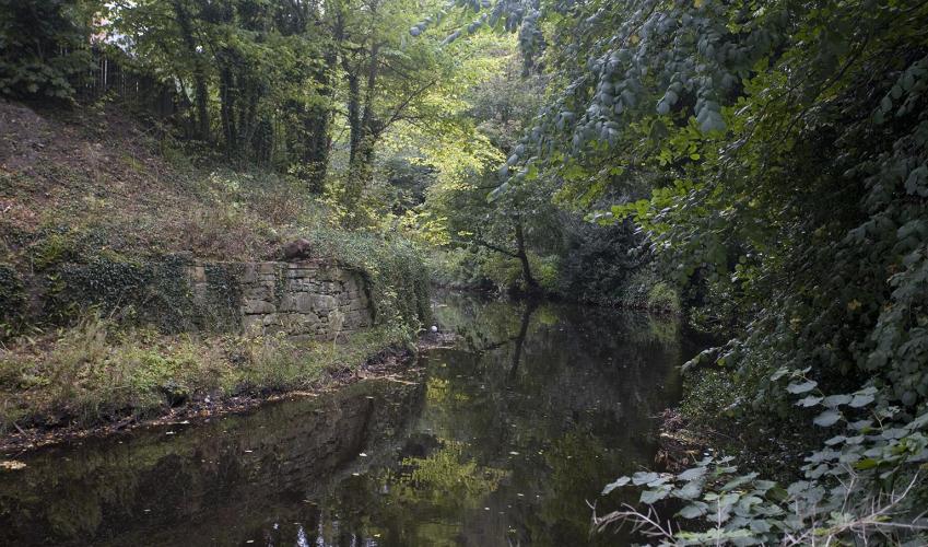
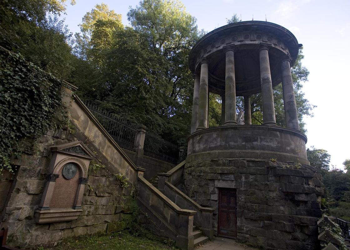
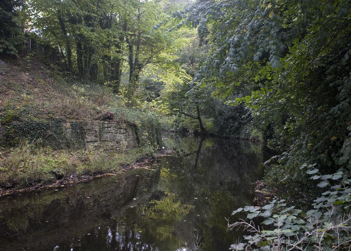
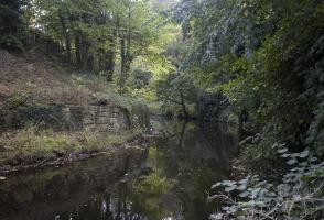
Follow this to walk under the impressive arches of the Dean Bridge, which was designed by Thomas Telford and opened in 1832. Your path then runs along the bottom of the steeply sided gorge, beside the Water of Leith, and feels extremely rural. You'll pass an old well on your left, followed by the more impressive St Bernard's Well.
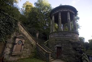
St Bernard's Well was discovered by some schoolboys in 1760. The mineral water was said to have healing properties and, in 1789, the present Roman Temple was built, with Hygeia – the goddess of health – at the centre. From here continue along the main path, then go up the steps. Turn left, and go right onto Dean Terrace to reach Stockbridge.
Cross the road and go down the steps ahead – immediately to the right of the building with the clock tower. Continue to follow the surfaced Water of Leith Walkway beside the river. Where the path ends, cross the bridge and climb onto the road. Turn left, following the Water of Leith Walkway, and then turn right to go down Arboretum Avenue.
Walk along this road, then turn right along the path marked 'Rocheid Path'. This runs beside the river and is a popular cycleway and jogging path. Follow this, passing the Colonies. This low-cost housing was built by the Edinburgh Co-operative for artisans living here in the late 19th century. The idea was to provide houses in a healthy environment away from the dirt of the city. Walk past the modern Rustic Bridge on your right, and carry on along the Water of Leith to Tanfield Bridge.
Cross the footbridge, turn left and follow the footpath, with the water on your left and a high stone wall on your right. Pass under a green-painted iron bridge and turn right up a set of steps to Brandon Terrace. Turn left, towards a small clock tower. Cross Inverleith Terrace, turn left along Warriston Place, then right down Warriston Crescent. Walk to the end, with playing fields on your left.
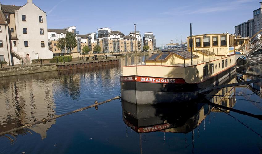
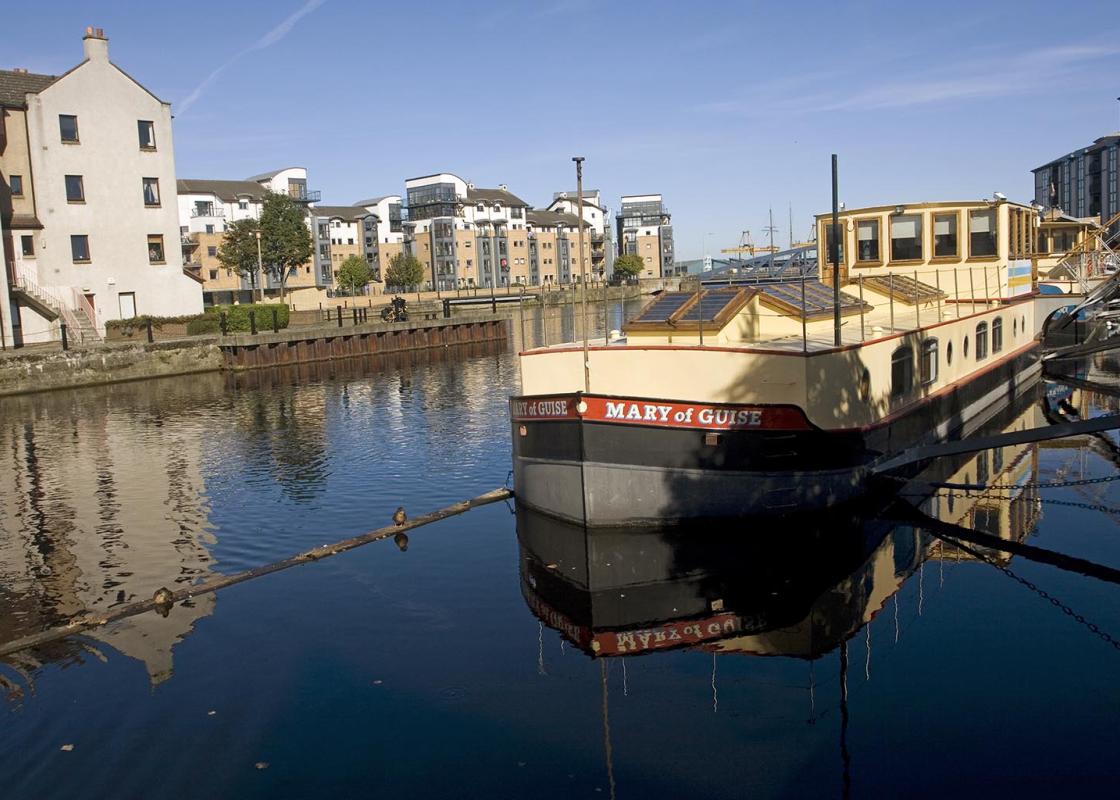
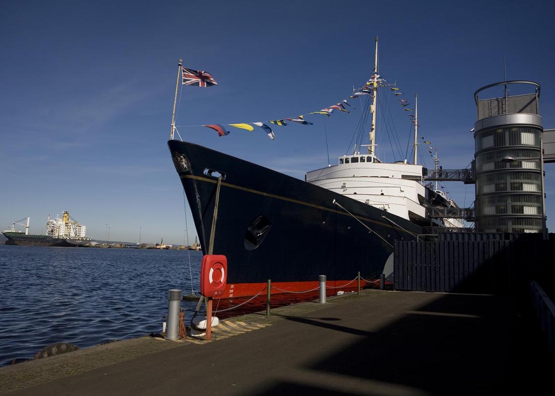
At the end, where a white and blue sign points to Warriston Path, turn left then immediately right on a tarred path with chain link fences on either side. Follow the path as it bears uphill between trees. Turn left at the top and follow the cycle track marked 'Leith 1¼'. Follow this all the way into Leith, where it brings you out near the old Custom House. Cross the bridge, then turn left to walk along the shore and take the chance to explore the pubs, before returning to town by bus (number 22 or 23) or tram.
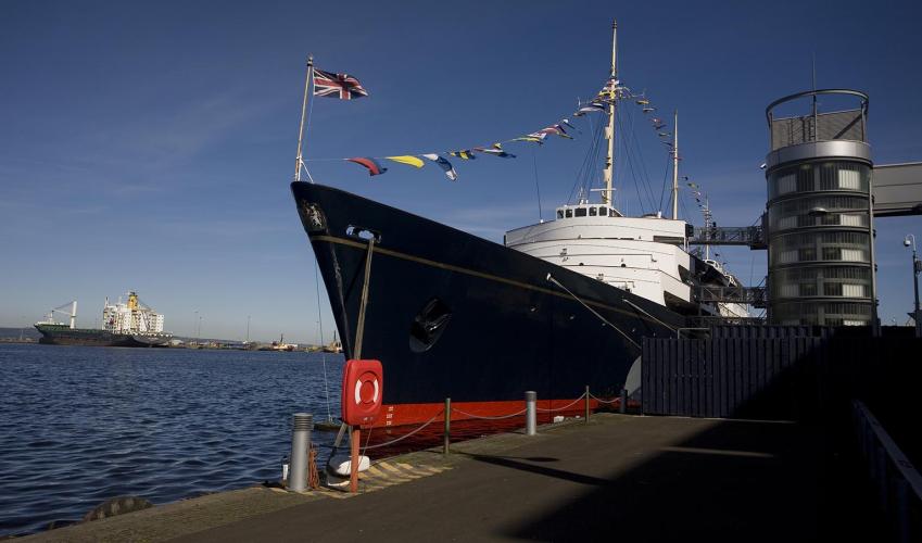
Visitors often forget to come to Leith, yet Edinburgh's ancient seaport is full of history. The docks may have been spruced up and become rather trendy, but Leith retains an edgy, maritime atmosphere – like an old sea dog who'll spin you a yarn for a pint. A taste for claret There has been a port... at Leith, where the Water of Leith flows into the Forth, from at least the first century AD, when the Romans stored wine for their legions here. The port grew and by medieval times was facilitating valuable trade with France. Ships would leave loaded with dried local fish and return laden with wines, which were landed by the French monks of St Anthony who were based in Edinburgh. One of the main imports was claret. It rapidly became Scotland's national drink (the most popular drink in England at the time was port). One old verse sums up its popularity, beginning with the words: 'Guid claret best keeps out the cauld an drives awa the winter soon'. When cargoes arrived, some would be sent on a cart through Leith and anyone who fancied a sample simply turned up with a jug, which would be filled for 6d. It didn't seem to matter how large the jug was. Whisky makes its mark The quality of the claret imported and bottled in Leith was extremely good. One historian said it 'held in its day a cachet comparable to that which one now associates with chateau-bottled wines'. Claret drinking was seen as a symbol of Scotland's national identity, and Jacobites drank it as a symbol of independence. During the 18th century the British government, determined to price the French out of the market, raised taxes on claret. Inevitably traders began to smuggle it into Scotland instead. It was only in the 19th century that claret drinking declined when taxes rose and the Napoleonic Wars made it scarce. While Leith claret was still drunk by the wealthiest people, whisky (a drink from the Highlands) took its place as the people's pick-me-up, going from strength to strength to reach its present state of popularity. The Darien disaster The Port of Leith continued to grow in importance and it was from here, in 1698, that the ill-fated Darien Expedition set sail, a venture that was eventually to cost Scotland her independence. The intention was to establish a permanent colony at Darien on the Isthmus of Panama. It cost £400,000 to fund, but it was thought that the venture would give Scotland control of a potentially lucrative trading route. However the terrain was hostile and the colonists rapidly died. The Scottish economy was plunged into crisis and the country was pushed inexorably towards union with England.
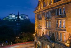
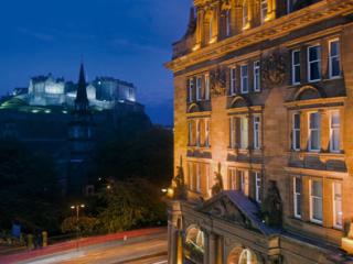
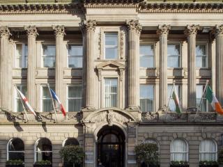
Edinburgh is one of Britain’s most spectacular cities and both Old and New Towns have UNESCO World Heritage status. At its heart, the Old Town is a treasury of architecture stretching back to medieval times with its labyrinth of narrow lanes (‘wynds’ or ‘closes’).
From the junction of the Dean Bridge and Queensferry Street, turn left to walk down Bell's Brae. You are now in the Dean Village, which dates back to 1128. It was once a milling centre and had 11 watermills producing all the meal for Edinburgh. At the bottom, turn right into Miller Row.
1 of 7
Follow this to walk under the impressive arches of the Dean Bridge, which was designed by Thomas Telford and opened in 1832. Your path then runs along the bottom of the steeply sided gorge, beside the Water of Leith, and feels extremely rural. You'll pass an old well on your left, followed by the more impressive St Bernard's Well.
2 of 7
St Bernard's Well was discovered by some schoolboys in 1760. The mineral water was said to have healing properties and, in 1789, the present Roman Temple was built, with Hygeia – the goddess of health – at the centre. From here continue along the main path, then go up the steps. Turn left, and go right onto Dean Terrace to reach Stockbridge.
3 of 7
Cross the road and go down the steps ahead – immediately to the right of the building with the clock tower. Continue to follow the surfaced Water of Leith Walkway beside the river. Where the path ends, cross the bridge and climb onto the road. Turn left, following the Water of Leith Walkway, and then turn right to go down Arboretum Avenue.
4 of 7
Walk along this road, then turn right along the path marked 'Rocheid Path'. This runs beside the river and is a popular cycleway and jogging path. Follow this, passing the Colonies. This low-cost housing was built by the Edinburgh Co-operative for artisans living here in the late 19th century. The idea was to provide houses in a healthy environment away from the dirt of the city. Walk past the modern Rustic Bridge on your right, and carry on along the Water of Leith to Tanfield Bridge.
5 of 7
Cross the footbridge, turn left and follow the footpath, with the water on your left and a high stone wall on your right. Pass under a green-painted iron bridge and turn right up a set of steps to Brandon Terrace. Turn left, towards a small clock tower. Cross Inverleith Terrace, turn left along Warriston Place, then right down Warriston Crescent. Walk to the end, with playing fields on your left.
6 of 7
At the end, where a white and blue sign points to Warriston Path, turn left then immediately right on a tarred path with chain link fences on either side. Follow the path as it bears uphill between trees. Turn left at the top and follow the cycle track marked 'Leith 1¼'. Follow this all the way into Leith, where it brings you out near the old Custom House. Cross the bridge, then turn left to walk along the shore and take the chance to explore the pubs, before returning to town by bus (number 22 or 23) or tram.
Visitors often forget to come to Leith, yet Edinburgh's ancient seaport is full of history. The docks may have been spruced up and become rather trendy, but Leith retains an edgy, maritime atmosphere – like an old sea dog who'll spin you a yarn for a pint. A taste for claret There has been a port... at Leith, where the Water of Leith flows into the Forth, from at least the first century AD, when the Romans stored wine for their legions here. The port grew and by medieval times was facilitating valuable trade with France. Ships would leave loaded with dried local fish and return laden with wines, which were landed by the French monks of St Anthony who were based in Edinburgh. One of the main imports was claret. It rapidly became Scotland's national drink (the most popular drink in England at the time was port). One old verse sums up its popularity, beginning with the words: 'Guid claret best keeps out the cauld an drives awa the winter soon'. When cargoes arrived, some would be sent on a cart through Leith and anyone who fancied a sample simply turned up with a jug, which would be filled for 6d. It didn't seem to matter how large the jug was. Whisky makes its mark The quality of the claret imported and bottled in Leith was extremely good. One historian said it 'held in its day a cachet comparable to that which one now associates with chateau-bottled wines'. Claret drinking was seen as a symbol of Scotland's national identity, and Jacobites drank it as a symbol of independence. During the 18th century the British government, determined to price the French out of the market, raised taxes on claret. Inevitably traders began to smuggle it into Scotland instead. It was only in the 19th century that claret drinking declined when taxes rose and the Napoleonic Wars made it scarce. While Leith claret was still drunk by the wealthiest people, whisky (a drink from the Highlands) took its place as the people's pick-me-up, going from strength to strength to reach its present state of popularity. The Darien disaster The Port of Leith continued to grow in importance and it was from here, in 1698, that the ill-fated Darien Expedition set sail, a venture that was eventually to cost Scotland her independence. The intention was to establish a permanent colony at Darien on the Isthmus of Panama. It cost £400,000 to fund, but it was thought that the venture would give Scotland control of a potentially lucrative trading route. However the terrain was hostile and the colonists rapidly died. The Scottish economy was plunged into crisis and the country was pushed inexorably towards union with England.
Edinburgh is one of Britain’s most spectacular cities and both Old and New Towns have UNESCO World Heritage status. At its heart, the Old Town is a treasury of architecture stretching back to medieval times with its labyrinth of narrow lanes (‘wynds’ or ‘closes’).