

Belhaven Bay Caravan & Camping Park
Belhaven Bay Caravan and Camping Park is located on the outskirts of Dunbar, this is a sheltered…

East Linton
5.25 miles (8.4kms)
If you were to design your ideal walk, what would it include? A dash of history; a crumbling castle; perhaps some fields of waving corn and a peaceful river bank? And maybe a pretty village, in which to settle down finally with a cup of tea and a large wedge of home-made cake? This walk's for you, then. It takes you on a lovely varied route through the fertile countryside of East Lothian, just a few miles outside Edinburgh. It's the sort of walk that is enjoyable at any time of year – but it is particularly lovely in the summer, when wild flowers line your way.
The first part of the walk takes you past an old doo'cot (dovecote) where pigeons were bred to be used as food. It once belonged to Phantassie house, a local property which was the birthplace of Sir John Rennie in 1761. Rennie was a civil engineer who studied at Edinburgh University, then moved to London. There he constructed Southwark and Waterloo bridges, as well as designing dockyards, bridges and canals throughout the country.
Not far from the doo'cot is the photogenic Preston Mill, owned by the National Trust for Scotland. This is an 18th-century grain mill and was used to process the produce of East Lothian's fertile arable fields. It has a distinctive conical kiln, which was used for drying the grain, and a barn where the grain was ground. The machinery is driven by a waterwheel.
Later on in the walk, as you make your way towards Hailes Castle, you might well see the scarlet heads of poppies waving among the ripening crops. If you see them on a hot day in August, they make a magnificent spectacle. Poppies have been a symbol of blood, harvest and regeneration for thousands of years, as they grow in fields of grain and will rapidly colonise disturbed ground – this was most graphically illustrated on the battlefields of World War I, and poppies have also become a symbol of remembrance of lives lost.
Poppies were the sacred plant of the Roman crop goddess Ceres (from whose name we get the word 'cereal'). The Romans used to decorate her statues with garlands of poppies and barley, and poppy seeds were offered up during rituals to ensure a good harvest. Poppy seeds mixed with grains of barley have also been found in Egyptian relics dating from 2500 BC. In Britain it was once believed that picking poppies would provoke a storm, and they were nicknamed 'thundercup', 'thunderflower' or 'lightnings'. Whatever you call them, they're a glorious and welcome sight.
From the Market Cross in the centre of the town, take the lane that runs to the left of the church. When you come to the main street turn left, then walk over the bridge and continue until you reach a derelict filling station on the right-hand side and a bus stop on your left. Turn left here into the farm opposite the garage, following the sign for the public path to Tyninghame and Preston Mill.
Follow the path to the right, round the extensive but derelict red sandstone buildings of Phantassie Steading. There are proposals to convert this sample of historic industrial architecture into a shopping complex, which may limit access when building work begins, but no start date has been announced. Skirt the steading, following a farm track and turning right and then left until you see the old doo’cot (dovecote) ahead of you. Walk straight on with this old stone building on your right, and carry straight ahead with fields to right and left.
At the end of the path, cross a white-painted footbridge where fingerposts point to ‘John Muir Way, East Linton ½ (Preston Mill ¼ )’. At the other side, go through a kissing gate and bear right across a field to the old mill. Once you've inspected the mill – you can go inside when it's open – continue on to meet the main road, cross over, then turn left to walk back into the town. Turn right to walk along the High Street, then cross over the road and turn left to go down Langside.
When you reach the recreation ground, maintain direction and walk across the grass to reach the railway. After passing beneath the railway, walk along a muddy track with a tumbledown stone wall on your right and a new housing estate on your left. Cross a stone wall by some old stone steps. Carry straight on, pass through an electric fence by a kissing gate, and cross another field to pass through a broad gap in a collapsed stone wall. Walk on towards the fingerpost which you can see ahead of you, which reads ‘Public Path Pencraig Hill ½’ When you reach it, turn left on an unsurfaced tractor track.
Turn right and follow the paved footway through the Pencraig pull-in and on to a signpost to Overhailes. Turn right here and follow the path round and under the dual carriageway. From the farm continue down to the end of the lane at Hailes Mill. At the foot of the lane, where it turns right to Hailes Mill, leave the tarred lane and follow a rough path to the riverside. Turn left along the river. Shortly, you reach the cottages of Hailes Mill and a footbridge on your right.
Don't cross over the bridge (unless you intend to visit the ruins of Hailes Castle) but instead follow the path that runs to the left of the steps. You're now walking along the river's edge on a narrow path. Follow the path along a field margin and under a road bridge, then enter some woods. Walk up a flight of stairs, then down some steps, and continue following the path to walk under another modern road bridge. The path now runs through a garden and onto the road, where you turn right. Walk under the railway bridge, then turn left and return to the starting point of the walk in the town centre.
Field paths, river margins and woodland tracks; short section of busy road; several stiles
Cultivated fields, lively river and picturesque village
Can run free for many sections, but watch for sheep
OS Explorer 351 Dunbar & North Berwick
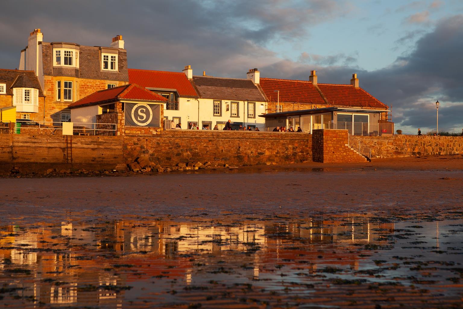
Main street in East Linton
Pencraig picnic site
Read our tips to look after yourself and the environment when following this walk.
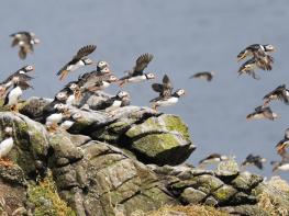
Said to be the sunniest area of Scotland, East Lothian boasts a dramatic coastline. In summer, you’ll hear larks singing high above the four-mile sweep of dunes, sandy shoreline and saltmarsh that forms the John Muir Country Park, named after the Dunbar-born explorer, naturalist and father of conservation. Eider and shelduck nest in the dunes, and gannets skim the waves on their way to and from their fishing grounds and roosts on the nearby Bass Rock.
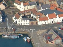
Dunbar’s prosperity was built on fishing and whaling, and its three historic harbours are still home to a busy fleet of small fishing boats. The oldest is overlooked by Dunbar Castle whose ruins now provide a home to a vast colony of 600 pairs of kittiwakes. Tucked beside a rocky headland, North Berwick’s harbour is a yachting and lobster fishing centre. For 500 years it provided a ferry on the pilgrimage route to St Andrews, which dramatically shortened the journey from the south. The handsome market town of Haddington is set in prime agricultural country on the River Tyne. It was granted the status of a royal burgh in the 12th century and later became the county town for East Lothian.
Discover more than 15,000 professionally rated places to stay, eat and visit from across the UK and Ireland.
Choose a place to stay safe in the knowledge that it has been expertly assessed by trained assessors.
Search by location or the type of place you're visiting to find your next ideal holiday experience.
Read our articles, city guides and recommended things to do for inspiration. We're here to help you explore the UK.