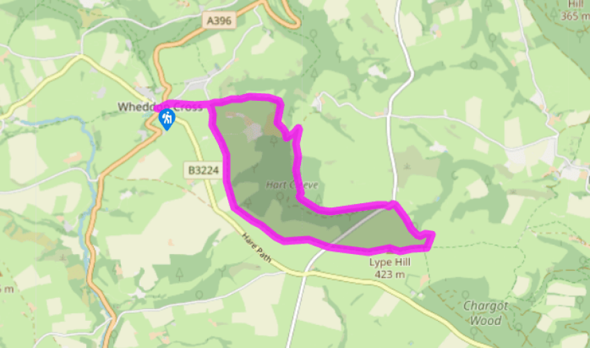
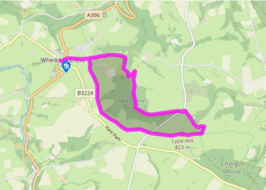
"A sunken lane from Wheddon Cross leads up to Lype Hill, the high point of the Brendons."
Walk directions
From the main crossroads head towards the village of Dunster, and pass a small car park on the right. At the war memorial, opposite the school, take the right hand lane, signposted Putham. This is called Popery Lane – but no, the school we just passed was a Church of England one. The sunken lane runs to Cutcombe Cross, where you keep ahead ('Luxburough via Putham Ford') then bear left at a sign into Putham Lane.
Horses and tractors also use this longish narrow hedged track. At the bottom it crosses a ford, with a stone footbridge alongside. Now keep ahead on to a climbing lane surfaced with eroded tarmac.
At the top of the steep climb a field gate on the right has a partially obscured sign with ‘Lype Hill 1 ½ miles’. It leads on to a green track that runs below and then into a wood. A gate on the right leads to a less used track. In 100yds (91m) turn down right across a stream, with yellow spots and posts marking the small path uphill to its right, into an open space. A slightly wider path above slants up along a bracken clearing. After a gate it follows the foot of a felled plantation, to join a forest road and emerge on to a road.
Turn left, down a wide verge, and take the upper of two gates on the right: the correct one has a stile and footpath sign. Head up with beech bank on your left to cross the top of a wooded combe. Now a sea view is on the left, a stile and gate ahead. Don't cross, but turn right, and right again across the top of the field to a gate beside the trig point on Lype Hill.
Through the gate keep ahead across a field, with a tumulus 70yds (64m) away on the left, and after a gate bear left to follow the fence on the left to its corner. A gate ahead leads on to a road. Cross to a signposted gate, and bear left to the corner. Go through the gate and continue diagonally left, with a beech bank on your left, to a waymarked gate set in a fence. Don’t go through, but follow the fence downhill. Continue downhill with fences on your right and then a hedge on your left, towards the whitewalled Pitleigh Kennels. A gate leads to the driveway just to the left of the farm.
Cross the driveway into a green track. This becomes a fenced-in field-edge to a gate on the left. Turn right to continue as before with hedges now on your right. After two fields you reach a hedged track. This runs down to the crossroads in Popery Lane and your return route to Wheddon Cross and the car park.
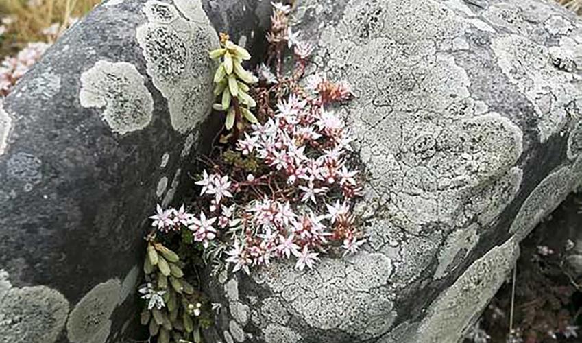
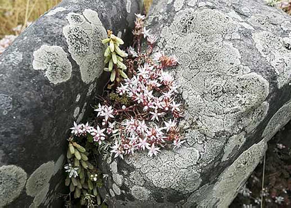
This walk takes in the highest point of the Brendons, Lype Hill, at 1,388ft (423m). The wrap-around view includes Dunkery Beacon, Wales and Dartmoor. The trig point itself stands on an ancient tumulus; the second apparent tumulus nearby houses a modern-day water tank. Brown Hill Brendon means... 'brown hill'. The shales and muddy sandstones are sea bottom rocks: though the oldest in Somerset, they formed from the decomposition of still older mountains that have now appeared. The Brendons are not particularly high, and are farmed to their tops, though the steeper sides are wooded. The scene appears timeless, but the hilltops were forested into the Middle Ages, and later became an industrial estate. Return of the Iron Age The Iron Age on Brendon saw the digging of long ramparts across the plateau, and a great settlement on the high ground. However, apart from a small fort at Elworthy Barrows, this activity wasn't in pre-Roman times, but in the more recent 19th century. A railway ran along the Brendon ridge from the iron ore mines. At its eastern end was a form of engineering we no longer see, except in Switzerland: a rope-assisted incline taking ore down to valley level. The ore then passed along the mineral railway to Watchet and the smelters of South Wales. Below the mining areas and the farmland the hillsides have been less disturbed by man. Here, altitude, thin soils, and western levels of rainfall mean a sort of woodland more akin to the Scottish Highlands. You'll see the silver birch, for example – silver and gold if you're lucky enough to be here in late October. As well as a variety of autumn fungi in vivid colours, Hartcleeve has striking examples of Witch's Broom in its birch trees. These twig-clusters resemble untidy spherical nests but are in fact caused by a fungus infection (ascomycete) which interferes with the tree's growth hormones. A really well-established Witch's Broom can be 3ft (1m) across and will consist of hundreds of twigs. The sinking of lanes Putham Lane shows several centuries' worth of erosion in action: a speeded up version of what's happening to the hills as a whole over millions of years (rather than a few hundred). Looking through the hedge you can see how much lower the lane is than the surrounding fields. Where the lane steepens, it also gets more deeply dug in; at its steepest point you can see bare grey bedrock in its floor. Where the track has dug itself down below the water table, a permanent stream trickles down it. After rain or during snowmelt this stream becomes a flood. Even at its low summer level, it's easy to see how it combines with feet (and, latterly, wheels) to excavate the track.
Somerset remains rural and unspoiled, and ever popular areas to visit are the limestone and red sandstone Mendip Hills rising to over 1,000 feet, and by complete contrast, to the south and southwest, the flat landscape of the Somerset Levels. Another popular spot, the Quantocks, once the haunt of poets Coleridge and Wordsworth, are noted for their gentle slopes, heather-covered moorland expanses and red deer.
"A sunken lane from Wheddon Cross leads up to Lype Hill, the high point of the Brendons."
Walk details
3hrs
Difficulty:
Hard
Gradient:
Moderate
Distance:
5.75 miles (9.2kms)
Ascent:
850ft (259m)
Walk directions
From the main crossroads head towards the village of Dunster, and pass a small car park on the right. At the war memorial, opposite the school, take the right hand lane, signposted Putham. This is called Popery Lane – but no, the school we just passed was a Church of England one. The sunken lane runs to Cutcombe Cross, where you keep ahead ('Luxburough via Putham Ford') then bear left at a sign into Putham Lane.
1 of 6
Horses and tractors also use this longish narrow hedged track. At the bottom it crosses a ford, with a stone footbridge alongside. Now keep ahead on to a climbing lane surfaced with eroded tarmac.
2 of 6
At the top of the steep climb a field gate on the right has a partially obscured sign with ‘Lype Hill 1 ½ miles’. It leads on to a green track that runs below and then into a wood. A gate on the right leads to a less used track. In 100yds (91m) turn down right across a stream, with yellow spots and posts marking the small path uphill to its right, into an open space. A slightly wider path above slants up along a bracken clearing. After a gate it follows the foot of a felled plantation, to join a forest road and emerge on to a road.
3 of 6
Turn left, down a wide verge, and take the upper of two gates on the right: the correct one has a stile and footpath sign. Head up with beech bank on your left to cross the top of a wooded combe. Now a sea view is on the left, a stile and gate ahead. Don't cross, but turn right, and right again across the top of the field to a gate beside the trig point on Lype Hill.
4 of 6
Through the gate keep ahead across a field, with a tumulus 70yds (64m) away on the left, and after a gate bear left to follow the fence on the left to its corner. A gate ahead leads on to a road. Cross to a signposted gate, and bear left to the corner. Go through the gate and continue diagonally left, with a beech bank on your left, to a waymarked gate set in a fence. Don’t go through, but follow the fence downhill. Continue downhill with fences on your right and then a hedge on your left, towards the whitewalled Pitleigh Kennels. A gate leads to the driveway just to the left of the farm.
5 of 6
Cross the driveway into a green track. This becomes a fenced-in field-edge to a gate on the left. Turn right to continue as before with hedges now on your right. After two fields you reach a hedged track. This runs down to the crossroads in Popery Lane and your return route to Wheddon Cross and the car park.
This walk takes in the highest point of the Brendons, Lype Hill, at 1,388ft (423m). The wrap-around view includes Dunkery Beacon, Wales and Dartmoor. The trig point itself stands on an ancient tumulus; the second apparent tumulus nearby houses a modern-day water tank. Brown Hill Brendon means... 'brown hill'. The shales and muddy sandstones are sea bottom rocks: though the oldest in Somerset, they formed from the decomposition of still older mountains that have now appeared. The Brendons are not particularly high, and are farmed to their tops, though the steeper sides are wooded. The scene appears timeless, but the hilltops were forested into the Middle Ages, and later became an industrial estate. Return of the Iron Age The Iron Age on Brendon saw the digging of long ramparts across the plateau, and a great settlement on the high ground. However, apart from a small fort at Elworthy Barrows, this activity wasn't in pre-Roman times, but in the more recent 19th century. A railway ran along the Brendon ridge from the iron ore mines. At its eastern end was a form of engineering we no longer see, except in Switzerland: a rope-assisted incline taking ore down to valley level. The ore then passed along the mineral railway to Watchet and the smelters of South Wales. Below the mining areas and the farmland the hillsides have been less disturbed by man. Here, altitude, thin soils, and western levels of rainfall mean a sort of woodland more akin to the Scottish Highlands. You'll see the silver birch, for example – silver and gold if you're lucky enough to be here in late October. As well as a variety of autumn fungi in vivid colours, Hartcleeve has striking examples of Witch's Broom in its birch trees. These twig-clusters resemble untidy spherical nests but are in fact caused by a fungus infection (ascomycete) which interferes with the tree's growth hormones. A really well-established Witch's Broom can be 3ft (1m) across and will consist of hundreds of twigs. The sinking of lanes Putham Lane shows several centuries' worth of erosion in action: a speeded up version of what's happening to the hills as a whole over millions of years (rather than a few hundred). Looking through the hedge you can see how much lower the lane is than the surrounding fields. Where the lane steepens, it also gets more deeply dug in; at its steepest point you can see bare grey bedrock in its floor. Where the track has dug itself down below the water table, a permanent stream trickles down it. After rain or during snowmelt this stream becomes a flood. Even at its low summer level, it's easy to see how it combines with feet (and, latterly, wheels) to excavate the track.
Somerset remains rural and unspoiled, and ever popular areas to visit are the limestone and red sandstone Mendip Hills rising to over 1,000 feet, and by complete contrast, to the south and southwest, the flat landscape of the Somerset Levels. Another popular spot, the Quantocks, once the haunt of poets Coleridge and Wordsworth, are noted for their gentle slopes, heather-covered moorland expanses and red deer.