Isle of Wight Coastal Path: Blackgang Chine to Ventnor
Recommended by
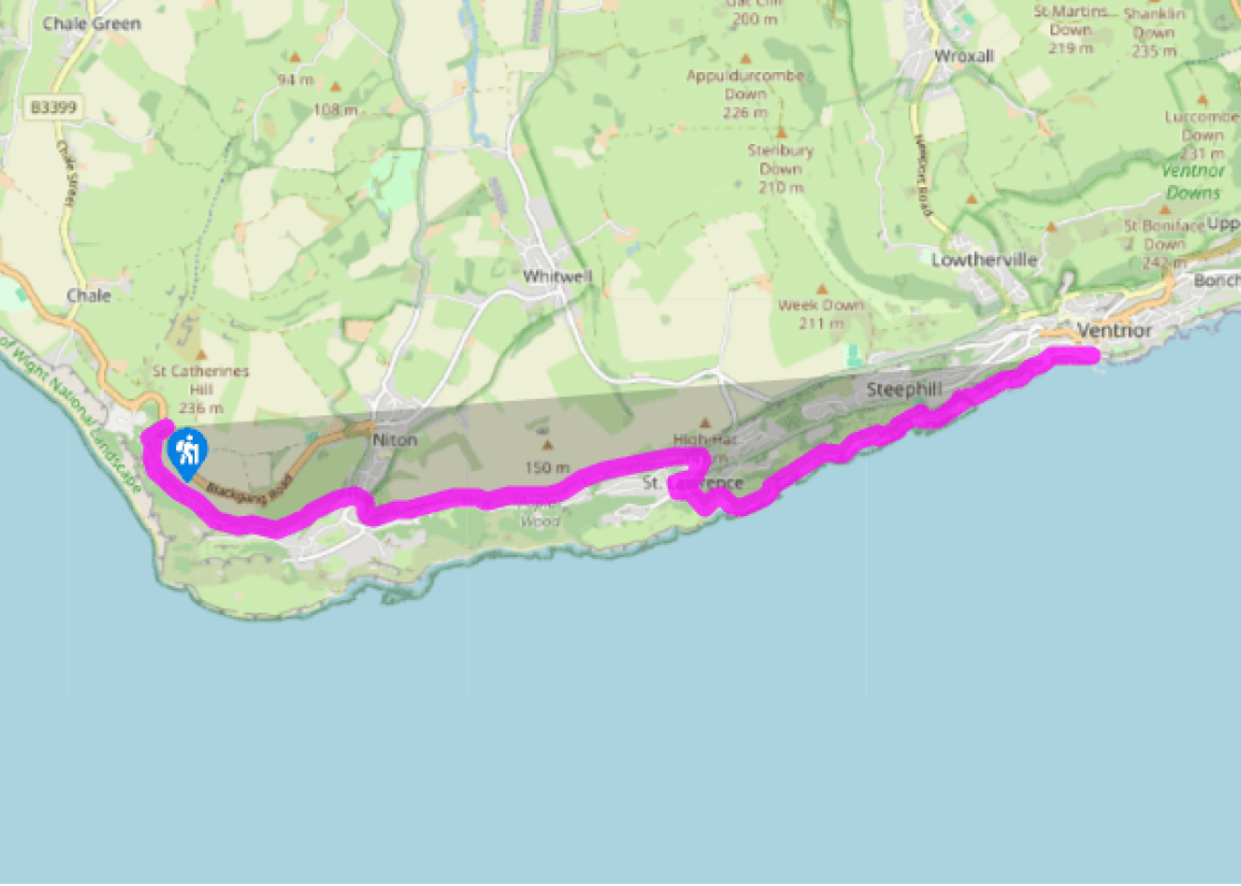
Walk directions
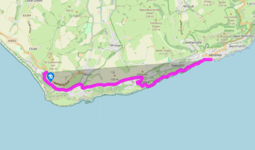
With your back to the road, walk through the car park and up steps to the left of a gate. At the end bear left on the coastal path. As you lose sight of the towers on St Catherine’s Hill, the low-lying land of the Undercliff and St Catherine’s Point comes into view on your right. This lush, fertile area, created by years of landslip, is now a haven for wildlife, with some very desirable human residences too. Eventually you’ll see the white lighthouse. As you ascend the cliff there are superb views back to Tennyson Down and the Dorset coastline.
Pass a bench above the lighthouse where the lower path joins, and keep ahead. The path continues through woodland. Go on through two kissing gates and follow the path ahead downhill towards Niton.
At the road (A3055) cross with care, and turn right then immediately left onto a tarmac drive. Where the track forks, bear right. Bear left, signed NT29. Walk along the muddy path between hedgerows, with fields opening out on your left. The path veers right through the trees, staying parallel with the field edge. Pass the end of a field boundary hedge and head steadily uphill. Near the top, pass an information board. By a redbrick building and radio mast, follow as the path dips right, to cross a muddy stile. Descend to a junction of paths by a fingerpost at High Hat.
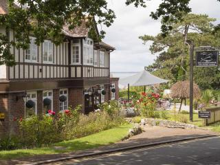
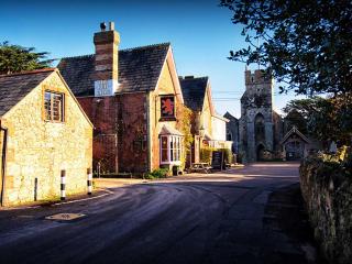
Turn right down V81 towards St Lawrence, passing a bench and information board. Descend steps to a kissing gate and continue down the steep, stepped path, hooking right to reach a road. Turn left here, into St Lawrence. Turn right into Spindlers Road, cross the road at the bottom (Undercliffe Drive) and head down Old Park Road, passing Craigie Lodge on the corner. Keep left, then turn left into Wolverton Road. Soon turn right through a wooden gate into the conservation area. The path is initially rough and steep, but levels out just before a stile. Cross this, and walk ahead. Turn left onto the grassy track. Follow it to a gate, and turn right, passing a row of cottages.
Bear left up steps and along the cliff top. Follow this undulating and sometimes very muddy path up steps, and on. Eventually pass behind a modern house built into the cliff. Continue ahead up its concrete drive and go straight on through the gap and up the field ahead. Keep left up a path, past an old brick incinerator. This was part of the former Royal National Hospital, a tuberculosis sanitorium which stood where the car park for the botanic gardens now lies. The footpath passes along the edge of the park, pine-scented on warm days.
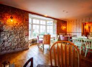
At a wooden gateway turn right down steps, then zigzag left and right, descending to characterful Steephill Cove. There are seasonal restaurants on the pretty bay, and public toilets. Walk past the lighthouse along the shore access road, and up a steep slope a the end of the bay. Cross a stream from an ornamental pond and ascend a long flight of steps. Follow the tarmac path up more steps and along the coast towards Ventnor. Bear left at a huge boulder, through the car park. Soon bear right again to pass a shelter. Continue down the hill to the seafront, passing above The Spyglass Inn and down to the sandy beach.
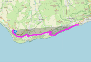
The route follows the Coastal Path (69 miles/111km), which is well signed on the ground with blue signs and a seagull symbol. Constant erosion of the island’s coastline means the path may be rerouted at any point, but this is usually clearly marked. Note that access for dogs to most of the island’s... beaches is restricted in summer. For information about bus links and timetables, see www.islandbuses.info Look inland to the top of St Catherine’s Hill, where there appears to be a rocket about to take off. This is called the Pepper Pot, and the odd building next to it is the Salt Cellar. Both are the remains of lighthouses – the octagonal Pepper Pot dating back to 1320, while the Salt Cellar was begun in 1800 but never finished. While rounding St Catherine’s Point, look out to sea at the horrendous tidal race. Even on a flat, calm day this can be a swirling maelstrom, caused by a variety of different tidal flows and currents. The tides of the Solent and surrounding area are the most complex in the UK. Ventnor grew as a fashionable Victorian health spa, lauded by Queen Victoria’s doctor, Sir James Clark, as early as 1829. Today its grand, elegant villas and pretty curving, sandy bay are prominent features, and its mild climate – it was dubbed ‘the English Madeira’ – has encouraged a variety of interesting and unusual plants in the sub-tropical Botanic Gardens, built on the extensive site of the former Royal National Hospital for Consumption and Diseases of the Chest (demolished in 1969). While the steep hills to the north protected the town from cold winds, however, Ventnor’s exposure to the gales from the south has created some serious problems, from numerous piers being simply washed away, to the persistent threat of mudslides and cliff collapse.
Small and intimate – at just 23 miles by 13 miles, the Isle of Wight is a popular holiday destination; with its mild climate, long hours of sunshine and colourful architecture, it has something of a continental flavour. Visitors can walk along the island’s varied coastline using the well-established Coast Path or step back in time to explore the island’s history at some of the forts and castles.
Isle of Wight Coastal Path: Blackgang Chine to Ventnor
Recommended by
Walk details
3hrs
Difficulty:
Medium
Gradient:
Moderate
Distance:
5.5 miles (9kms)
Ascent:
1457ft (444m)
Walk directions
With your back to the road, walk through the car park and up steps to the left of a gate. At the end bear left on the coastal path. As you lose sight of the towers on St Catherine’s Hill, the low-lying land of the Undercliff and St Catherine’s Point comes into view on your right. This lush, fertile area, created by years of landslip, is now a haven for wildlife, with some very desirable human residences too. Eventually you’ll see the white lighthouse. As you ascend the cliff there are superb views back to Tennyson Down and the Dorset coastline.
1 of 6
Pass a bench above the lighthouse where the lower path joins, and keep ahead. The path continues through woodland. Go on through two kissing gates and follow the path ahead downhill towards Niton.
2 of 6
At the road (A3055) cross with care, and turn right then immediately left onto a tarmac drive. Where the track forks, bear right. Bear left, signed NT29. Walk along the muddy path between hedgerows, with fields opening out on your left. The path veers right through the trees, staying parallel with the field edge. Pass the end of a field boundary hedge and head steadily uphill. Near the top, pass an information board. By a redbrick building and radio mast, follow as the path dips right, to cross a muddy stile. Descend to a junction of paths by a fingerpost at High Hat.
3 of 6
Turn right down V81 towards St Lawrence, passing a bench and information board. Descend steps to a kissing gate and continue down the steep, stepped path, hooking right to reach a road. Turn left here, into St Lawrence. Turn right into Spindlers Road, cross the road at the bottom (Undercliffe Drive) and head down Old Park Road, passing Craigie Lodge on the corner. Keep left, then turn left into Wolverton Road. Soon turn right through a wooden gate into the conservation area. The path is initially rough and steep, but levels out just before a stile. Cross this, and walk ahead. Turn left onto the grassy track. Follow it to a gate, and turn right, passing a row of cottages.
4 of 6
Bear left up steps and along the cliff top. Follow this undulating and sometimes very muddy path up steps, and on. Eventually pass behind a modern house built into the cliff. Continue ahead up its concrete drive and go straight on through the gap and up the field ahead. Keep left up a path, past an old brick incinerator. This was part of the former Royal National Hospital, a tuberculosis sanitorium which stood where the car park for the botanic gardens now lies. The footpath passes along the edge of the park, pine-scented on warm days.
5 of 6
At a wooden gateway turn right down steps, then zigzag left and right, descending to characterful Steephill Cove. There are seasonal restaurants on the pretty bay, and public toilets. Walk past the lighthouse along the shore access road, and up a steep slope a the end of the bay. Cross a stream from an ornamental pond and ascend a long flight of steps. Follow the tarmac path up more steps and along the coast towards Ventnor. Bear left at a huge boulder, through the car park. Soon bear right again to pass a shelter. Continue down the hill to the seafront, passing above The Spyglass Inn and down to the sandy beach.
The route follows the Coastal Path (69 miles/111km), which is well signed on the ground with blue signs and a seagull symbol. Constant erosion of the island’s coastline means the path may be rerouted at any point, but this is usually clearly marked. Note that access for dogs to most of the island’s... beaches is restricted in summer. For information about bus links and timetables, see www.islandbuses.info Look inland to the top of St Catherine’s Hill, where there appears to be a rocket about to take off. This is called the Pepper Pot, and the odd building next to it is the Salt Cellar. Both are the remains of lighthouses – the octagonal Pepper Pot dating back to 1320, while the Salt Cellar was begun in 1800 but never finished. While rounding St Catherine’s Point, look out to sea at the horrendous tidal race. Even on a flat, calm day this can be a swirling maelstrom, caused by a variety of different tidal flows and currents. The tides of the Solent and surrounding area are the most complex in the UK. Ventnor grew as a fashionable Victorian health spa, lauded by Queen Victoria’s doctor, Sir James Clark, as early as 1829. Today its grand, elegant villas and pretty curving, sandy bay are prominent features, and its mild climate – it was dubbed ‘the English Madeira’ – has encouraged a variety of interesting and unusual plants in the sub-tropical Botanic Gardens, built on the extensive site of the former Royal National Hospital for Consumption and Diseases of the Chest (demolished in 1969). While the steep hills to the north protected the town from cold winds, however, Ventnor’s exposure to the gales from the south has created some serious problems, from numerous piers being simply washed away, to the persistent threat of mudslides and cliff collapse.
Small and intimate – at just 23 miles by 13 miles, the Isle of Wight is a popular holiday destination; with its mild climate, long hours of sunshine and colourful architecture, it has something of a continental flavour. Visitors can walk along the island’s varied coastline using the well-established Coast Path or step back in time to explore the island’s history at some of the forts and castles.