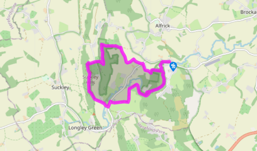
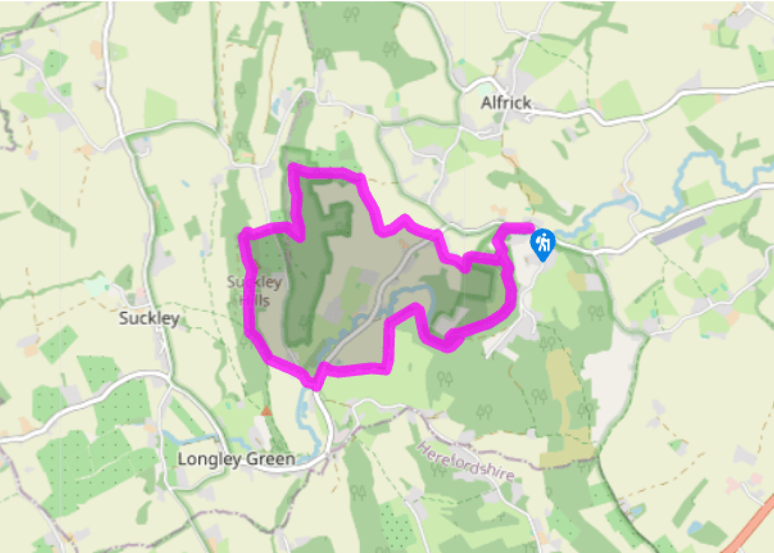
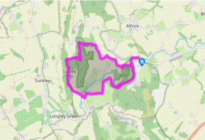
From the parking area, take the path through the main entrance of the Nature Reserve with the stream on your left. Pass the visitor centre, walking initially downhill then through old orchards (beside a weir) and meadow for 700yds (639m).
At a small brick bridge, turn right turn up the field-edge to use the handgate into woodland. Go ahead 50 paces, then turn left (waymark Post 13). In 220yds (201m) fork right (Post 12), soon climbing a long series of wooden steps. Keep ahead to find an information board at a path junction in 400yds (366m). Bend right, following this woodland path to a fork near a forestry hut. Go left, shortly joining a wider track through to Alfrick Pound.
Turn left to use a fingerposted gate on the right in 20yds (18m). Beyond the orchard keep to the right edge, through a field gate and, in 75yds (69m), descend the field to a gate-side footbridge at a hedge-gap. Once over turn right at the stile into stream-edge pastures. Beyond the second field cross the gravel track, use the metal kissing gate and turn left to a stile into a sloping orchard. Turn right to the corner oak in 100yds (91m); here keep uphill through the orchard, soon putting woods on your left. At the higher corner a stile gains a thin, rising woodland path. This hits a wider cross-track. This hits a wider cross-track; turn right for 80yds (73m).
Turn left on the fence-side track, the Worcestershire Way. In 550yds (502m) turn right with the Worcestershire Way, descending to a lane. Cross straight over, rising then beside the orchard to use a handgate into woods. In 75yds (69m) turn left (Worcestershire Way), gently climbing on for 0.5 miles (800m). Fork left on the waymarked crossing bridleway, descending to a split at the woodland foot. Use the gate into pasture and head half-right to the farm and converted oast houses.
Turn right and, at a T-junction, go left. In 150yds (137m) turn right up the lane beside the half-timbered barn at Lower Tundridge Farm. Walk the lane to its very end. Turn left through the yard, joining a field-foot track which passes through a neck of woodland. Cross the stile beside double metal gates; then drop half-right to walk beside wood rail fencing (on your left). The track rises through woodland to a pasture-edge gateway. Turn right to use the nearby gate, then go left (waymark arrow painted on tree) on a muddy track within the woods. In 300yds (274m) go left (waymarked), soon passing close to sheds then a garden. At the rough driveway turn back-left to cross the footbridge at Nightingale Bower.
Turn left. At the top turn right. In just 40yds (37m) take a gate back down into the woods. A wood-end handgate leads into a meadow; stay beside the stream to the brick bridge (passed early on in the walk). Return to The Knapp & Papermill Visitor Centre and car park by following the track for 700yds (639m).
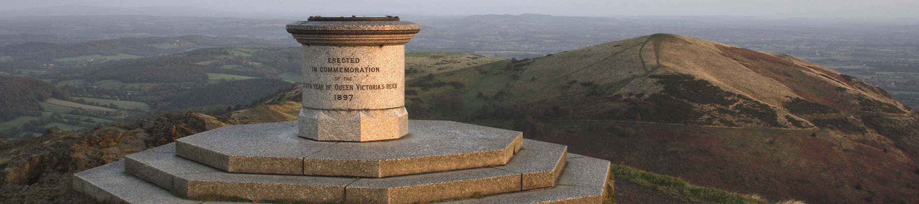
It’s an unusual name for a nature reserve, but past land use explains the reason why. Making full use of the Leigh Brook, which runs through the reserve owned and managed by the Worcestershire Wildlife Trust, previous landowners once used mills here to make paper. There were two mills within the... 84 acres (34ha) now owned by the Trust. The remnants of Gunwick (or Gunnick) Mill, beneath the area of Papermill Cottage (on the walk just after Point 6) were washed away in a flood in 1852. Traces of the mill leat are still visible. Papermill Cottage stands next to Papermill Coppice, the woodland actively managed for many years. The only known written mention of paper production at the site is in The Transactions of the Worcestershire Naturalist Club. They state that a Welshman, Mr Jones, was producing ‘cap paper’, a specific writing or coarse wrapping paper. Seasonal hop-pickers from the local area would give their old clothes to the miller who would use the woollen fibres to make paper. The second mill, also no longer standing, was served by the weir near the orchard, which, until 1973, was one of just a few mills in the country still using direct water power. Just beyond the orchard, the Daffodil Field is so called because of the cultivated daffodils that were once planted there for commercial purposes. During World War II a Birmingham-based circus was moved to Alfrick for safety. Some of the animals were kept on what is now the reserve. An elephant died and was allegedly buried within the orchard, although the remains have never been found. The Knapp and Papermill Nature Reserve is within the Suckley Hills, a part of the Malvern Hills Area of Outstanding Natural Beauty. The AONB was designated as such in 1959 and covers 40 square miles (105 km2), including parts of Herefordshire and Gloucestershire in addition to Worcestershire. Meanwhile, the Leigh Brook Valley was designated a Site of Special Scientific Interest because of the diversity of quality habitats.
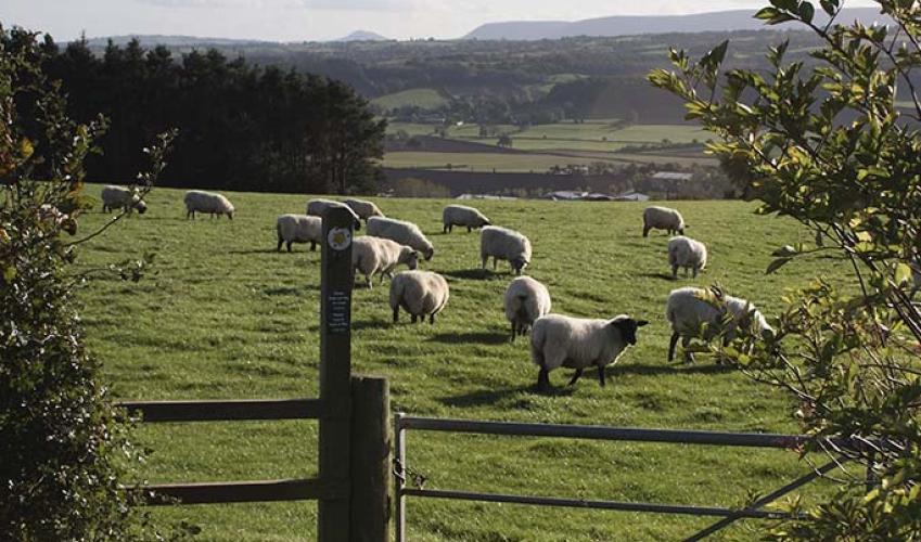
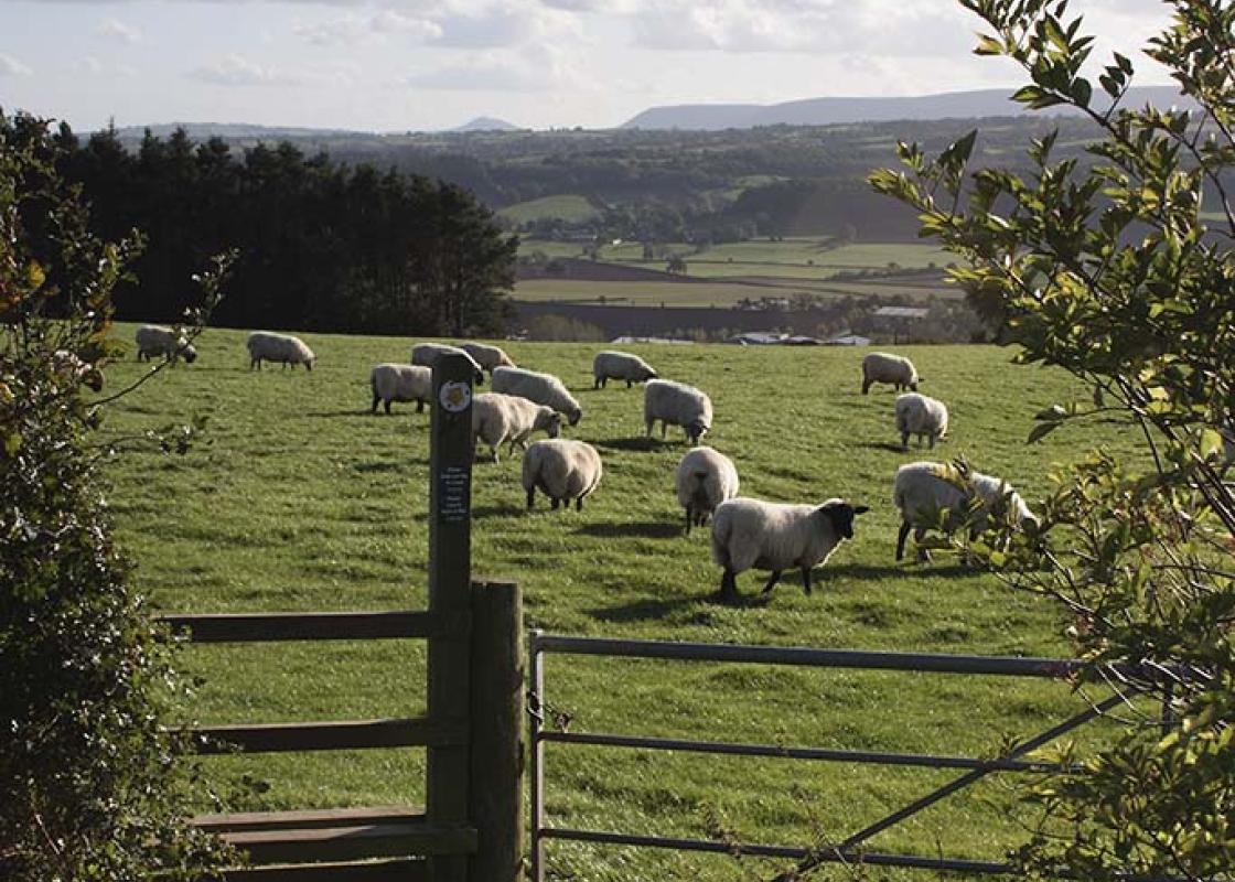
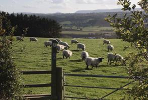
Worcestershire is a county of rolling hills, save for the flat Vale of Evesham in the east and the prominent spine of the Malverns in the west. Nearly all of the land is worked in some way; arable farming predominates – oilseed rape, cereals and potatoes – but there are concentrated areas of specific land uses, such as market gardening and plum growing.
From the parking area, take the path through the main entrance of the Nature Reserve with the stream on your left. Pass the visitor centre, walking initially downhill then through old orchards (beside a weir) and meadow for 700yds (639m).
1 of 6
At a small brick bridge, turn right turn up the field-edge to use the handgate into woodland. Go ahead 50 paces, then turn left (waymark Post 13). In 220yds (201m) fork right (Post 12), soon climbing a long series of wooden steps. Keep ahead to find an information board at a path junction in 400yds (366m). Bend right, following this woodland path to a fork near a forestry hut. Go left, shortly joining a wider track through to Alfrick Pound.
2 of 6
Turn left to use a fingerposted gate on the right in 20yds (18m). Beyond the orchard keep to the right edge, through a field gate and, in 75yds (69m), descend the field to a gate-side footbridge at a hedge-gap. Once over turn right at the stile into stream-edge pastures. Beyond the second field cross the gravel track, use the metal kissing gate and turn left to a stile into a sloping orchard. Turn right to the corner oak in 100yds (91m); here keep uphill through the orchard, soon putting woods on your left. At the higher corner a stile gains a thin, rising woodland path. This hits a wider cross-track. This hits a wider cross-track; turn right for 80yds (73m).
3 of 6
Turn left on the fence-side track, the Worcestershire Way. In 550yds (502m) turn right with the Worcestershire Way, descending to a lane. Cross straight over, rising then beside the orchard to use a handgate into woods. In 75yds (69m) turn left (Worcestershire Way), gently climbing on for 0.5 miles (800m). Fork left on the waymarked crossing bridleway, descending to a split at the woodland foot. Use the gate into pasture and head half-right to the farm and converted oast houses.
4 of 6
Turn right and, at a T-junction, go left. In 150yds (137m) turn right up the lane beside the half-timbered barn at Lower Tundridge Farm. Walk the lane to its very end. Turn left through the yard, joining a field-foot track which passes through a neck of woodland. Cross the stile beside double metal gates; then drop half-right to walk beside wood rail fencing (on your left). The track rises through woodland to a pasture-edge gateway. Turn right to use the nearby gate, then go left (waymark arrow painted on tree) on a muddy track within the woods. In 300yds (274m) go left (waymarked), soon passing close to sheds then a garden. At the rough driveway turn back-left to cross the footbridge at Nightingale Bower.
5 of 6
Turn left. At the top turn right. In just 40yds (37m) take a gate back down into the woods. A wood-end handgate leads into a meadow; stay beside the stream to the brick bridge (passed early on in the walk). Return to The Knapp & Papermill Visitor Centre and car park by following the track for 700yds (639m).
It’s an unusual name for a nature reserve, but past land use explains the reason why. Making full use of the Leigh Brook, which runs through the reserve owned and managed by the Worcestershire Wildlife Trust, previous landowners once used mills here to make paper. There were two mills within the... 84 acres (34ha) now owned by the Trust. The remnants of Gunwick (or Gunnick) Mill, beneath the area of Papermill Cottage (on the walk just after Point 6) were washed away in a flood in 1852. Traces of the mill leat are still visible. Papermill Cottage stands next to Papermill Coppice, the woodland actively managed for many years. The only known written mention of paper production at the site is in The Transactions of the Worcestershire Naturalist Club. They state that a Welshman, Mr Jones, was producing ‘cap paper’, a specific writing or coarse wrapping paper. Seasonal hop-pickers from the local area would give their old clothes to the miller who would use the woollen fibres to make paper. The second mill, also no longer standing, was served by the weir near the orchard, which, until 1973, was one of just a few mills in the country still using direct water power. Just beyond the orchard, the Daffodil Field is so called because of the cultivated daffodils that were once planted there for commercial purposes. During World War II a Birmingham-based circus was moved to Alfrick for safety. Some of the animals were kept on what is now the reserve. An elephant died and was allegedly buried within the orchard, although the remains have never been found. The Knapp and Papermill Nature Reserve is within the Suckley Hills, a part of the Malvern Hills Area of Outstanding Natural Beauty. The AONB was designated as such in 1959 and covers 40 square miles (105 km2), including parts of Herefordshire and Gloucestershire in addition to Worcestershire. Meanwhile, the Leigh Brook Valley was designated a Site of Special Scientific Interest because of the diversity of quality habitats.
Worcestershire is a county of rolling hills, save for the flat Vale of Evesham in the east and the prominent spine of the Malverns in the west. Nearly all of the land is worked in some way; arable farming predominates – oilseed rape, cereals and potatoes – but there are concentrated areas of specific land uses, such as market gardening and plum growing.