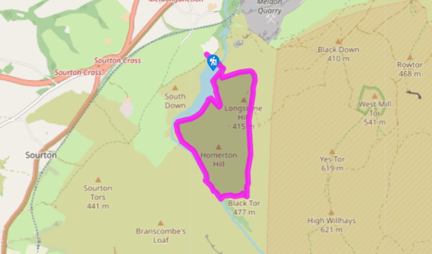
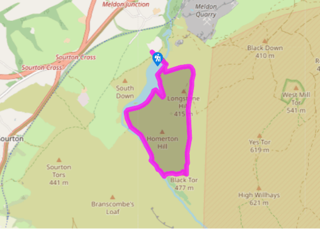
Walk up the steps by the toilets, through the gate and go left towards the dam, signposted ‘Bridlepath to Moor’. Cross over the dam and go through a gate.
Turn right on a stony track alongside a fence. Note a gate (right) leading to a waterside picnic area. Do not go through the gate but keep ahead where the track bears left, following the edge of the reservoir through a side valley and over a small footbridge. The narrow path bears right above the water and runs along the contours before descending into the broad marshy valley of the West Okement River; the swell of Corn Ridge, 1,762ft 537m), lies ahead.
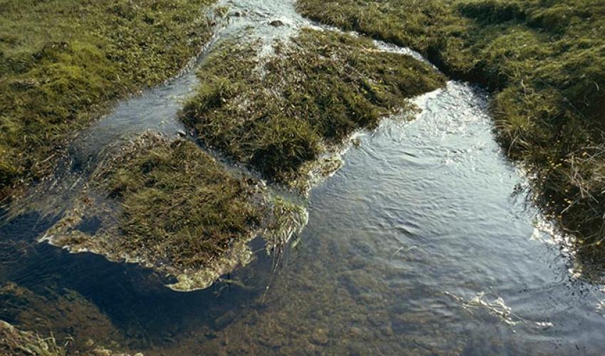
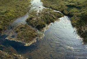
Pass the small wooden footbridge and take the narrow path along the left edge of the valley, keeping to the bottom of the steep slope. The path rounds Vellake Corner and passes a water gauging station, then broadens and climbs steadily above the river (right).
At the top of the hill the track levels and Black-a-tor Copse can be glimpsed ahead. Follow the river upstream passing left of a granite enclosure, and along the riverbank to enter the copse – a wonderful picnic spot.
Retrace your steps out of the trees and bear right around the copse edge, uphill aiming for the left outcrop of Black Tor on the ridge above. Pick your way through the bracken to gain the left edge of the left outcrop. The right outcrop rises to 1,647ft (502m).
Climb to the top of the tor if you wish; if not keep ahead in the same direction, aiming for a fairly obvious track visible ahead bearing left across Longstone Hill. To find it go slightly downhill from the tor to cross a small stream, then pass between granite blocks marking the track.
The intermittent track runs straight across open moor. Where the Red-a-ven Brook Valley appears below to the right, enjoy the view of (left to right) Row Tor, West Mill Tor and Yes Tor. High Willhays, Dartmoor’s highest point, lies just out of sight to the right. The track bears left around the end of the hill, with good views towards the quarry and viaduct, and drops back to the reservoir.
Bear right on the track, to walk along side the reservoir and at the dam keep ahead through a small gate. At the fork keep left along the narrow path high above the West Okement River. The path meets a broader one; turn left, downhill, to meander through the former site of the quarry. Cross the Red-a-ven Brook and then a parking area and through a gate to meet a lane. Turn left and after a few paces bear right on a footpath (‘Rock Park’). At a fork go left (the right path gives access to the Granite Way, and Meldon Buffet when open), soon turning left again and descending steeply to pass under Meldon viaduct. Follow the path on, now through woodland, and at the second path junction turn left to the lane and cross over and descend to cross the river.
Follow the path as it bears left uphill through woodland to meet a broad track via a gate. Turn left, soon walking under the viaduct again. Pass an old lime kiln and flooded limestone quarry. The path ascends through woodland, and into open ground; bear left uphill as signed, then follow the hedge bank back to a gate. Turn right, and right again for the car park.
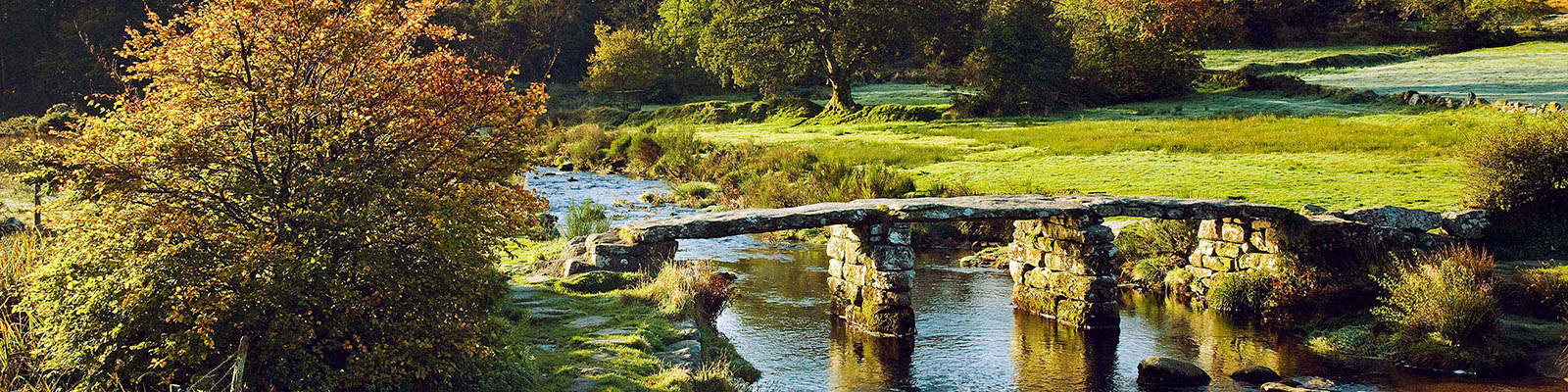
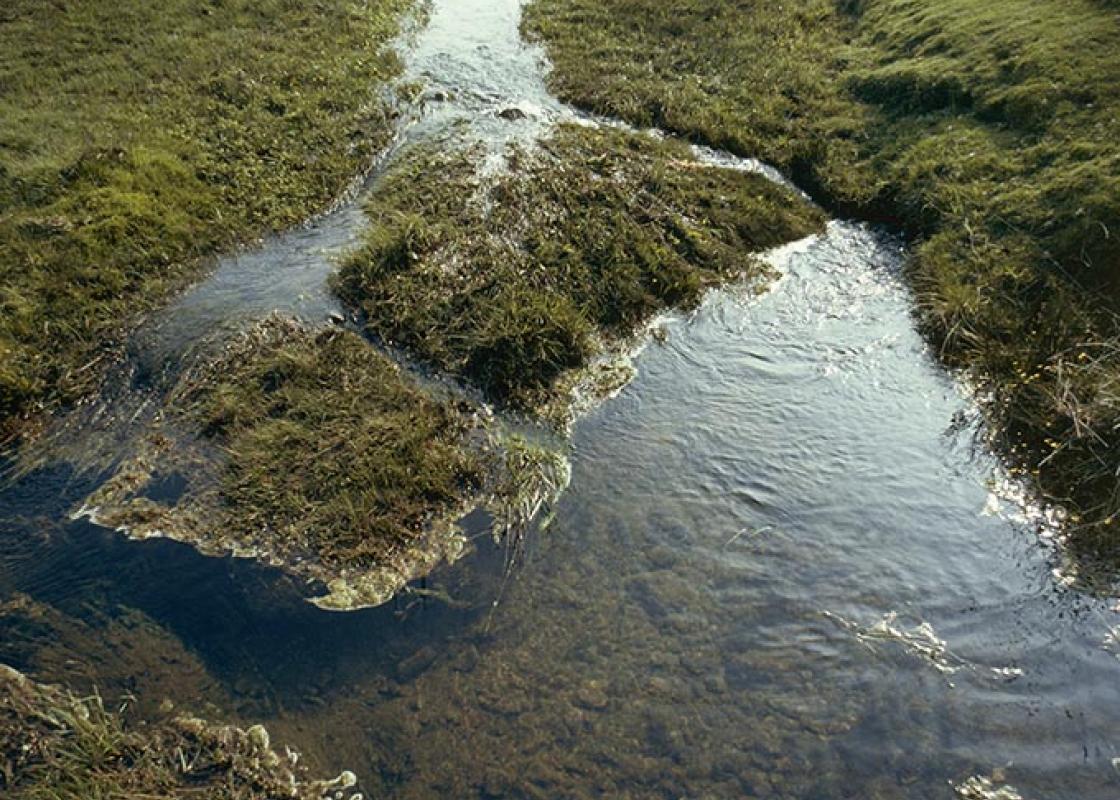
If you want to get a ‘quick fix’ and to experience examples of almost everything that Dartmoor has to offer, but fairly easily and in a relatively short time – then this is the walk for you. Within 10 minutes of the A30 as it races past Okehampton you can get the lot: a tranquil reservoir, a... sparkling river and waterfall tumbling though a beautiful tree-lined valley, wide expanses of open moorland, an area of ancient lichen-encrusted oak woodland and a great view of the highest tors on the moor – and all without expending too much effort. You don’t have to tramp for miles over inhospitable moorland or get to grips with a compass to get a real feel of the moor. Owned by the Duchy of Cornwall, this is one of the best areas of ancient high-altitude oak woodland in Britain, and was established as a National Nature Reserve in 1996. There is a huge variety of mosses and lichens covering the granite boulders from which the stunted oaks emerge. It makes a wonderful focus for the walk. There are two other areas of upland woodland on the moor – at Piles Copse in the Erme Valley and at Wistman’s Wood by the side of the West Dart River just north of Two Bridges. In all three places the oaks have remained ungrazed because the clutter of granite boulders beneath has protected them from the local sheep. Black-a-tor Copse feels little visited and remote – the atmosphere is quite magical. Dartmoor is basically a huge granite intrusion, pushed up through surrounding sedimentary rocks, formed in the same way as Bodmin Moor in Cornwall and the Isles of Scilly. Where it is exposed to the elements this raised granite plateau has been weathered into giant blocks, creating the tors so characteristic of the area. The highest part of the moor lies in the northeast corner just south of the A30, where it rises to 2,037ft (621m) at High Willhays, seen from this walk. The average height of the moor, however, is around 1,200ft (366m).
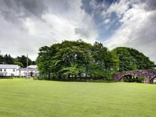
Devon sums up all that is best about the British landscape, with its magnificent coastlines, two historic cities, the world-famous Dartmoor National Park and south Devon’s glorious English Riviera. A fashionable and much-loved holiday destination, hiking and cycling in the National Parks is extremely popular among visitors, with a great choice of off-road routes.
Walk up the steps by the toilets, through the gate and go left towards the dam, signposted ‘Bridlepath to Moor’. Cross over the dam and go through a gate.
1 of 9
Turn right on a stony track alongside a fence. Note a gate (right) leading to a waterside picnic area. Do not go through the gate but keep ahead where the track bears left, following the edge of the reservoir through a side valley and over a small footbridge. The narrow path bears right above the water and runs along the contours before descending into the broad marshy valley of the West Okement River; the swell of Corn Ridge, 1,762ft 537m), lies ahead.
2 of 9
Pass the small wooden footbridge and take the narrow path along the left edge of the valley, keeping to the bottom of the steep slope. The path rounds Vellake Corner and passes a water gauging station, then broadens and climbs steadily above the river (right).
3 of 9
At the top of the hill the track levels and Black-a-tor Copse can be glimpsed ahead. Follow the river upstream passing left of a granite enclosure, and along the riverbank to enter the copse – a wonderful picnic spot.
4 of 9
Retrace your steps out of the trees and bear right around the copse edge, uphill aiming for the left outcrop of Black Tor on the ridge above. Pick your way through the bracken to gain the left edge of the left outcrop. The right outcrop rises to 1,647ft (502m).
5 of 9
Climb to the top of the tor if you wish; if not keep ahead in the same direction, aiming for a fairly obvious track visible ahead bearing left across Longstone Hill. To find it go slightly downhill from the tor to cross a small stream, then pass between granite blocks marking the track.
6 of 9
The intermittent track runs straight across open moor. Where the Red-a-ven Brook Valley appears below to the right, enjoy the view of (left to right) Row Tor, West Mill Tor and Yes Tor. High Willhays, Dartmoor’s highest point, lies just out of sight to the right. The track bears left around the end of the hill, with good views towards the quarry and viaduct, and drops back to the reservoir.
7 of 9
Bear right on the track, to walk along side the reservoir and at the dam keep ahead through a small gate. At the fork keep left along the narrow path high above the West Okement River. The path meets a broader one; turn left, downhill, to meander through the former site of the quarry. Cross the Red-a-ven Brook and then a parking area and through a gate to meet a lane. Turn left and after a few paces bear right on a footpath (‘Rock Park’). At a fork go left (the right path gives access to the Granite Way, and Meldon Buffet when open), soon turning left again and descending steeply to pass under Meldon viaduct. Follow the path on, now through woodland, and at the second path junction turn left to the lane and cross over and descend to cross the river.
8 of 9
Follow the path as it bears left uphill through woodland to meet a broad track via a gate. Turn left, soon walking under the viaduct again. Pass an old lime kiln and flooded limestone quarry. The path ascends through woodland, and into open ground; bear left uphill as signed, then follow the hedge bank back to a gate. Turn right, and right again for the car park.
If you want to get a ‘quick fix’ and to experience examples of almost everything that Dartmoor has to offer, but fairly easily and in a relatively short time – then this is the walk for you. Within 10 minutes of the A30 as it races past Okehampton you can get the lot: a tranquil reservoir, a... sparkling river and waterfall tumbling though a beautiful tree-lined valley, wide expanses of open moorland, an area of ancient lichen-encrusted oak woodland and a great view of the highest tors on the moor – and all without expending too much effort. You don’t have to tramp for miles over inhospitable moorland or get to grips with a compass to get a real feel of the moor. Owned by the Duchy of Cornwall, this is one of the best areas of ancient high-altitude oak woodland in Britain, and was established as a National Nature Reserve in 1996. There is a huge variety of mosses and lichens covering the granite boulders from which the stunted oaks emerge. It makes a wonderful focus for the walk. There are two other areas of upland woodland on the moor – at Piles Copse in the Erme Valley and at Wistman’s Wood by the side of the West Dart River just north of Two Bridges. In all three places the oaks have remained ungrazed because the clutter of granite boulders beneath has protected them from the local sheep. Black-a-tor Copse feels little visited and remote – the atmosphere is quite magical. Dartmoor is basically a huge granite intrusion, pushed up through surrounding sedimentary rocks, formed in the same way as Bodmin Moor in Cornwall and the Isles of Scilly. Where it is exposed to the elements this raised granite plateau has been weathered into giant blocks, creating the tors so characteristic of the area. The highest part of the moor lies in the northeast corner just south of the A30, where it rises to 2,037ft (621m) at High Willhays, seen from this walk. The average height of the moor, however, is around 1,200ft (366m).
Devon sums up all that is best about the British landscape, with its magnificent coastlines, two historic cities, the world-famous Dartmoor National Park and south Devon’s glorious English Riviera. A fashionable and much-loved holiday destination, hiking and cycling in the National Parks is extremely popular among visitors, with a great choice of off-road routes.