Home>
Walks>
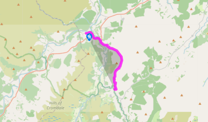
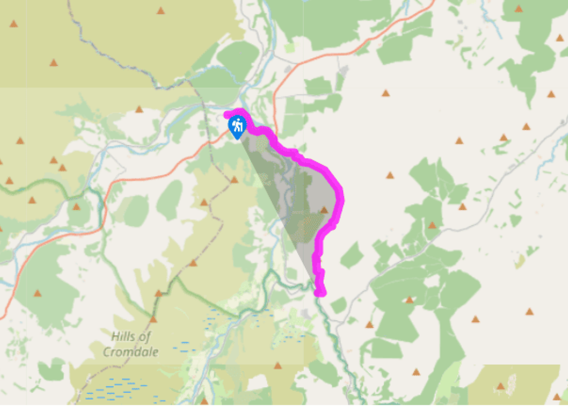
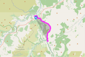
Speyside Way (Tominoul Spur): Ballindalloch Station to Glenlivet
Speyside Way (Tominoul Spur): Ballindalloch Station to Glenlivet
Recommended by
Our view
"Crossing the high flank of Ben Rinnes"
Walk directions
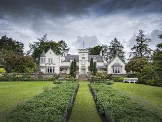
From Ballindalloch Station, the Speyside Way heads up the B9137 road to join the A95. Turn left along the busy road's verge, passing 3 remaining stones of a stone circle on your right. Just before the road crosses the River Avon, you can go down steps on the left onto the old bridge, somewhat dwarfed by the bulky road bridge above it. On the far side is an ornate gateway to Ballindalloch Castle.
Rejoining A95, it is a good 0.25 miles (400m), up its steep brae, with only a narrow footpath, to the Delnashaugh Hotel. Above the inn, you can use the edge of the former road, half buried under the banking of the new one – the path even retains its crash barrier, just in case you should swerve off it at 45mph. When the path emerges at a war memorial near a road junction, turn right along the B9008 above the Avon. The road curves round, giving tempting views southward, before the route leaves it, in about 0.5 miles (800m), to take the track towards the farm of Auldich.
The track continues beyond the farm, surfaced for a further 0.25 miles (400m) to reach a small car park with an information board. The track leads enticingly ahead, rising steadily.
A mile (1.6km) beyond Auldich the track bends left across the shallow valley; the route to Tomintoul, however, leaves it to head straight up ahead on a rough and peaty moorland path, still quite clear and with waymarks at intervals. At the brow of the hill, the path bends right at a waymarker, and in 100yds (90m) reaches the top end of a broken-down fence. (From here, it's only a short walk across the heather to the summit cairn of Cairnacay, 600yds (550m) to the northwest.)
The view southwards now opens out to reveal Glen Livet and Strath Avon, with the Hills of Cromdale away to the right. A peaty path leads down alongside the broken fence, then turns right to join a lower fence which bends down into the col before the slight rise of Hill of Deskie. The Speyside Way follows the fence just to right of this hump to a gate and stile on its south side.
The way down through the fields follows fences and is marked by waymarks and small metal gates. It heads downhill, then left across a field top, then down again, to pass above a cottage onto a farm track. Turn left to Deskie Farm, and follow its driveway track down to the B9008 road.
Terrain
- Main road verge, lanes, then rough, peaty hill path, no stiles
Landscape
- Wild heathery hillside
Dog friendliness
- On lead on roads, close control on moors during spring and early summer grouse nesting
Parking
- Ballindalloch Station, Glenlivet Public Hall, Old Bridge of Livet
Toilets en route
- Ballindalloch Station
About the walk
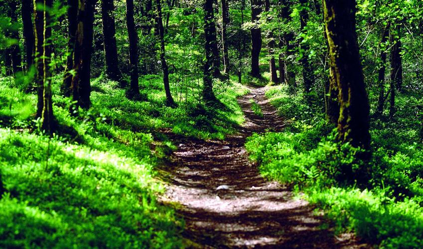
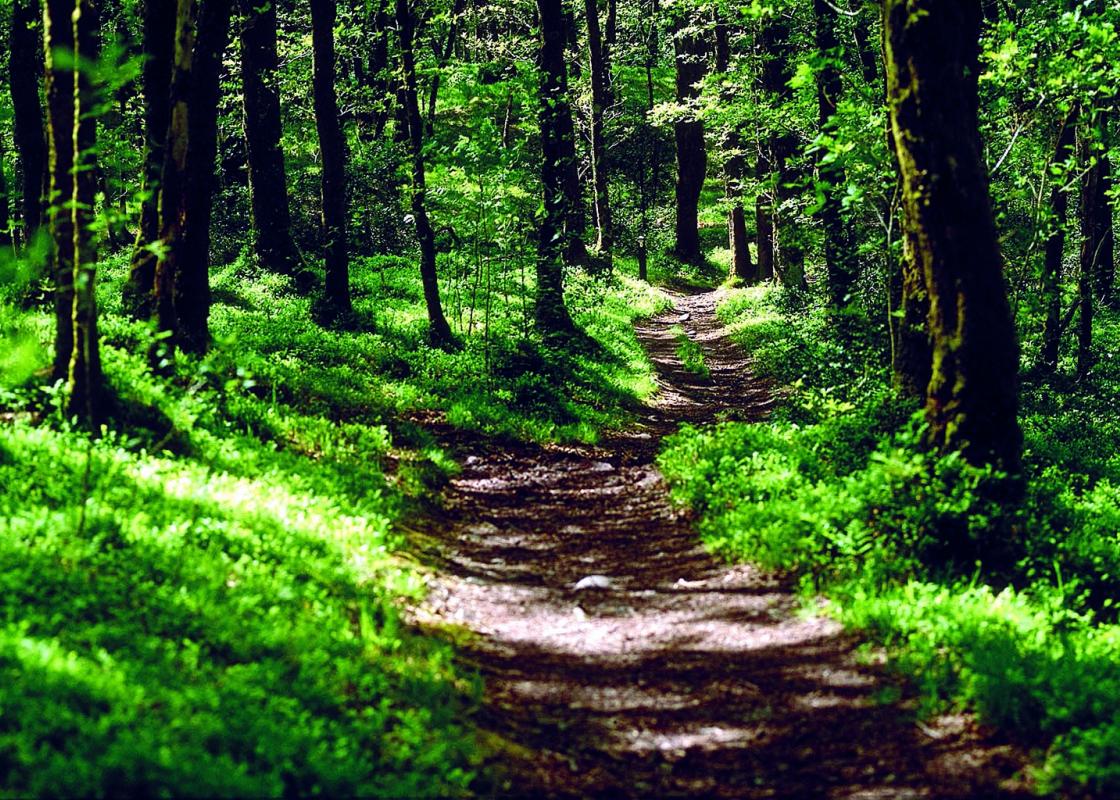
There is a definite feeling at Ballindalloch of a change of mood. The Spey has been left behind. The whole atmosphere is wilder and, to the mountain lover, more alluring. The variations in light and shade can be quite stunning, enhanced by the patchwork nature of the landscape: many darker forestry... plantations alternating with lighter-coloured farmland and the rich hues of the heather moor. It is a particularly fine scene in spring, with the last of the snow on the distant tops, and in late summer, when the heather is at its best. Moor is less This high-level heather moorland, bleak as it is, is no natural landscape. Original woodland has been cleared by man from the Bronze Age onwards. Rain then leaches out the soil minerals to leave the acid peatland. Soggy ground grows sphagnum mosses, breeding ground for the evil Highland midge. But for the naturalist, this bare scene is full of interest, with that insect life sustaining many species of moorland birds. Red grouse are very likely to be seen – and heard – on this stretch, urging you to ‘go back, go back’. And Blairfindy Moor boasts 110 different types of mosses. Granite and go Cairnacay is a moorland shoulder of Ben Rinnes, the area’s highest hill. Rinnes rises to 2,760ft (840m) to the left, decorated on top with a couple of granite tors. Far ahead, you may glimpse similar tors sticking out of Ben Avon, at the eastern end of the high Cairngorm range. Ben Avon's north side, which you're looking at, is often spotted with snow well into the summer. The Avon at the bridge below is here at the end of its turbulent journey from Loch Avon, deep in the Cairngorm Mountains below Ben Macdui. You could reach the romantic loch by a 20-mile (30km) walk on upstream from Tomintoul, with the mountains gradually closing in on either side, to end up ringed by crags as far from civilisation as anyone gets in Britain. At the head of the loch is the Shelter Stone, a hole below a boulder where 17 armed men can lie unseen, fabled in old romance and the ice-climbing annals of the mountaineers, and haunted by the grim Grey Man of Ben Macdui.
Speyside Way (Tominoul Spur): Ballindalloch Station to Glenlivet
Recommended by
Our view
"Crossing the high flank of Ben Rinnes"
Walk details
3hrs 15min
Difficulty:
Hard
Gradient:
Challenging
Distance:
6.5 miles (10.5kms)
Ascent:
1000ft (300m)
Walk directions
From Ballindalloch Station, the Speyside Way heads up the B9137 road to join the A95. Turn left along the busy road's verge, passing 3 remaining stones of a stone circle on your right. Just before the road crosses the River Avon, you can go down steps on the left onto the old bridge, somewhat dwarfed by the bulky road bridge above it. On the far side is an ornate gateway to Ballindalloch Castle.
1 of 6
Rejoining A95, it is a good 0.25 miles (400m), up its steep brae, with only a narrow footpath, to the Delnashaugh Hotel. Above the inn, you can use the edge of the former road, half buried under the banking of the new one – the path even retains its crash barrier, just in case you should swerve off it at 45mph. When the path emerges at a war memorial near a road junction, turn right along the B9008 above the Avon. The road curves round, giving tempting views southward, before the route leaves it, in about 0.5 miles (800m), to take the track towards the farm of Auldich.
2 of 6
The track continues beyond the farm, surfaced for a further 0.25 miles (400m) to reach a small car park with an information board. The track leads enticingly ahead, rising steadily.
3 of 6
A mile (1.6km) beyond Auldich the track bends left across the shallow valley; the route to Tomintoul, however, leaves it to head straight up ahead on a rough and peaty moorland path, still quite clear and with waymarks at intervals. At the brow of the hill, the path bends right at a waymarker, and in 100yds (90m) reaches the top end of a broken-down fence. (From here, it's only a short walk across the heather to the summit cairn of Cairnacay, 600yds (550m) to the northwest.)
4 of 6
The view southwards now opens out to reveal Glen Livet and Strath Avon, with the Hills of Cromdale away to the right. A peaty path leads down alongside the broken fence, then turns right to join a lower fence which bends down into the col before the slight rise of Hill of Deskie. The Speyside Way follows the fence just to right of this hump to a gate and stile on its south side.
5 of 6
The way down through the fields follows fences and is marked by waymarks and small metal gates. It heads downhill, then left across a field top, then down again, to pass above a cottage onto a farm track. Turn left to Deskie Farm, and follow its driveway track down to the B9008 road.
Terrain
- Main road verge, lanes, then rough, peaty hill path, no stiles
Landscape
- Wild heathery hillside
Dog friendliness
- On lead on roads, close control on moors during spring and early summer grouse nesting
Parking
- Ballindalloch Station, Glenlivet Public Hall, Old Bridge of Livet
Toilets en route
- Ballindalloch Station
About the walk
There is a definite feeling at Ballindalloch of a change of mood. The Spey has been left behind. The whole atmosphere is wilder and, to the mountain lover, more alluring. The variations in light and shade can be quite stunning, enhanced by the patchwork nature of the landscape: many darker forestry... plantations alternating with lighter-coloured farmland and the rich hues of the heather moor. It is a particularly fine scene in spring, with the last of the snow on the distant tops, and in late summer, when the heather is at its best. Moor is less This high-level heather moorland, bleak as it is, is no natural landscape. Original woodland has been cleared by man from the Bronze Age onwards. Rain then leaches out the soil minerals to leave the acid peatland. Soggy ground grows sphagnum mosses, breeding ground for the evil Highland midge. But for the naturalist, this bare scene is full of interest, with that insect life sustaining many species of moorland birds. Red grouse are very likely to be seen – and heard – on this stretch, urging you to ‘go back, go back’. And Blairfindy Moor boasts 110 different types of mosses. Granite and go Cairnacay is a moorland shoulder of Ben Rinnes, the area’s highest hill. Rinnes rises to 2,760ft (840m) to the left, decorated on top with a couple of granite tors. Far ahead, you may glimpse similar tors sticking out of Ben Avon, at the eastern end of the high Cairngorm range. Ben Avon's north side, which you're looking at, is often spotted with snow well into the summer. The Avon at the bridge below is here at the end of its turbulent journey from Loch Avon, deep in the Cairngorm Mountains below Ben Macdui. You could reach the romantic loch by a 20-mile (30km) walk on upstream from Tomintoul, with the mountains gradually closing in on either side, to end up ringed by crags as far from civilisation as anyone gets in Britain. At the head of the loch is the Shelter Stone, a hole below a boulder where 17 armed men can lie unseen, fabled in old romance and the ice-climbing annals of the mountaineers, and haunted by the grim Grey Man of Ben Macdui.