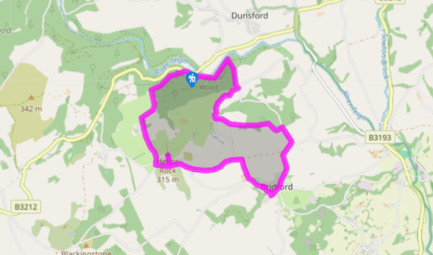
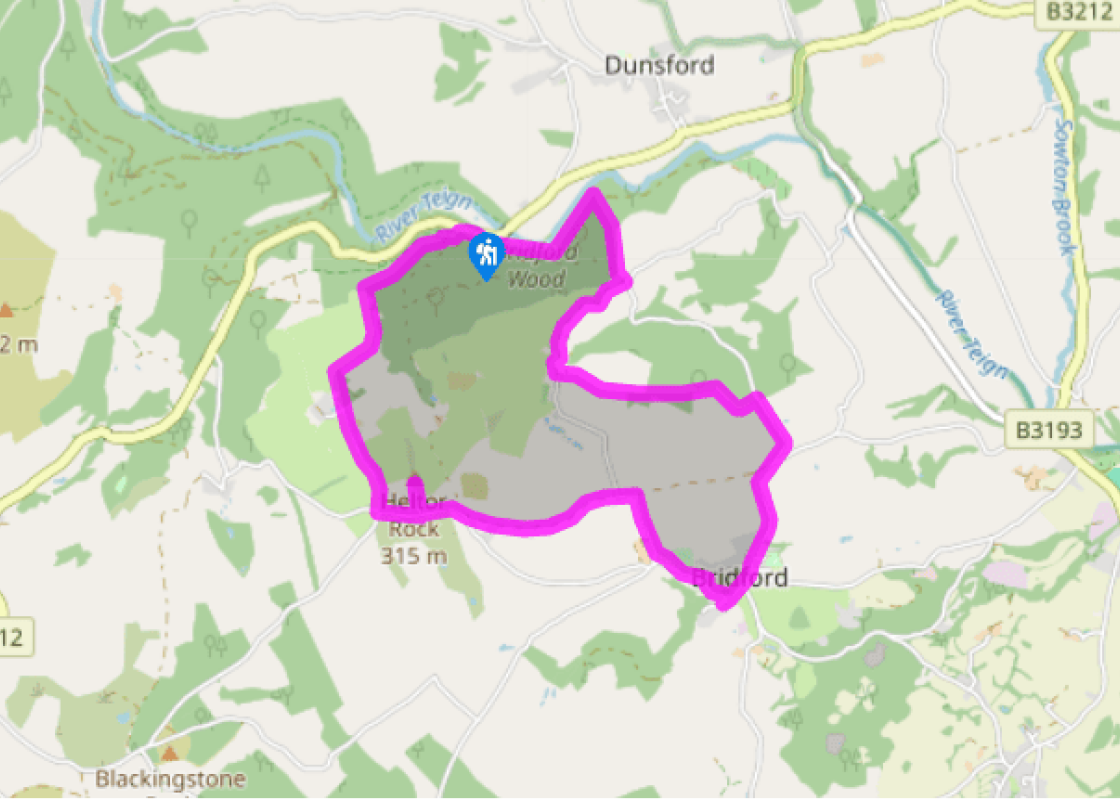
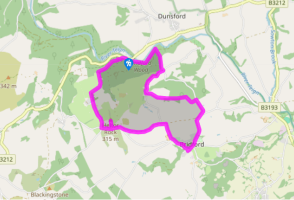
From the car park cross the road, and turn right up the concrete track, then left towards the former youth hostel building; the path bears right, and is signed for Heltor Farm. On meeting a track turn left and climb steeply through pretty woodland. At the top follow yellow markers left to pass through an open gateway by a small gate.
Follow a fenced path straight up the field and through a small gate. Keep up the left edge of the next field; pass through a gateway and look to the left to see Heltor Rock.
At the end of the second field turn left as signed through a wooden gate into a plantation; follow the path to meet a gate onto a lane. Turn left and walk uphill to meet a tarmac lane.
Turn left (signs for Bridford). After 200yds (183m) turn left over a stile up the narrow fenced permissive path to Heltor, from where you can enjoy an amazing panorama. Retrace your steps to the road and turn left, soon passing the drive to Burnicombe Farm.
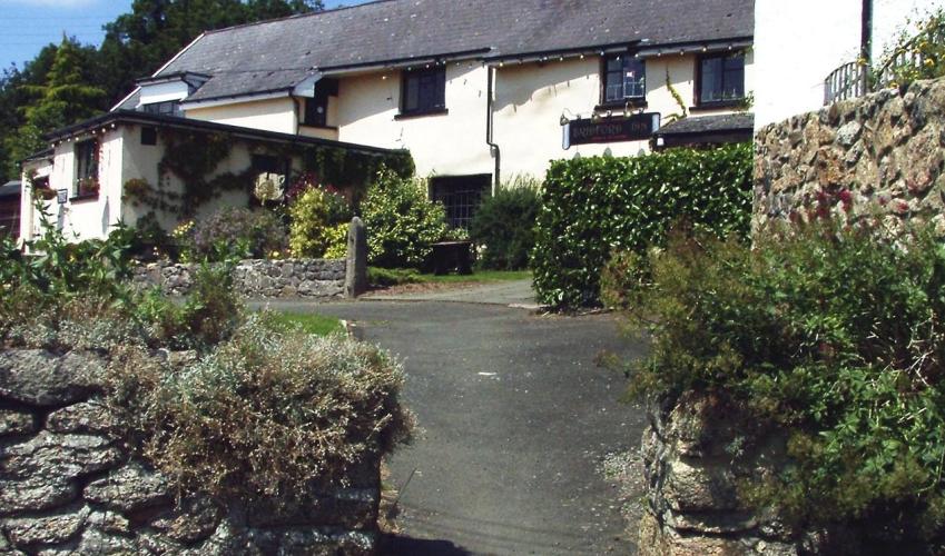
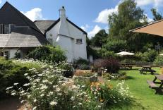
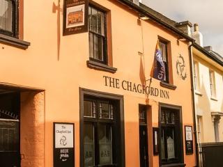
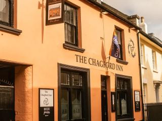
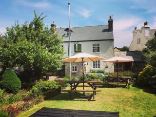
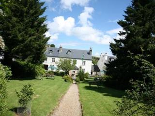
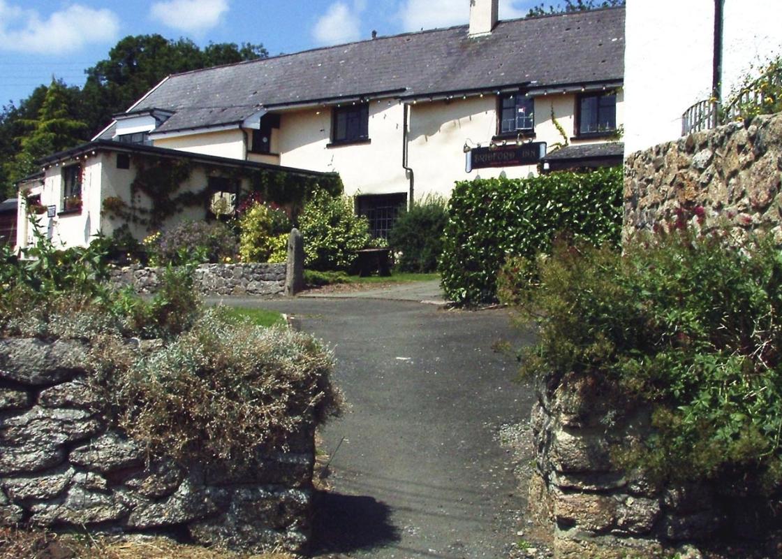
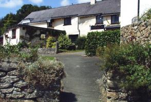
Take the next track left (to Lowton). Meet a lane on a bend and keep ahead, following it sharp right; eventually turn left through a gate into Bridford Woodland Park. Follow the permissive path around its edge to reach the lane; turn left. Turn right down a steep lane signed ‘Parish Hall & Church’. Follow the church wall path, down steps and right to find the Bridford Inn.
Turn left from the pub and follow the lane through the centre of the village. As the road bends sharp left, take the fourth turning (Neadon Lane) on the right, by a telephone box. Just past where a bridleway joins (from the left) the lane dips to the right, downhill; take the left fork ahead to pass Westbirch Farm on the right, then Birchdown Farm on the left. Keep straight on at the farms; turn left as signed to Lowton Farm on a fenced path, which bears right to a kissing gate; pass through and up the right edge of the next field to a stile in the top corner. Carry straight on through an area of gorse and bracken. Cross a stile by some beech trees.
Follow the fenced path along the top of two fields, and down a green lane to reach Lower Lowton Farm. Turn right as signed before the farm on a permissive bridle path, which descends (with a stream, right) then rises to the next signpost; turn right for Steps Bridge down the narrow green lane, passing through a small gate. Continue down the deeply banked green lane until you reach a surfaced lane though a gate.
Turn left through the middle gate, signed ‘Byway to Steps Bridge’. At the edge of Bridford Wood (by the National Trust sign) turn right following the footpath signposts. The path is fairly narrow and quite steep. On meeting a path go left, then right, keeping down-hill. The path drops down steps to a junction. Turn left, now high above the river to meet the road just above Steps
Bridge. Turn left here to return to your car.
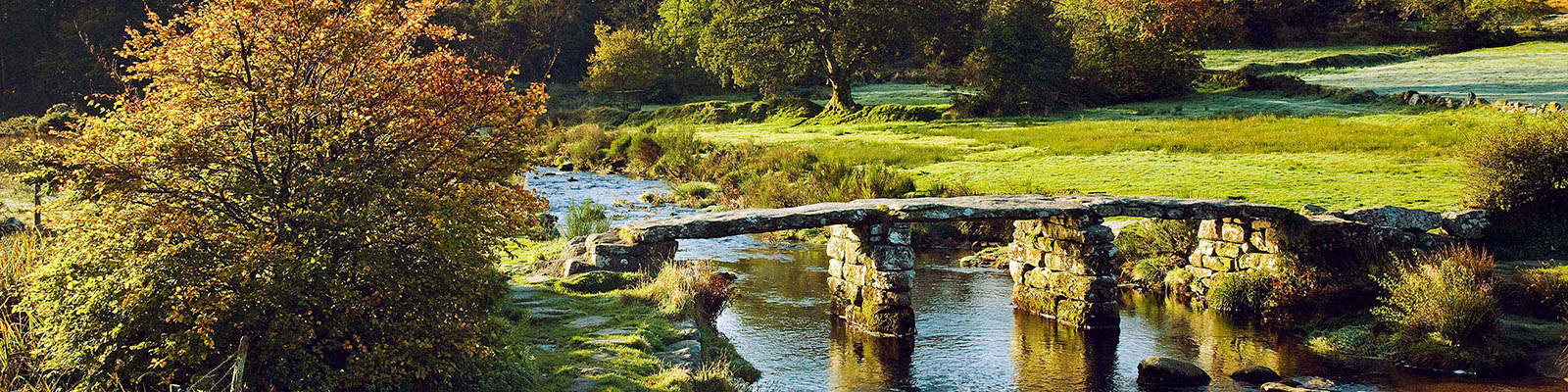
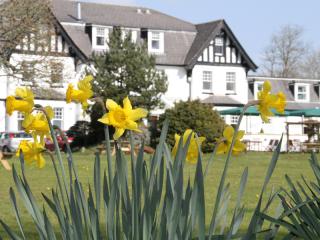
In early springtime many people travel out to Steps Bridge (built in 1816) to stroll along the River Teign, enjoying the sight of thousands of tiny wild daffodils crowding the river banks. But there’s a better way to explore this valley, which includes a close look at an example of that most... characteristic Dartmoor feature, a tor – and a pint at a Teign Valley pub as an added bonus. Much of the ancient semi-natural woodland and valley meadows around Steps Bridge is a Site of Special Scientific Interest (SSSI), and many acres are owned by the National Trust. Dunsford Wood (on the opposite bank of the Teign from the car park) is managed as a nature reserve by the Devon Wildlife Trust. These woodlands are glorious all year round: there are snowdrops in February, daffodils in early spring, wood anenomes and ramsoms; then foxgloves, woodrush and cow-wheat in summer. Look out for the nest of the wood ant by the side of the path, which can be as much as a metre high. If you place your cheek or hand near to a nest you’ll get a shock – the ants squirt formic acid from their abdomens in a defensive move, and it stings. Blackingstone Rock is another outlying tor, 1 mile (1.6km) southwest of Heltor Rock. Turn right rather than left at Point 4 and you will soon be aware of its huge, granite mass rising above the lane on the left. You can get to the top by climbing up an almost vertical flight of steps which were added in the 19th century for that purpose. While you’re in Bridford, part way round the walk, it’s well worthwhile going inside the church. The original chapel on this site was dedicated by Bishop Bronescombe in 1259, to the murdered Archbishop Thomas à Becket, who died at Canterbury Cathedral in 1170. This was still a common practice in many West Country churches during the century following his death. The present building dates from the 15th century, and its most famous feature is the superb eight-bay rood screen, thought to date from 1508. The faces of the richly carved and coloured figures were mutilated by Puritan soldiers during the Civil War, but what survives is still impressive. The doors are also unusual in that they are made in one piece rather than being divided in the middle.
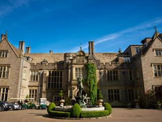
Devon sums up all that is best about the British landscape, with its magnificent coastlines, two historic cities, the world-famous Dartmoor National Park and south Devon’s glorious English Riviera. A fashionable and much-loved holiday destination, hiking and cycling in the National Parks is extremely popular among visitors, with a great choice of off-road routes.
From the car park cross the road, and turn right up the concrete track, then left towards the former youth hostel building; the path bears right, and is signed for Heltor Farm. On meeting a track turn left and climb steeply through pretty woodland. At the top follow yellow markers left to pass through an open gateway by a small gate.
1 of 8
Follow a fenced path straight up the field and through a small gate. Keep up the left edge of the next field; pass through a gateway and look to the left to see Heltor Rock.
2 of 8
At the end of the second field turn left as signed through a wooden gate into a plantation; follow the path to meet a gate onto a lane. Turn left and walk uphill to meet a tarmac lane.
3 of 8
Turn left (signs for Bridford). After 200yds (183m) turn left over a stile up the narrow fenced permissive path to Heltor, from where you can enjoy an amazing panorama. Retrace your steps to the road and turn left, soon passing the drive to Burnicombe Farm.
4 of 8
Take the next track left (to Lowton). Meet a lane on a bend and keep ahead, following it sharp right; eventually turn left through a gate into Bridford Woodland Park. Follow the permissive path around its edge to reach the lane; turn left. Turn right down a steep lane signed ‘Parish Hall & Church’. Follow the church wall path, down steps and right to find the Bridford Inn.
5 of 8
Turn left from the pub and follow the lane through the centre of the village. As the road bends sharp left, take the fourth turning (Neadon Lane) on the right, by a telephone box. Just past where a bridleway joins (from the left) the lane dips to the right, downhill; take the left fork ahead to pass Westbirch Farm on the right, then Birchdown Farm on the left. Keep straight on at the farms; turn left as signed to Lowton Farm on a fenced path, which bears right to a kissing gate; pass through and up the right edge of the next field to a stile in the top corner. Carry straight on through an area of gorse and bracken. Cross a stile by some beech trees.
6 of 8
Follow the fenced path along the top of two fields, and down a green lane to reach Lower Lowton Farm. Turn right as signed before the farm on a permissive bridle path, which descends (with a stream, right) then rises to the next signpost; turn right for Steps Bridge down the narrow green lane, passing through a small gate. Continue down the deeply banked green lane until you reach a surfaced lane though a gate.
7 of 8
Turn left through the middle gate, signed ‘Byway to Steps Bridge’. At the edge of Bridford Wood (by the National Trust sign) turn right following the footpath signposts. The path is fairly narrow and quite steep. On meeting a path go left, then right, keeping down-hill. The path drops down steps to a junction. Turn left, now high above the river to meet the road just above Steps
Bridge. Turn left here to return to your car.
In early springtime many people travel out to Steps Bridge (built in 1816) to stroll along the River Teign, enjoying the sight of thousands of tiny wild daffodils crowding the river banks. But there’s a better way to explore this valley, which includes a close look at an example of that most... characteristic Dartmoor feature, a tor – and a pint at a Teign Valley pub as an added bonus. Much of the ancient semi-natural woodland and valley meadows around Steps Bridge is a Site of Special Scientific Interest (SSSI), and many acres are owned by the National Trust. Dunsford Wood (on the opposite bank of the Teign from the car park) is managed as a nature reserve by the Devon Wildlife Trust. These woodlands are glorious all year round: there are snowdrops in February, daffodils in early spring, wood anenomes and ramsoms; then foxgloves, woodrush and cow-wheat in summer. Look out for the nest of the wood ant by the side of the path, which can be as much as a metre high. If you place your cheek or hand near to a nest you’ll get a shock – the ants squirt formic acid from their abdomens in a defensive move, and it stings. Blackingstone Rock is another outlying tor, 1 mile (1.6km) southwest of Heltor Rock. Turn right rather than left at Point 4 and you will soon be aware of its huge, granite mass rising above the lane on the left. You can get to the top by climbing up an almost vertical flight of steps which were added in the 19th century for that purpose. While you’re in Bridford, part way round the walk, it’s well worthwhile going inside the church. The original chapel on this site was dedicated by Bishop Bronescombe in 1259, to the murdered Archbishop Thomas à Becket, who died at Canterbury Cathedral in 1170. This was still a common practice in many West Country churches during the century following his death. The present building dates from the 15th century, and its most famous feature is the superb eight-bay rood screen, thought to date from 1508. The faces of the richly carved and coloured figures were mutilated by Puritan soldiers during the Civil War, but what survives is still impressive. The doors are also unusual in that they are made in one piece rather than being divided in the middle.
Devon sums up all that is best about the British landscape, with its magnificent coastlines, two historic cities, the world-famous Dartmoor National Park and south Devon’s glorious English Riviera. A fashionable and much-loved holiday destination, hiking and cycling in the National Parks is extremely popular among visitors, with a great choice of off-road routes.