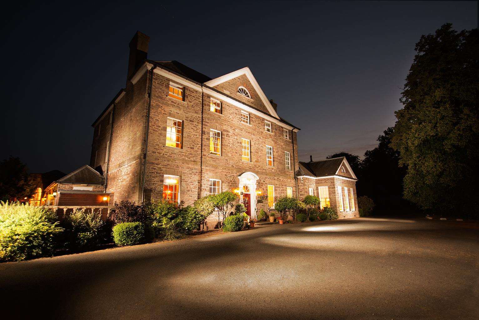


Pencelli Castle Caravan & Camping Park
Lying in the heart of the Brecon Beacons National Park, this charming park offers peace,…

A magical tour of reservoirs, high ridges and the highest mountains in southern Britain.
Neuadd Reservoirs
9 miles (14.5kms)
This is a fine way to visit the area’s highest ground, particularly if you feel like a long outing but are afraid of over-committing yourself, as any, or all, of the big peaks can be by-passed if required. It’s also an easy way to gain the tops, as it starts at an altitude over 1,300ft (396m) and, with the exception of two short but stiff sections, the climbing remains gentle to the point of being almost undetectable.
The Taf Fechan has certainly carved itself a beautiful valley. Its grand sweeping architecture doesn’t appear any the worse for the addition of the Neuadd reservoirs. Built to supply water to Merthyr Tydfil during the Industrial Revolution, in recent years the dam walls have shown their age and a decision was taken to drain both reservoirs. Subsequently, the lower reservoir dam wall has been totally removed. The upper reservoir will remain drained until it is required once again.
Once up, the walk cruises easily along the sandstone promenade of Graig Fan Ddu and Craig Gwaun Taf, offering great views across the magnificent cwm to the steep head of the valley, where the two highest peaks in southern Britain preside. It also rewards the walker with some tantalising glimpses of the stunning and seldom visited valley of Cwm Crew, which runs southwest from the narrowest section of the ridge at Rhiw yr Ysgyfarnog – the Slope of the Hare.
The high peaks need little introduction. Their might and stature are clear from almost any viewpoint, although you may find yourself surprised by the sheer scale of the drop from the north face of Corn Du and the incomparable northeast face of Pen y Fan, which falls precipitously down over 1,000ft (305m) to the rolling moorland of Cwm Sere below. Not so surprising are the views from the top, which are magnificent and matched only by the elation of reaching the summit. As you’d expect, the highest peaks also act as a divide for the watersheds, with the water to the north draining into the Usk and the hills to the south feeding the Taff, which runs south to Cardiff.
Steep and rocky ground leads down from the table-top summit, with the grassy flanks of Cribyn appearing much steeper than they really are up ahead. If you don’t think you can manage another climb, sneak around the peak to the right, otherwise, more fine views await you on the cramped summit. This time you can gaze north over Cwm Cynwyn, as fine a natural amphitheatre as you’re ever likely to see. With the peaks bagged, you’ll drop into the atmospheric rocky saddle of Bwlch ar y Fan and pick up an ancient track, known locally as the ‘Gap Road’. Although many claim it is of Roman origin, the exact age of the track isn’t known. It does, however, afford easy progress for tired legs back down to the valley floor. The grassy shores of the former lower lake make a great sun-trap and an excellent picnic spot from where you can look back up the valley to the impressive outlines of the mountains you’ve just climbed.
Leave the car park by the far end and head along the road to a gate. Just before it, take a stony track that bears off to the right. Pass through a gate and over a stream in a gully before turning left at a fork to go downhill to another gate. Go through this and turn left to yet another gate. Don’t go through this but turn right down a path next to it. Cross the road at the bottom, turn right and, after a few paces, turn left down a path immediately after a Neuadd Reservoir sign. This path bends down to the right of a derelict building to a small footbridge. Climb up on to the bank opposite and bear left to walk along its top. This will take you to a gate that leads out on to open moorland.
Go through this and keep straight ahead, taking the left-hand of the two tracks, which leads uphill towards the edge of a mainly felled forest. Follow the clear track up, with the forest to your left, and then climb steeply up a stony gully to the top of the escarpment.
Once there, turn right on to the obvious path and follow the escarpment along for over 2.5 miles (4km). You’ll eventually drop into a distinct saddle with the flat-topped summit of Corn Du directly ahead. Where the path comes to a crossroads, keep straight ahead and climb easily up on to the summit. Follow the escarpment edge along and then drop down into another saddle, where you take the path up on to the next peak, Pen y Fan.
Again, from the summit cairn, follow the escarpment around and drop steeply, on a rocky path, down into a deep col beneath Cribyn. Keep straight ahead to climb steeply up to the cairn on the narrow summit. Note: this climb can be avoided by forking right and following another clear path that contours right around the southern flanks of the mountain and brings you out at Point 6.
From the top, bear right and follow the escarpment around to the southeast. After a long flat stretch, you’ll drop steeply down into to a deep col known as Bwlch ar y Fan.
Turn right on to the wellmade track that leads easily down the mountain. Follow this for over 1.5 miles (2.4km), until it forks. Turn left down to a stream and retrace your steps to the start.
Clear well-trodden paths, boggy patches, broad rocky track
Steep rocky escarpments overlooking deep U-shaped valley and two small reservoirs
Care needed near livestock, several steep drops
OS Explorer OL12 Brecon Beacons National Park
Neuadd car park towards end of lane heading north from Pontsticill
None on route
Read our tips to look after yourself and the environment when following this walk.
The largest unitary authority in Wales, Powys covers an area of approximately 2,000 square miles. Much of that is mountainous because it actually has the lowest population density of all the Welsh counties.
This much wild, empty space is perhaps best typified by the International Dark Sky Reserve in the Brecon Beacons National Park, one of only eleven in the world. The absence of light pollution creates an exceptional spot for star gazing. You won’t find any cities in Powys, just villages and smaller-sized towns, but that’s the way its inhabitants like it.
Newtown, the largest settlement, is perhaps most famous for being the birthplace of Robert Owen, the founder of the Co-operative movement. Brecon is a market town set on the edge of the Brecon Beacons National Park, while the pretty Victorian spa town of Llandrindod Wells boasts the National Cycle Collection. Elsewhere, Hay-on-Wye hosts a major literary festival every year.
Powys is liberally scattered with castles, burial mounds, hill forts, and other historic markers; Powis Castle, near Welshpool is probably one of the most impressive. And for walking enthusiasts, it’s not just the Brecon Beacons on offer – the Elan Valley describes itself as the ‘Welsh Lake District’.
Discover more than 15,000 professionally rated places to stay, eat and visit from across the UK and Ireland.
Choose a place to stay safe in the knowledge that it has been expertly assessed by trained assessors.
Search by location or the type of place you're visiting to find your next ideal holiday experience.
Read our articles, city guides and recommended things to do for inspiration. We're here to help you explore the UK.