"Following cattle thieves and drovers to the lochan used by the fairies for their laundry."
Walk directions
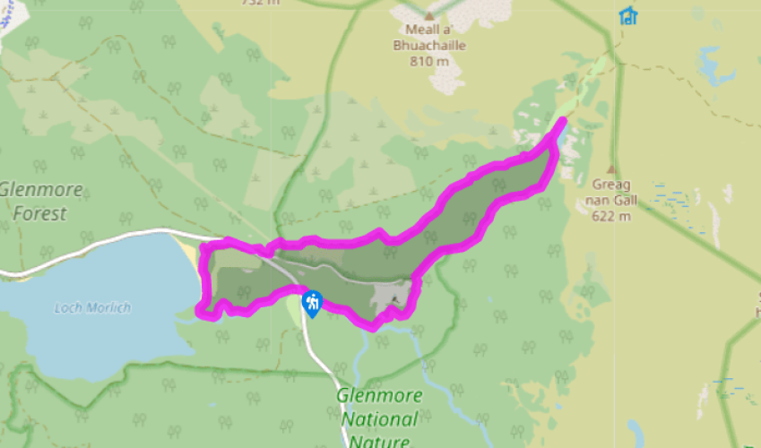
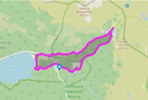
Head upstream on a sandy track to the left of the river. After 550yds (503m), turn left on a wide smooth path with purple-top waymarkers. Ahead is a gate into Glenmore Lodge rifle range; here the path bends right, to a wide gravel track.
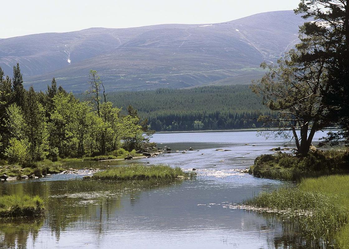
Turn right, away from Glenmore Lodge. At a side track on the right, keep ahead. The track narrows as it heads into the Pass of Ryvoan between steep wooded slopes of pine, birch and scree. At a path crossroads, the path left has a blue waymarker and is the one you'll take in a moment. Opposite it, a short path on the right leads to a viewpoint bench overlooking Lochan Uaine; just beyond this, take the steps on the right down to the lochan shore. Walk round to the left of the water on the beach. At the head of the loch a small path leads back up to the track. Turn sharp left, back to the junction already visited; now turn off to the right on to the narrower path with the blue waymarker.
This small path crosses some duckboard and heads back down the valley. Very soon it starts to climb steeply to the right, up rough stone steps. When it levels off the going is easier, although it's still narrow with tree roots. The path reaches a forest road at a bench and a waymarker.
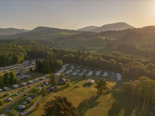
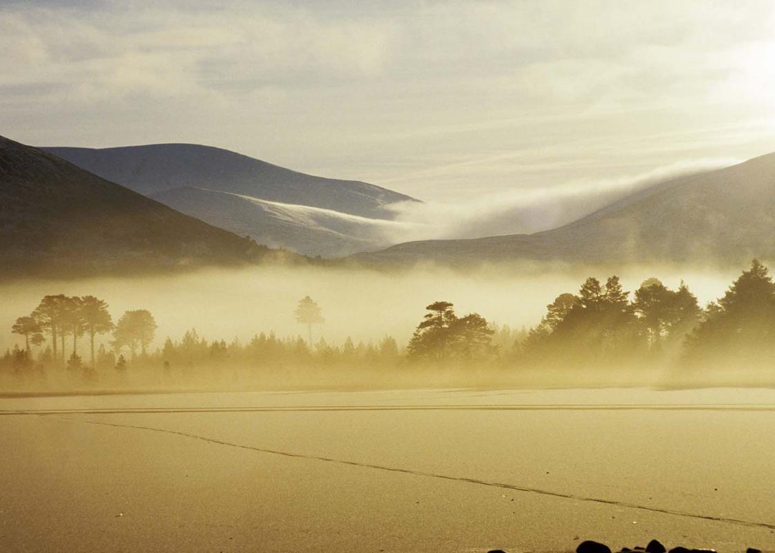
Continue ahead along the track. After a clear-felled area with views, the track re-enters trees and slopes downhill into Glenmore village. Just above the main road turn right to reach Glenmore Visitor Centre. Pass through its car park to the main road. Turn right for 200yds (183m), then cross to Glenmore shop.
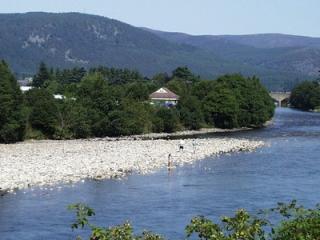
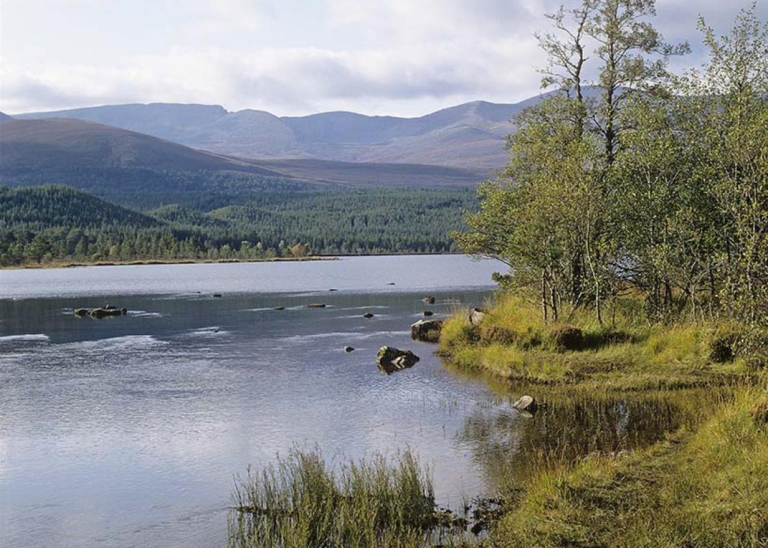
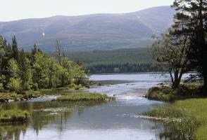
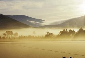
Behind a post-box, steps lead down to the campsite. A path through woods to the right of the campsite leads to the shore of Loch Morlich. Head left across a footbridge and follow the beaches around a wide bay. Then keep ahead into the woods until another river blocks the way. Turn left along the river bank. Ignore a footbridge, but continue on the wide path with the river on your right. Where the path divides, the right branch continues beside the river through bushes to the car park.
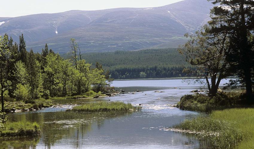
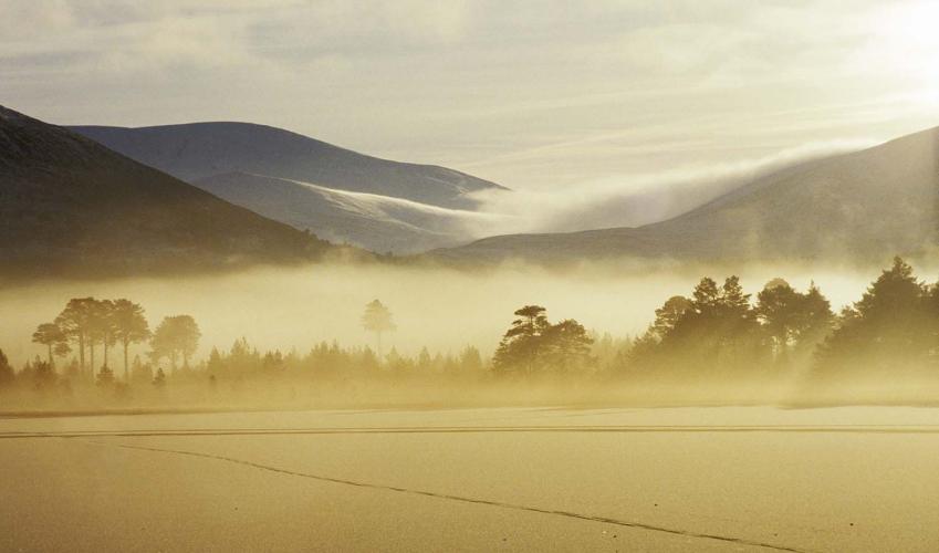
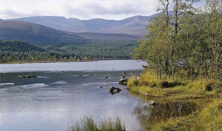
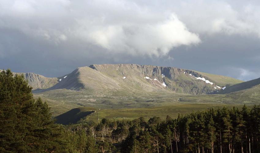
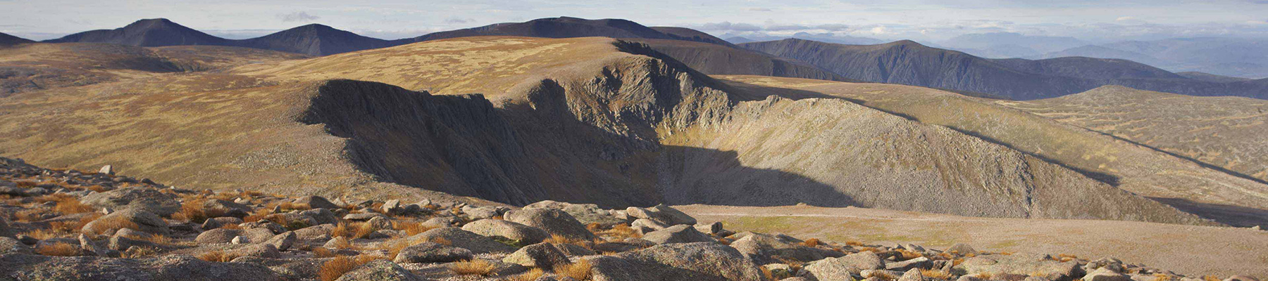
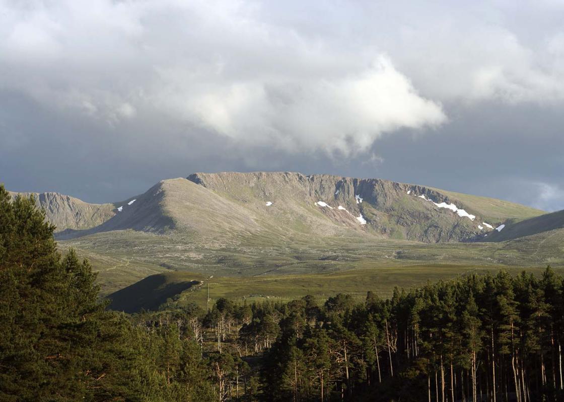
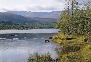
The Pass of Ryvoan has all the atmosphere of a classic Cairngorm through-route. It's a scaled down version of the famous and fearsome Lairig Ghru that cuts through the Cairngorm range southwards from Aviemore. You pass from the shelter of the forest to a green lochan, trapped between two high and... stony mountainsides. Once through the narrow gap, you'll find wide moors and a ring of peaks around the horizon. Thieving ways Ryvoan marked the exit of the Thieves' Road that ran out of Rannoch and Lochaber by secret ways through the Rothiemurchus Forest. The MacDonalds of Glen Coe used to come raiding here in the 17th century, as did Clan Cameron from Loch Eil near Fort William. Once through the pass, they could take their pick from the rich lands of Moray and Aberdeenshire. In more settled times, the raiding chieftains became landlords, and their rents were paid in the small black cattle of the glens. Every autumn, the drove herds assembled for their long walk to the markets of Falkirk, Perth and northern England. The old drove road The drovers used the same road as their thieving grandfathers, but once through the pass they turned sharp right across the flank of the mountain. The Lairig an Lui, the Pass of the Calves, crosses the dangerous ford of the Avon and runs down Glen Derry to Braemar. It's 30 miles (48km) to the next grazing and shelter - two full days for the drove. Overnight the cattle would snatch some grazing from the rough grasses, while the drovers cooked their oatmeal and potatoes, before rolling themselves in their woollen plaids on a bed of heather. As late as 1859, Queen Victoria found the Lairig path torn up by hooves and scented with fresh cow pats. The Sithe and others Lochan Uaine means 'Green Loch'. Some say the green colour is caused by flecks of mica. Others claim that it's where the fairies wash their green garments. The Highland fairies, the Sithe (pronounced 'Shee'), don't dance around with wands and grant you wishes. They are touchy and vengeful, and if you meet one it is best to address him politely in good Gaelic. Precautions you can take are to avoid wearing green, which is known to annoy them, and never to address your friends by name while under the trees. The Bodach Lamh-dearg is a spectre who appears wrapped in a grey plaid with one bloodstained hand, challenging passers-by to a fight and leaving their bodies for the foxes. Big Donald, the King of the Fairies, lived beside Loch Morlich.
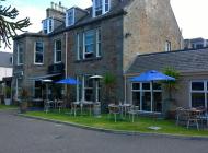
Apart from the Orkneys and the Shetlands, Highland is Scotland’s northernmost county. Probably its most famous feature is the mysterious and evocative Loch Ness, allegedly home to an ancient monster that has embedded itself in the world’s modern mythology, and the region’s tourist industry.
"Following cattle thieves and drovers to the lochan used by the fairies for their laundry."
Walk details
2hrs 15min
Difficulty:
Medium
Gradient:
Moderate
Distance:
5 miles (8kms)
Ascent:
400ft (122m)
Walk directions
Head upstream on a sandy track to the left of the river. After 550yds (503m), turn left on a wide smooth path with purple-top waymarkers. Ahead is a gate into Glenmore Lodge rifle range; here the path bends right, to a wide gravel track.
1 of 5
Turn right, away from Glenmore Lodge. At a side track on the right, keep ahead. The track narrows as it heads into the Pass of Ryvoan between steep wooded slopes of pine, birch and scree. At a path crossroads, the path left has a blue waymarker and is the one you'll take in a moment. Opposite it, a short path on the right leads to a viewpoint bench overlooking Lochan Uaine; just beyond this, take the steps on the right down to the lochan shore. Walk round to the left of the water on the beach. At the head of the loch a small path leads back up to the track. Turn sharp left, back to the junction already visited; now turn off to the right on to the narrower path with the blue waymarker.
2 of 5
This small path crosses some duckboard and heads back down the valley. Very soon it starts to climb steeply to the right, up rough stone steps. When it levels off the going is easier, although it's still narrow with tree roots. The path reaches a forest road at a bench and a waymarker.
3 of 5
Continue ahead along the track. After a clear-felled area with views, the track re-enters trees and slopes downhill into Glenmore village. Just above the main road turn right to reach Glenmore Visitor Centre. Pass through its car park to the main road. Turn right for 200yds (183m), then cross to Glenmore shop.
4 of 5
Behind a post-box, steps lead down to the campsite. A path through woods to the right of the campsite leads to the shore of Loch Morlich. Head left across a footbridge and follow the beaches around a wide bay. Then keep ahead into the woods until another river blocks the way. Turn left along the river bank. Ignore a footbridge, but continue on the wide path with the river on your right. Where the path divides, the right branch continues beside the river through bushes to the car park.
The Pass of Ryvoan has all the atmosphere of a classic Cairngorm through-route. It's a scaled down version of the famous and fearsome Lairig Ghru that cuts through the Cairngorm range southwards from Aviemore. You pass from the shelter of the forest to a green lochan, trapped between two high and... stony mountainsides. Once through the narrow gap, you'll find wide moors and a ring of peaks around the horizon. Thieving ways Ryvoan marked the exit of the Thieves' Road that ran out of Rannoch and Lochaber by secret ways through the Rothiemurchus Forest. The MacDonalds of Glen Coe used to come raiding here in the 17th century, as did Clan Cameron from Loch Eil near Fort William. Once through the pass, they could take their pick from the rich lands of Moray and Aberdeenshire. In more settled times, the raiding chieftains became landlords, and their rents were paid in the small black cattle of the glens. Every autumn, the drove herds assembled for their long walk to the markets of Falkirk, Perth and northern England. The old drove road The drovers used the same road as their thieving grandfathers, but once through the pass they turned sharp right across the flank of the mountain. The Lairig an Lui, the Pass of the Calves, crosses the dangerous ford of the Avon and runs down Glen Derry to Braemar. It's 30 miles (48km) to the next grazing and shelter - two full days for the drove. Overnight the cattle would snatch some grazing from the rough grasses, while the drovers cooked their oatmeal and potatoes, before rolling themselves in their woollen plaids on a bed of heather. As late as 1859, Queen Victoria found the Lairig path torn up by hooves and scented with fresh cow pats. The Sithe and others Lochan Uaine means 'Green Loch'. Some say the green colour is caused by flecks of mica. Others claim that it's where the fairies wash their green garments. The Highland fairies, the Sithe (pronounced 'Shee'), don't dance around with wands and grant you wishes. They are touchy and vengeful, and if you meet one it is best to address him politely in good Gaelic. Precautions you can take are to avoid wearing green, which is known to annoy them, and never to address your friends by name while under the trees. The Bodach Lamh-dearg is a spectre who appears wrapped in a grey plaid with one bloodstained hand, challenging passers-by to a fight and leaving their bodies for the foxes. Big Donald, the King of the Fairies, lived beside Loch Morlich.
Apart from the Orkneys and the Shetlands, Highland is Scotland’s northernmost county. Probably its most famous feature is the mysterious and evocative Loch Ness, allegedly home to an ancient monster that has embedded itself in the world’s modern mythology, and the region’s tourist industry.