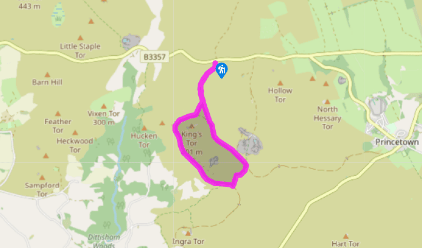
"Walk along the route of Devon’s first ‘iron railroad’ through the heart of the Princetown quarries."
Walk directions
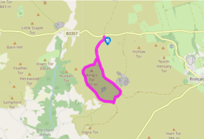
Walk away from the road and through a narrow gap in a wall (the site of Foggintor School in the early 20th century) to pass a solitary conifer. Pass through another wall gap and cross the leat (supplying local farms and cottages) on a granite slab. Keep ahead, downhill, curving right to pass a boundary stone (marked ‘T and A’ for Tavistock and Ashburton), aiming for the bottom corner of a wall that runs downhill beyond the stream. Pass through a bank to meet the stream bank.
Bear left to wade through the ford, or right towards the wall corner on the opposite bank to cross at a shallower, rocky, spot. Follow the wall uphill, and where it curves right, keep ahead up a grassy path, weaving through granite blocks to reach the disused railway track.
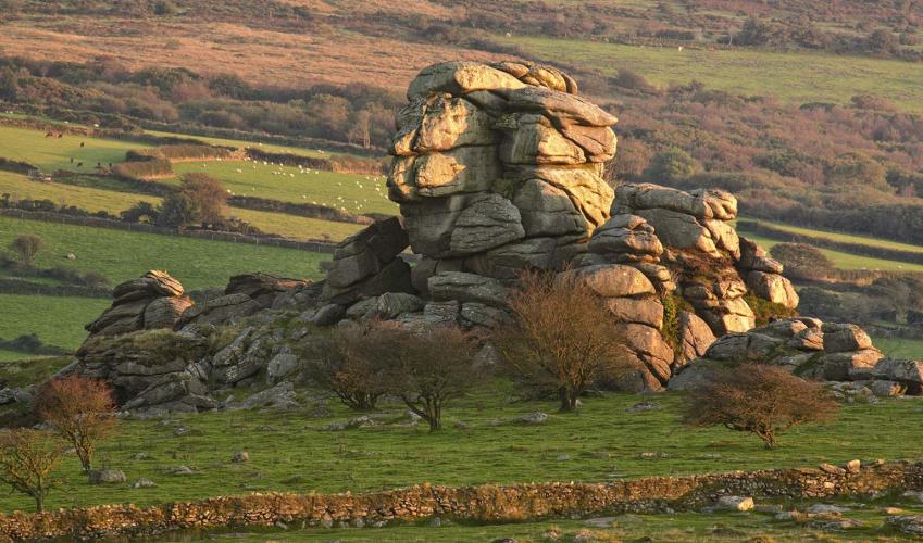
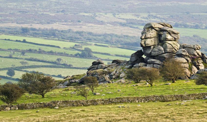
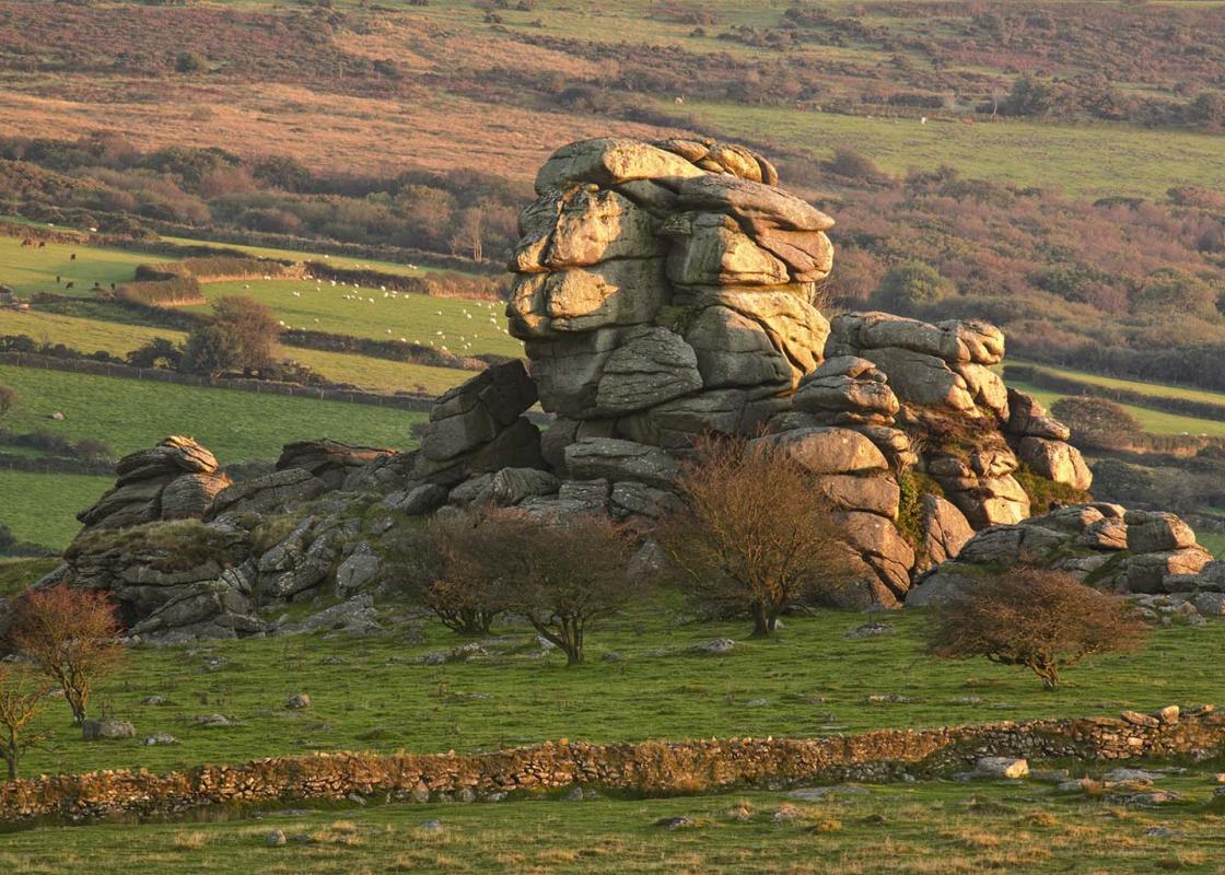
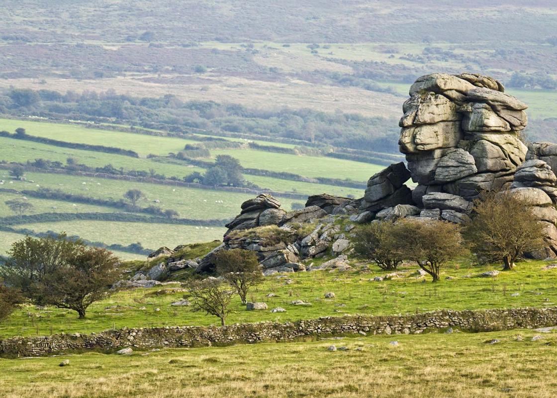
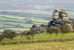
Turn right along the embanked track, with views west to Bodmin Moor. Nearer at hand you can see the rugged outline of Vixen Tor, which has the greatest drop of Dartmoor’s tors (100ft/30.5m). The line curves left through a cutting, with views to Plymouth Sound, and across the wooded valley of the River Walkham right, and crosses a bridge.
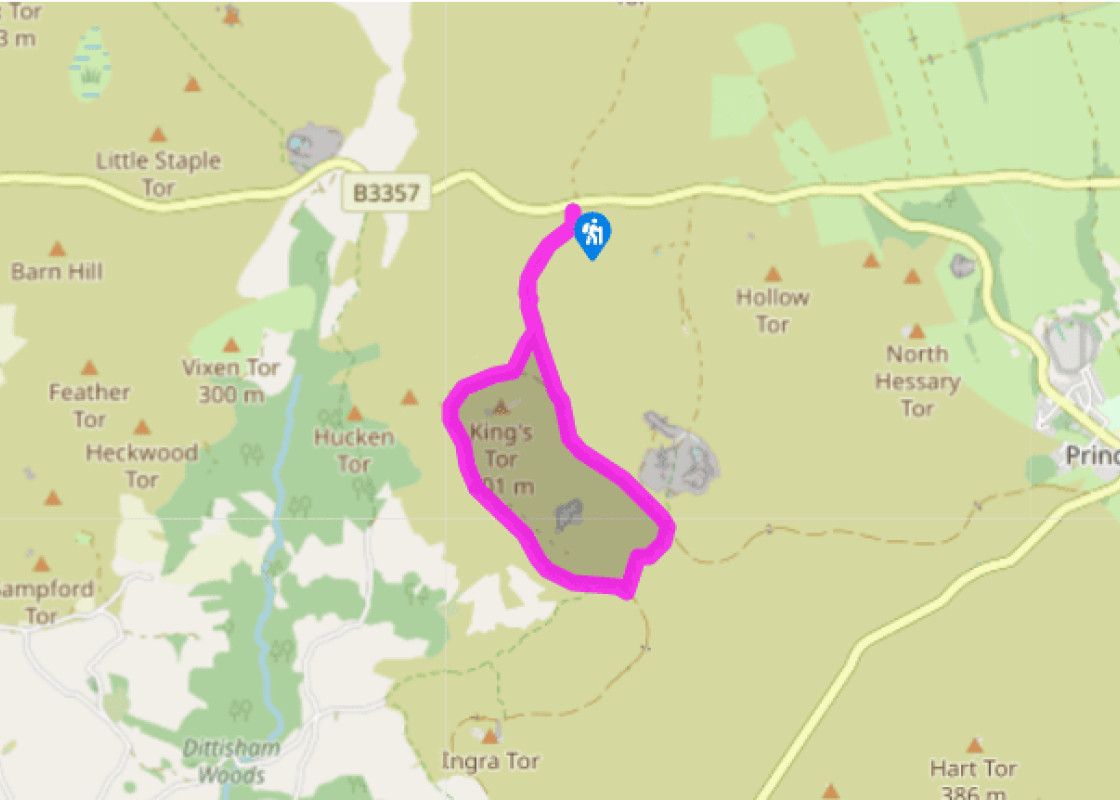
Soon after, at an obvious track junction, bear half left on a raised and grassy siding which runs towards the quarry at King’s Tor. After about 250yds (229m), note 12 granite corbels – they were made for London Bridge, but were found to be surplus to requirements.
From the corbels bear right to the main track, and turn left past ruins and spoil heaps of Swelltor Quarries, soon passing a bridleway on the right. Note the line of the railway running away ahead.
About 200yds (183m) later, as the line bears right, and opposite a gate, turn left up a rough path beside a dilapidated granite wall. Where the wall bears away right, stay on the path, soon climbing to meet the disused railway at a path junction.
Turn left along the line, soon taking the left fork at a junction; the car park and Great Mis Tor come into view. The track bears left round the hill slope. Where the wall originally followed up from the stream comes into view, bear right downhill, aiming for the bottom wall corner.
Cross the stream and bear slightly right through the bank ahead. Follow the broad, grassy path past the boundary stone to return to the car park.
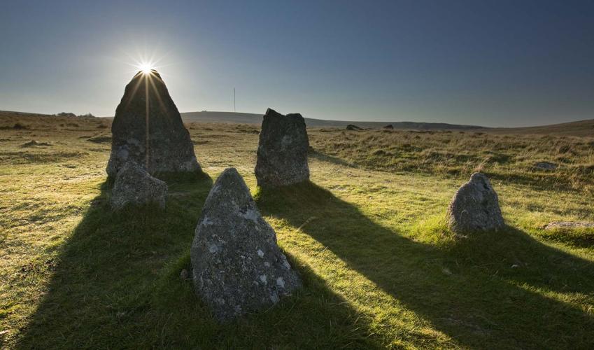
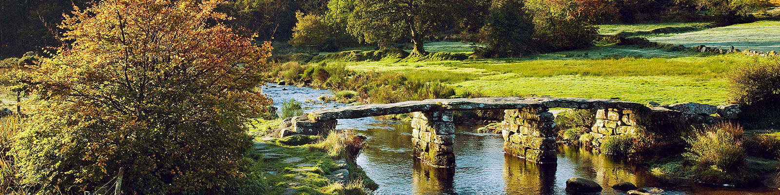
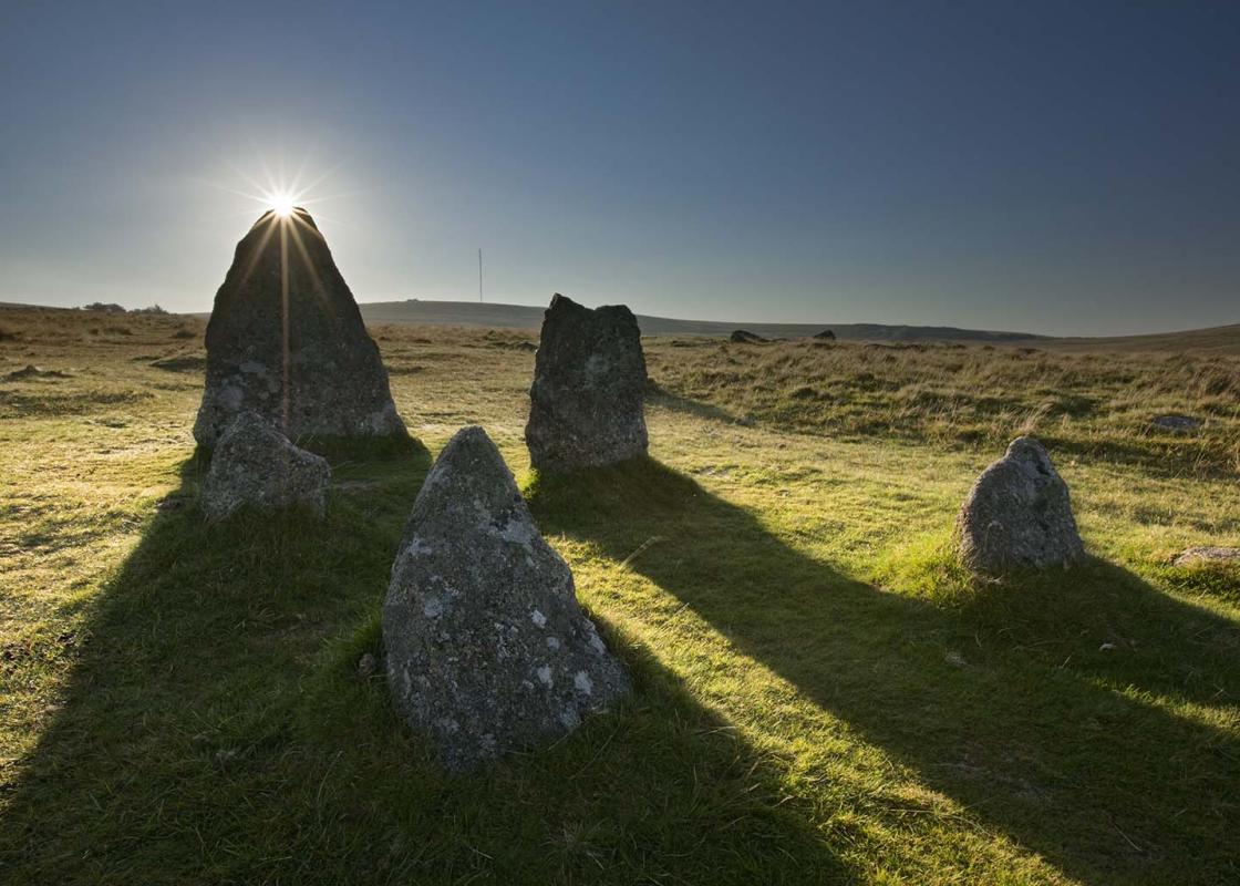
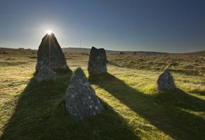
This wonderful – and relatively untaxing – moorland walk is packed with interest from the very start. Not only is Dartmoor’s highest town, Princetown – and its notorious prison – just up the road, there are also disused granite quarries, the former line of the old Plymouth and Dartmoor Railway, and... some of the best Bronze Age structures on the moor a stone’s throw from the route. The walk is also blessed with sweeping views in every direction, from the majestic heights of Great Staple and Great Mis tors to the north, and as far south as Plymouth Sound. Note that there is one stream crossing, and no bridge: it’s a case of hopping from one bank to the other or wading across the ford at times of low water. Tyrwhitt’s railroad The Plymouth and Dartmoor Railway was the brainchild of Thomas Tyrwhitt, a friend of the Prince Regent (later George IV). In 1796 he was appointed as auditor to the Duchy of Cornwall. He determined to build a flourishing settlement on the high moor – Princetown – though many of his schemes were unsuccessful. To this end he developed the local quarries, and laid the foundation stone for the new prison in March 1806. In 1823 he built the horse-drawn Plymouth and Dartmoor Railroad (eventually extended into Princetown village) to take granite out of the quarries at Foggintor, Swelltor and King’s Tor. The line was taken over by the Great Western Railway in 1883, and closed in 1956. Today it makes for an excellent walking and off-road cycling route.
Devon sums up all that is best about the British landscape, with its magnificent coastlines, two historic cities, the world-famous Dartmoor National Park and south Devon’s glorious English Riviera. A fashionable and much-loved holiday destination, hiking and cycling in the National Parks is extremely popular among visitors, with a great choice of off-road routes.
"Walk along the route of Devon’s first ‘iron railroad’ through the heart of the Princetown quarries."
Walk details
2hrs
Difficulty:
Medium
Gradient:
Gentle
Distance:
3.75 miles (6kms)
Ascent:
164ft (50m)
Walk directions
Walk away from the road and through a narrow gap in a wall (the site of Foggintor School in the early 20th century) to pass a solitary conifer. Pass through another wall gap and cross the leat (supplying local farms and cottages) on a granite slab. Keep ahead, downhill, curving right to pass a boundary stone (marked ‘T and A’ for Tavistock and Ashburton), aiming for the bottom corner of a wall that runs downhill beyond the stream. Pass through a bank to meet the stream bank.
1 of 8
Bear left to wade through the ford, or right towards the wall corner on the opposite bank to cross at a shallower, rocky, spot. Follow the wall uphill, and where it curves right, keep ahead up a grassy path, weaving through granite blocks to reach the disused railway track.
2 of 8
Turn right along the embanked track, with views west to Bodmin Moor. Nearer at hand you can see the rugged outline of Vixen Tor, which has the greatest drop of Dartmoor’s tors (100ft/30.5m). The line curves left through a cutting, with views to Plymouth Sound, and across the wooded valley of the River Walkham right, and crosses a bridge.
3 of 8
Soon after, at an obvious track junction, bear half left on a raised and grassy siding which runs towards the quarry at King’s Tor. After about 250yds (229m), note 12 granite corbels – they were made for London Bridge, but were found to be surplus to requirements.
4 of 8
From the corbels bear right to the main track, and turn left past ruins and spoil heaps of Swelltor Quarries, soon passing a bridleway on the right. Note the line of the railway running away ahead.
5 of 8
About 200yds (183m) later, as the line bears right, and opposite a gate, turn left up a rough path beside a dilapidated granite wall. Where the wall bears away right, stay on the path, soon climbing to meet the disused railway at a path junction.
6 of 8
Turn left along the line, soon taking the left fork at a junction; the car park and Great Mis Tor come into view. The track bears left round the hill slope. Where the wall originally followed up from the stream comes into view, bear right downhill, aiming for the bottom wall corner.
7 of 8
Cross the stream and bear slightly right through the bank ahead. Follow the broad, grassy path past the boundary stone to return to the car park.
This wonderful – and relatively untaxing – moorland walk is packed with interest from the very start. Not only is Dartmoor’s highest town, Princetown – and its notorious prison – just up the road, there are also disused granite quarries, the former line of the old Plymouth and Dartmoor Railway, and... some of the best Bronze Age structures on the moor a stone’s throw from the route. The walk is also blessed with sweeping views in every direction, from the majestic heights of Great Staple and Great Mis tors to the north, and as far south as Plymouth Sound. Note that there is one stream crossing, and no bridge: it’s a case of hopping from one bank to the other or wading across the ford at times of low water. Tyrwhitt’s railroad The Plymouth and Dartmoor Railway was the brainchild of Thomas Tyrwhitt, a friend of the Prince Regent (later George IV). In 1796 he was appointed as auditor to the Duchy of Cornwall. He determined to build a flourishing settlement on the high moor – Princetown – though many of his schemes were unsuccessful. To this end he developed the local quarries, and laid the foundation stone for the new prison in March 1806. In 1823 he built the horse-drawn Plymouth and Dartmoor Railroad (eventually extended into Princetown village) to take granite out of the quarries at Foggintor, Swelltor and King’s Tor. The line was taken over by the Great Western Railway in 1883, and closed in 1956. Today it makes for an excellent walking and off-road cycling route.
Devon sums up all that is best about the British landscape, with its magnificent coastlines, two historic cities, the world-famous Dartmoor National Park and south Devon’s glorious English Riviera. A fashionable and much-loved holiday destination, hiking and cycling in the National Parks is extremely popular among visitors, with a great choice of off-road routes.