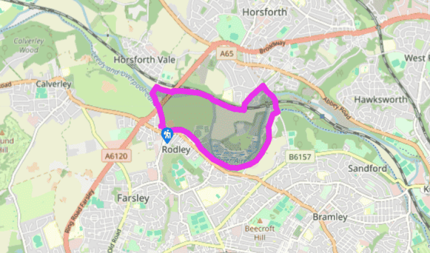
Cross the canal swing bridge, and go left along the broad tow path, passing beneath a bridge carrying the ring road. Reaching a second swing bridge, turn right along a paved lane. After only 30yds (27m), drop along a stepped path on the left to a lower track. Follow it over a stone bridge spanning the River Aire.
On the far bank, immediately turn off right down steps to a riverside path. Follow it downstream from the bridge, passing back beneath the main road. Carry on for another 0.5 mile (800m) then, as the river swings away to the right, bear off to a kissing gate. Stick with the higher path, signed to New Laithes Road, which rises at the edge of pasture alongside a deepening railway cutting. Eventually reaching another kissing gate, slip through and continue on a contained path that soon swings across a railway bridge and leads out to a street.
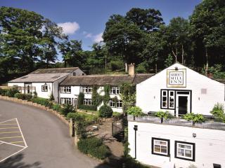
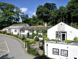
Turn right and walk along Newlaithes Road for 0.25 miles (400). Approaching its eventual end, watch for a stepped path dropping on the right that cuts the corner onto Newlay Lane. Walk down the hill to Newlay Bridge crossing the river and continue to a second bridge spanning the railway. Walk on past the Abbey Inn to approach a bridge arching over the canal. Drop left to the tow path.
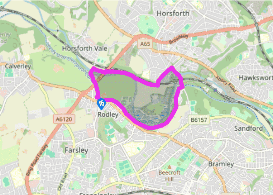
Carry on along the tow path, beneath the bridge to the right. After a mile (1.6km), at the second swing bridge, a track off through gates on the right leads into the Rodley Nature Reserve. Pools, marshland, a willow coppice and hay meadow attract wildfowl and many species of small birds as well as butterflies and dragonflies. The reserve is open on Wednesdays, weekends and most bank holidays and admission is free.
Walk on beside the canal. It is only just over 0.25 miles (400m) back to the start point.
The Leeds and Liverpool Canal was conceived at a meeting in Bradford in 1766, but it was not until 1770 that the first sod was cut near Liverpool. The ambitious scheme followed a convoluted 127-mile (204km) route across the Pennines, linking many of the important textile towns with the coal pits... of Wigan and the western port of Liverpool. From Leeds, via the Aire and Calder Navigation and the River Ouse, there was also a continuous waterway to the ports of Hull and Grimsby. There were several major changes of plan along the way and, in the end, the Leeds and Liverpool required the construction of 91 locks and a 1,640-yard (1500m) tunnel to broach the summit at Foulridge. The canal was finally opened end to end in 1816, although intermediate sections were already in use to great effect. The section from Leeds to Skipton opened to a jubilant fanfare on 8 April 1773, and the arrival of two boatloads of coal halved the previous selling price. The ability to transport raw materials and produce them quickly and cheaply completely changed the face of this part of England and, with the invention of efficient steam engines, the Industrial Revolution became unstoppable. By 1840, almost 4,500 miles (7,242km) of navigable waterway crisscrossed Britain, opening the hinterland to trade and industry. Some canals, like the Leeds and Liverpool, were highly profitable and returned massive fortunes to their backers. But the writing was already on the wall. In 1825, the Stockton–Darlington railway opened with the Liverpool–Manchester line following five years later. Unaffected by icy winters or summer drought and able to shift far greater loads at speed, the railway age had arrived. By the end of the 19th century the country had 22,000 miles (35,000km) of railway. Yet, the canals did not suffer an instant death. Many were taken over and operated by the new railway companies, and trade on the major routes, albeit steadily declining, continued well into the 20th century. From the 1950s, recreational use reversed the decline, saving some canals from closure while bringing others back to life. The Leeds and Liverpool remained navigable is today a vibrant corridor linking urban centres to the countryside.
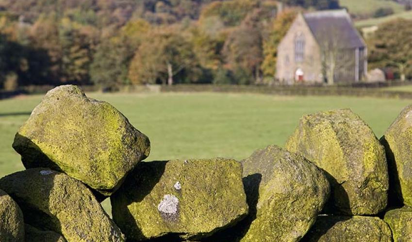
Everybody knows that Yorkshire has some special landscapes. The Dales and the Moors first spring to mind, but what about West Yorkshire? That’s Leeds and Bradford isn’t it? Back-to-back houses and blackened mills… Certainly if you had stood on any of the hills surrounding Hebden Bridge a hundred years ago, and gazed down into the valley, all you would have seen was the pall of smoke issuing from the chimneys of 33 textile mills.
Cross the canal swing bridge, and go left along the broad tow path, passing beneath a bridge carrying the ring road. Reaching a second swing bridge, turn right along a paved lane. After only 30yds (27m), drop along a stepped path on the left to a lower track. Follow it over a stone bridge spanning the River Aire.
1 of 5
On the far bank, immediately turn off right down steps to a riverside path. Follow it downstream from the bridge, passing back beneath the main road. Carry on for another 0.5 mile (800m) then, as the river swings away to the right, bear off to a kissing gate. Stick with the higher path, signed to New Laithes Road, which rises at the edge of pasture alongside a deepening railway cutting. Eventually reaching another kissing gate, slip through and continue on a contained path that soon swings across a railway bridge and leads out to a street.
2 of 5
Turn right and walk along Newlaithes Road for 0.25 miles (400). Approaching its eventual end, watch for a stepped path dropping on the right that cuts the corner onto Newlay Lane. Walk down the hill to Newlay Bridge crossing the river and continue to a second bridge spanning the railway. Walk on past the Abbey Inn to approach a bridge arching over the canal. Drop left to the tow path.
3 of 5
Carry on along the tow path, beneath the bridge to the right. After a mile (1.6km), at the second swing bridge, a track off through gates on the right leads into the Rodley Nature Reserve. Pools, marshland, a willow coppice and hay meadow attract wildfowl and many species of small birds as well as butterflies and dragonflies. The reserve is open on Wednesdays, weekends and most bank holidays and admission is free.
4 of 5
Walk on beside the canal. It is only just over 0.25 miles (400m) back to the start point.
The Leeds and Liverpool Canal was conceived at a meeting in Bradford in 1766, but it was not until 1770 that the first sod was cut near Liverpool. The ambitious scheme followed a convoluted 127-mile (204km) route across the Pennines, linking many of the important textile towns with the coal pits... of Wigan and the western port of Liverpool. From Leeds, via the Aire and Calder Navigation and the River Ouse, there was also a continuous waterway to the ports of Hull and Grimsby. There were several major changes of plan along the way and, in the end, the Leeds and Liverpool required the construction of 91 locks and a 1,640-yard (1500m) tunnel to broach the summit at Foulridge. The canal was finally opened end to end in 1816, although intermediate sections were already in use to great effect. The section from Leeds to Skipton opened to a jubilant fanfare on 8 April 1773, and the arrival of two boatloads of coal halved the previous selling price. The ability to transport raw materials and produce them quickly and cheaply completely changed the face of this part of England and, with the invention of efficient steam engines, the Industrial Revolution became unstoppable. By 1840, almost 4,500 miles (7,242km) of navigable waterway crisscrossed Britain, opening the hinterland to trade and industry. Some canals, like the Leeds and Liverpool, were highly profitable and returned massive fortunes to their backers. But the writing was already on the wall. In 1825, the Stockton–Darlington railway opened with the Liverpool–Manchester line following five years later. Unaffected by icy winters or summer drought and able to shift far greater loads at speed, the railway age had arrived. By the end of the 19th century the country had 22,000 miles (35,000km) of railway. Yet, the canals did not suffer an instant death. Many were taken over and operated by the new railway companies, and trade on the major routes, albeit steadily declining, continued well into the 20th century. From the 1950s, recreational use reversed the decline, saving some canals from closure while bringing others back to life. The Leeds and Liverpool remained navigable is today a vibrant corridor linking urban centres to the countryside.
Everybody knows that Yorkshire has some special landscapes. The Dales and the Moors first spring to mind, but what about West Yorkshire? That’s Leeds and Bradford isn’t it? Back-to-back houses and blackened mills… Certainly if you had stood on any of the hills surrounding Hebden Bridge a hundred years ago, and gazed down into the valley, all you would have seen was the pall of smoke issuing from the chimneys of 33 textile mills.