"From the scars of Upton coal mine, a nature reserve is created."
Walk directions
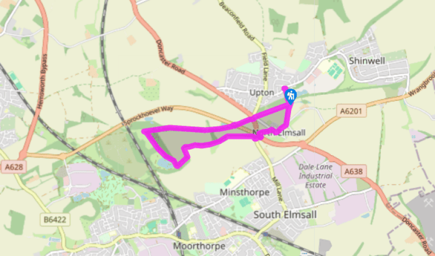
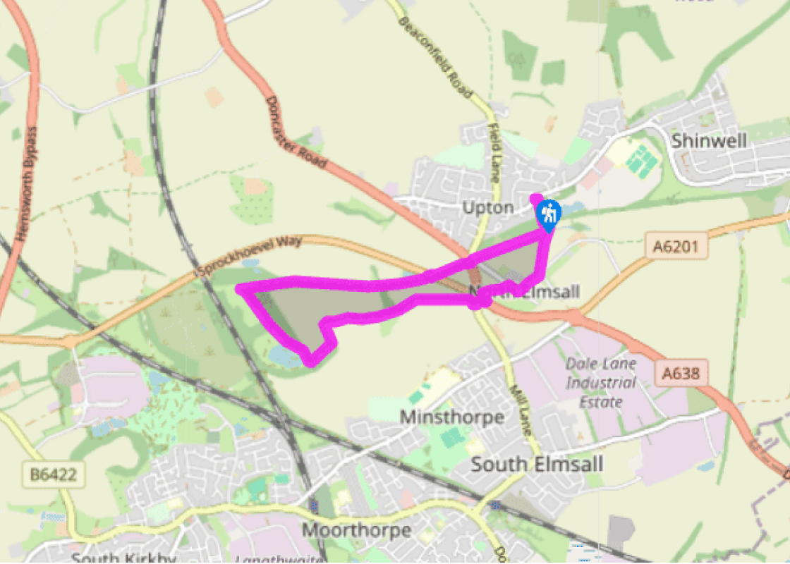
Leave the car park through a kissing gate by a fishing pond. Turn right to a second kissing gate and follow the cinder track bed of the former Hull and Barnsley Railway to the right. Keep to the main path, passing a tree-fringed pond and then later, the overgrown platform of Upton and North Elmsall Station. Finally, emerge through a gate beside a junction of roads with the A638.
Carefully cross the main road to pick up the ongoing track opposite. Signed as a bridleway, it runs within a wooded cutting to a second main road (A6201). Again cross and continue along the former railway line, which alternates between embankment and cutting across the rolling countryside. The path eventually rises onto more open ground, shortly meeting a broad trail near the crest of the hill.
Turning sharp left, descend between the trees towards a lake that soon appears ahead. Bear left at a fork to pass around the eastern bank. Meeting a crossing track at its far end, go left. Keep with it as it subsequently swings left and then right. Continue for another 0.75 miles (1.2km) before ultimately coming out at a large roundabout.
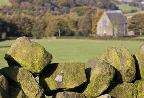
Following bridleway signs anticlockwise around the roundabout, cross the B6474 and then the A638 before turning off down a truncated minor road into North Elmsall. At the end go right and then left into Hall Lane. Walk up to a junction just beyond the church. There, leave over a stone stile on the left. A sign to Upton points a diagonal line across a couple of fields. At the far side, cross a drainage ditch and walk forward to a final stile. Rejoining the course of the railway, go right and then left back to the car park.
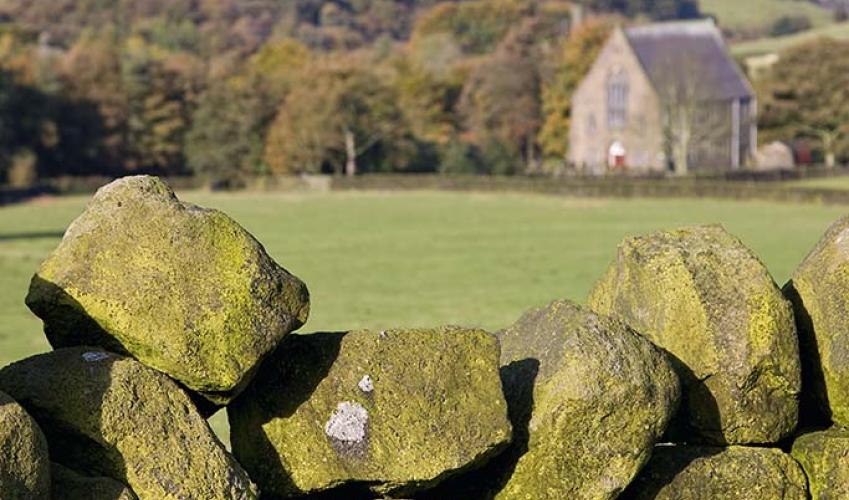
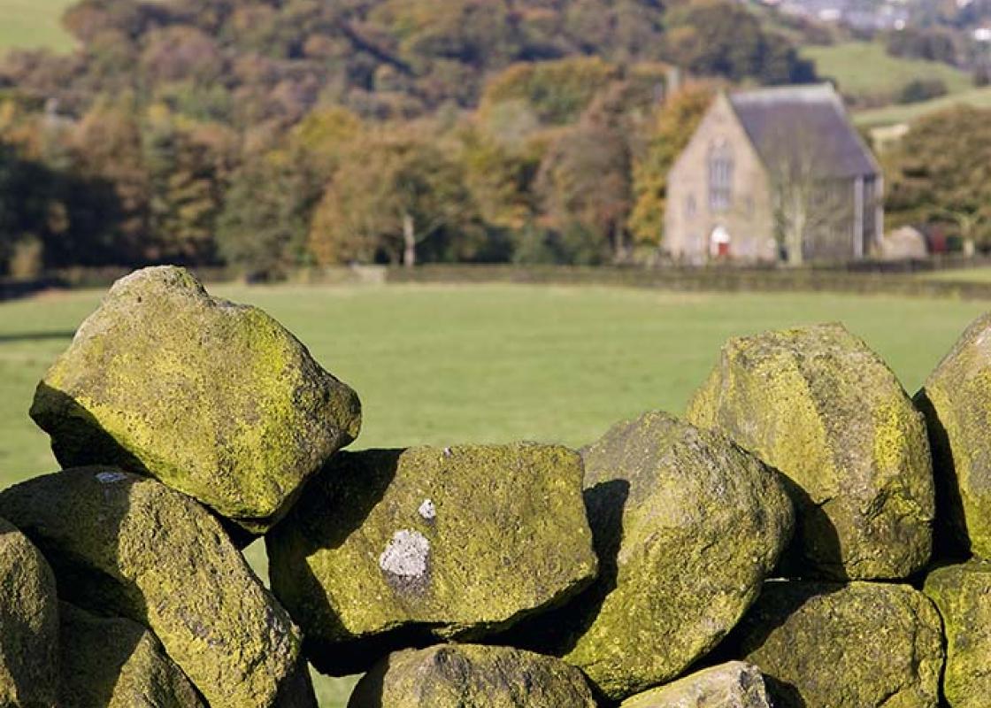
The scenery of the southeastern corner of West Yorkshire contrasts markedly with the high moorlands to the west. Breaking from the hills, the rivers writhe and twist across a flatter landscape more suited to agriculture than the abrupt slopes and bleak tops of the Pennines. Further west, the towns... had grown out of narrow valleys, where fast-flowing streams had powered the beginnings of the Industrial Revolution, but here, it was what lay below the ground that would make the difference. Although Yorkshire’s coal has probably been dug since Roman times, it was not until the end of the 18th century that mining was developed on any significant scale. The change came with the development of river navigations, canals and subsequent railways, which, for the first time, created a cheap and effective network for transportation. Towns and villages sprang up around the pitheads, housing close-knit communities that depended upon the mines for their livelihood. The burgeoning steam age brought an almost insatiable demand, and in the early years of the 20th century, mines were sunk ever deeper in pursuit of seams far beneath the surface. The area became one of the largest coal producers in the country, but wholesale closures from the mid-1980s finished the industry. Undertaken on a limited scale, traces of the early coal industry are often only revealed in the small craters of collapsed bell pits hidden amongst old woodland. But the mines of the industrial age changed the landscape irrevocably, in places creating barren moonscapes of mountainous tips and vast craters. Equally dramatic are the changes of the last 30 years. Great heaps of spoil have been planted with grasses, shrubs and trees, water has flooded opencast workings and subsidence flashes to create lakes, while disused railway lines now serve as footpaths and cycle routes. All have become havens for insects, birds, animals and wildflowers. Beginning at a fishing lake on the site of the former Upton colliery, which was sunk in 1924 and operated for 40 years, the first half of this walk follows the course of the Hull and Barnsley Railway. Opened in 1885, it survived into the middle of the 20th century, but was progressively closed during the 1960s to leave just a remnant servicing the docks at Hull. Along the way are the remains of Upton Station, as well as embankments and cuttings, now cloaked in shrubwood that attracts birds and butterflies. At the halfway point is Johnny Brown’s Common, a former tip at the foot of which is a large lake offering refuge to wildfowl.
Everybody knows that Yorkshire has some special landscapes. The Dales and the Moors first spring to mind, but what about West Yorkshire? That’s Leeds and Bradford isn’t it? Back-to-back houses and blackened mills… Certainly if you had stood on any of the hills surrounding Hebden Bridge a hundred years ago, and gazed down into the valley, all you would have seen was the pall of smoke issuing from the chimneys of 33 textile mills.
"From the scars of Upton coal mine, a nature reserve is created."
Walk details
1hr 15min
Difficulty:
Easy
Gradient:
Gentle
Distance:
3.5 miles (5.7kms)
Ascent:
197ft (60m)
Walk directions
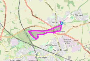
Leave the car park through a kissing gate by a fishing pond. Turn right to a second kissing gate and follow the cinder track bed of the former Hull and Barnsley Railway to the right. Keep to the main path, passing a tree-fringed pond and then later, the overgrown platform of Upton and North Elmsall Station. Finally, emerge through a gate beside a junction of roads with the A638.
1 of 4
Carefully cross the main road to pick up the ongoing track opposite. Signed as a bridleway, it runs within a wooded cutting to a second main road (A6201). Again cross and continue along the former railway line, which alternates between embankment and cutting across the rolling countryside. The path eventually rises onto more open ground, shortly meeting a broad trail near the crest of the hill.
2 of 4
Turning sharp left, descend between the trees towards a lake that soon appears ahead. Bear left at a fork to pass around the eastern bank. Meeting a crossing track at its far end, go left. Keep with it as it subsequently swings left and then right. Continue for another 0.75 miles (1.2km) before ultimately coming out at a large roundabout.
3 of 4
Following bridleway signs anticlockwise around the roundabout, cross the B6474 and then the A638 before turning off down a truncated minor road into North Elmsall. At the end go right and then left into Hall Lane. Walk up to a junction just beyond the church. There, leave over a stone stile on the left. A sign to Upton points a diagonal line across a couple of fields. At the far side, cross a drainage ditch and walk forward to a final stile. Rejoining the course of the railway, go right and then left back to the car park.
The scenery of the southeastern corner of West Yorkshire contrasts markedly with the high moorlands to the west. Breaking from the hills, the rivers writhe and twist across a flatter landscape more suited to agriculture than the abrupt slopes and bleak tops of the Pennines. Further west, the towns... had grown out of narrow valleys, where fast-flowing streams had powered the beginnings of the Industrial Revolution, but here, it was what lay below the ground that would make the difference. Although Yorkshire’s coal has probably been dug since Roman times, it was not until the end of the 18th century that mining was developed on any significant scale. The change came with the development of river navigations, canals and subsequent railways, which, for the first time, created a cheap and effective network for transportation. Towns and villages sprang up around the pitheads, housing close-knit communities that depended upon the mines for their livelihood. The burgeoning steam age brought an almost insatiable demand, and in the early years of the 20th century, mines were sunk ever deeper in pursuit of seams far beneath the surface. The area became one of the largest coal producers in the country, but wholesale closures from the mid-1980s finished the industry. Undertaken on a limited scale, traces of the early coal industry are often only revealed in the small craters of collapsed bell pits hidden amongst old woodland. But the mines of the industrial age changed the landscape irrevocably, in places creating barren moonscapes of mountainous tips and vast craters. Equally dramatic are the changes of the last 30 years. Great heaps of spoil have been planted with grasses, shrubs and trees, water has flooded opencast workings and subsidence flashes to create lakes, while disused railway lines now serve as footpaths and cycle routes. All have become havens for insects, birds, animals and wildflowers. Beginning at a fishing lake on the site of the former Upton colliery, which was sunk in 1924 and operated for 40 years, the first half of this walk follows the course of the Hull and Barnsley Railway. Opened in 1885, it survived into the middle of the 20th century, but was progressively closed during the 1960s to leave just a remnant servicing the docks at Hull. Along the way are the remains of Upton Station, as well as embankments and cuttings, now cloaked in shrubwood that attracts birds and butterflies. At the halfway point is Johnny Brown’s Common, a former tip at the foot of which is a large lake offering refuge to wildfowl.
Everybody knows that Yorkshire has some special landscapes. The Dales and the Moors first spring to mind, but what about West Yorkshire? That’s Leeds and Bradford isn’t it? Back-to-back houses and blackened mills… Certainly if you had stood on any of the hills surrounding Hebden Bridge a hundred years ago, and gazed down into the valley, all you would have seen was the pall of smoke issuing from the chimneys of 33 textile mills.