


Birchwood Tourist Park
Set in 50 acres of parkland located within Wareham Forest, this site offers direct access to…

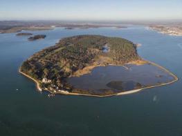
Wareham Forest
6 miles (9.6kms)
The expanse of Wareham Forest encompasses both wood and lowland heath. It was one of many forests planted by the newly formed Forestry Commission after World War I, which had exposed the country’s strategic lack of timber; vast quantities had been used in shoring trenches and as pit props in the coal mines.
Early planting relied on fast-cropping species and resulted in conifer blankets that were visually unappealing and provided almost no wildlife habitat. But after war again depleted the country’s timber reserve, the strategy began to change, introducing a variety of species, including broad-leaved trees, and developing an increasing awareness of environmental issues and the importance of habitat variety.
Wareham Forest today is both productive and sustains a huge diversity of wildlife. Among the tree species are several varieties of pine as well as larch and oak, with birch, hazel, holly and other trees established around the plantation fringes. The ongoing cycle of planting, thinning and felling creates a rotating pattern of open space that allows wildflowers and heath plants to develop, while the lowland wetland at its heart is one of the largest such areas in Britain.
The largest animals roaming the forest are deer, of which there are three species: sika, roe and fallow. Roe deer are native, while fallow deer were re-introduced by both the Romans and the Normans. Sika arrived from the Far East during the late 19th century, escapees from private parks and now so successful that numbers have to be controlled. There are plenty of foxes and badgers and occasional sightings of otter, but less obvious are dormice, which were originally thought to live only in ancient woodland.
The area is particularly important for reptiles and is one of the few places where you might see all six of Britain’s native reptiles: adder, grass snake, smooth snake, sand lizard, common lizard and slow worm. The smooth snake is secretive and although sometimes superficially resembling an adder, is not venomous, subduing its prey by constriction. Sand lizards are much larger than the common lizard and, like them, might be seen basking in the sun. The male is readily identifiable by having green flanks, which become prominent during the breeding season.
The woodland is rich in birdlife, including woodpeckers, treecreepers and crossbills as well as birds of prey such as red kites, buzzards and hen harriers. The heath is one of the strongholds of the Dartford warbler and on summer evenings you may hear a nightjar.
Among the plants to look out for around the marsh are bog asphodel, its yellow flowers once collected to make hair dye, and the sundew, a carnivorous plant that traps and absorbs nutrients from insects.
Look for a tall Sika ‘Red Trail’ marker near the far-right corner of the car park by picnic tables. Walk through the trees to a bridle gate and, following red markers, go right on a broad swathe. As it later curves left at the forest edge, ignore a path off right and carry on back into trees to a major crossroads. Go right and carry on to a junction in front of a boundary gate.
Swinging left, head down beside the boundary. At the bottom of the hill, the trail curves left at the edge of Morden Bog.
Reaching a junction of tracks by a dark pool, abandon the red markers and turn right. Entering the National Nature Reserve, cross a stream. As the trail curves left, ignore a track right. The way gently rises across Great Ovens Hill, from where there is an extensive view across the marsh and surrounding forest. Rounding a bend, watch for a track forking down left by a bench to continue around the convoluted perimeter of the bog. Carry on for 1.5 miles (2.4km), eventually passing a lookout tower perched at the edge of the forest plantation. Just beyond, the track turns in along a break between the trees to meet a crossing track, a short distance south of the Old Decoy Pond.
Turn right. Approaching a gate at the eastern edge of the plantation, swing left beside a wire fence. After 200yds (183m), the path curves gently left. Keep left at a fork and carry on above the northern edge of the Old Decoy Pond. Ignore a couple of tracks leaving on the right towards the higher ground, soon arriving at a crossing path at the edge of trees.
Go left and keep straight on at the next junction, later crossing a bridge and reaching a fork. Stick with the branch ahead and carry on for another half-mile (800m) to a junction beside a memorial stone at Parson’s Pleasure. Continue forward, shortly passing another junction to reach a red-topped waypost, 100yds (91m) further on, marking a narrow path off to the right.
Rising from the bog, the path undulates into the forest. Later reaching a fork, take the left branch and climb to a broad trail. Still following red-topped wayposts, go right and then immediately left, rising to a second trail. Follow that right, shortly arriving at a junction in front of a couple of gates. Pass through the smaller bridle gate on the left, from which a path winds through the trees back to the car park.
Clear woodland tracks and paths
Pine forest and wetland heath
Under close control because of deer and nesting birds
OS Explorer OL15 Purbeck & South Dorset
Sika Trail car park, beside minor road 1 mile (1.6km) northwest of Wareham
None on route
Read our tips to look after yourself and the environment when following this walk.
Dorset means rugged varied coastlines and high chalk downlands. Squeezed in among the cliffs and set amid some of Britain’s most beautiful scenery is a chain of picturesque villages and seaside towns. Along the coast you’ll find the Lulworth Ranges, which run from Kimmeridge Bay in the east to Lulworth Cove in the west. Together with a stretch of East Devon, this is Britain’s Jurassic Coast, a UNESCO World Heritage Site and Area of Outstanding Natural Beauty, noted for its layers of shale and numerous fossils embedded in the rock. Among the best-known natural landmarks on this stretch of the Dorset coast is Durdle Door, a rocky arch that has been shaped and sculpted to perfection by the elements. The whole area has the unmistakable stamp of prehistory.
Away from Dorset’s magical coastline lies a landscape with a very different character and atmosphere, but one that is no less appealing. Here, winding, hedge-lined country lanes lead beneath lush, green hilltops to snug, sleepy villages hidden from view and the wider world. The people of Dorset are justifiably proud of the achievements of Thomas Hardy, its most famous son, and much of the county is immortalised in his writing.
Discover more than 15,000 professionally rated places to stay, eat and visit from across the UK and Ireland.
Choose a place to stay safe in the knowledge that it has been expertly assessed by trained assessors.
Search by location or the type of place you're visiting to find your next ideal holiday experience.
Read our articles, city guides and recommended things to do for inspiration. We're here to help you explore the UK.