"The internationally important birdlife of Devon’s most hidden corner"
Walk directions
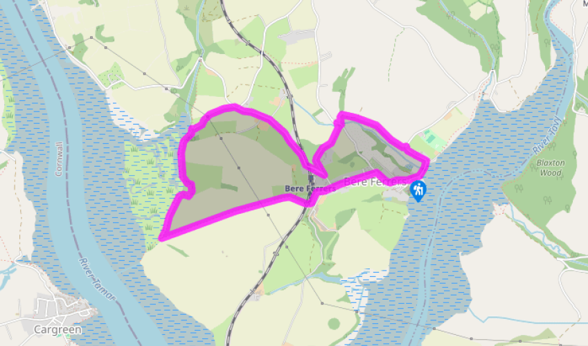
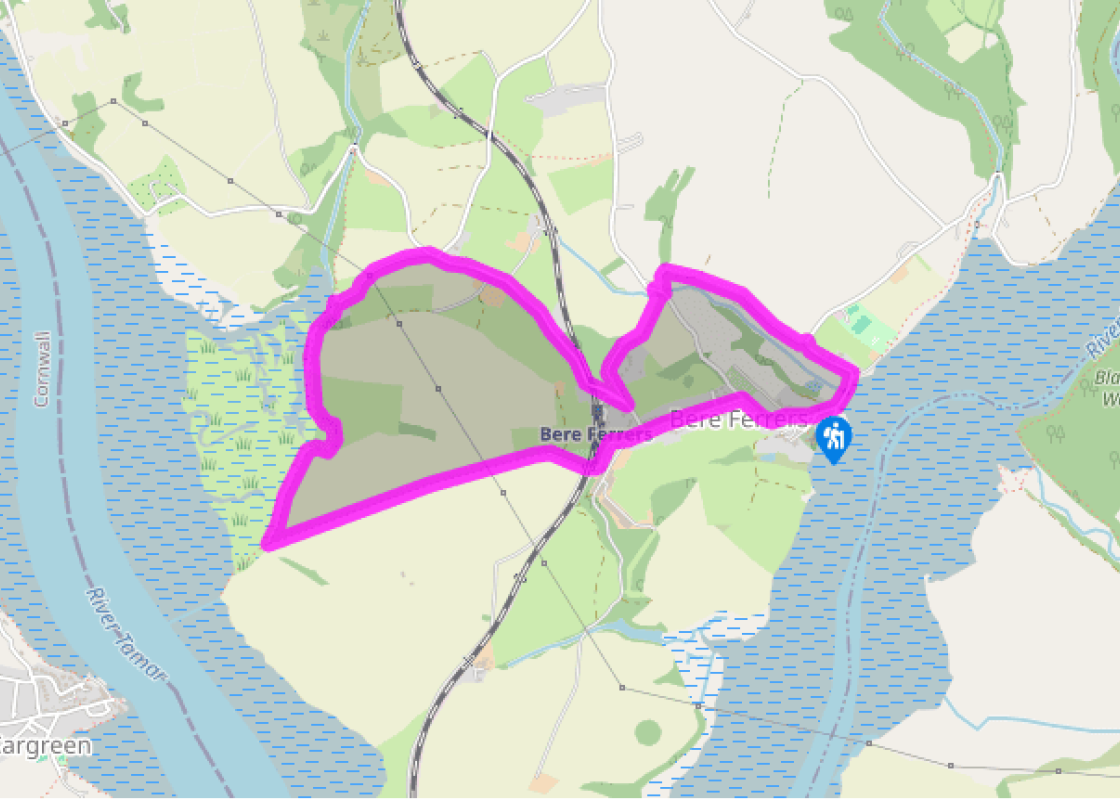
From the war memorial and well (dated 1852), walk uphill away from the river. By the Social Club turn left into Station Road, passing the church hall.
Where the lane bears right, keep ahead up a lane, still on Station Road and pass under the railway line. Keep ahead up a track, bearing left over a stile by a gate, and cross the field. Pass through a small gate in a larger one and continue, with a fence to your left, eventually descending with glorious views over the River Tamar into Cornwall. Look left to see the Tamar and Royal Albert bridges in Plymouth.
Turn right along the bottom of the field, with beautiful oaks to the left and reed beds beyond. Bear right at the end, then left over a V-stile, through a gate and along boardwalks as the path returns to the river. Pass through a gate (access to water, left) and follow the fenced path to a gate. Go through and cross damp ground to reach the slipway at Liphill Quay, a one-time smuggling spot.
Turn right, soon ascending a track which rises steeply to meet a lane. Look back for views over the saltmarsh, an important wildlife habitat.
Turn right to pass Ormonde House; continue downhill to cross the railway near the station.
Just past the station turn left down a drive (footpath sign), soon passing through the left of two gateways (Coach House) into the grounds of the Old Rectory. Follow the drive to the house, then pass to the left of the building (across the garden) and through a gate in the hedge. Now follow a fenced path down across the field, and cross a stile onto a lane. Turn right for a few paces.
Turn left over a ladder stile. Head across boggy ground and ascend rough grassland to a footpath post. Turn right here over a stile on a narrow path. Cross a stile and keep along the right edge of the field. Bear right at the end through a field gate and head downhill, passing the entrance to Shutecombe, to meet a lane on a bend.
Turn right. The lane meets the Tavy foreshore and bears right past the harbour. Follow Fore Street uphill past The Olde Plough Inn to the start point.
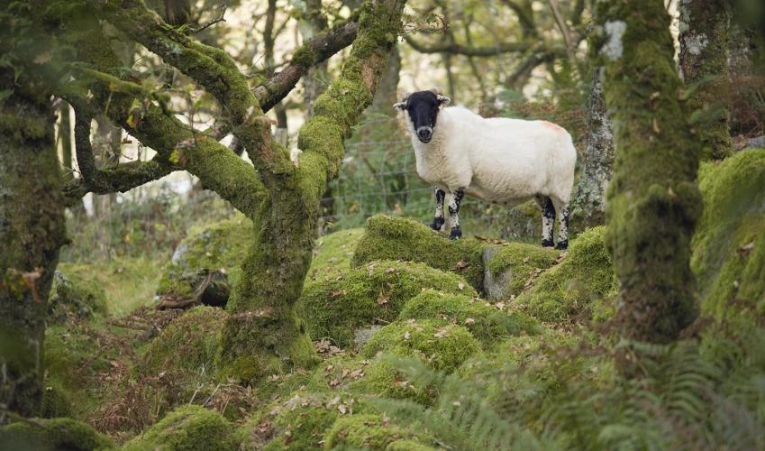
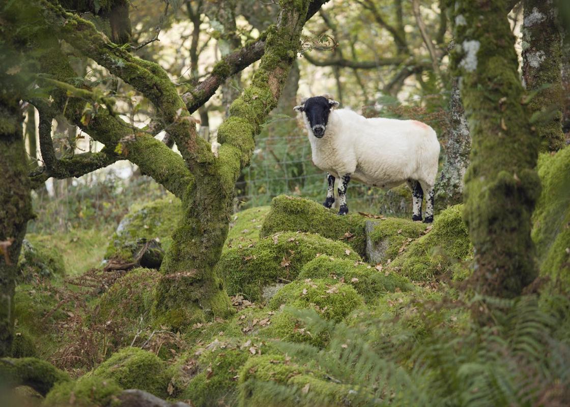
Two of South Devon’s greatest rivers, the Tavy and the Tamar, meet just south of the pretty little peninsula village of Bere Ferrers. This is one of the most picturesque locations in the county, bordered on two sides by the waters of the Tamar estuaries. With just 1.5 miles (2.4km) of land... separating the peninsula from the rest of Devon you do feel that you are surrounded by water. The Tamar here forms the Devon–Cornwall boundary. These rivers have witnessed a huge amount of activity over the generations. Remnants of fords, quays and crossing places can be seen on both the Tamar and Tavy, dating from a time when most movement of people and goods was by water rather than overland. The area’s prosperity came from the many silver and lead mines in the area, which were active from the 13th to 16th centuries, and again in the 19th century. Silver and lead were exported downriver to Plymouth; coal from South Wales and lime came back up again. In the early 19th century more than 1,000 people were employed in local mines, the main ones being South Hooe Mine and South Tamar Consols. Weir Quay, on the west side of the peninsula, was the main quay for the import and export of goods. There are remains of kilns on both rivers, where lime was burned to produce fertiliser. Another important local product was fruit – the valleys enjoy a particularly balmy climate. There are records of black cherries, pears, strawberries and walnuts being produced and exported in the late 18th century. The coming of the railway greatly assisted the fruit and flower growers, as their produce could reach markets more quickly.
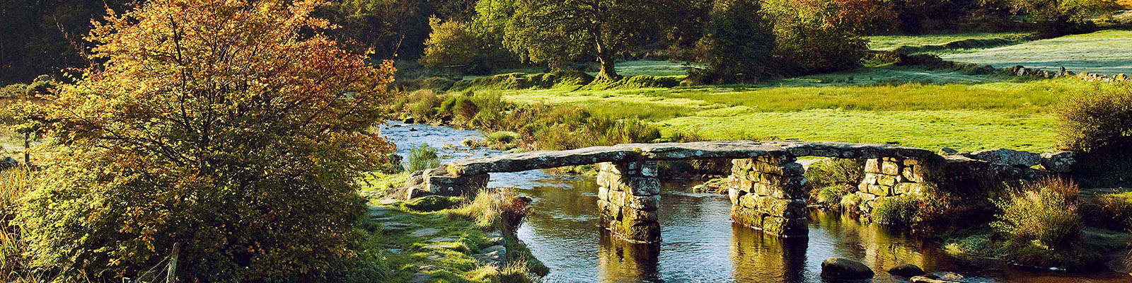
Devon sums up all that is best about the British landscape, with its magnificent coastlines, two historic cities, the world-famous Dartmoor National Park and south Devon’s glorious English Riviera. A fashionable and much-loved holiday destination, hiking and cycling in the National Parks is extremely popular among visitors, with a great choice of off-road routes.
"The internationally important birdlife of Devon’s most hidden corner"
Walk details
2hrs
Difficulty:
Medium
Gradient:
Moderate
Distance:
3.5 miles (5.7kms)
Ascent:
180ft (55m)
Walk directions
From the war memorial and well (dated 1852), walk uphill away from the river. By the Social Club turn left into Station Road, passing the church hall.
1 of 8
Where the lane bears right, keep ahead up a lane, still on Station Road and pass under the railway line. Keep ahead up a track, bearing left over a stile by a gate, and cross the field. Pass through a small gate in a larger one and continue, with a fence to your left, eventually descending with glorious views over the River Tamar into Cornwall. Look left to see the Tamar and Royal Albert bridges in Plymouth.
2 of 8
Turn right along the bottom of the field, with beautiful oaks to the left and reed beds beyond. Bear right at the end, then left over a V-stile, through a gate and along boardwalks as the path returns to the river. Pass through a gate (access to water, left) and follow the fenced path to a gate. Go through and cross damp ground to reach the slipway at Liphill Quay, a one-time smuggling spot.
3 of 8
Turn right, soon ascending a track which rises steeply to meet a lane. Look back for views over the saltmarsh, an important wildlife habitat.
4 of 8
Turn right to pass Ormonde House; continue downhill to cross the railway near the station.
5 of 8
Just past the station turn left down a drive (footpath sign), soon passing through the left of two gateways (Coach House) into the grounds of the Old Rectory. Follow the drive to the house, then pass to the left of the building (across the garden) and through a gate in the hedge. Now follow a fenced path down across the field, and cross a stile onto a lane. Turn right for a few paces.
6 of 8
Turn left over a ladder stile. Head across boggy ground and ascend rough grassland to a footpath post. Turn right here over a stile on a narrow path. Cross a stile and keep along the right edge of the field. Bear right at the end through a field gate and head downhill, passing the entrance to Shutecombe, to meet a lane on a bend.
7 of 8
Turn right. The lane meets the Tavy foreshore and bears right past the harbour. Follow Fore Street uphill past The Olde Plough Inn to the start point.
Two of South Devon’s greatest rivers, the Tavy and the Tamar, meet just south of the pretty little peninsula village of Bere Ferrers. This is one of the most picturesque locations in the county, bordered on two sides by the waters of the Tamar estuaries. With just 1.5 miles (2.4km) of land... separating the peninsula from the rest of Devon you do feel that you are surrounded by water. The Tamar here forms the Devon–Cornwall boundary. These rivers have witnessed a huge amount of activity over the generations. Remnants of fords, quays and crossing places can be seen on both the Tamar and Tavy, dating from a time when most movement of people and goods was by water rather than overland. The area’s prosperity came from the many silver and lead mines in the area, which were active from the 13th to 16th centuries, and again in the 19th century. Silver and lead were exported downriver to Plymouth; coal from South Wales and lime came back up again. In the early 19th century more than 1,000 people were employed in local mines, the main ones being South Hooe Mine and South Tamar Consols. Weir Quay, on the west side of the peninsula, was the main quay for the import and export of goods. There are remains of kilns on both rivers, where lime was burned to produce fertiliser. Another important local product was fruit – the valleys enjoy a particularly balmy climate. There are records of black cherries, pears, strawberries and walnuts being produced and exported in the late 18th century. The coming of the railway greatly assisted the fruit and flower growers, as their produce could reach markets more quickly.
Devon sums up all that is best about the British landscape, with its magnificent coastlines, two historic cities, the world-famous Dartmoor National Park and south Devon’s glorious English Riviera. A fashionable and much-loved holiday destination, hiking and cycling in the National Parks is extremely popular among visitors, with a great choice of off-road routes.