Additional information
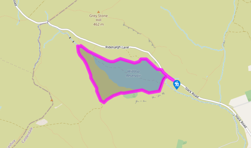
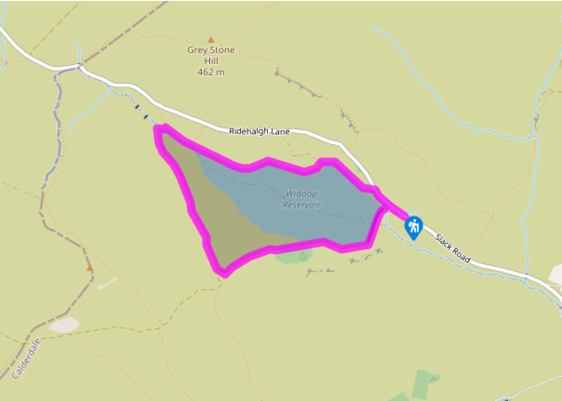
Terrain
- Good tracks and paths, some potentially boggy moorland
Landscape
- Reservoir set in crag-surrounded moorland bowl
Dog friendliness
- Sheep graze the moors around Widdop so dogs should be on leads
Parking
- Widdop Reservoir car park, Widdop
Toilets en route
- None on route
About the walk
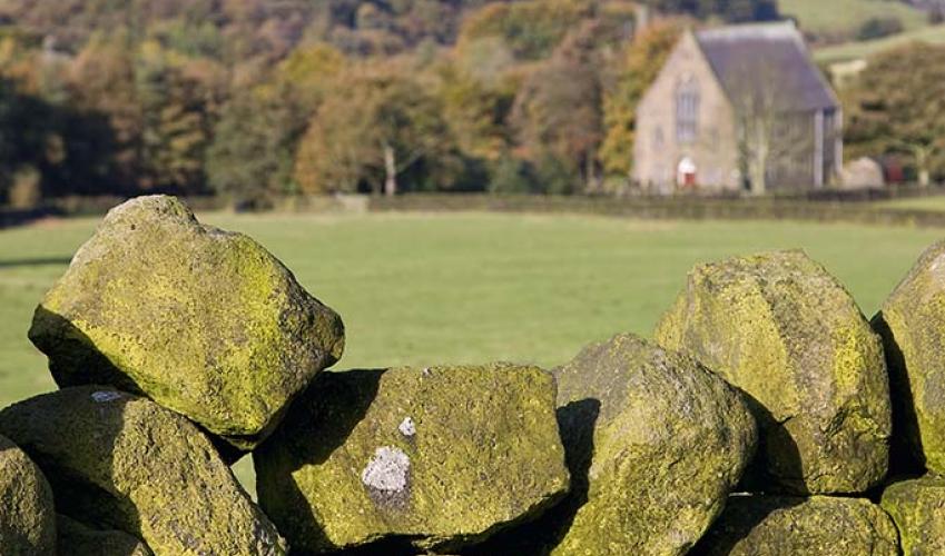
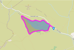
Of all the moorland reservoirs that stud West Yorkshire’s peaty uplands, Widdop is the shining jewel, a glittering pool set in a wide, crag-rimmed hollow surrounded by mile-after-mile of rolling peaty moorland. Poet Laureate Ted Hughes, who was born just a few miles away in Mytholmroyd in 1930,... described it as a ‘frightened lake’ in Remains of Elmet, the famous volume of poems about his vanishing South Pennine boyhood. Widdop was, between 1871 and 1878, the first of the reservoirs to be built on the moors above Heptonstall to supply drinking water for the people of Halifax. With a capacity of 633 million gallons (2,880 million litres) it’s also the largest. During construction a small, temporary village of wooden huts, with its own bake house and store, was built at Widdop. At its peak, around 200 men lived there. Materials for the dam that couldn’t be found on site were brought along a horse-drawn tramway that ran from Shackleton, above the National Trust’s main car park at Hardcastle Crags, along the edge of the Hebden valley to Holme End, Clough Foot and then Widdop. Materials were pulled up the hillside to Shackleton by a stationary engine on an inclined tramway, the huge ramp for which can be seen in the lower reaches of Crimsworth Dean. The tramline can still be traced on foot from Shackleton. The valve house at the far end of Widdop’s dam wall looks slightly incongruous – an Egyptian-looking building made from Pennine gritstone. John Frederick Bateman, the engineer employed by Halifax Corporation to oversee the reservoir’s construction, had attended the opening of the Suez Canal in 1869. He was so impressed by the architecture he saw there, that he incorporated elements of it in the design of the reservoir’s valve house. Bateman, regarded as one of the greatest dam builder of his generation, was responsible for overseeing the water supplies for Manchester, Glasgow, Dublin and many other cities and his work formed the basis of the water supply network still used today. The impressive gritstone crags that frame the southern edge of the reservoir are The Cludders, more commonly known as Widdop Rocks. They’re very popular with climbers; renowned climber Don Whillans did the first ascent of a route known as Ceiling Crack here in 1955. Other rocks nearby have equally evocative names Clattering Stones, Boggart Stones, Slack Stones, Raven Stones and Frock Holes. The boulders scattered beneath Cludders have also attracted celebrity. John Wesley, the Methodist preacher, is said to have delivered a sermon to Widdop’s isolated population from one of them in 1766 – one is inscribed with his initials and the date.
Read more