"Natural and artificial landscapes merge on this route through wooded valley, heathy hill and across the mighty Wimbleball Dam."
Walk directions
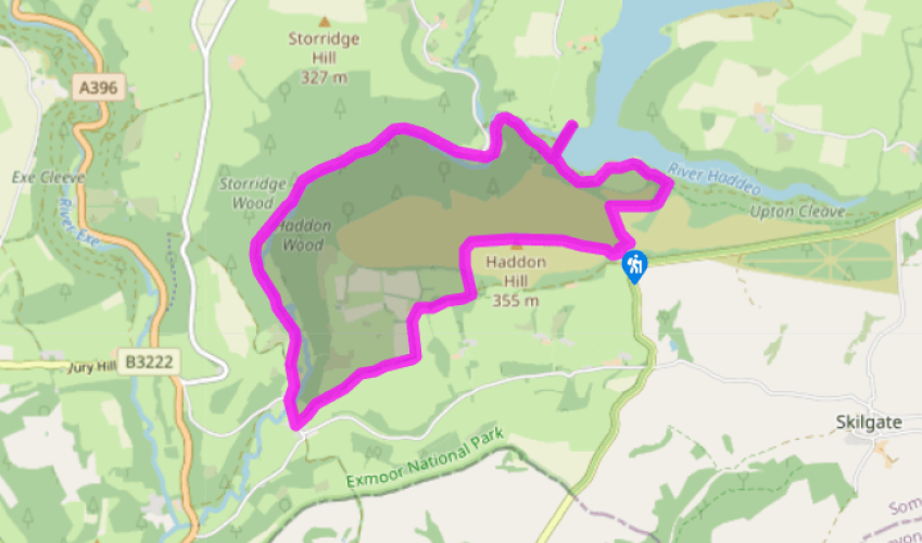
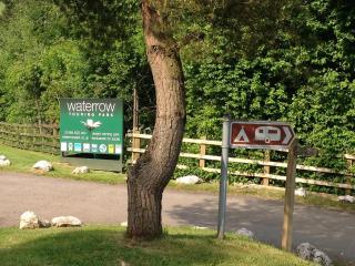
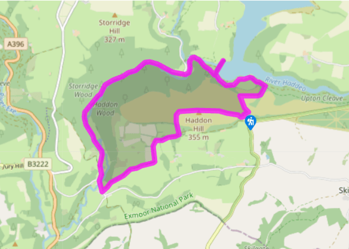
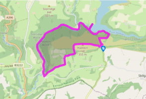
Leave the car park by a kissing gate, which overlooks the reservoir. The earth path down ahead crosses another earth track, and runs down towards the reservoir to meet a concrete track. (Left down this track leads to the dam, seen later.) Cross and turn right, looking out for a rough track contouring to the right. After 350yds (320m) this enters scattered birches. Turn down left, on a smaller path, to meet a stony track just above the reservoir.
Turn left on this. It emerges into open grassland and starts rising to the left. Watch out for a stile down on the right, into woodland. Across this, turn left on a small path that emerges near the Wimbleball Dam. A side-trip on to the dam gives fine views of Hartford Bottom below.
Return along the dam and turn right into a descending tarmac lane signed 'Bury 2.5'. At the bottom keep ahead on a concrete path signed 'Bridleway'. With a bridge ahead, bear left on to a grass track, this time signposted 'Bridleway to Bury'. It leads to a ford, so watch out for the footbridge on the right. Once across, take a track between houses, to turn left out into Hartford.
Turn left ('Bury 2') on a well-used track past the Exmoor Fisheries trout farm. Through the gate, it passes through woods of oak and beech beside the River Haddeo. The track becomes tarmac as it enters the charming little village of Bury.
Turn left to the packhorse bridge beside the road's ford. Ignore a riverside track on the left and continue for 180yds (165m) to turn left at a bridleway sign, 'Haddon Hill'. Here pass between houses and ahead into a sunken track. This climbs steeply, with a stream at the bottom that flows over orange bedrock. At the top it continues as a green (or brown) track between grownout hedges, before turning left for another short climb to reach Haddon Farm.
Pass to the left of the farmhouse, on its access track. After 0.25 miles (400m) this reaches the corner of a wood. As the track is concreted on a steep section, look out for a stile above leading into the wood. Go up the left-hand side of the wood to reach a gate on to the open hill at its top corner.
Take a track that bears left to cross the crest of the hill. With views ahead to Brompton Regis, turn sharp right, on a wide track that runs to the top of Haddon Hill. Continue downhill, on a wide track through open moor of gorse and heather, to the car park.
You'll probably find it hard to imagine an outward force of 3.3 tons per square foot (36 tonnes per square metre) but that is the force exerted by the waters of Wimbleball Lake against the wall which contains them. Wimbleball Dam Some 200,000 tons of crushed stone from a quarry at Bampton was... used to construct the dam in the mid-1970s. Sand from Cullompton was chosen to impart a pinkish colour and match the local bedrock. It's made of concrete, though the surface texture vaguely imitates massive stonework; and the 13 buttresses have no particular structural purpose but, aesthetically, they prevent it from looking too huge. The dam took four years to build, and the reservoir behind it needed another year just to fill up. Water cycled and recycled The reservoir holds almost 5 billion gallons (23 billion litres), which is enough to supply the whole South West peninsula for 44 days, or a town like Bridgwater for nine and a half years. Its main job is to store water from the winter through into summer. It is also used to maintain the water level in the River Exe. When the river is full, a pipeline pumps water from Exebridge near Dulverton up into the reservoir. For the rest of the time the same pipeline, working the other way, delivers water to Dulverton. And, when it's really dry, the reservoir releases water into the Haddeo below the dam and so back into the Exe. Some of this will be water that had already flowed down the Exe during the previous winter. A multipurpose reservoir Some 50 years ago water boards took the view that humans were dirty beasts who shouldn't be allowed anywhere near their own drinking water. However, Wimbleball was planned from the start to provide not only drinking water but also recreation: fishing water, sailing water and walkaround- it water. (If you've half a day to spare, you can do a complete circuit on a waymarked path.) The woodland that looks so natural was planned by landscape architect Dame Sylvia Crowe and planted just 30 years ago, with the trees around the car park being the first to go in. Sadly, nothing can be done about the ugly and barren foreshore, since no plant can establish itself on ground that is submerged for months at a time. But, thanks to careful management, the weird, rattling cry of the nightjar now floats across the crystal clear and still drinking water. To finish with, here are some more numbers to ponder as you are walking: 1.5 million people live downstream from Wimbleball Lake and drink its water, but every year 2 million sail on it, fish from it, or just walk down to its shores to have a look.
Somerset remains rural and unspoiled, and ever popular areas to visit are the limestone and red sandstone Mendip Hills rising to over 1,000 feet, and by complete contrast, to the south and southwest, the flat landscape of the Somerset Levels. Another popular spot, the Quantocks, once the haunt of poets Coleridge and Wordsworth, are noted for their gentle slopes, heather-covered moorland expanses and red deer.
"Natural and artificial landscapes merge on this route through wooded valley, heathy hill and across the mighty Wimbleball Dam."
Walk details
3hrs
Difficulty:
Hard
Gradient:
Challenging
Distance:
6 miles (9.7kms)
Ascent:
750ft (229m)
Walk directions
Leave the car park by a kissing gate, which overlooks the reservoir. The earth path down ahead crosses another earth track, and runs down towards the reservoir to meet a concrete track. (Left down this track leads to the dam, seen later.) Cross and turn right, looking out for a rough track contouring to the right. After 350yds (320m) this enters scattered birches. Turn down left, on a smaller path, to meet a stony track just above the reservoir.
1 of 7
Turn left on this. It emerges into open grassland and starts rising to the left. Watch out for a stile down on the right, into woodland. Across this, turn left on a small path that emerges near the Wimbleball Dam. A side-trip on to the dam gives fine views of Hartford Bottom below.
2 of 7
Return along the dam and turn right into a descending tarmac lane signed 'Bury 2.5'. At the bottom keep ahead on a concrete path signed 'Bridleway'. With a bridge ahead, bear left on to a grass track, this time signposted 'Bridleway to Bury'. It leads to a ford, so watch out for the footbridge on the right. Once across, take a track between houses, to turn left out into Hartford.
3 of 7
Turn left ('Bury 2') on a well-used track past the Exmoor Fisheries trout farm. Through the gate, it passes through woods of oak and beech beside the River Haddeo. The track becomes tarmac as it enters the charming little village of Bury.
4 of 7
Turn left to the packhorse bridge beside the road's ford. Ignore a riverside track on the left and continue for 180yds (165m) to turn left at a bridleway sign, 'Haddon Hill'. Here pass between houses and ahead into a sunken track. This climbs steeply, with a stream at the bottom that flows over orange bedrock. At the top it continues as a green (or brown) track between grownout hedges, before turning left for another short climb to reach Haddon Farm.
5 of 7
Pass to the left of the farmhouse, on its access track. After 0.25 miles (400m) this reaches the corner of a wood. As the track is concreted on a steep section, look out for a stile above leading into the wood. Go up the left-hand side of the wood to reach a gate on to the open hill at its top corner.
6 of 7
Take a track that bears left to cross the crest of the hill. With views ahead to Brompton Regis, turn sharp right, on a wide track that runs to the top of Haddon Hill. Continue downhill, on a wide track through open moor of gorse and heather, to the car park.
You'll probably find it hard to imagine an outward force of 3.3 tons per square foot (36 tonnes per square metre) but that is the force exerted by the waters of Wimbleball Lake against the wall which contains them. Wimbleball Dam Some 200,000 tons of crushed stone from a quarry at Bampton was... used to construct the dam in the mid-1970s. Sand from Cullompton was chosen to impart a pinkish colour and match the local bedrock. It's made of concrete, though the surface texture vaguely imitates massive stonework; and the 13 buttresses have no particular structural purpose but, aesthetically, they prevent it from looking too huge. The dam took four years to build, and the reservoir behind it needed another year just to fill up. Water cycled and recycled The reservoir holds almost 5 billion gallons (23 billion litres), which is enough to supply the whole South West peninsula for 44 days, or a town like Bridgwater for nine and a half years. Its main job is to store water from the winter through into summer. It is also used to maintain the water level in the River Exe. When the river is full, a pipeline pumps water from Exebridge near Dulverton up into the reservoir. For the rest of the time the same pipeline, working the other way, delivers water to Dulverton. And, when it's really dry, the reservoir releases water into the Haddeo below the dam and so back into the Exe. Some of this will be water that had already flowed down the Exe during the previous winter. A multipurpose reservoir Some 50 years ago water boards took the view that humans were dirty beasts who shouldn't be allowed anywhere near their own drinking water. However, Wimbleball was planned from the start to provide not only drinking water but also recreation: fishing water, sailing water and walkaround- it water. (If you've half a day to spare, you can do a complete circuit on a waymarked path.) The woodland that looks so natural was planned by landscape architect Dame Sylvia Crowe and planted just 30 years ago, with the trees around the car park being the first to go in. Sadly, nothing can be done about the ugly and barren foreshore, since no plant can establish itself on ground that is submerged for months at a time. But, thanks to careful management, the weird, rattling cry of the nightjar now floats across the crystal clear and still drinking water. To finish with, here are some more numbers to ponder as you are walking: 1.5 million people live downstream from Wimbleball Lake and drink its water, but every year 2 million sail on it, fish from it, or just walk down to its shores to have a look.
Somerset remains rural and unspoiled, and ever popular areas to visit are the limestone and red sandstone Mendip Hills rising to over 1,000 feet, and by complete contrast, to the south and southwest, the flat landscape of the Somerset Levels. Another popular spot, the Quantocks, once the haunt of poets Coleridge and Wordsworth, are noted for their gentle slopes, heather-covered moorland expanses and red deer.