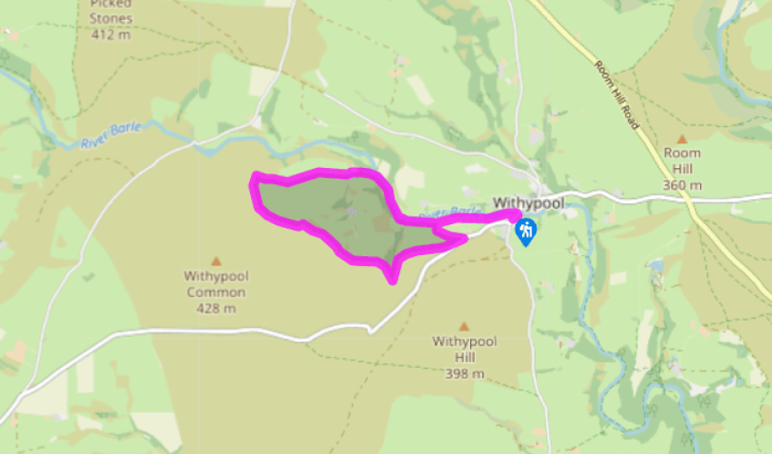
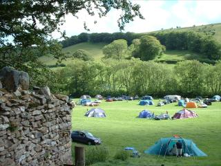
"A short walk up the wooded riverside and on to grassy moorland."
Walk directions
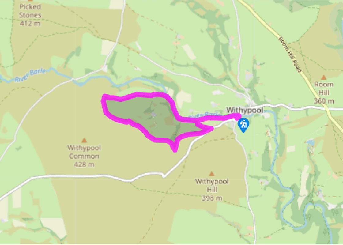
A small gate leads out of the car park to the River Barle. Turn left, following the river bank upstream. The waymarked path goes through a gate and over a footbridge, then passes through a gate into a short, hedged way. After a stile it follows the edge of two boggy fields, below the big shed of Waterhouse Farm, to a stile. Now bear slightly left to a stile with a hedged track (signed Withypool Hill) going uphill beyond.
This track is the return route. At the track foot turn right to a stile. Cross a field next to a railed fence on the right, with the river beyond. At the corner, cross a stone footbridge to a wooden one, and continue on the riverbank. Ignore two kissing gates on the left, but cross a stile ahead into an open field. At the end of this field turn uphill at a signpost on a faint path with a hedge on the right, to a corner gasp. Here another sign points towards Brightworthy Farm.
Pass through the gates immediately to the right of the buildings, into a fenced-off path round a field-edge. A bridge on the left leads to steps down on to an earth track. Turn right, and, as the track fades out, pass a concrete shed to follow the bottom edges of two fields. The moorland is one field above, and the river now about two fields below. Through a field gate in the corner, the trench of a track-way descends gently to a gate leading to the open moor.
From here you could extend your walk to the medieval Landacre Bridge, soon visible 0.5 miles (800m) ahead – a suitable place for a picnic. Otherwise turn left, following the sign for Withypool Common. A faint, rutted path runs along the moorside edge of the hedge that forms the boundary of the enclosed ground. After an initial climb, it bends left and levels off. The path gets clearer, and follows the hedge bank just below. It crosses a tarred driveway running down into fields. Soon after you encounter the steep-sided stream valley of Knighton Combe.
The path slants down to the right and crosses the stream at a shallow ford. Head downstream for about 100yds (91m) between rowans, then slant up the combe side to re-join the combe-top hedge. The path is now clear, running towards the road that runs down into Withypool.
About 220yds (201m) before the road turn down left to a stile with a yellow paint spot in a corner of the hedge. A lane, signed Withypool Hill, runs downhill to a gate. Cross this and the stile ahead to rejoin the outward route. Turn right and continue downstream to Withypool Bridge.
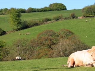
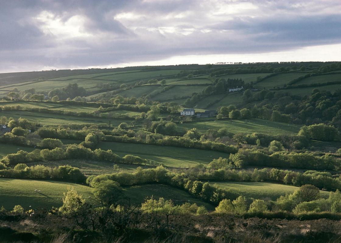
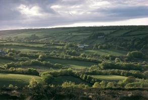
The upper Barle Valley is the heart of Exmoor: not dramatic combes and sudden seaside, but a gentle and rather melancholy landscape. Withypool, with its wooded brook, lies below the long grass slopes and the bare moorland plateau; this walk follows the Barle and then gradually works its way up... through the fields above, turning back at the edge of the moorland to return along the outside of the top of the enclosed lands. Below the open moor Exmoor hedges, separating the cultivated farmland and grazing from the open moor and one field from another, are both ancient and intricate, the product of generations of maintenance. The traditional Exmoor hedge grows on an earthy or stone bank, and can act as a border as well as stock-proofing – look out for solitary trees on a hedge-line; these often mark historic boundaries between different farms. Hedges are kept dense by traditional management in the form of regular laying and bank repair, and for farmers living inside the National Park this is a mandatory duty that’s overseen by the Park Authority. Laying and coppicing are normally done during the winter, when the sap is not rising; banking takes place whenever busy farmers can schedule it. Good husbandry like this means Exmoor will keep its historic hedges, iconic landscape features that provide shelter for crops and livestock and support wildlife of every type. Moor natives The bare moor and plateau is characterised by a quiet that may be broken by the occasional whinny of a pony. Ponies have been on Exmoor for longer than people; they are the closest there is to the original wild horse of Europe. A hundred years ago they came close to extinction. We have Sir Thomas Dyke Acland, the landowner who left Winsford Hill to the National Trust, to thank for their continued existence. Today there are only about 1,000 of these ponies in the world. The 150 ponies on Exmoor are in 11 herds, two of them in the care of the National Park Authority. You are most likely to see ponies at quiet times of day. They live wild on the moors year-round. Evolution has given them a thick weatherproof coat, long mane, tough hooves, and a raised ridge around the eye (the so-called ‘toad’ eye) to cast off rain, as well as enough speed and endurance to escape from the sabre-toothed tiger that once hunted them. But every Exmoor pony belongs to someone and every autumn they are gathered, inspected for disease, micro-chipped and branded.
Somerset remains rural and unspoiled, and ever popular areas to visit are the limestone and red sandstone Mendip Hills rising to over 1,000 feet, and by complete contrast, to the south and southwest, the flat landscape of the Somerset Levels. Another popular spot, the Quantocks, once the haunt of poets Coleridge and Wordsworth, are noted for their gentle slopes, heather-covered moorland expanses and red deer.
"A short walk up the wooded riverside and on to grassy moorland."
Walk details
1hr 45min
Difficulty:
Medium
Gradient:
Gentle
Distance:
3.5 miles (5.7kms)
Ascent:
350ft (107m)
Walk directions
A small gate leads out of the car park to the River Barle. Turn left, following the river bank upstream. The waymarked path goes through a gate and over a footbridge, then passes through a gate into a short, hedged way. After a stile it follows the edge of two boggy fields, below the big shed of Waterhouse Farm, to a stile. Now bear slightly left to a stile with a hedged track (signed Withypool Hill) going uphill beyond.
1 of 6
This track is the return route. At the track foot turn right to a stile. Cross a field next to a railed fence on the right, with the river beyond. At the corner, cross a stone footbridge to a wooden one, and continue on the riverbank. Ignore two kissing gates on the left, but cross a stile ahead into an open field. At the end of this field turn uphill at a signpost on a faint path with a hedge on the right, to a corner gasp. Here another sign points towards Brightworthy Farm.
2 of 6
Pass through the gates immediately to the right of the buildings, into a fenced-off path round a field-edge. A bridge on the left leads to steps down on to an earth track. Turn right, and, as the track fades out, pass a concrete shed to follow the bottom edges of two fields. The moorland is one field above, and the river now about two fields below. Through a field gate in the corner, the trench of a track-way descends gently to a gate leading to the open moor.
3 of 6
From here you could extend your walk to the medieval Landacre Bridge, soon visible 0.5 miles (800m) ahead – a suitable place for a picnic. Otherwise turn left, following the sign for Withypool Common. A faint, rutted path runs along the moorside edge of the hedge that forms the boundary of the enclosed ground. After an initial climb, it bends left and levels off. The path gets clearer, and follows the hedge bank just below. It crosses a tarred driveway running down into fields. Soon after you encounter the steep-sided stream valley of Knighton Combe.
4 of 6
The path slants down to the right and crosses the stream at a shallow ford. Head downstream for about 100yds (91m) between rowans, then slant up the combe side to re-join the combe-top hedge. The path is now clear, running towards the road that runs down into Withypool.
5 of 6
About 220yds (201m) before the road turn down left to a stile with a yellow paint spot in a corner of the hedge. A lane, signed Withypool Hill, runs downhill to a gate. Cross this and the stile ahead to rejoin the outward route. Turn right and continue downstream to Withypool Bridge.
The upper Barle Valley is the heart of Exmoor: not dramatic combes and sudden seaside, but a gentle and rather melancholy landscape. Withypool, with its wooded brook, lies below the long grass slopes and the bare moorland plateau; this walk follows the Barle and then gradually works its way up... through the fields above, turning back at the edge of the moorland to return along the outside of the top of the enclosed lands. Below the open moor Exmoor hedges, separating the cultivated farmland and grazing from the open moor and one field from another, are both ancient and intricate, the product of generations of maintenance. The traditional Exmoor hedge grows on an earthy or stone bank, and can act as a border as well as stock-proofing – look out for solitary trees on a hedge-line; these often mark historic boundaries between different farms. Hedges are kept dense by traditional management in the form of regular laying and bank repair, and for farmers living inside the National Park this is a mandatory duty that’s overseen by the Park Authority. Laying and coppicing are normally done during the winter, when the sap is not rising; banking takes place whenever busy farmers can schedule it. Good husbandry like this means Exmoor will keep its historic hedges, iconic landscape features that provide shelter for crops and livestock and support wildlife of every type. Moor natives The bare moor and plateau is characterised by a quiet that may be broken by the occasional whinny of a pony. Ponies have been on Exmoor for longer than people; they are the closest there is to the original wild horse of Europe. A hundred years ago they came close to extinction. We have Sir Thomas Dyke Acland, the landowner who left Winsford Hill to the National Trust, to thank for their continued existence. Today there are only about 1,000 of these ponies in the world. The 150 ponies on Exmoor are in 11 herds, two of them in the care of the National Park Authority. You are most likely to see ponies at quiet times of day. They live wild on the moors year-round. Evolution has given them a thick weatherproof coat, long mane, tough hooves, and a raised ridge around the eye (the so-called ‘toad’ eye) to cast off rain, as well as enough speed and endurance to escape from the sabre-toothed tiger that once hunted them. But every Exmoor pony belongs to someone and every autumn they are gathered, inspected for disease, micro-chipped and branded.
Somerset remains rural and unspoiled, and ever popular areas to visit are the limestone and red sandstone Mendip Hills rising to over 1,000 feet, and by complete contrast, to the south and southwest, the flat landscape of the Somerset Levels. Another popular spot, the Quantocks, once the haunt of poets Coleridge and Wordsworth, are noted for their gentle slopes, heather-covered moorland expanses and red deer.