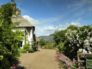
"A pretty village and a wooded riverside on the edge of the Brendons."
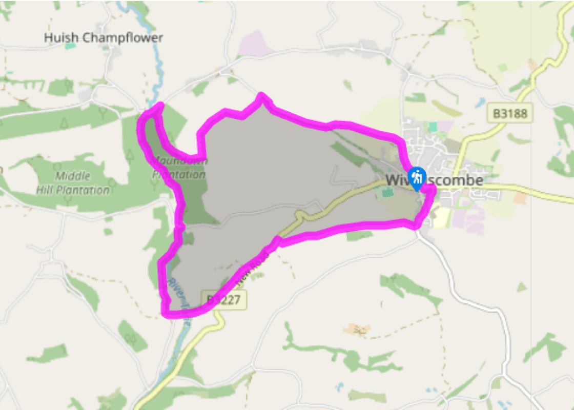
Walk directions
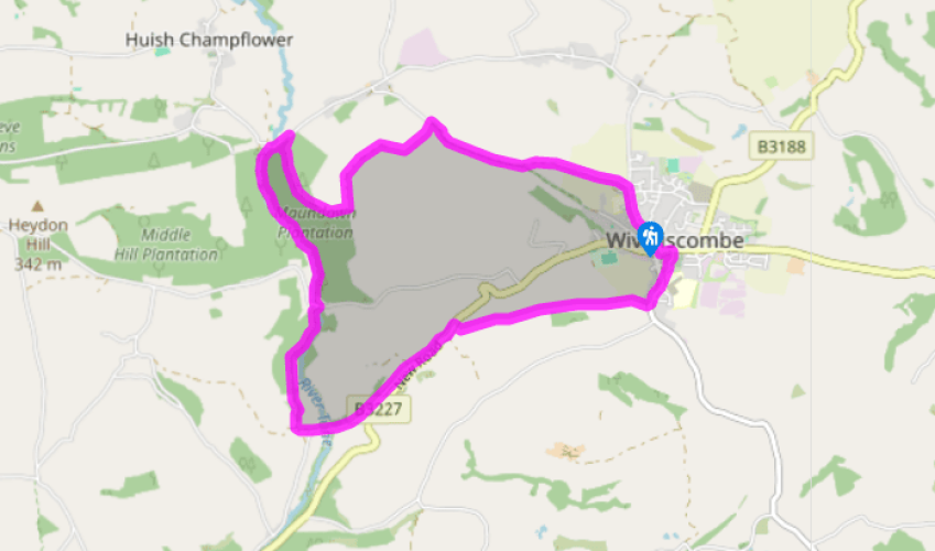
Turn left out of the car park into the Square, head down High Street and turn left at the traffic lights into Church Street. Turn right, down steps under a narrow arch, to reach Rotton Row. Continue down to South Street and turn left along the pavement past a school.
At the end of the village (house No 2) turn right, along a lane, then left at The Linny. Follow this track up, with farm buildings above, to continue along the bottom edges of three fields. the bottom edges of three fields. Now the stile in the hedge ahead has grown over, so head up to the left for 30yds (27m) to a gateway before returning to the field foot to pass through a group of farm buildings. Continue in the same direction up the left-hand edge of the field above to reach a gate leading on to the B3227.
Turn left, then right into a lane heading downhill. After about 0.75 miles (1.2km) it crosses the River Tone and bends left at Marshes Farm. Keep ahead, on a track marked by a bridleway sign. Do not turn right here on the track towards Wadham's Farm but keep uphill to join an upper farm track. Turn right to the top of a deeply sunken lane. Turn right in this, descending towards the farm, but at its first buildings turn left. This track runs above the River Tone. With houses visible ahead, turn right to cross a footbridge and turn left to Challick Lane.
The track continues upstream beside the River Tone through very pleasant woodland to reach Washbattle Bridge.
Turn right, up the road, for 200yds (183m). A forest track, with a footpath signpost, leads uphill on the right. Beside a pheasant rearing pen, bear left on to a wide path that continues uphill. At the wood edge, exit through a field gate and then turn right, to cross the bottom corner of a field to more woodland opposite. Turn uphill alongside this to reach a gate beside a large concrete water tank.
Go through this gate and turn left, with a hedge beside you on the left. The next gate opens on to a hedged track. This turns right, and passes a reservoir at the summit of Maundown Hill. At the top of a tarred public road turn sharply right on to a track that becomes a descending, hedged path. At a signposted fork turn left on to a contouring path. Soon a tarred lane leads down into the town; turn right to find the car park car park near by on the right.
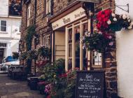
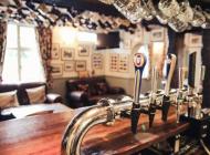
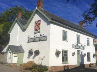
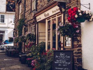
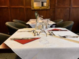
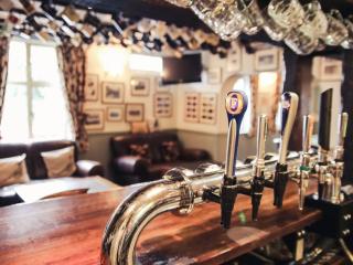
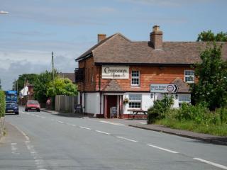
Wiveliscombe formed around a crossroads that was probably more important in the Iron Age than it is today. Its earliest building is the earth fort on Castle Hill. It became quietly prosperous after Edward the Confessor gave the Manor Farm to the Bishop of Bath and Wells in the 11th century. The... bishop brought in the latest monastic improvements and set up a small holiday palace for himself. It has remained prosperous ever since. For most of its history Wiveliscombe has lived on wool. In the 18th century it manufactured a rough blue cloth, called Penistones, that clothed the slave population of the West Indies. Today the village has become the real ale capital of Somerset, with two separate breweries established in the late 1970s, making the Exmoor and the Cotleigh Ales. William Hancock began the first Wiveliscombe brewery in 1807. By the 1920s it was the largest brewing operation in the South West, but mergers led to its closure in 1959. Wiveliscombe is away from the main roads, and also from the tourist trail, and remains largely self-sufficient: a former market town, now a local shopping centre. The town is known affectionately as Wivey, pronounced 'Wivvy'. It has moved peacefully through the centuries, almost untouched by national politics. In the 1670s the town's churchwardens were in trouble for not being nasty enough to Quakers and other nonconformists. Ten years later a survey recorded accommodation available for 76 horses and 53 human beings; the White Hart, the Bear and the Courtyard Inn are still open for business. In 1804 the National Health Service arrived over 140 years early in the form of a free dispensary for working people and the poor. The buildings of Wiveliscombe are a pick-and-mix of the last 1,000 years. The town hall is, sadly, boarded up; it's Victorian but looks Georgian. Opposite is an absurd building called the Court House. Technically late-Victorian, it belongs to no known architectural style, its overhanging storeys are hung with tiles and decorated with carved animal heads. In the High Street you pass between modest 18th-century terraces; the archway on the right was for stagecoaches, the one on the left may have been part of the bishop's summer palace. South Street was formerly known as 'Gullet', being the way the rainwater ran out of the town. Down in Church Street Nos. 10 and 12 are timber-framed medieval cottages: No. 10 has some medieval brickwork and No. 12 has an upstairs windowsill that's served many centuries. The houses in Rotton Row show the local, plum-coloured sandstone. This has also been used in the 19th-century church near by and throughout the town, giving it a slightly autumnal, bruised look.
Somerset remains rural and unspoiled, and ever popular areas to visit are the limestone and red sandstone Mendip Hills rising to over 1,000 feet, and by complete contrast, to the south and southwest, the flat landscape of the Somerset Levels. Another popular spot, the Quantocks, once the haunt of poets Coleridge and Wordsworth, are noted for their gentle slopes, heather-covered moorland expanses and red deer.
"A pretty village and a wooded riverside on the edge of the Brendons."
Walk details
3hrs 15min
Difficulty:
Easy
Gradient:
Moderate
Distance:
6 miles (9.7kms)
Ascent:
1000ft (305m)
Walk directions
Turn left out of the car park into the Square, head down High Street and turn left at the traffic lights into Church Street. Turn right, down steps under a narrow arch, to reach Rotton Row. Continue down to South Street and turn left along the pavement past a school.
1 of 6
At the end of the village (house No 2) turn right, along a lane, then left at The Linny. Follow this track up, with farm buildings above, to continue along the bottom edges of three fields. the bottom edges of three fields. Now the stile in the hedge ahead has grown over, so head up to the left for 30yds (27m) to a gateway before returning to the field foot to pass through a group of farm buildings. Continue in the same direction up the left-hand edge of the field above to reach a gate leading on to the B3227.
2 of 6
Turn left, then right into a lane heading downhill. After about 0.75 miles (1.2km) it crosses the River Tone and bends left at Marshes Farm. Keep ahead, on a track marked by a bridleway sign. Do not turn right here on the track towards Wadham's Farm but keep uphill to join an upper farm track. Turn right to the top of a deeply sunken lane. Turn right in this, descending towards the farm, but at its first buildings turn left. This track runs above the River Tone. With houses visible ahead, turn right to cross a footbridge and turn left to Challick Lane.
3 of 6
The track continues upstream beside the River Tone through very pleasant woodland to reach Washbattle Bridge.
4 of 6
Turn right, up the road, for 200yds (183m). A forest track, with a footpath signpost, leads uphill on the right. Beside a pheasant rearing pen, bear left on to a wide path that continues uphill. At the wood edge, exit through a field gate and then turn right, to cross the bottom corner of a field to more woodland opposite. Turn uphill alongside this to reach a gate beside a large concrete water tank.
5 of 6
Go through this gate and turn left, with a hedge beside you on the left. The next gate opens on to a hedged track. This turns right, and passes a reservoir at the summit of Maundown Hill. At the top of a tarred public road turn sharply right on to a track that becomes a descending, hedged path. At a signposted fork turn left on to a contouring path. Soon a tarred lane leads down into the town; turn right to find the car park car park near by on the right.
Wiveliscombe formed around a crossroads that was probably more important in the Iron Age than it is today. Its earliest building is the earth fort on Castle Hill. It became quietly prosperous after Edward the Confessor gave the Manor Farm to the Bishop of Bath and Wells in the 11th century. The... bishop brought in the latest monastic improvements and set up a small holiday palace for himself. It has remained prosperous ever since. For most of its history Wiveliscombe has lived on wool. In the 18th century it manufactured a rough blue cloth, called Penistones, that clothed the slave population of the West Indies. Today the village has become the real ale capital of Somerset, with two separate breweries established in the late 1970s, making the Exmoor and the Cotleigh Ales. William Hancock began the first Wiveliscombe brewery in 1807. By the 1920s it was the largest brewing operation in the South West, but mergers led to its closure in 1959. Wiveliscombe is away from the main roads, and also from the tourist trail, and remains largely self-sufficient: a former market town, now a local shopping centre. The town is known affectionately as Wivey, pronounced 'Wivvy'. It has moved peacefully through the centuries, almost untouched by national politics. In the 1670s the town's churchwardens were in trouble for not being nasty enough to Quakers and other nonconformists. Ten years later a survey recorded accommodation available for 76 horses and 53 human beings; the White Hart, the Bear and the Courtyard Inn are still open for business. In 1804 the National Health Service arrived over 140 years early in the form of a free dispensary for working people and the poor. The buildings of Wiveliscombe are a pick-and-mix of the last 1,000 years. The town hall is, sadly, boarded up; it's Victorian but looks Georgian. Opposite is an absurd building called the Court House. Technically late-Victorian, it belongs to no known architectural style, its overhanging storeys are hung with tiles and decorated with carved animal heads. In the High Street you pass between modest 18th-century terraces; the archway on the right was for stagecoaches, the one on the left may have been part of the bishop's summer palace. South Street was formerly known as 'Gullet', being the way the rainwater ran out of the town. Down in Church Street Nos. 10 and 12 are timber-framed medieval cottages: No. 10 has some medieval brickwork and No. 12 has an upstairs windowsill that's served many centuries. The houses in Rotton Row show the local, plum-coloured sandstone. This has also been used in the 19th-century church near by and throughout the town, giving it a slightly autumnal, bruised look.
Somerset remains rural and unspoiled, and ever popular areas to visit are the limestone and red sandstone Mendip Hills rising to over 1,000 feet, and by complete contrast, to the south and southwest, the flat landscape of the Somerset Levels. Another popular spot, the Quantocks, once the haunt of poets Coleridge and Wordsworth, are noted for their gentle slopes, heather-covered moorland expanses and red deer.