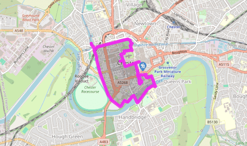
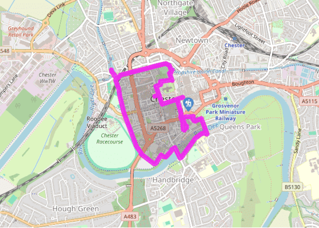
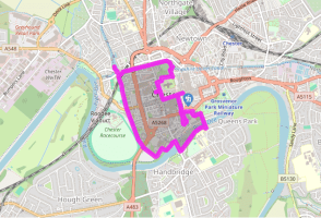
"The classic circuit of Chester's medieval walls, with a few variations."
Walk directions
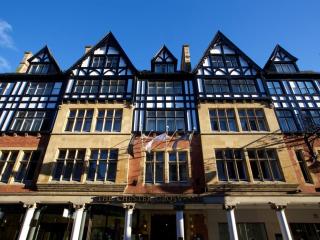
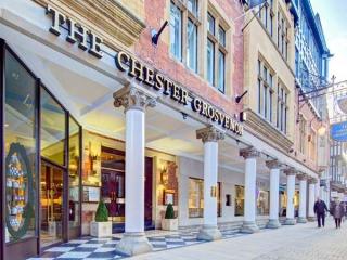
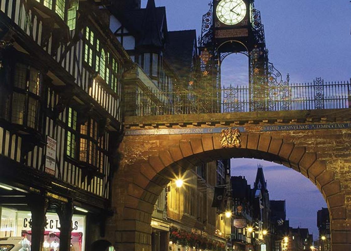
Begin beneath the Jubilee Clock on Eastgate Street and head west past The Chester Grosvenor. Approaching a junction by St Peter's Church and Chester's medieval cross, swing right into Northgate Street. At the end of the Row, turn left past the Dublin Packet and through an arch to see the Roman Strong Room, revealed on your right.
Return to Northgate Street and continue to the impressive Victorian town hall. The cathedral is in St Werburgh Street (off right), but the route is through an archway into Abbey Square, a few steps further on. Leave at the far side along Abbey Street, climbing onto the wall at its end.
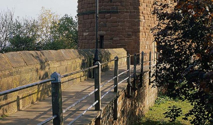
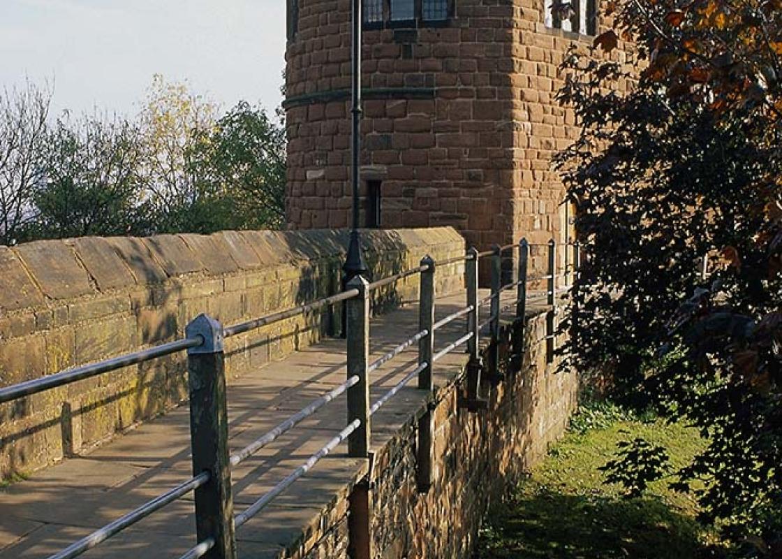
To the left, the wall leads to the Phoenix Tower, from which Charles I witnessed his army's defeat. Continue round above the Shropshire Union Canal and over Northgate Bridge to a Civil War gun tower, Morgan's Mount. Descend steps and pass through the wall to the canal bank. Follow it down beside a staircase of three deep locks and around a bend to the Northgate Basin, where Telford's Warehouse extends over the canal to facilitate loading.
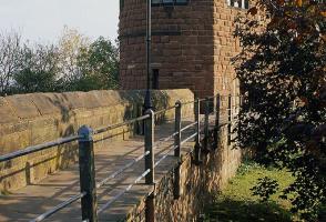
Return around the canal bend and then double back sharp right, climbing to the entrance of Water Tower Gardens. Go left up steps onto the wall and turn right, passing Bonewaldesthorne's Tower and the connected Water Tower, which once stood in the river. The path drops to the pavement along City Walls Road before climbing to cross Watergate Bridge. Returning to the street, carry on past the racecourse.
Cross Grosvenor Road and regain the wall below Chester Castle. Meeting the street behind County Hall, go left on a path opposite above the Dee. Cross the river on the 14th-century Old Dee Bridge and immediately turn upstream past the Chester Weir. It was built in 1093 to provide power for mills lower down.
Return to the north bank on Queen's Park Bridge and climb the steps beyond. At the top, go through a gate on the left to walk behind St John's Church, Chester's cathedral prior to the Dissolution. Emerging onto a street, go past the church's west front and then turn left through a gate past the ruins of the amphitheatre.
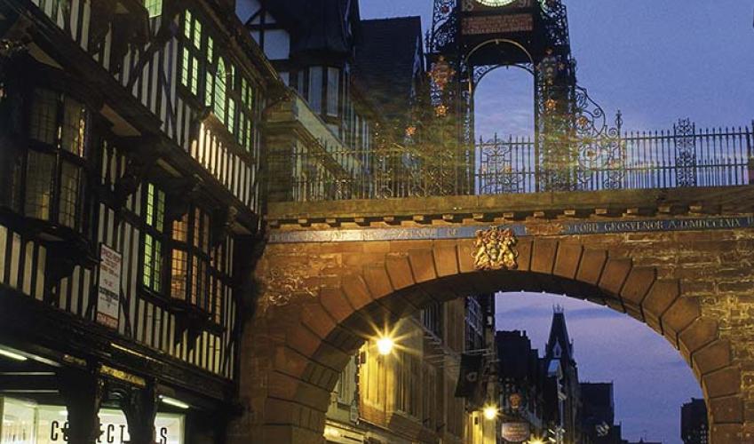
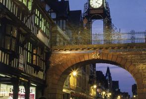
Joining the main road, walk left past Roman Gardens and beneath Newgate Bridge before turning left along Park Street. At the bottom, climb back onto the wall and double back left above the gardens. Beyond Newgate Bridge is Thimbley's Tower, its interior on view. A short distance beyond is Eastgate, where the walk began, easily recognised by the elaborate clock placed there to celebrate Queen Victoria's Diamond Jubilee. The gate stands on the site of the original entrance to the Roman fort.
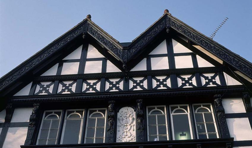
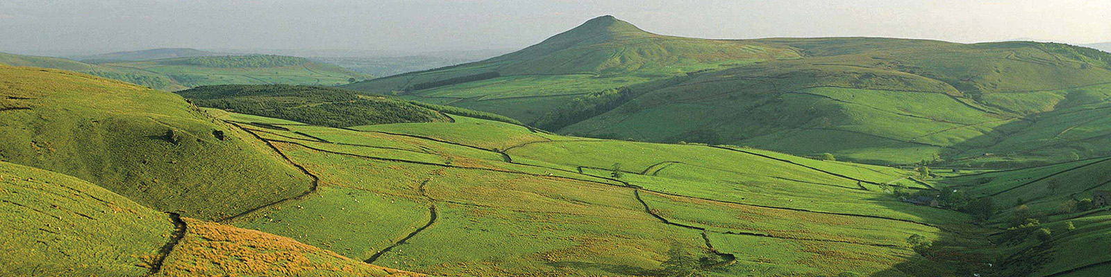
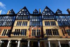
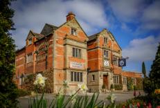
Overlooking the banks of the River Dee to the distant Clwydian Hills, Chester ranks high among England's most beautiful cities. Founded by the Romans to exercise control over the native Britons of Wales and northern England, its winding streets and passageways are imbued with 2,000 years of... history, so don't be surprised if you bump into a Roman soldier guiding a party of visitors around the walls. A Roman fort Founded in AD 79 and named for the native god of the river beside which it stood, Deva was the largest Roman fort in Britain, greater even than either London or York. It soon became the focus of a thriving town, with an amphitheatre capable of holding up to 10,000 spectators and a large port that funnelled trade from across the empire. The town's fortunes fluctuated after the Romans left, but in AD 689 the Mercian king Æthelred founded the first cathedral, dedicated to St John the Baptist. His niece, St Werburgh, was subsequently buried nearby in what would become the abbey church and present-day cathedral. Medieval prosperity The town fell to the Normans during the Harrying of the North in 1070. Hugo d'Avranches consolidated his position with a castle and town walls, raised largely on the foundation of those laid by the Romans. He also founded a Benedictine abbey dedicated to St Werburgh. Medieval Chester prospered from Continental and Irish trade, despite a silting river that shifted to create the Roodee on which the racecourse now stands. The unique Rows or elevated walkways date from this period and lined the four main arteries of the town, comprising upper and street level premises with sometimes a basement level as well, all serving as dwellings, shops or workrooms. Roundheads and cavaliers The town's fortunes changed with the onset of the Civil War. Garrisoned for the King, Chester was besieged on and off for over a year, and Charles' attempt to push back the Roundheads at the Battle of Rowton Heath resulted in a disastrous defeat. Starved and bombarded into submission, the town finally surrendered in January 1646, only to be further decimated by a visitation of plague the following year. A city not to be missed Recovery brought a rebuilding that has continued to the present day, creating an eclectic mix of architectural styles. Although the port lost out to Liverpool because of the steadily increasing size of shipping, it became a fashionable place to live and visit away from the burgeoning industrial towns fronting the Mersey. Neither the Chester Canal (now the Shropshire Union) nor the subsequent railways generated a huge industrial impact, a factor that has no doubt contributed to the present attractiveness of the city centre.
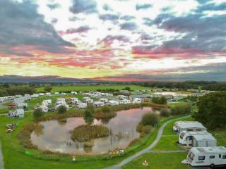
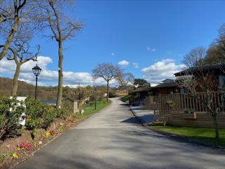
Nestled between the Welsh hills and Derbyshire Peaks, the Cheshire plains make an ideal location to take things slow and mess around in boats. Cheshire has more than 200 miles (302 km) of man-made waterways, more than any other county in England.
"The classic circuit of Chester's medieval walls, with a few variations."
Walk details
1hr 15min
Difficulty:
Easy
Gradient:
Gentle
Distance:
3 miles (4.8kms)
Ascent:
246ft (75m)
Walk directions
Begin beneath the Jubilee Clock on Eastgate Street and head west past The Chester Grosvenor. Approaching a junction by St Peter's Church and Chester's medieval cross, swing right into Northgate Street. At the end of the Row, turn left past the Dublin Packet and through an arch to see the Roman Strong Room, revealed on your right.
1 of 7
Return to Northgate Street and continue to the impressive Victorian town hall. The cathedral is in St Werburgh Street (off right), but the route is through an archway into Abbey Square, a few steps further on. Leave at the far side along Abbey Street, climbing onto the wall at its end.
2 of 7
To the left, the wall leads to the Phoenix Tower, from which Charles I witnessed his army's defeat. Continue round above the Shropshire Union Canal and over Northgate Bridge to a Civil War gun tower, Morgan's Mount. Descend steps and pass through the wall to the canal bank. Follow it down beside a staircase of three deep locks and around a bend to the Northgate Basin, where Telford's Warehouse extends over the canal to facilitate loading.
3 of 7
Return around the canal bend and then double back sharp right, climbing to the entrance of Water Tower Gardens. Go left up steps onto the wall and turn right, passing Bonewaldesthorne's Tower and the connected Water Tower, which once stood in the river. The path drops to the pavement along City Walls Road before climbing to cross Watergate Bridge. Returning to the street, carry on past the racecourse.
4 of 7
Cross Grosvenor Road and regain the wall below Chester Castle. Meeting the street behind County Hall, go left on a path opposite above the Dee. Cross the river on the 14th-century Old Dee Bridge and immediately turn upstream past the Chester Weir. It was built in 1093 to provide power for mills lower down.
5 of 7
Return to the north bank on Queen's Park Bridge and climb the steps beyond. At the top, go through a gate on the left to walk behind St John's Church, Chester's cathedral prior to the Dissolution. Emerging onto a street, go past the church's west front and then turn left through a gate past the ruins of the amphitheatre.
6 of 7
Joining the main road, walk left past Roman Gardens and beneath Newgate Bridge before turning left along Park Street. At the bottom, climb back onto the wall and double back left above the gardens. Beyond Newgate Bridge is Thimbley's Tower, its interior on view. A short distance beyond is Eastgate, where the walk began, easily recognised by the elaborate clock placed there to celebrate Queen Victoria's Diamond Jubilee. The gate stands on the site of the original entrance to the Roman fort.
Overlooking the banks of the River Dee to the distant Clwydian Hills, Chester ranks high among England's most beautiful cities. Founded by the Romans to exercise control over the native Britons of Wales and northern England, its winding streets and passageways are imbued with 2,000 years of... history, so don't be surprised if you bump into a Roman soldier guiding a party of visitors around the walls. A Roman fort Founded in AD 79 and named for the native god of the river beside which it stood, Deva was the largest Roman fort in Britain, greater even than either London or York. It soon became the focus of a thriving town, with an amphitheatre capable of holding up to 10,000 spectators and a large port that funnelled trade from across the empire. The town's fortunes fluctuated after the Romans left, but in AD 689 the Mercian king Æthelred founded the first cathedral, dedicated to St John the Baptist. His niece, St Werburgh, was subsequently buried nearby in what would become the abbey church and present-day cathedral. Medieval prosperity The town fell to the Normans during the Harrying of the North in 1070. Hugo d'Avranches consolidated his position with a castle and town walls, raised largely on the foundation of those laid by the Romans. He also founded a Benedictine abbey dedicated to St Werburgh. Medieval Chester prospered from Continental and Irish trade, despite a silting river that shifted to create the Roodee on which the racecourse now stands. The unique Rows or elevated walkways date from this period and lined the four main arteries of the town, comprising upper and street level premises with sometimes a basement level as well, all serving as dwellings, shops or workrooms. Roundheads and cavaliers The town's fortunes changed with the onset of the Civil War. Garrisoned for the King, Chester was besieged on and off for over a year, and Charles' attempt to push back the Roundheads at the Battle of Rowton Heath resulted in a disastrous defeat. Starved and bombarded into submission, the town finally surrendered in January 1646, only to be further decimated by a visitation of plague the following year. A city not to be missed Recovery brought a rebuilding that has continued to the present day, creating an eclectic mix of architectural styles. Although the port lost out to Liverpool because of the steadily increasing size of shipping, it became a fashionable place to live and visit away from the burgeoning industrial towns fronting the Mersey. Neither the Chester Canal (now the Shropshire Union) nor the subsequent railways generated a huge industrial impact, a factor that has no doubt contributed to the present attractiveness of the city centre.
Nestled between the Welsh hills and Derbyshire Peaks, the Cheshire plains make an ideal location to take things slow and mess around in boats. Cheshire has more than 200 miles (302 km) of man-made waterways, more than any other county in England.