Home>
Walks>
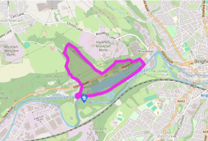
Cromwell Bottom and the Calderdale Way
Cromwell Bottom and the Calderdale Way
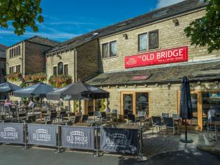
Recommended by
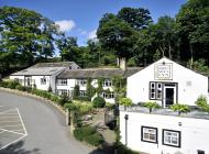
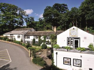
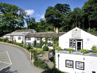
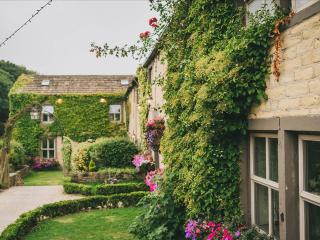
Our view
"A peaceful nature reserve offers tranquillity between industrious Brighouse and Elland"
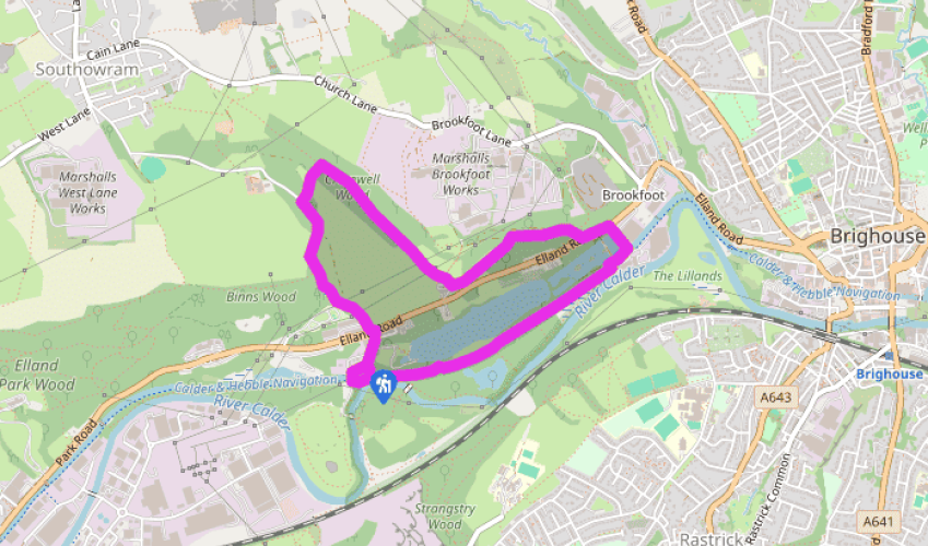
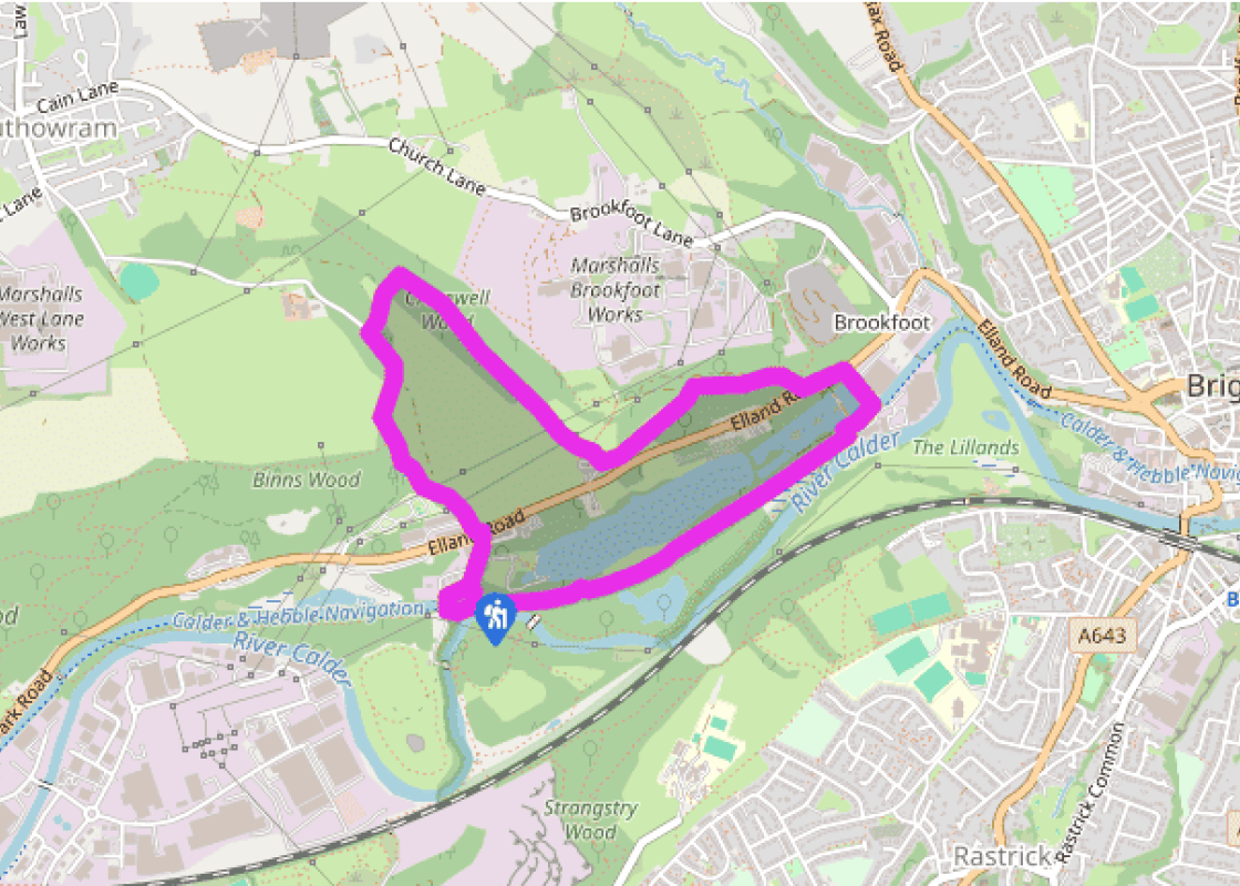
Walk directions
Take the trail from the far end of the car park, immediately turning left on to a footbridge across the Calder and Hebble Navigation. Descend steps and turn right onto the tow path.
About 65yds (60m) after passing between a pair of gate posts either side of the tow path, turn right through a kissing gate, on to a path that winds through Cromwell Bottom Nature Reserve. Bear left at the first junction, soon passing a large rush-fringed body of water on your right, before rejoining the tow path, via another kissing gate, at Cromwell Lock. Bear right again, past Cromwell Bridge, to the next set of lock gates, Brookfoot Locks. Cross a stone bridge and bear right to a road.
Turn left here, along the edge of an industrial estate, to the main A6025 road. Cross carefully and take the stile opposite into a lane climbing away from the road; this is the Calderdale Way. Where the track forks 220yds (201m) later, keep left with the Calderdale Way. Ignore the next left turn and stay with the track, marked with the ‘CW’ brand on a wall corner. The walled lane gently rises to pass beneath power lines.
Where the track turns off right, climb a wooden step stile by a gate in the bend ahead, and descend a long flight of steps toward a farmyard passing through a gated squeeze stile mid-way. At the foot of the steps, turn right up a walled lane into oak woodland. Stay on the main woodland path, ignoring any side trails.
When you’re 600yds (549m) into the woodland, where a track comes down the slope from your right to cross yours, look for the faint path down the slope to your left. Descend this to a wooden kissing gate, beyond which the path fords a stream. Climb the grassy bank opposite, which is steep and can be slippery after rain, ignoring a muddy vehicle track to trend up and left into into trees and rising to pass through a stone stile into a walled lane.
Turn left, downhill, to Boggart House. Beyond, the route continues ahead as a narrower path, stepping over a wooden barrier to descend an old stone cart track through woods for 220yds (201m). A stile on your left then takes you off, on to a woodland path, part of the Brighouse Boundary Walk. It descends, alongside a deep, ravine-like clough, to a junction of tracks.
Turn right here, down a lane, to the A6025 Brighouse–Elland road. Cross with care and head down the lane directly opposite back to the car park.
Terrain
- Canal tow path, woodland and farm tracks; several stiles
Landscape
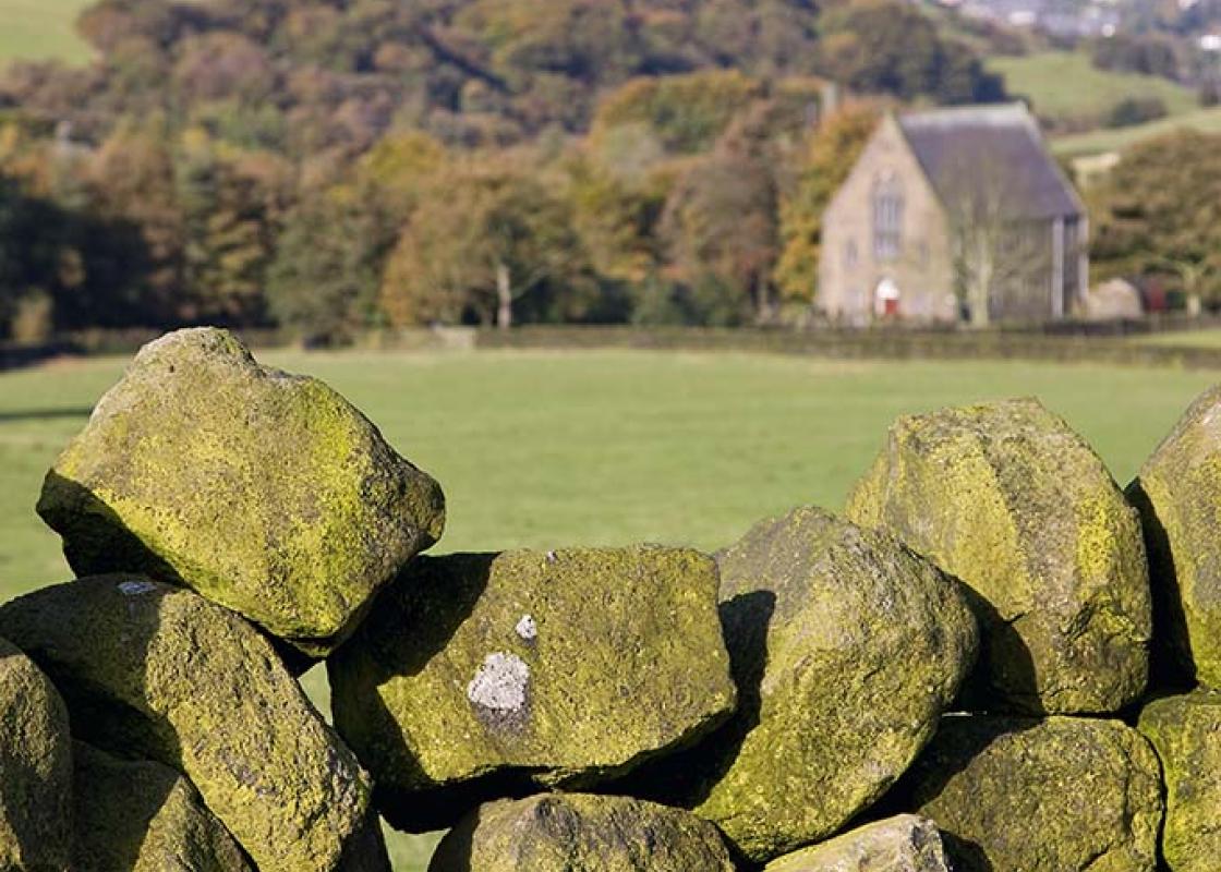
- Peaceful canal side, wooded valley sides
Dog friendliness
- Dogs should be under control in the nature reserve but are free to exercise in the woodlands across the valley
Parking
- Small car park (height restriction) behind Cromwell House, off the A6025 Elland Road, Brighouse
Toilets en route
- None on route
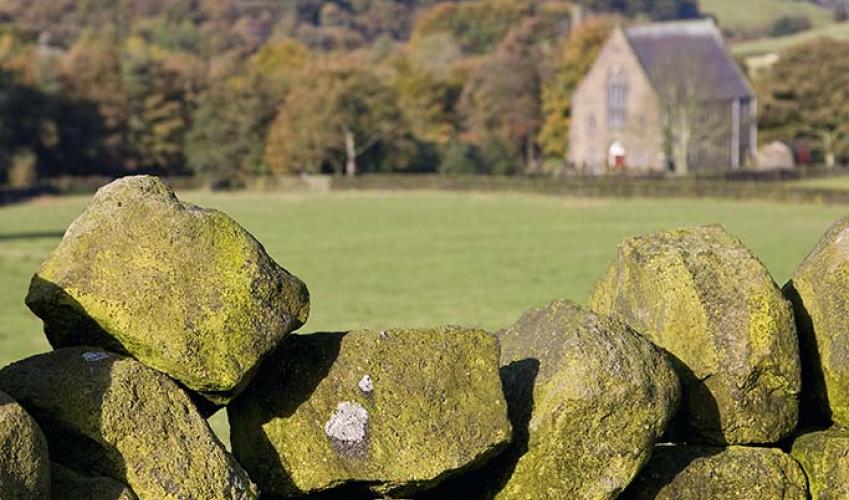
About the walk
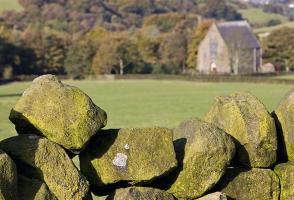
Never heard of Cromwell Bottom? Well, the birds have. In fact more than 200 species have been recorded at this secretive reserve sandwiched between the River Calder and the Calder and Hebble Navigation, just outside Brighouse. Most avid avian twitchers are happy if they spot 100 in their lifetime. ... Cromwell Bottom, a mix of woodland, wetland and grassland, is regarded as one of Calderdale’s most important sites for nature conservation, boasting an extraordinary diversity of flora and fauna. Around 130 species of plant have been recorded, along with amphibians, including frogs, toads and newts, mammals such as roe deer, and insects including dragonflies and damselflies. Butterflies recorded here include orange tip (often mistaken for a cabbage white), peacock, brimstone and small tortoiseshell, while the list of birds seems almost endless though its thoroughness is no doubt helped by the fact that the Royal Society for the Protection of Birds once had its northwest office in the nearby mill complex. Along the River Calder This walk takes in just a small part of the site – not all of it is easily accessible yet – and visits a variety of other habitats including woodland, canal bank and pasture. The Calder and Hebble Navigation along which it begins was one of the last canals in England to carry freight along its length. It developed during the 18th century, when waterways became important for the distribution of raw materials and finished goods to and from the burgeoning mill towns of the north. In this case, it began not as a canal but as an attempt to improve the River Calder for boats by bypassing non-navigable stretches with man-made diversions between Brighouse, Elland and Sowerby Bridge. Despite strong opposition from mill owners, who feared the works might reduce the power available from the river for their water-powered mills, Parliament granted permission for the river to be improved in 1758. Work began in 1761, under the command of the great canal engineers John Smeaton and James Brindley. The 24-mile (39km) length of the Calder and Hebble Navigation between Wakefield and Sowerby Bridge opened in 1770 and over successive years further lengths of river were bypassed, until the majority of the route was manmade, including the peaceful, straight-as-a-dye stretch between Brighouse and Elland followed by this walk. While other canals were put out of business by the development of the railways, the Calder and Hebble continued to bear commercial freight until the 1980s, when road haulage finally beat it into submission.
"A peaceful nature reserve offers tranquillity between industrious Brighouse and Elland"
Walk details
1hr 15min
Difficulty:
Medium
Gradient:
Moderate
Distance:
2.5 miles (4.4kms)
Ascent:
470ft (143m)
Walk directions
Take the trail from the far end of the car park, immediately turning left on to a footbridge across the Calder and Hebble Navigation. Descend steps and turn right onto the tow path.
1 of 7
About 65yds (60m) after passing between a pair of gate posts either side of the tow path, turn right through a kissing gate, on to a path that winds through Cromwell Bottom Nature Reserve. Bear left at the first junction, soon passing a large rush-fringed body of water on your right, before rejoining the tow path, via another kissing gate, at Cromwell Lock. Bear right again, past Cromwell Bridge, to the next set of lock gates, Brookfoot Locks. Cross a stone bridge and bear right to a road.
2 of 7
Turn left here, along the edge of an industrial estate, to the main A6025 road. Cross carefully and take the stile opposite into a lane climbing away from the road; this is the Calderdale Way. Where the track forks 220yds (201m) later, keep left with the Calderdale Way. Ignore the next left turn and stay with the track, marked with the ‘CW’ brand on a wall corner. The walled lane gently rises to pass beneath power lines.
3 of 7
Where the track turns off right, climb a wooden step stile by a gate in the bend ahead, and descend a long flight of steps toward a farmyard passing through a gated squeeze stile mid-way. At the foot of the steps, turn right up a walled lane into oak woodland. Stay on the main woodland path, ignoring any side trails.
4 of 7
When you’re 600yds (549m) into the woodland, where a track comes down the slope from your right to cross yours, look for the faint path down the slope to your left. Descend this to a wooden kissing gate, beyond which the path fords a stream. Climb the grassy bank opposite, which is steep and can be slippery after rain, ignoring a muddy vehicle track to trend up and left into into trees and rising to pass through a stone stile into a walled lane.
5 of 7
Turn left, downhill, to Boggart House. Beyond, the route continues ahead as a narrower path, stepping over a wooden barrier to descend an old stone cart track through woods for 220yds (201m). A stile on your left then takes you off, on to a woodland path, part of the Brighouse Boundary Walk. It descends, alongside a deep, ravine-like clough, to a junction of tracks.
6 of 7
Turn right here, down a lane, to the A6025 Brighouse–Elland road. Cross with care and head down the lane directly opposite back to the car park.
Terrain
- Canal tow path, woodland and farm tracks; several stiles
Landscape
- Peaceful canal side, wooded valley sides
Dog friendliness
- Dogs should be under control in the nature reserve but are free to exercise in the woodlands across the valley
Parking
- Small car park (height restriction) behind Cromwell House, off the A6025 Elland Road, Brighouse
Toilets en route
- None on route
About the walk
Never heard of Cromwell Bottom? Well, the birds have. In fact more than 200 species have been recorded at this secretive reserve sandwiched between the River Calder and the Calder and Hebble Navigation, just outside Brighouse. Most avid avian twitchers are happy if they spot 100 in their lifetime. ... Cromwell Bottom, a mix of woodland, wetland and grassland, is regarded as one of Calderdale’s most important sites for nature conservation, boasting an extraordinary diversity of flora and fauna. Around 130 species of plant have been recorded, along with amphibians, including frogs, toads and newts, mammals such as roe deer, and insects including dragonflies and damselflies. Butterflies recorded here include orange tip (often mistaken for a cabbage white), peacock, brimstone and small tortoiseshell, while the list of birds seems almost endless though its thoroughness is no doubt helped by the fact that the Royal Society for the Protection of Birds once had its northwest office in the nearby mill complex. Along the River Calder This walk takes in just a small part of the site – not all of it is easily accessible yet – and visits a variety of other habitats including woodland, canal bank and pasture. The Calder and Hebble Navigation along which it begins was one of the last canals in England to carry freight along its length. It developed during the 18th century, when waterways became important for the distribution of raw materials and finished goods to and from the burgeoning mill towns of the north. In this case, it began not as a canal but as an attempt to improve the River Calder for boats by bypassing non-navigable stretches with man-made diversions between Brighouse, Elland and Sowerby Bridge. Despite strong opposition from mill owners, who feared the works might reduce the power available from the river for their water-powered mills, Parliament granted permission for the river to be improved in 1758. Work began in 1761, under the command of the great canal engineers John Smeaton and James Brindley. The 24-mile (39km) length of the Calder and Hebble Navigation between Wakefield and Sowerby Bridge opened in 1770 and over successive years further lengths of river were bypassed, until the majority of the route was manmade, including the peaceful, straight-as-a-dye stretch between Brighouse and Elland followed by this walk. While other canals were put out of business by the development of the railways, the Calder and Hebble continued to bear commercial freight until the 1980s, when road haulage finally beat it into submission.