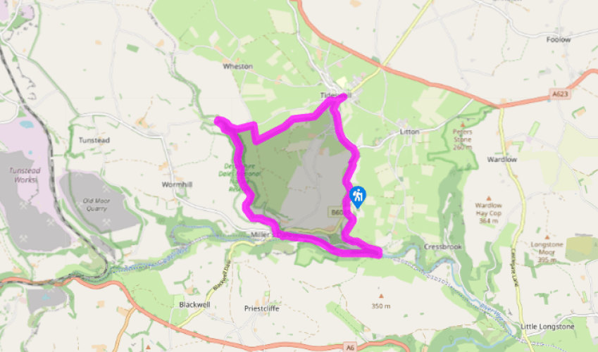
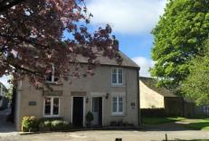
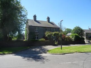
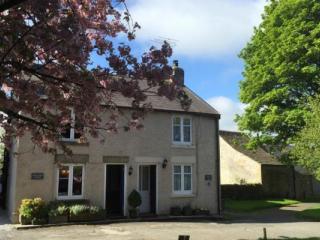
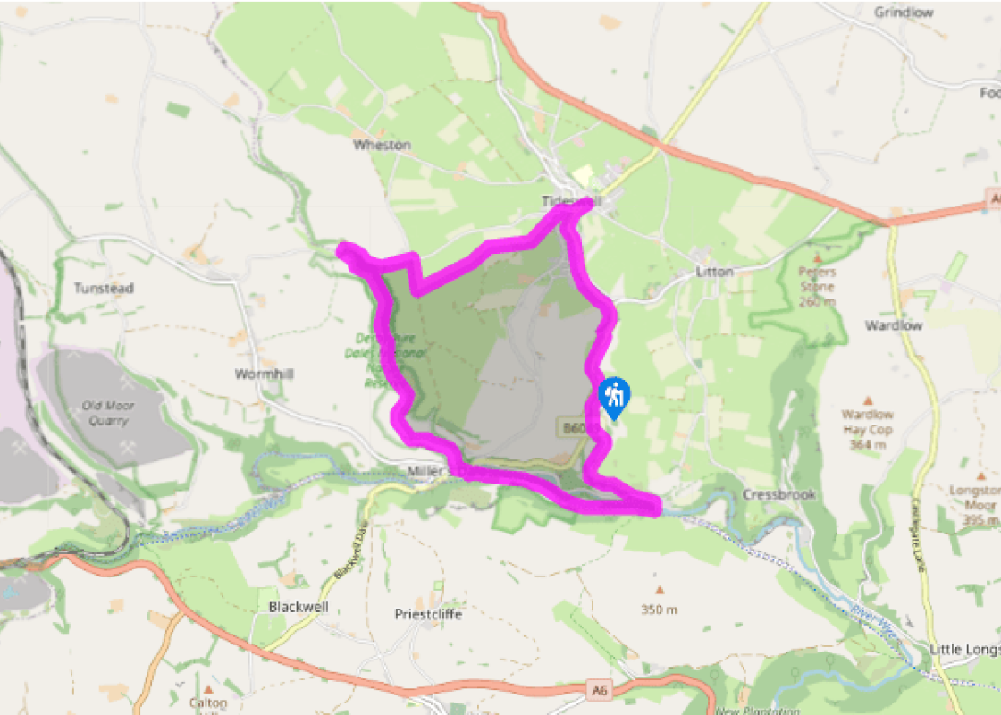
From the church walk down the main street into the centre of Tideswell and turn right along Parke Road. Go left on to Sherwood Road and in 50yds (46m) right on to Summer Cross. After a few paces turn left on to a track known as Slancote Lane and follow this up and out of the village.
After 400yards (366m) and at the top of the slope take a waymarked path over a stone stile on the right. The field path follows the wall westwards across numerous fields and the end of a farm track. After crossing two large fields it finally climbs to a walled track used by the Limestone Way and Pennine Bridleway. Turn right, then left at the end on to the lane and follow this all the way down to the end of Monk’s Dale.
Turn left at the public footpath signpost for the route across a field and into the woods of Monk’s Dale. Continue along the densely wooded valley bottom for almost a mile (1.6km) until the path abruptly climbs up to the left and emerges into the open.
Climb up the slope on the upper of two paths and follow this route down the dale, descending to cross a footbridge over the stream. On the far side turn left for a path just above the water, which eventually climbs up to a gate. Go through this and down a stepped path to the road next to the church. Turn left along the surfaced lane opposite.
About 50 yards (46m) before The Anglers Rest pub turn right across two footbridges, then on the far side of the river climb up to the Monsal Trail. Go left along this wide and popular route, then, just after a bridge, turn left at the sign for Litton Mill.
Drop down to re-cross the Wye and turn left along the lane, then right into Tideswell Dale. Continue on the path through the car park to a gate beyond trees by the road.
Cross over the road and go right, along the pavement, then take the signposted path left, up across the hillside. At the top go right on a track back to Tideswell, going straight over the junction at the end.
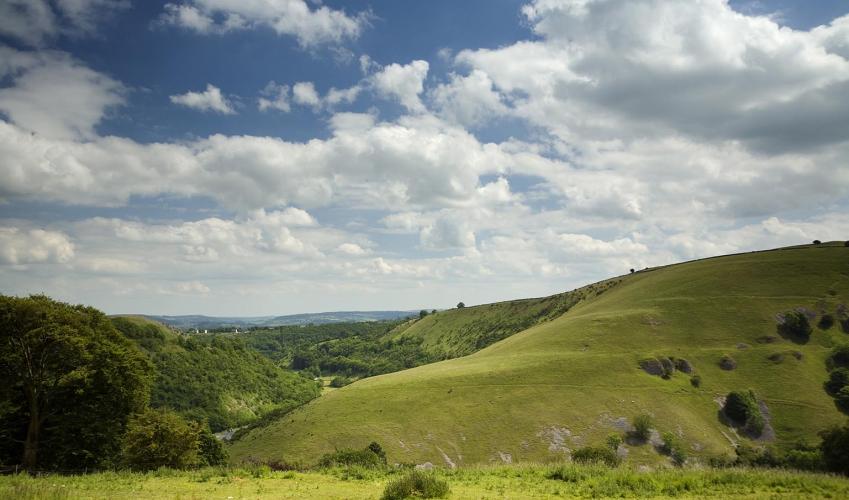
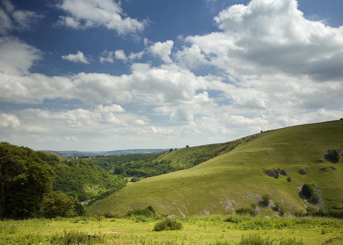
The dales of the White Peak are renowned for their stunning landscapes, limestone geology and rich natural history. Five separate valleys form the Derbyshire Dales National Nature Reserve: Long Dale and Lathkill Dale south of Bakewell, and Cressbrook Dale, Hay Dale and Monk’s Dale to the northwest.... All are slightly different in character, but Monk’s Dale’s relative inaccessibility makes it one of the quietest and most rewarding to walk through. There’s no habitation at all until you get down to Miller’s Dale, where a small monastery that gave the dale its name once stood. You can’t help but feel that if the monks were after a place of seclusion and tranquillity they chose a pretty good spot. Flower-rich Slopes and Woodland Bottom Monk’s Dale is a deep and untouched corridor of oak and ash woodland flanked by steep-sided slopes of grass and occasionally scree. Because of its formal protection as a nature reserve, no doubt helped by its relative inaccessibility, Monk’s Dale boasts an abundance of flowers and wildlife. The open limestone slopes are among the richest in England for wild flowers and they say you can find as many as 40 different species in just one square metre. Cowslips and orchids decorate the slopes in spring and early summer, while common rock rose, bloody cranesbill and many other limestone-loving plants can also be found here. The open slopes are to be found further down the dale, since the path initially sticks to the woodland bottom. Here you might find plants like herb Paris and wood anemone, while the tree cover also attracts seasonal birds such as flycatchers, whitethroats and redstarts. Deep among the vegetation it usually feels cool and damp, with moss and lichen covering the gnarly old trees, and some walkers have likened it to the feel of a rain forest. However, this initial section through the woods can also be hard going underfoot, especially if it’s wet. A combination of jumbled tree roots and exposed limestone can make this a potentially slippery and awkward part of the walk, so choose a dry day and don’t hurry. Return via Tideswell Dale After leaving Monk’s Dale the walk crosses the River Wye and joins the Monsal Trail. If you want to visit Miller’s Dale Station and the giant bridges that span the gorge, then turn right for a short distance. Otherwise, press on down the valley on the trackbed of the former railway to reach Litton Mill, before swinging north into Tideswell Dale. After Monk’s Dale this smaller limestone valley is a much gentler affair, with a smooth path along its bottom and an easier conclusion to the walk.
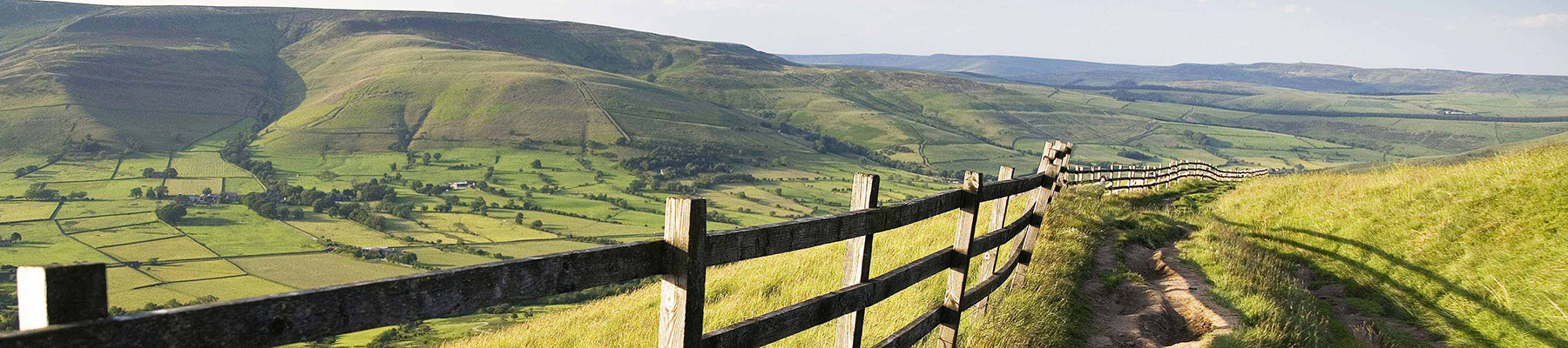
The natural features of this central English county range from the modest heights of the Peak District National Park, where Kinder Scout stands at 2,088 ft (636 m), to the depths of its remarkable underground caverns, floodlit to reveal exquisite Blue John stone. Walkers and cyclists will enjoy the High Peak Trail which extends from the Derwent Valley to the limestone plateau near Buxton, and for many, the spectacular scenery is what draws them to the area.
From the church walk down the main street into the centre of Tideswell and turn right along Parke Road. Go left on to Sherwood Road and in 50yds (46m) right on to Summer Cross. After a few paces turn left on to a track known as Slancote Lane and follow this up and out of the village.
1 of 7
After 400yards (366m) and at the top of the slope take a waymarked path over a stone stile on the right. The field path follows the wall westwards across numerous fields and the end of a farm track. After crossing two large fields it finally climbs to a walled track used by the Limestone Way and Pennine Bridleway. Turn right, then left at the end on to the lane and follow this all the way down to the end of Monk’s Dale.
2 of 7
Turn left at the public footpath signpost for the route across a field and into the woods of Monk’s Dale. Continue along the densely wooded valley bottom for almost a mile (1.6km) until the path abruptly climbs up to the left and emerges into the open.
3 of 7
Climb up the slope on the upper of two paths and follow this route down the dale, descending to cross a footbridge over the stream. On the far side turn left for a path just above the water, which eventually climbs up to a gate. Go through this and down a stepped path to the road next to the church. Turn left along the surfaced lane opposite.
4 of 7
About 50 yards (46m) before The Anglers Rest pub turn right across two footbridges, then on the far side of the river climb up to the Monsal Trail. Go left along this wide and popular route, then, just after a bridge, turn left at the sign for Litton Mill.
5 of 7
Drop down to re-cross the Wye and turn left along the lane, then right into Tideswell Dale. Continue on the path through the car park to a gate beyond trees by the road.
6 of 7
Cross over the road and go right, along the pavement, then take the signposted path left, up across the hillside. At the top go right on a track back to Tideswell, going straight over the junction at the end.
The dales of the White Peak are renowned for their stunning landscapes, limestone geology and rich natural history. Five separate valleys form the Derbyshire Dales National Nature Reserve: Long Dale and Lathkill Dale south of Bakewell, and Cressbrook Dale, Hay Dale and Monk’s Dale to the northwest.... All are slightly different in character, but Monk’s Dale’s relative inaccessibility makes it one of the quietest and most rewarding to walk through. There’s no habitation at all until you get down to Miller’s Dale, where a small monastery that gave the dale its name once stood. You can’t help but feel that if the monks were after a place of seclusion and tranquillity they chose a pretty good spot. Flower-rich Slopes and Woodland Bottom Monk’s Dale is a deep and untouched corridor of oak and ash woodland flanked by steep-sided slopes of grass and occasionally scree. Because of its formal protection as a nature reserve, no doubt helped by its relative inaccessibility, Monk’s Dale boasts an abundance of flowers and wildlife. The open limestone slopes are among the richest in England for wild flowers and they say you can find as many as 40 different species in just one square metre. Cowslips and orchids decorate the slopes in spring and early summer, while common rock rose, bloody cranesbill and many other limestone-loving plants can also be found here. The open slopes are to be found further down the dale, since the path initially sticks to the woodland bottom. Here you might find plants like herb Paris and wood anemone, while the tree cover also attracts seasonal birds such as flycatchers, whitethroats and redstarts. Deep among the vegetation it usually feels cool and damp, with moss and lichen covering the gnarly old trees, and some walkers have likened it to the feel of a rain forest. However, this initial section through the woods can also be hard going underfoot, especially if it’s wet. A combination of jumbled tree roots and exposed limestone can make this a potentially slippery and awkward part of the walk, so choose a dry day and don’t hurry. Return via Tideswell Dale After leaving Monk’s Dale the walk crosses the River Wye and joins the Monsal Trail. If you want to visit Miller’s Dale Station and the giant bridges that span the gorge, then turn right for a short distance. Otherwise, press on down the valley on the trackbed of the former railway to reach Litton Mill, before swinging north into Tideswell Dale. After Monk’s Dale this smaller limestone valley is a much gentler affair, with a smooth path along its bottom and an easier conclusion to the walk.
The natural features of this central English county range from the modest heights of the Peak District National Park, where Kinder Scout stands at 2,088 ft (636 m), to the depths of its remarkable underground caverns, floodlit to reveal exquisite Blue John stone. Walkers and cyclists will enjoy the High Peak Trail which extends from the Derwent Valley to the limestone plateau near Buxton, and for many, the spectacular scenery is what draws them to the area.