"Great short walk around the ruined churches and chapels found at Tobha Mor"
Walk directions
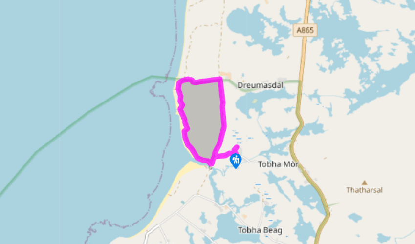
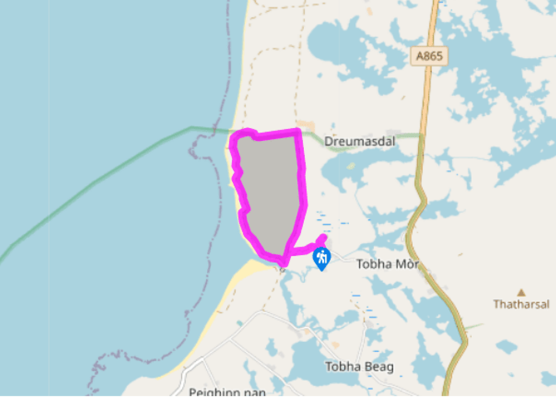
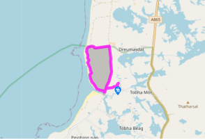
From the parking area follow the signs to the ruins and the hostel, just by the fingerpost sign for Tobha Mor Chapel and Burial ground. The ruins are visible, just 150 yards (140m) away, though the ground is uneven and lumpy.
Walk back towards Howmore Church and take the stony track to the left of the church towards the sea, to reach a T-junction with a grassy track by a fence. Turn right and follow this path due north, in a straight line, for one mile (1.6km). Pass several fenced-in fields, and then Loch an Eilein on your right. In the middle, on a raised islet, are the squat stone ruins of Caisteal Bheagram, a ruined 15th/16th-century oblong tower.
Reach a gate by Drimsdale House, and go through this into the field. (There is often a bull in this field – a notice will be displayed if this is the case.) Turn left to follow the small track by a raised field furrow in front of you.
A fence comes in from the left. Continue ahead for 200yds (180m) to a gate in the fence on the left-hand side. With your back to the gate, follow the track half right towards the sea for 200yds (180m) to another gate. Go through this to reach the beach.
If the tide is out you can turn left and walk along the shoreline all the way past the rocky outcrops and skerries of Sgeir Dhreumasdail to where the beach meets the river and then turn inland, to join the clear riverside path. If the tide's in, or if you prefer, turn left and walk just above the shoreline through the marram grass, with a fence up to your left. There are several indistinct tracks here that very quickly unite into a clearer sandy track which rises up above the shore.
Where the fence bears sharp left, your path drops down behind the dunes, leaving the fence, and bearing right along a grassy track. Follow this path for 800yds (730m) as it runs behind the dunes, soon becoming a broader track outlined by tractor wheels. A fence comes in from the left and the path then swings left to follow the bank of the Howmore river. This sandy-shored river is the outflow for two lochs.
Where the grassy track comes to a bridge, bear left, passing a turquoise waymarker to reach the T-junction where your route from the church originally turned right (Point 1). Turn right here to return to the church and the start of the walk.
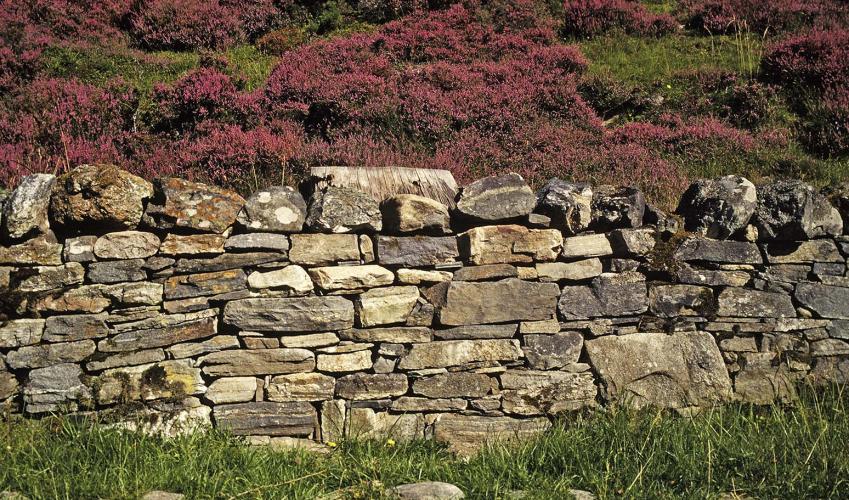
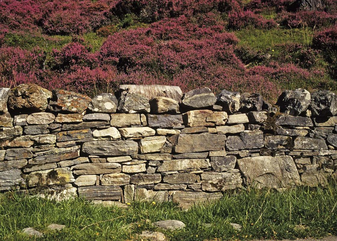
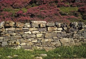
South Uist's history and geography are at the heart of this walk. 'Tobha' comes from an old Norse word for 'mound', and the four ruined churches and chapels found at Tobha Mor are regarded by archaeologists as the most important Christian remains on the Outer Hebrides. Early Christianity Tobha... Mor is believed to have been an important ecclesiastical centre from early medieval times when the area was effectively an island, cut off from the mainland of South Uist by a narrow, marshy waterway. The remains of a succession of chapels are thought to date from AD 1200, and to resemble early Irish Celtic monastic sites. The graveyard is the largest feature, and within it are four Celtic crosses. Other elements of ruined, roofless chapels are scattered within and outside the graveyard. There are two carefully maintained graves from World War I. A distinctive coastline For much of this walk, even though you are close to the sea, the fields rise up like waves towards the coastline, hiding the Atlantic Ocean until you are almost upon it. When you do reach it, you are standing on a more or less continuous 25-mile (40km) shoreline that runs down the west coast of South Uist. Many seabirds congregate at the water's edge, including great black-backed gulls and sanderlings, while in spring and summer you are likely to see many nesting oystercatchers and lapwings. Geese and golden plovers see out the winter here. Until the 1960s mattresses were made locally from the seaweed, and beds from driftwood. Along the coast, tradition has seen islanders gather dulse, a red seaweed, for making butter or broth, and carrageen, a delicate seaweed used for milk pudding. The coastline is in striking contrast to the view when you turn east, of the rocky and mountainous eastern half of the island. A good deal of this walk takes you across the machair, a Gaelic word that means 'fertile low-lying grassy plain'. For much of the year machair has the smooth appearance of a golfing green, but in the second half of summer this fertile soil is transformed by sprouting wild flowers, such as the foam-like lady’s bedstraw, with its abundance of minute yellow flowers. The source of this fertility is the sand, largely made up of calcium-rich crushed shells that have been regularly overturned by traditional crofting practices and winter storms.
"Great short walk around the ruined churches and chapels found at Tobha Mor"
Walk details
1 hr
Difficulty:
Easy
Gradient:
Gentle
Distance:
2.5 miles (4kms)
Ascent:
33ft (10m)
Walk directions
From the parking area follow the signs to the ruins and the hostel, just by the fingerpost sign for Tobha Mor Chapel and Burial ground. The ruins are visible, just 150 yards (140m) away, though the ground is uneven and lumpy.
1 of 7
Walk back towards Howmore Church and take the stony track to the left of the church towards the sea, to reach a T-junction with a grassy track by a fence. Turn right and follow this path due north, in a straight line, for one mile (1.6km). Pass several fenced-in fields, and then Loch an Eilein on your right. In the middle, on a raised islet, are the squat stone ruins of Caisteal Bheagram, a ruined 15th/16th-century oblong tower.
2 of 7
Reach a gate by Drimsdale House, and go through this into the field. (There is often a bull in this field – a notice will be displayed if this is the case.) Turn left to follow the small track by a raised field furrow in front of you.
3 of 7
A fence comes in from the left. Continue ahead for 200yds (180m) to a gate in the fence on the left-hand side. With your back to the gate, follow the track half right towards the sea for 200yds (180m) to another gate. Go through this to reach the beach.
4 of 7
If the tide is out you can turn left and walk along the shoreline all the way past the rocky outcrops and skerries of Sgeir Dhreumasdail to where the beach meets the river and then turn inland, to join the clear riverside path. If the tide's in, or if you prefer, turn left and walk just above the shoreline through the marram grass, with a fence up to your left. There are several indistinct tracks here that very quickly unite into a clearer sandy track which rises up above the shore.
5 of 7
Where the fence bears sharp left, your path drops down behind the dunes, leaving the fence, and bearing right along a grassy track. Follow this path for 800yds (730m) as it runs behind the dunes, soon becoming a broader track outlined by tractor wheels. A fence comes in from the left and the path then swings left to follow the bank of the Howmore river. This sandy-shored river is the outflow for two lochs.
6 of 7
Where the grassy track comes to a bridge, bear left, passing a turquoise waymarker to reach the T-junction where your route from the church originally turned right (Point 1). Turn right here to return to the church and the start of the walk.
South Uist's history and geography are at the heart of this walk. 'Tobha' comes from an old Norse word for 'mound', and the four ruined churches and chapels found at Tobha Mor are regarded by archaeologists as the most important Christian remains on the Outer Hebrides. Early Christianity Tobha... Mor is believed to have been an important ecclesiastical centre from early medieval times when the area was effectively an island, cut off from the mainland of South Uist by a narrow, marshy waterway. The remains of a succession of chapels are thought to date from AD 1200, and to resemble early Irish Celtic monastic sites. The graveyard is the largest feature, and within it are four Celtic crosses. Other elements of ruined, roofless chapels are scattered within and outside the graveyard. There are two carefully maintained graves from World War I. A distinctive coastline For much of this walk, even though you are close to the sea, the fields rise up like waves towards the coastline, hiding the Atlantic Ocean until you are almost upon it. When you do reach it, you are standing on a more or less continuous 25-mile (40km) shoreline that runs down the west coast of South Uist. Many seabirds congregate at the water's edge, including great black-backed gulls and sanderlings, while in spring and summer you are likely to see many nesting oystercatchers and lapwings. Geese and golden plovers see out the winter here. Until the 1960s mattresses were made locally from the seaweed, and beds from driftwood. Along the coast, tradition has seen islanders gather dulse, a red seaweed, for making butter or broth, and carrageen, a delicate seaweed used for milk pudding. The coastline is in striking contrast to the view when you turn east, of the rocky and mountainous eastern half of the island. A good deal of this walk takes you across the machair, a Gaelic word that means 'fertile low-lying grassy plain'. For much of the year machair has the smooth appearance of a golfing green, but in the second half of summer this fertile soil is transformed by sprouting wild flowers, such as the foam-like lady’s bedstraw, with its abundance of minute yellow flowers. The source of this fertility is the sand, largely made up of calcium-rich crushed shells that have been regularly overturned by traditional crofting practices and winter storms.