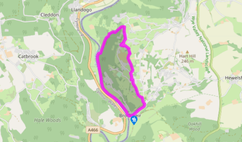
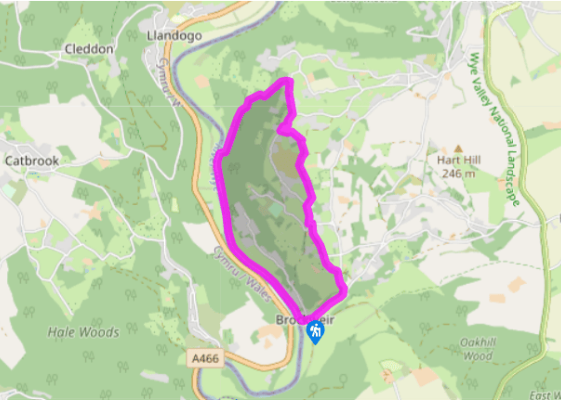
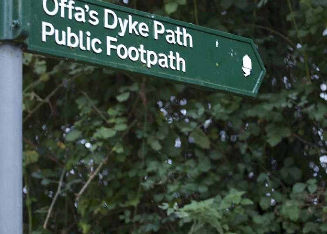
Walk uphill out of Brockweir until you reach a junction on your left, signposted ‘Coldharbour’. Turn left along this narrow lane for about 200yds (183m). At a bend beside Rock Farm turn left onto a track, marked ‘Offa’s Dyke Path’, which narrows and climbs to a lane.
Cross this and continue your ascent to reach another lane. Turn left here and follow the lane for 200yds (183m) to pass a cottage on the right, followed by some ruined stone buildings. Turn right along a lane.
Keep to the right of Chapel Cottage onto a path, still ascending. Further up, still on the path, keep left at a waymarked junction. Continue to climb until it brings you to another track. Turn left again.
After 50yds (46m), before a gate, fork right to a metal kissing gate into a field. Cross the field to a similar gate, to the left of a house. In the next field stay to the left of a farm and come to a third kissing gate at a lane. Turn right to climb gently. It levels out and then, where it starts to climb again at a corner, turn left onto the right-hand track, heading towards Oak Cottage (handpainted sign). Descend until you arrive at a lane with a gate on the left.
Turn left here to follow a track that descends to a house called Meg’s Folly. Continue down, to the right of the house, alongside its garden boundary, ignoring a signposted path after 25yds (23m). After a further 250yds (229m) this time fork right to take the signposted path, descending more steeply. In 80yds (73m), at a low wooden marker post, turn left. This waymarked path now zig-zags down beside slabbed dry-stone walls. Keep an eye out for loose pebbles among the forest debris on the path. Eventually the path straightens and steepens, and you reach the edge of the woods and another metal kissing gate. Beyond it flows the River Wye, which is tidal here.
Turn left through the metal kissing gate and follow the river back to Brockweir. As you approach the village keep close to the river to enter a path that will bring you onto a lane leading up to the road at Brockweir Bridge. Turn left to return to the start.
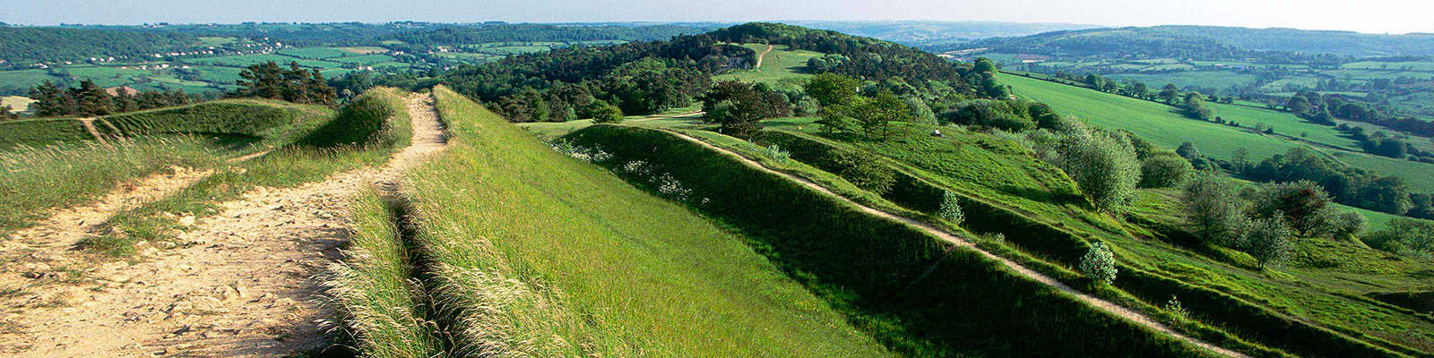
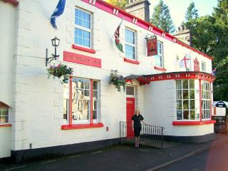
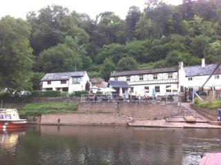
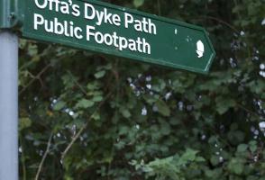
Offa’s Dyke is a massive earthwork constructed by King Offa, the ruler of the Saxon kingdom of Mercia, in the 8th century ad. The dyke represented the western frontier of his kingdom and ran for about 170 miles (274km) from Chepstow in the south (near the confluence of the Wye and the Severn) to... Prestatyn in the north. Its basic construction consisted of a bank of earth, 20ft (6.1m) high and 8ft (2.4m) wide, with a ditch at the foot of its western flank. Even today the frontier between Wales and England runs largely along the course of the dyke. (On this stretch of it the River Wye forms the precise modern boundary between Gloucestershire and Monmouthshire.) The construction of the dyke was felt to be necessary at a time when, after the Romans decamped and the Angles and Saxons invaded, Britain was divided into a number of warring kingdoms. Among these Mercia finally became pre-eminent in England, but the Celtic Britons clung tenaciously to their western mountains. Under Offa, Mercia absorbed other kingdoms and its king became de facto ruler of the English in England. It is not thought that the dyke was conceived as a fortification – it was rather a means of definitively marking the boundary between Mercia and its neighbouring kingdoms. Nor was it the first such structure of its kind. Other Saxon rulers had defined their kingdoms in a similar fashion, but none had done so on the scale undertaken by Offa. It is an impressive achievement for its time. The Offa’s Dyke Path, opened in 1971, is more or less the same length as the dyke itself but only rarely do the two coincide precisely. Brockweir was once the most important port of the River Wye. Together with the River Severn, the River Wye was the main trade route serving the Forest of Dean. Timber, iron and coal from the Forest were brought to Brockweir, loaded at the wharf and shipped downstream to Chepstow. A horse-drawn tram that brought the goods from the mines also served the port. Brockweir became a centre of shipbuilding. All of this came to an end with the arrival of the railway in the late 19th century.
Gloucestershire is home to a variety of landscapes, including the Cotswolds, a region of gentle hills, valleys and gem-like villages that roll through the county. To their west is the Severn Plain, watered by Britain’s longest river and characterised by orchards and farms marked out by hedgerows that blaze with mayflower in the spring; beyond the Severn are the Forest of Dean and the Wye Valley.
Walk uphill out of Brockweir until you reach a junction on your left, signposted ‘Coldharbour’. Turn left along this narrow lane for about 200yds (183m). At a bend beside Rock Farm turn left onto a track, marked ‘Offa’s Dyke Path’, which narrows and climbs to a lane.
1 of 6
Cross this and continue your ascent to reach another lane. Turn left here and follow the lane for 200yds (183m) to pass a cottage on the right, followed by some ruined stone buildings. Turn right along a lane.
2 of 6
Keep to the right of Chapel Cottage onto a path, still ascending. Further up, still on the path, keep left at a waymarked junction. Continue to climb until it brings you to another track. Turn left again.
3 of 6
After 50yds (46m), before a gate, fork right to a metal kissing gate into a field. Cross the field to a similar gate, to the left of a house. In the next field stay to the left of a farm and come to a third kissing gate at a lane. Turn right to climb gently. It levels out and then, where it starts to climb again at a corner, turn left onto the right-hand track, heading towards Oak Cottage (handpainted sign). Descend until you arrive at a lane with a gate on the left.
4 of 6
Turn left here to follow a track that descends to a house called Meg’s Folly. Continue down, to the right of the house, alongside its garden boundary, ignoring a signposted path after 25yds (23m). After a further 250yds (229m) this time fork right to take the signposted path, descending more steeply. In 80yds (73m), at a low wooden marker post, turn left. This waymarked path now zig-zags down beside slabbed dry-stone walls. Keep an eye out for loose pebbles among the forest debris on the path. Eventually the path straightens and steepens, and you reach the edge of the woods and another metal kissing gate. Beyond it flows the River Wye, which is tidal here.
5 of 6
Turn left through the metal kissing gate and follow the river back to Brockweir. As you approach the village keep close to the river to enter a path that will bring you onto a lane leading up to the road at Brockweir Bridge. Turn left to return to the start.
Offa’s Dyke is a massive earthwork constructed by King Offa, the ruler of the Saxon kingdom of Mercia, in the 8th century ad. The dyke represented the western frontier of his kingdom and ran for about 170 miles (274km) from Chepstow in the south (near the confluence of the Wye and the Severn) to... Prestatyn in the north. Its basic construction consisted of a bank of earth, 20ft (6.1m) high and 8ft (2.4m) wide, with a ditch at the foot of its western flank. Even today the frontier between Wales and England runs largely along the course of the dyke. (On this stretch of it the River Wye forms the precise modern boundary between Gloucestershire and Monmouthshire.) The construction of the dyke was felt to be necessary at a time when, after the Romans decamped and the Angles and Saxons invaded, Britain was divided into a number of warring kingdoms. Among these Mercia finally became pre-eminent in England, but the Celtic Britons clung tenaciously to their western mountains. Under Offa, Mercia absorbed other kingdoms and its king became de facto ruler of the English in England. It is not thought that the dyke was conceived as a fortification – it was rather a means of definitively marking the boundary between Mercia and its neighbouring kingdoms. Nor was it the first such structure of its kind. Other Saxon rulers had defined their kingdoms in a similar fashion, but none had done so on the scale undertaken by Offa. It is an impressive achievement for its time. The Offa’s Dyke Path, opened in 1971, is more or less the same length as the dyke itself but only rarely do the two coincide precisely. Brockweir was once the most important port of the River Wye. Together with the River Severn, the River Wye was the main trade route serving the Forest of Dean. Timber, iron and coal from the Forest were brought to Brockweir, loaded at the wharf and shipped downstream to Chepstow. A horse-drawn tram that brought the goods from the mines also served the port. Brockweir became a centre of shipbuilding. All of this came to an end with the arrival of the railway in the late 19th century.
Gloucestershire is home to a variety of landscapes, including the Cotswolds, a region of gentle hills, valleys and gem-like villages that roll through the county. To their west is the Severn Plain, watered by Britain’s longest river and characterised by orchards and farms marked out by hedgerows that blaze with mayflower in the spring; beyond the Severn are the Forest of Dean and the Wye Valley.