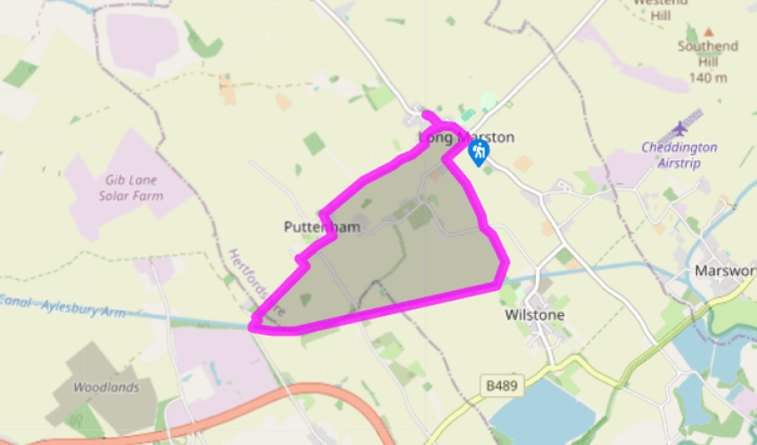
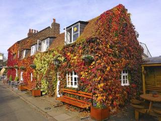
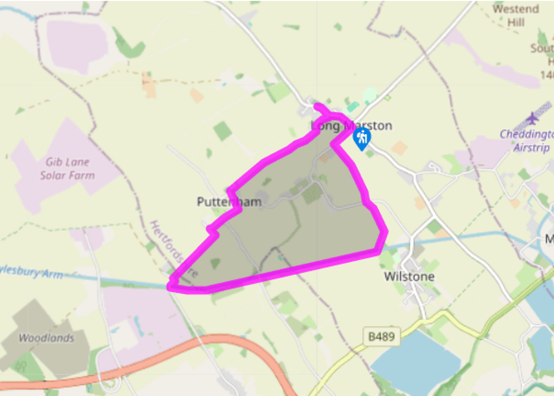
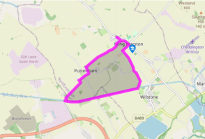
From the crossroads by The Queen's Head pub walk north along Station Road, which curves past the War Memorial opposite. Continue past the war memorial cross to visit the Victorian Church of All Saints. Return to the war memorial. Now turn right, down Chapel Lane, towards the medieval tower of the old church, set amid trees beyond the thatched Old Church Cottage.
Opposite, go through a hand gate by a five-bar gate and walk diagonally across the field to a hand gate. Cross a track and go through another hand gate to walk along the right-hand side of a stream and hedge and continue ahead through several fields. In winter head for the tower of Puttenham church in the distance, using it as a directional landmark. Go through a kissing gate, enter a triangular field and, near its end, go left over a footbridge, turn right to another one and, once over this, walk across pasture to Puttenham church.
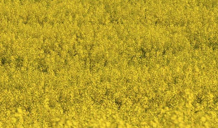
Follow the lane, past the Cecilia Hall, to a road junction. Turn right to walk along the road, but where it turns left, carry straight on, past Rectory Stables. At some modern farm cottages go left through a kissing gate by a footpath sign to follow the hedge south then west, around two sides of a field. Go through a kissing gate and through another field – the next hedge and kissing gate is the Buckinghamshire county boundary. Crossing another path and over a stile, the path passes alongside some corrugated iron sheds to another stile. When you reach a track, head for the canal bridge beyond its 10-ton limit signs. At this point you will see a vast group of gleaming new industrial buildings to the south. These are the Arla dairies, completed in 2013 and capable of producing a staggering billion litres of milk per year.
Walk over bridge No 8, then descend left to the canal tow path. Follow this as it passes under bridge No 7 and past two locks to bridge No 5.
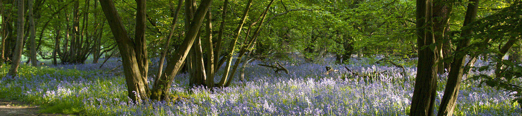
Leave the tow path and cross bridge No 5. Go through a hand gate bear right to follow the left-hand side of a hedge and stream. Follow the path through several fields, then cross a lane and head north along a green lane, ignoring a kissing gate to the left. Follow the scrubby green lane beside a stream, cross a footbridge and go through a kissing gate. Emerge from the scrub via a gated footbridge. Continue ahead across a cultivated field, leaving it via another gated footbridge. Cross another field to a kissing gate and continue ahead alongside a hedge, then a hedged path to the road. Turn right into Astrope Lane to walk back into Long Marston.
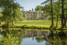
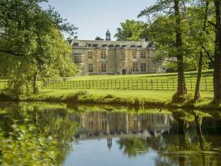
Around Tring there is a curious projection of Hertfordshire into the heart of Buckinghamshire. Now thinly populated it was mostly within the parish of Tring, with only Puttenham as an independent parish. It must have been the Anglo Saxon administrative area assigned to Tring township. Tiscott and... Ardwick, in the far north of the projection, beyond Long Marston, were medieval villages that have vanished. Up the spine of this salient is the Wingrave road from Tring that leads to more thinly populated country over the Buckinghamshire border. Long Marston The two villages on this walk are a complete contrast. Puttenham is little more than a hamlet while Long Marston straggles along the Wingrave road for 0.5 miles (800m). The core of Long Marston was west along Church Lane. Although the manor house has gone, the tower of the original parish church remains within its churchyard. This is the story of a church that moved. The tower is the surviving fragment of the medieval All Saints Church. The partly Norman and later medieval church was built on a site that had became so saturated and unstable that it was downright dangerous. Its last event was a wedding in April 1882 at which only the priest, the happy couple and the witnesses were allowed in. It had been a chapel of ease to St Peter and St Paul in Tring, and only became a separate parish in 1867. All but the tower was pulled down in 1883. A new church, built on the Wingrave road in the cemetery, opened in 1870. The old churchyard had been closed in 1866 for health reasons – the mind boggles! Much of the material from the old church was reused in the new church, but its north nave arcade came from Tring Church, which was also undergoing restoration at the time. Re-used parts include the 14th-century font, the Jacobean pulpit and various windows of the north aisle. Ironically, the gault clay under the new church proved just as unstable: major structural repairs were needed by 1907. Perhaps wisely, the great tower that had been planned was never built. Puttenham Across the fields St Mary's Church, Puttenham, survives intact. Surrounded as it is by sheep-cropped pastures, it is a picture of Midland tranquillity. The church's striking 15th-century battlemented tower was built in a chequer pattern of flint and stone. Attached to it is a short, three-bay nave with a superb, 15th-century roof. This has figures of saints and angels supporting the cross beams and heraldic bosses. The interior is flooded with light and there are also a couple of fragments of medieval stained glass.
As Hertfordshire is so close to London, many of its towns have become commuter havens. St Albans, less than 19 miles (30km) from the capital, has retained its distinctive character, along with many historic remains.
From the crossroads by The Queen's Head pub walk north along Station Road, which curves past the War Memorial opposite. Continue past the war memorial cross to visit the Victorian Church of All Saints. Return to the war memorial. Now turn right, down Chapel Lane, towards the medieval tower of the old church, set amid trees beyond the thatched Old Church Cottage.
1 of 5
Opposite, go through a hand gate by a five-bar gate and walk diagonally across the field to a hand gate. Cross a track and go through another hand gate to walk along the right-hand side of a stream and hedge and continue ahead through several fields. In winter head for the tower of Puttenham church in the distance, using it as a directional landmark. Go through a kissing gate, enter a triangular field and, near its end, go left over a footbridge, turn right to another one and, once over this, walk across pasture to Puttenham church.
2 of 5
Follow the lane, past the Cecilia Hall, to a road junction. Turn right to walk along the road, but where it turns left, carry straight on, past Rectory Stables. At some modern farm cottages go left through a kissing gate by a footpath sign to follow the hedge south then west, around two sides of a field. Go through a kissing gate and through another field – the next hedge and kissing gate is the Buckinghamshire county boundary. Crossing another path and over a stile, the path passes alongside some corrugated iron sheds to another stile. When you reach a track, head for the canal bridge beyond its 10-ton limit signs. At this point you will see a vast group of gleaming new industrial buildings to the south. These are the Arla dairies, completed in 2013 and capable of producing a staggering billion litres of milk per year.
3 of 5
Walk over bridge No 8, then descend left to the canal tow path. Follow this as it passes under bridge No 7 and past two locks to bridge No 5.
4 of 5
Leave the tow path and cross bridge No 5. Go through a hand gate bear right to follow the left-hand side of a hedge and stream. Follow the path through several fields, then cross a lane and head north along a green lane, ignoring a kissing gate to the left. Follow the scrubby green lane beside a stream, cross a footbridge and go through a kissing gate. Emerge from the scrub via a gated footbridge. Continue ahead across a cultivated field, leaving it via another gated footbridge. Cross another field to a kissing gate and continue ahead alongside a hedge, then a hedged path to the road. Turn right into Astrope Lane to walk back into Long Marston.
Around Tring there is a curious projection of Hertfordshire into the heart of Buckinghamshire. Now thinly populated it was mostly within the parish of Tring, with only Puttenham as an independent parish. It must have been the Anglo Saxon administrative area assigned to Tring township. Tiscott and... Ardwick, in the far north of the projection, beyond Long Marston, were medieval villages that have vanished. Up the spine of this salient is the Wingrave road from Tring that leads to more thinly populated country over the Buckinghamshire border. Long Marston The two villages on this walk are a complete contrast. Puttenham is little more than a hamlet while Long Marston straggles along the Wingrave road for 0.5 miles (800m). The core of Long Marston was west along Church Lane. Although the manor house has gone, the tower of the original parish church remains within its churchyard. This is the story of a church that moved. The tower is the surviving fragment of the medieval All Saints Church. The partly Norman and later medieval church was built on a site that had became so saturated and unstable that it was downright dangerous. Its last event was a wedding in April 1882 at which only the priest, the happy couple and the witnesses were allowed in. It had been a chapel of ease to St Peter and St Paul in Tring, and only became a separate parish in 1867. All but the tower was pulled down in 1883. A new church, built on the Wingrave road in the cemetery, opened in 1870. The old churchyard had been closed in 1866 for health reasons – the mind boggles! Much of the material from the old church was reused in the new church, but its north nave arcade came from Tring Church, which was also undergoing restoration at the time. Re-used parts include the 14th-century font, the Jacobean pulpit and various windows of the north aisle. Ironically, the gault clay under the new church proved just as unstable: major structural repairs were needed by 1907. Perhaps wisely, the great tower that had been planned was never built. Puttenham Across the fields St Mary's Church, Puttenham, survives intact. Surrounded as it is by sheep-cropped pastures, it is a picture of Midland tranquillity. The church's striking 15th-century battlemented tower was built in a chequer pattern of flint and stone. Attached to it is a short, three-bay nave with a superb, 15th-century roof. This has figures of saints and angels supporting the cross beams and heraldic bosses. The interior is flooded with light and there are also a couple of fragments of medieval stained glass.
As Hertfordshire is so close to London, many of its towns have become commuter havens. St Albans, less than 19 miles (30km) from the capital, has retained its distinctive character, along with many historic remains.