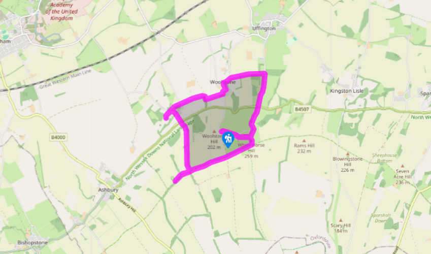
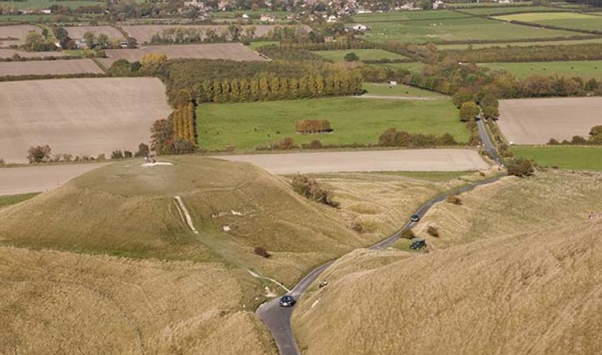
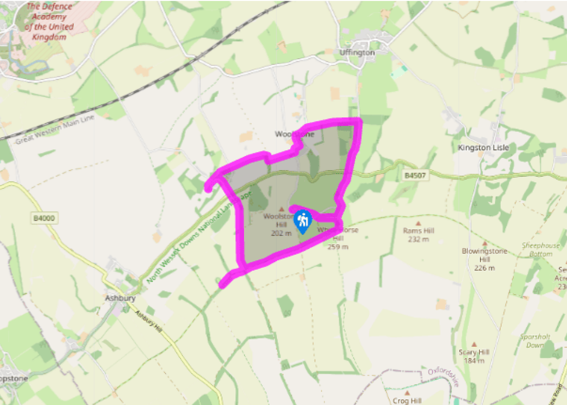
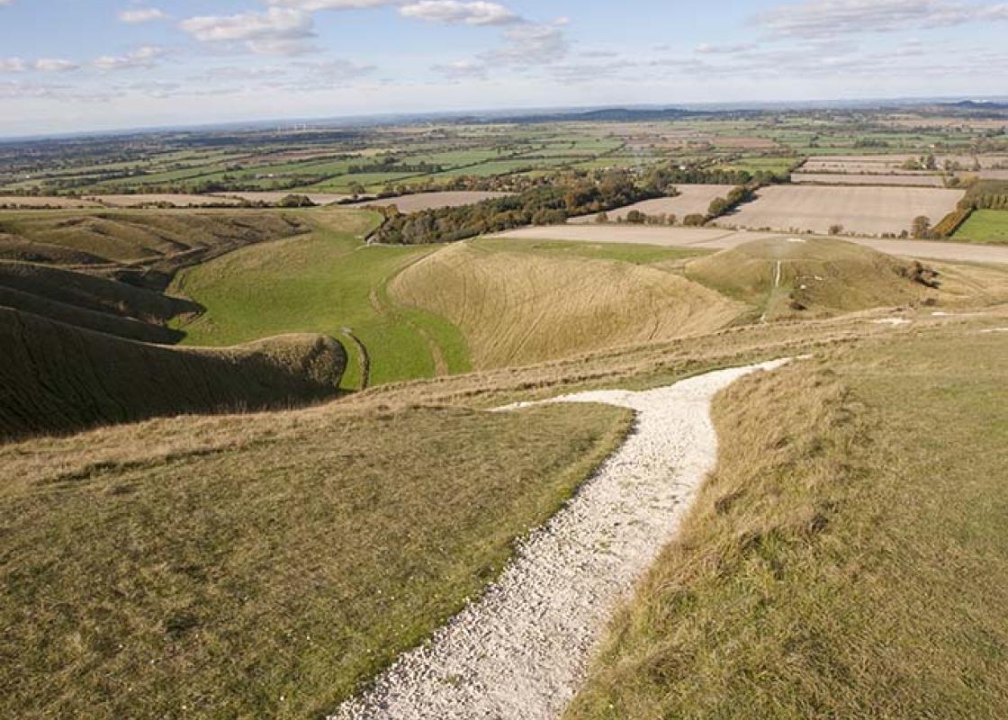
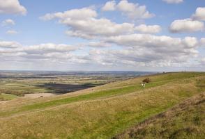
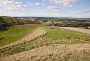
From the car park go through any gate to follow the outline of the grassy path along the lower slopes towards the hill. Make for a gate and cross the lane to join a bridleway. Make sure to keep left at the fork, by a bridleway waymark, and walk along to the head of Uffington’s galloping White Horse.
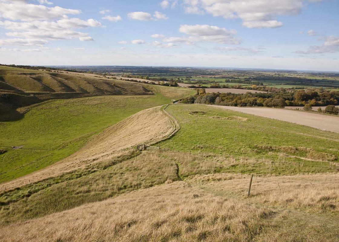
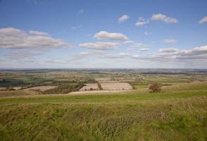
Descend steeply on the path to the tarmac access road, keeping the chalk figure on your left. If you prefer to avoid the dramatic descent, retrace your steps to the lane, turn right and continue down to the junction with the B4507. Cross over and take the road towards Uffington, continue past Sower Hill Farm Stables turning left at the path signposted to Woolstone. Go through a gate and keep the hedge on your right. Go ahead, briefly through woods, and continue straight ahead across two fields, with hedges on the left. Keep ahead with the hedgerow on your left to reach a gate.
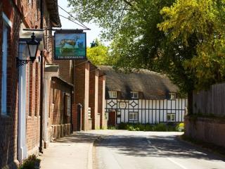
Go through a kissing gate, turn left at the road and walk through the village of Woolstone. Turn left by the White Horse Inn and follow the road to All Saints’ Church. At its metal kissing gate, veer right across the churchyard to a gate. Cross a paddock to a further gate. Turn left up the road for less than 100yds (91m) and turn right at the footpath sign over a stile. Walk for 0.25 mile (400m) with a hedge on your left side, across three fields (and two stiles), to a stile. Cross this, turn right and walk through the trees for about 150yds (137m), looking for a concealed footbridge on your left. Cross the footbridge and broken stile to a field and go straight on along the field edge to a stile. Aim ahead, across a further stile, to a thatched cottage. As you pass the cottage to your left you will reach a stile to a road.
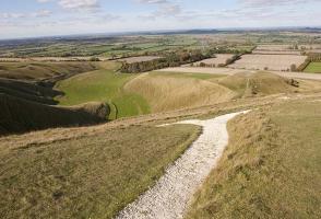
Cross the road and follow the D’Arcy Dalton Way, signposted through a gate on the opposite side. Cross a stile into woodland, then a stile into a paddock then veer left, ascending slightly. Keep straight ahead and go through a gate to join a rough track to the road by the village sign for Compton Beauchamp. Cross over and take the drive to the church, next to the manor. Retrace your steps to the sign and walk up to meet the junction with the B4507. Cross over and climb quite steeply to the Ridgeway.
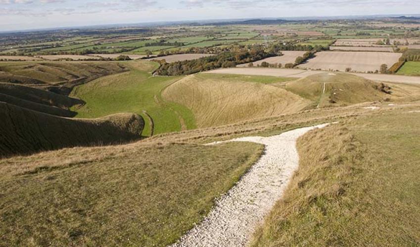
Turn right for 550yds (503m) if you wish to visit Wayland’s Smithy (see While You’re There). Otherwise, turn left and stride out for a long mile (1.6km), resisting a path into the Uffington Castle fort. At the highest point on the track, about 50yds (46m) beyond a track junction, turn left. Go to the trig pillar, then swing left (visiting the fort first) and descend to rejoin the outward track, back to the car park.
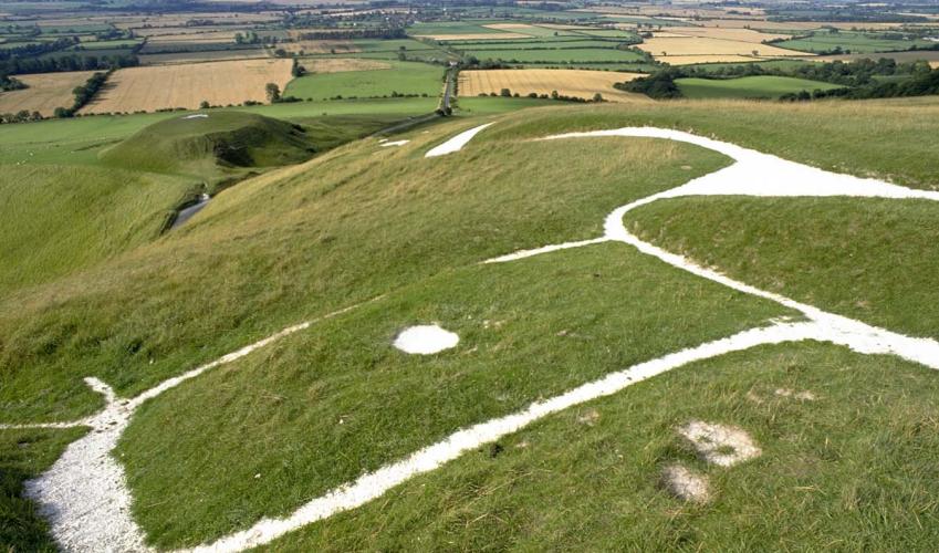
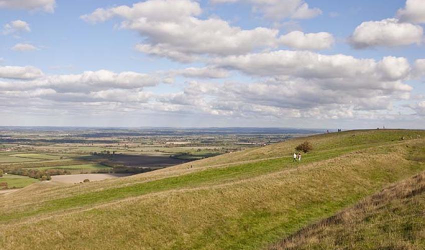
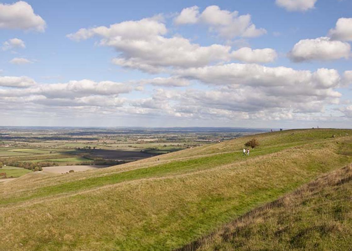
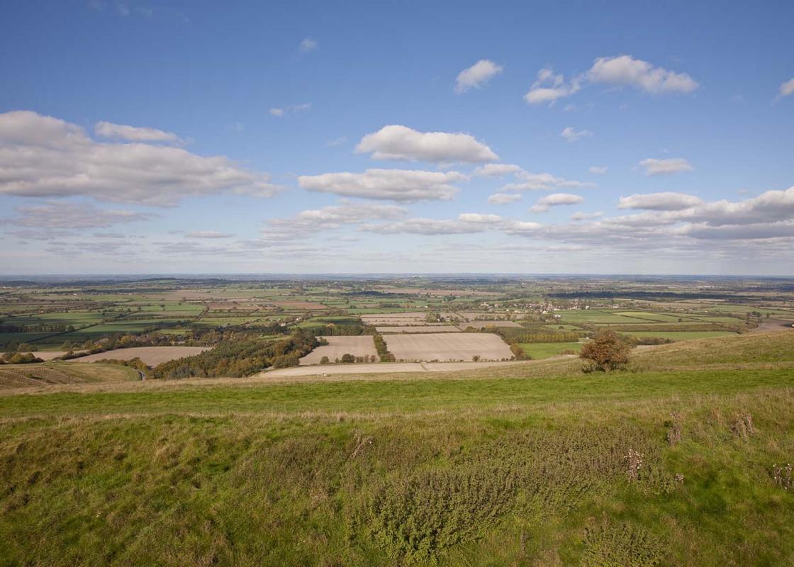
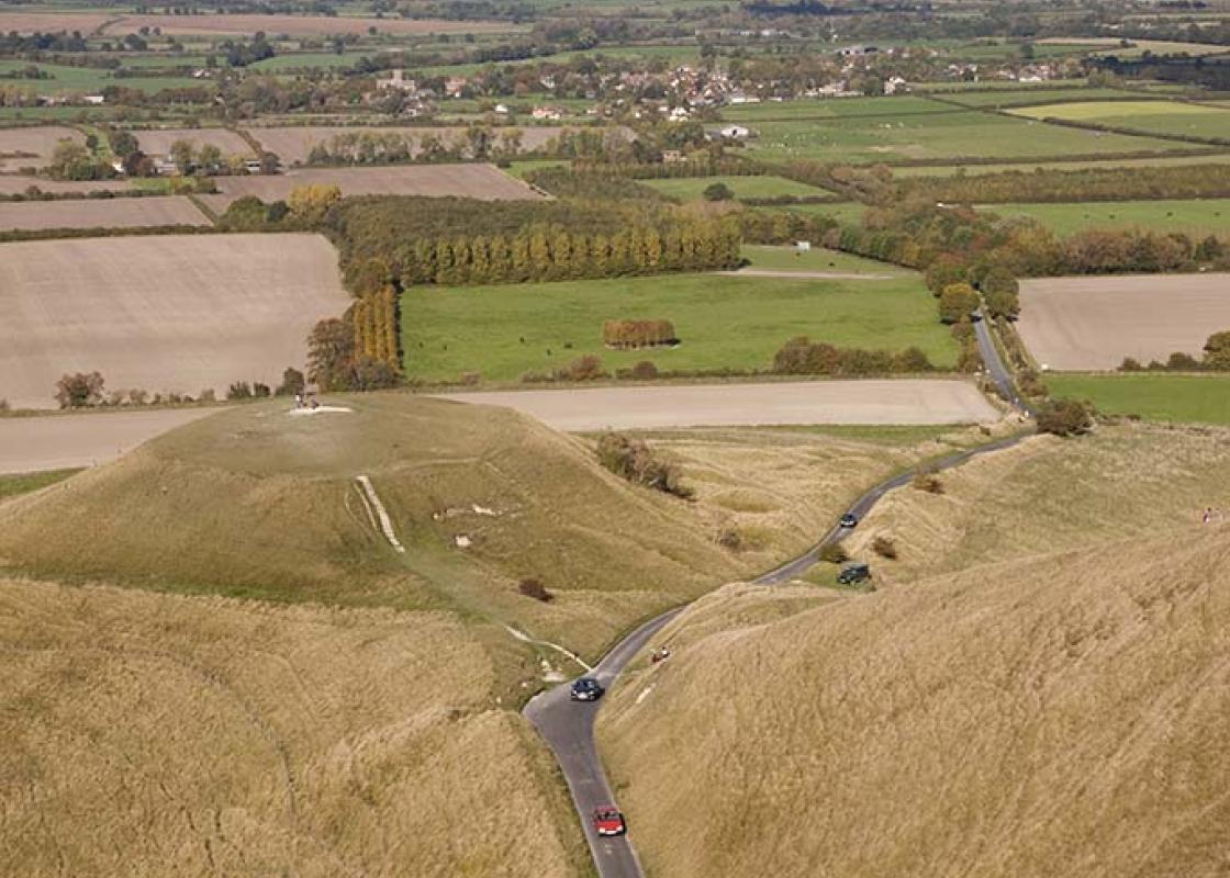
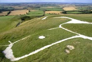
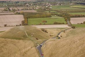
High above the Oxfordshire countryside stands the chalk figure of a galloping horse. Shrouded in the mists of the past, this noted 856ft (261m) high landmark, 365ft (111m) long and 130ft (40m) tall, represents one of Britain’s most famous antiquities. The best time to see the horse is early on a... summer’s day or during the week in the middle of winter, when the crowds and the cars are scarce. It is then that the Uffington White Horse exudes its own peculiar air of mystery. Regarded as far and away the most beautiful of all the British chalk hill figures, the horse is formed from a chalk-filled trench and, contrary to popular belief, not etched into the natural chalk. Its design is stylised, with an elegant, slender body and a distinctive beaked jaw similar to those displayed on early Iron Age coins. There have been countless theories over the years as to its age and exact purpose. A medieval document records it as one of the wonders of Britain, along with Stonehenge, while some sources suggest it was cut some time during the 1st century ad. Others claim it was established to celebrate King Alfred’s victory over the Danes at the Battle of Ashdown in ad 871. In more recent times, the age of the horse has been scientifically pinpointed by a series of archaeological digs and analysis of soil samples, indicating that it dates back almost 3,000 years, to the late Bronze Age or early Iron Age. The horse is not clearly appreciated other than from the air or from some distance away – which gives credence to the theory that the White Horse may have acted as a tribal banner or badge for the inhabitants of the Vale of White Horse below. What does it symbolise and why was this particular site chosen? There are no conclusive answers. Certainly the White Horse is closely associated with mythology. One legend claims that the figure is St George’s steed and that the flat-topped chalk outcrop below, known as Dragon Hill, is where St George slew the beast. A bare patch on the summit is supposed to mark where the dragon’s blood was spilt. The Uffington White Horse has also attracted its fair share of literary figures. G K Chesterton (1874–1936), creator of the fictional detective priest Father Brown, wrote about it in his Ballad of the White Horse, and Thomas Hughes (1822–96), who was born in Uffington, described the custom of scouring the horse, clearing it of grass and weeds, in The Scouring of the White Horse. It was Hughes who helped revive the tradition, which at one time attracted as many as 30,000 volunteers.
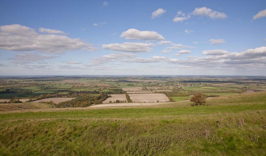
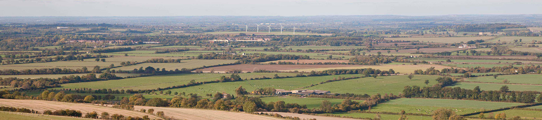
Located at the heart of England, Oxfordshire enjoys a rich heritage and varied scenery, with Oxford’s elegant streets a highlight for visitors. The landscape encompasses open chalk downland, picturesque rivers and attractive villages, while northwest of Oxfordshire is home to the sleepy backwaters of Abingdon, Wallingford, Wantage, Watlington and Witney that reveal how Oxfordshire’s old towns evolved over the centuries.
From the car park go through any gate to follow the outline of the grassy path along the lower slopes towards the hill. Make for a gate and cross the lane to join a bridleway. Make sure to keep left at the fork, by a bridleway waymark, and walk along to the head of Uffington’s galloping White Horse.
1 of 5
Descend steeply on the path to the tarmac access road, keeping the chalk figure on your left. If you prefer to avoid the dramatic descent, retrace your steps to the lane, turn right and continue down to the junction with the B4507. Cross over and take the road towards Uffington, continue past Sower Hill Farm Stables turning left at the path signposted to Woolstone. Go through a gate and keep the hedge on your right. Go ahead, briefly through woods, and continue straight ahead across two fields, with hedges on the left. Keep ahead with the hedgerow on your left to reach a gate.
2 of 5
Go through a kissing gate, turn left at the road and walk through the village of Woolstone. Turn left by the White Horse Inn and follow the road to All Saints’ Church. At its metal kissing gate, veer right across the churchyard to a gate. Cross a paddock to a further gate. Turn left up the road for less than 100yds (91m) and turn right at the footpath sign over a stile. Walk for 0.25 mile (400m) with a hedge on your left side, across three fields (and two stiles), to a stile. Cross this, turn right and walk through the trees for about 150yds (137m), looking for a concealed footbridge on your left. Cross the footbridge and broken stile to a field and go straight on along the field edge to a stile. Aim ahead, across a further stile, to a thatched cottage. As you pass the cottage to your left you will reach a stile to a road.
3 of 5
Cross the road and follow the D’Arcy Dalton Way, signposted through a gate on the opposite side. Cross a stile into woodland, then a stile into a paddock then veer left, ascending slightly. Keep straight ahead and go through a gate to join a rough track to the road by the village sign for Compton Beauchamp. Cross over and take the drive to the church, next to the manor. Retrace your steps to the sign and walk up to meet the junction with the B4507. Cross over and climb quite steeply to the Ridgeway.
4 of 5
Turn right for 550yds (503m) if you wish to visit Wayland’s Smithy (see While You’re There). Otherwise, turn left and stride out for a long mile (1.6km), resisting a path into the Uffington Castle fort. At the highest point on the track, about 50yds (46m) beyond a track junction, turn left. Go to the trig pillar, then swing left (visiting the fort first) and descend to rejoin the outward track, back to the car park.
High above the Oxfordshire countryside stands the chalk figure of a galloping horse. Shrouded in the mists of the past, this noted 856ft (261m) high landmark, 365ft (111m) long and 130ft (40m) tall, represents one of Britain’s most famous antiquities. The best time to see the horse is early on a... summer’s day or during the week in the middle of winter, when the crowds and the cars are scarce. It is then that the Uffington White Horse exudes its own peculiar air of mystery. Regarded as far and away the most beautiful of all the British chalk hill figures, the horse is formed from a chalk-filled trench and, contrary to popular belief, not etched into the natural chalk. Its design is stylised, with an elegant, slender body and a distinctive beaked jaw similar to those displayed on early Iron Age coins. There have been countless theories over the years as to its age and exact purpose. A medieval document records it as one of the wonders of Britain, along with Stonehenge, while some sources suggest it was cut some time during the 1st century ad. Others claim it was established to celebrate King Alfred’s victory over the Danes at the Battle of Ashdown in ad 871. In more recent times, the age of the horse has been scientifically pinpointed by a series of archaeological digs and analysis of soil samples, indicating that it dates back almost 3,000 years, to the late Bronze Age or early Iron Age. The horse is not clearly appreciated other than from the air or from some distance away – which gives credence to the theory that the White Horse may have acted as a tribal banner or badge for the inhabitants of the Vale of White Horse below. What does it symbolise and why was this particular site chosen? There are no conclusive answers. Certainly the White Horse is closely associated with mythology. One legend claims that the figure is St George’s steed and that the flat-topped chalk outcrop below, known as Dragon Hill, is where St George slew the beast. A bare patch on the summit is supposed to mark where the dragon’s blood was spilt. The Uffington White Horse has also attracted its fair share of literary figures. G K Chesterton (1874–1936), creator of the fictional detective priest Father Brown, wrote about it in his Ballad of the White Horse, and Thomas Hughes (1822–96), who was born in Uffington, described the custom of scouring the horse, clearing it of grass and weeds, in The Scouring of the White Horse. It was Hughes who helped revive the tradition, which at one time attracted as many as 30,000 volunteers.
Located at the heart of England, Oxfordshire enjoys a rich heritage and varied scenery, with Oxford’s elegant streets a highlight for visitors. The landscape encompasses open chalk downland, picturesque rivers and attractive villages, while northwest of Oxfordshire is home to the sleepy backwaters of Abingdon, Wallingford, Wantage, Watlington and Witney that reveal how Oxfordshire’s old towns evolved over the centuries.