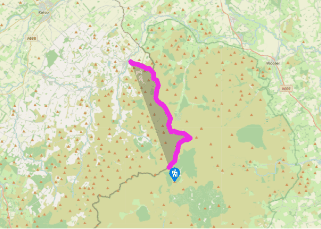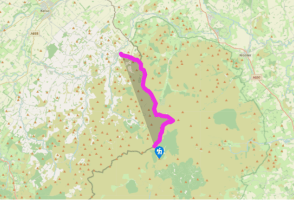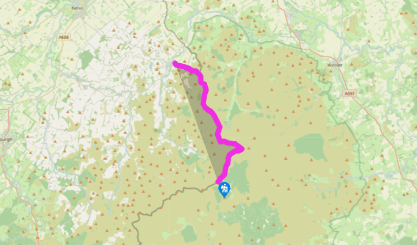
Pennine Way: Clennell Street to Kirk Yetholm
The walk starts from the highest point on the cross-border drove road called Clennell Street. This can be reached from the nearest road at Cocklawfoot, which is 2.2 miles (3.5km) to the northeast, or from the nearest village, Alwinton, which is 7.6 miles (12.2km) to the south. An area that is often shrouded in mist, route-finding is made easier by the almost constant presence of a fence. The route first follows the border fence along a broad ridge – Butt Roads – crossed via flagstones. It then rises to King’s Seat, where there is nothing but a triangulation point and wide acres of windswept heather. The ridge on the English side drops away to Usway Burn (pronounced Oozy or Uzzy). Several small streams drain the ridge eastwards, including Murder Cleugh and the Inner Hare Cleugh, where Black Rory the Highlander established one of his illicit stills 200 years ago.
Above King’s Seat there is a long pull northeastwards, by Green Gair and Cockersike Head, and although the ground is boggy the route is mainly by stone flagged path. As the route climbs even more steeply towards Cairn Hill there is a tumble of rocks on the brow to the right called the Hanging Stone; another place of ill-repute which marked the boundary between the Middle and East Marches.

Been on this walk?
Send us photos or a comment about this route. Or recommend a route of your own.

Walking in Safety
Read our tips to look after yourself and the environment when following this walk.

Get an AA guide
Explore our range of ‘50 Walks in’ guides - they’re the ideal companion for a ramble.
Been on this walk?
Send us photos or a comment about this route. Or recommend a route of your own.
Walking in Safety
Read our tips to look after yourself and the environment when following this walk.
Get an AA guide
Explore our range of ‘50 Walks in’ guides - they’re the ideal companion for a ramble.
Nearby places to stay
View all (8)