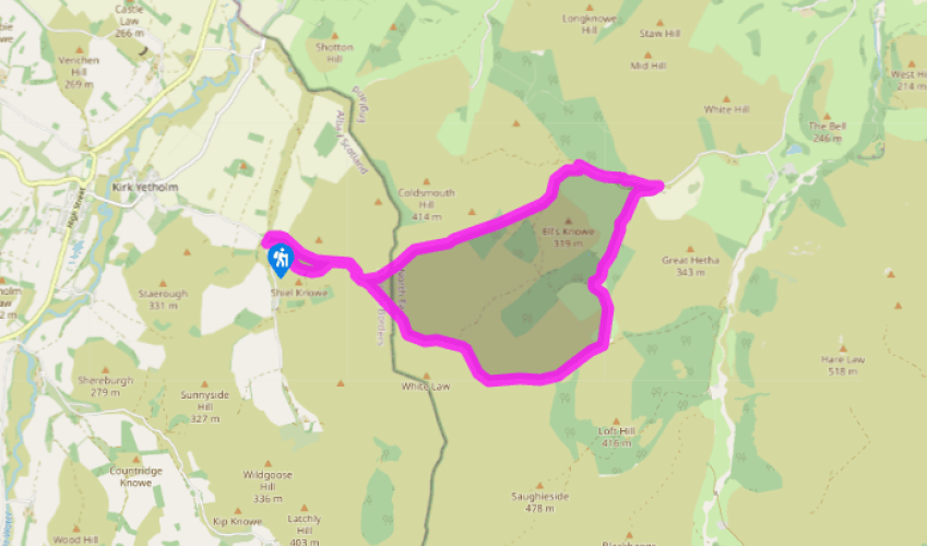
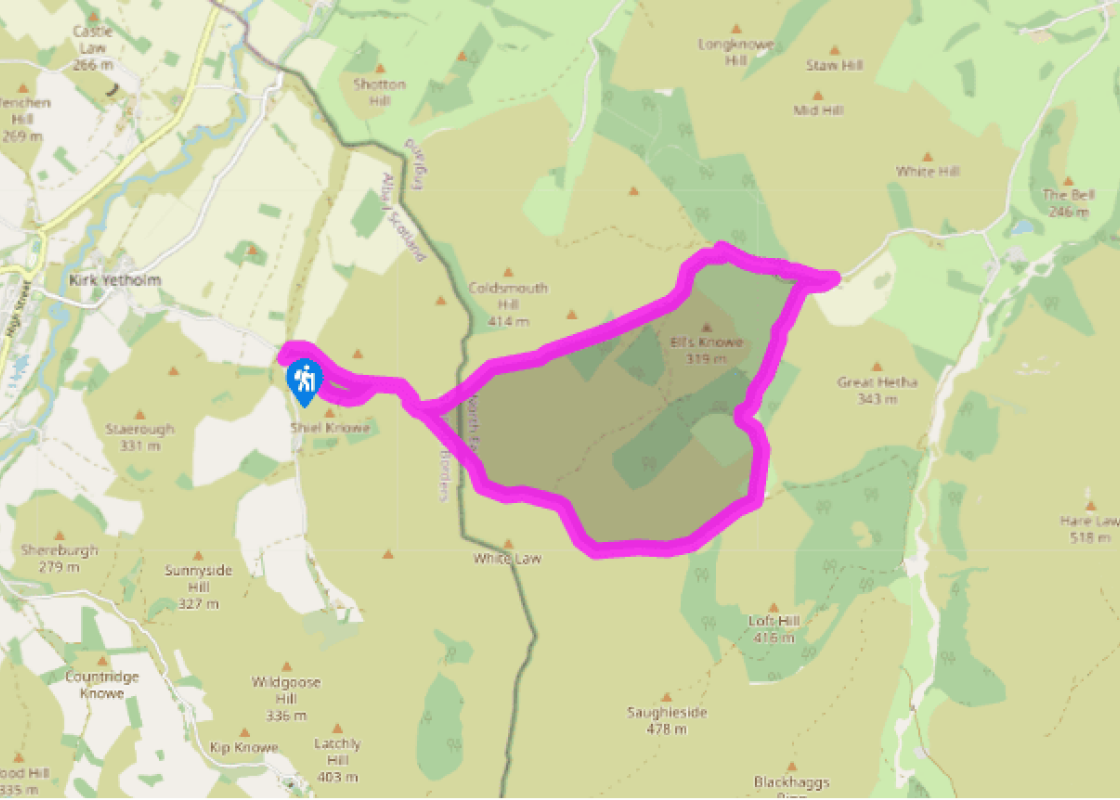
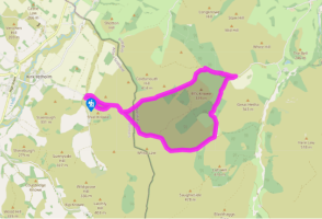
From the car park cross the burn by the footbridge, following the signs to St Cuthbert's Way. Bear right to follow the obvious track uphill, keeping the Shielknowe Burn below on your left. Eventually the track crosses the burn, then continues uphill, skirting the edge of Green Humbleton hill and eventually reaching a fingerpost.
This is the place where St Cuthbert's Way splits from the Pennine Way. Take the grassy path on the left to follow St Cuthbert's Way. Continue following this path as it winds uphill, then takes you to a fingerpost by a wall, which marks the border between Scotland and England.
Follow the path slantwise over the ridgeline ahead, then straight down into the valley beyond. At the valley floor, cross the right-hand stream to the near corner of a plantation. Cross a stile into the forest, where the path keeps near the foot of the trees, then joins the fence alongside the stream, before bearing slightly right into more open forest of pine. You'll soon walk down an avenue of trees and leave the wood by another stile.
Keep ahead across the field. From the gate at its far side a track starts that crosses a small stream, heads briefly uphill, then winds downs to reach Elsdonburn farm. Turn left between the farm buildings and follow the track as it bends round to the right. It becomes a tarred lane, with a conifer wood on its left and the burn on its right.
Follow this tarred track across a cattle grid to a signpost. Here you leave St Cuthbert's Way to take the tarred track on the right signed 'Trowupburn'. Follow this, passing a sheepfold and then a conifer plantation. The track eventually winds upwards, skirts a hill, then descends to Trowupburn farmhouse. Continue to walk past the farm buildings, then bear right to a fingerpost.
Go through the gate here and follow the sign 'Border Ridge 1.5'. Walk along this wide grassy track, then cross the ford next to the very large sheepfold. Head upstream with the burn now on your right, then cross the burn again, nip over the stile and join the sheep track that bears left through the bracken.
Walk round the hill and, when you are directly above a sheepfold on the left, bear right so that the Wide Open burn is on your left, the sheepfold behind you. Work your way uphill through the bracken to the head of the burn until you reach a fence on the higher ground.
Go through the gate at the corner and take the green path ahead across open ground. Walk around the head of a stream valley (the stream drops to the right) to the wall and fence marking the border with Scotland. Cross a stile and bear right to a Pennine Way fingerpost. Here, bear left and follow the green path and waymarkers downhill and past the fingerpost of St Cuthbert's Way, seen on the outward route. Keep ahead above the Shielknowe Burn, below and to your left, on a path leading down to the footbridge at the start.
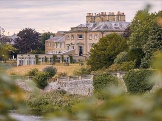
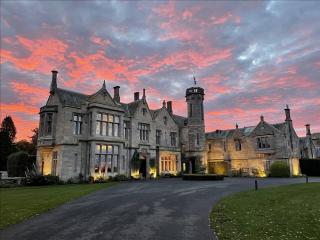
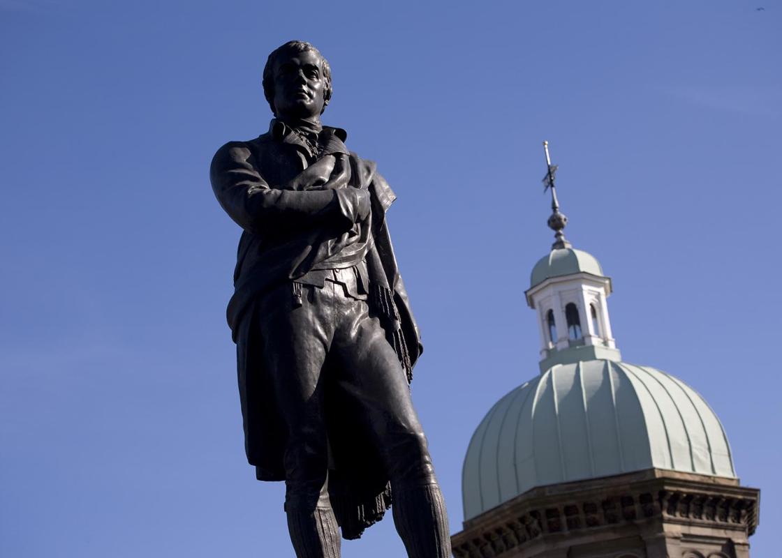
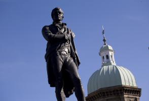
This is such a lovely walk that you'll want to do it again and again. It's easy to follow, the paths are good and the views have a definite 'wow' factor – so do try to save it for a clear day. The walk includes the added thrill of crossing the border from Scotland into England. The little village... of Kirk Yetholm was noted as a gypsy settlement from at least 1695, although they were probably there before that, as they were in Scotland by the early 16th century. Gypsies were often regarded with suspicion as they had a reputation for stealing and aggression – it was even said that they kidnapped children and brought them up as their own. However, they were also said to be loyal to those who helped them and never broke their word. A royal family home No one is quite sure how the gypsies came to settle in Kirk Yetholm, although many moved to the wild areas of the Borders where they could hide in the hills, after a law was passed in Scotland in 1609 making it legal to kill them. Some say that a young gypsy boy saved the life of a local laird, who showed his thanks by building several homes for gypsies in the village; others, that a gypsy boy helped a local laird to recover a horse that had been stolen and was rewarded with a house in Kirk Yetholm. There were several homes for gypsies in the village, with one cottage being specially built for the royal family – it's called the Gypsy Palace today. The gypsy royal family had the surname Faa. The first king in Kirk Yetholm was Patrick Faa, who married Jean Gordon. Jean was a powerful character who lived a wild life. Three of her sons were hanged for sheep stealing, and she was banned from Kirk Yetholm after attacking another woman. She was said to be the inspiration for Sir Walter Scott's character, Meg Merrilees. She was later immortalised by Keats in his eponymous poem that began: Old Meg she was a gypsy; and lived upon the moors: her bed it was the brown heath turf, and her house was out of doors. The last queen of the gypsies was Esther Faa-Blythe who once said the scattered village was 'sae mingle-mangle that ane micht think it was either built on a dark nicht, or sawn on a windy ane'. Her son, Charles Blythe, was crowned King in 1898 – but the gypsy way of life had gone by then. Today only the Palace remains – it's now a holiday cottage which can be rented.
Southern Scotland is often referred to as the Lowlands, to distinguish it from the mountainous grandeur of the North-West Highlands. But don’t be fooled by the description.
From the car park cross the burn by the footbridge, following the signs to St Cuthbert's Way. Bear right to follow the obvious track uphill, keeping the Shielknowe Burn below on your left. Eventually the track crosses the burn, then continues uphill, skirting the edge of Green Humbleton hill and eventually reaching a fingerpost.
1 of 8
This is the place where St Cuthbert's Way splits from the Pennine Way. Take the grassy path on the left to follow St Cuthbert's Way. Continue following this path as it winds uphill, then takes you to a fingerpost by a wall, which marks the border between Scotland and England.
2 of 8
Follow the path slantwise over the ridgeline ahead, then straight down into the valley beyond. At the valley floor, cross the right-hand stream to the near corner of a plantation. Cross a stile into the forest, where the path keeps near the foot of the trees, then joins the fence alongside the stream, before bearing slightly right into more open forest of pine. You'll soon walk down an avenue of trees and leave the wood by another stile.
3 of 8
Keep ahead across the field. From the gate at its far side a track starts that crosses a small stream, heads briefly uphill, then winds downs to reach Elsdonburn farm. Turn left between the farm buildings and follow the track as it bends round to the right. It becomes a tarred lane, with a conifer wood on its left and the burn on its right.
4 of 8
Follow this tarred track across a cattle grid to a signpost. Here you leave St Cuthbert's Way to take the tarred track on the right signed 'Trowupburn'. Follow this, passing a sheepfold and then a conifer plantation. The track eventually winds upwards, skirts a hill, then descends to Trowupburn farmhouse. Continue to walk past the farm buildings, then bear right to a fingerpost.
5 of 8
Go through the gate here and follow the sign 'Border Ridge 1.5'. Walk along this wide grassy track, then cross the ford next to the very large sheepfold. Head upstream with the burn now on your right, then cross the burn again, nip over the stile and join the sheep track that bears left through the bracken.
6 of 8
Walk round the hill and, when you are directly above a sheepfold on the left, bear right so that the Wide Open burn is on your left, the sheepfold behind you. Work your way uphill through the bracken to the head of the burn until you reach a fence on the higher ground.
7 of 8
Go through the gate at the corner and take the green path ahead across open ground. Walk around the head of a stream valley (the stream drops to the right) to the wall and fence marking the border with Scotland. Cross a stile and bear right to a Pennine Way fingerpost. Here, bear left and follow the green path and waymarkers downhill and past the fingerpost of St Cuthbert's Way, seen on the outward route. Keep ahead above the Shielknowe Burn, below and to your left, on a path leading down to the footbridge at the start.
This is such a lovely walk that you'll want to do it again and again. It's easy to follow, the paths are good and the views have a definite 'wow' factor – so do try to save it for a clear day. The walk includes the added thrill of crossing the border from Scotland into England. The little village... of Kirk Yetholm was noted as a gypsy settlement from at least 1695, although they were probably there before that, as they were in Scotland by the early 16th century. Gypsies were often regarded with suspicion as they had a reputation for stealing and aggression – it was even said that they kidnapped children and brought them up as their own. However, they were also said to be loyal to those who helped them and never broke their word. A royal family home No one is quite sure how the gypsies came to settle in Kirk Yetholm, although many moved to the wild areas of the Borders where they could hide in the hills, after a law was passed in Scotland in 1609 making it legal to kill them. Some say that a young gypsy boy saved the life of a local laird, who showed his thanks by building several homes for gypsies in the village; others, that a gypsy boy helped a local laird to recover a horse that had been stolen and was rewarded with a house in Kirk Yetholm. There were several homes for gypsies in the village, with one cottage being specially built for the royal family – it's called the Gypsy Palace today. The gypsy royal family had the surname Faa. The first king in Kirk Yetholm was Patrick Faa, who married Jean Gordon. Jean was a powerful character who lived a wild life. Three of her sons were hanged for sheep stealing, and she was banned from Kirk Yetholm after attacking another woman. She was said to be the inspiration for Sir Walter Scott's character, Meg Merrilees. She was later immortalised by Keats in his eponymous poem that began: Old Meg she was a gypsy; and lived upon the moors: her bed it was the brown heath turf, and her house was out of doors. The last queen of the gypsies was Esther Faa-Blythe who once said the scattered village was 'sae mingle-mangle that ane micht think it was either built on a dark nicht, or sawn on a windy ane'. Her son, Charles Blythe, was crowned King in 1898 – but the gypsy way of life had gone by then. Today only the Palace remains – it's now a holiday cottage which can be rented.
Southern Scotland is often referred to as the Lowlands, to distinguish it from the mountainous grandeur of the North-West Highlands. But don’t be fooled by the description.