Home>
Walks>
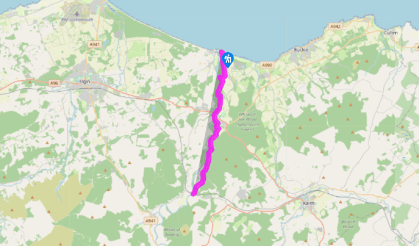
Speyside Way: Spey Bay to Boat o' Brig
Speyside Way: Spey Bay to Boat o' Brig
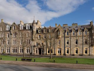
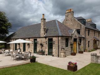
Recommended by
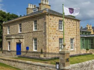
Our view
"Up Scotland's quickest river"
Walk directions
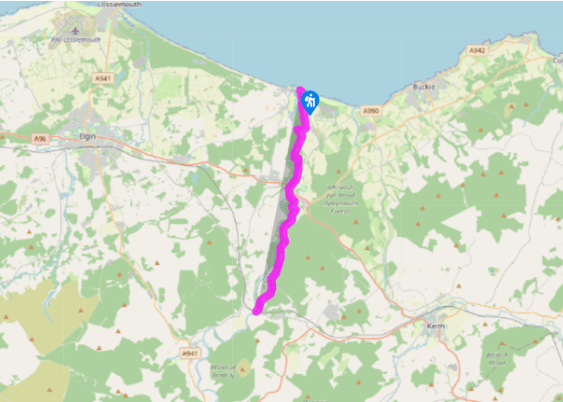
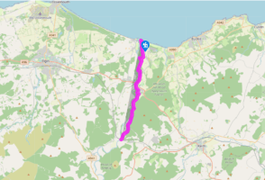
This section of the Speyside Way starts at the mouth of the river, at a car park beside the Dolphin Centre. Cross a footbridge to the riverside. The path soon runs along the outer edge of the wooded shingle alongside the river. It becomes a track leading south to a path junction close to the Garmouth Viaduct, a 0.25-mile (400m) construction glimpsed from the path.
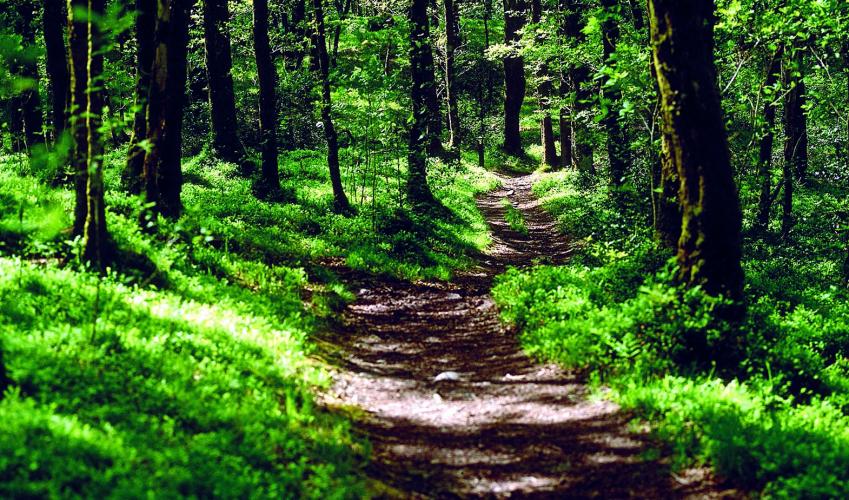
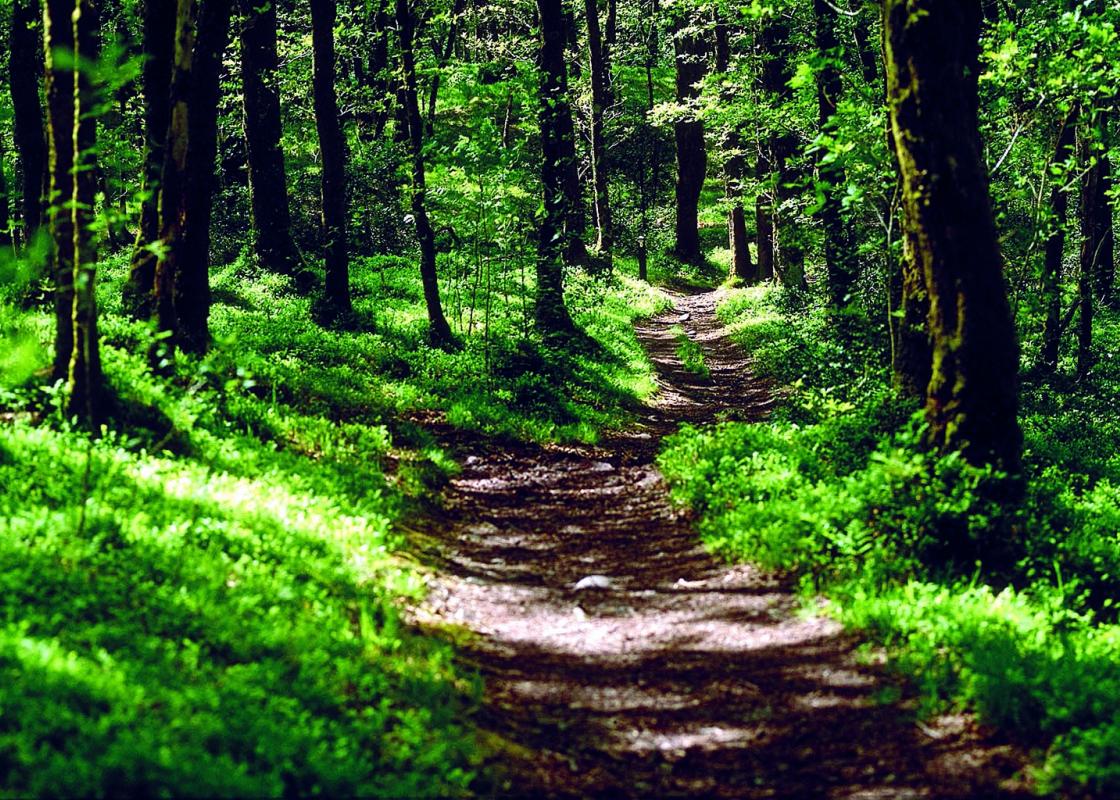
The path on the right would take you to the viaduct, and indeed crosses it to Garmouth (nearest bus stop, and a pub). The route itself continues ahead between fields, slightly away from the river. Opposite Bogmoor village it bends right, then turns left in a small wood. After more fields it reaches the start of a pine plantation next to the river.
The former path is blocked by a barrier as the riverbank ahead has eroded it away. The new route passes briefly to left of the plantation, then on forest tracks right through the middle of it. Finally after a vehicle barrier it turns right to the riverbank, and runs between the river and the B9104 for a mile (1.6km) to the outskirts of Fochabers. On the left here are the policies (estate) of Gordon Castle, former home of the Dukes of Richmond and Gordon, now luxury accommodation. Across the Spey here is the Baxters Highland Village.
The route passes under the A96 road into a pleasant riverside path. The Speyside Way does not actually pass through Fochabers, but it would be a pity to miss visiting the town, and a short diversion around it, including the Folk Museum, can easily be taken. Fochabers town has a good range of shops. From the riverside park, the two bridges crossing the Spey here can clearly be seen. The Speyside Way again turns away from the river to follow the Fochabers Burn. It crosses a bridge into West Street, and leaves the village past Milne’s High School. From here to Boat o’ Brig, it follows a minor road, providing very easy walking. There is rarely much in the way of traffic to trouble the walker.
At Aultderg (meaning ‘red stream’) a Forestry Commission car park, signed as 'Earth Pillars', has a path leading to a good viewpoint above the river, but for most of this section the Spey is out of sight as the road winds either through or alongside forest, high above the river plain. The road dips steeply and climbs again in zigzags. After a junction is passed, the road drops, gradually at first and then more steeply around a zig-zag of bends, to reach Delfur Lodge and Boat o’ Brig. Here there is a small Speyside Way car park beside the river.
Terrain
- Wide, smooth paths and tracks, minor road, no stiles
Landscape
- Woods and fields, occasionally on riverbank
Dog friendliness
- On lead in Fochabers
Parking
- Dolphin Centre, Fochabers north end, Ordiequish Forest, Aultdearg, Boat o' Brig
Toilets en route
- Fochabers Burn
About the walk
Tugnet Ice House is well worth a visit. It was built when the best way to store perishable food such as salmon from the Spey was to pack it between layers of ice and straw inside thick stone walls. It dates from 1830 and is now part of the Whale and Dolphin Conservation Society exhibition. Timber... River Across the river is Kingston, named by two entrepreneurs from Kingston-upon-Hull. In the 18th century they leased the large Glenmore Forest, between Aviemore and Grantown, from the Duke of Gordon, and floated pine logs in rafts down the Spey to this point. Much later, this historic timber traffic was used to establish the river as a right of navigation for canoeists! Some of the Glenmore timber was used for boatbuilding: there were seven shipyards between Kingston and Garmouth. The industry declined with the coming of iron-clad vessels, and no trace remains today. Barnett's Viaduct The Garmouth Viaduct was designed by Patrick Barnett and opened in 1886 to carry the Great North of Scotland Railway branch line from Elgin to Portgordon. Its great length and solid construction were necessary because of the power of the Spey, Scotland’s fastest-flowing river, its floods and its frequently shifting flow pattern through sandbanks. The viaduct has ornate castellated portals and is supported by huge piers which drop to 52ft (16m) below the river bed. Telford's Bridge Fochabers is a planned town, one of many in Scotland. In 1776, the 4th Duke of Gordon wished to enlarge his policies and castle. The village of Fochabers was in his way, so he engaged the architect John Baxter to lay out this new town. As is commonly the case, the basic street pattern is a gridiron and there is a handsome central square, which holds the fine Bellie Church. The history of the town is well told in the Folk Museum on the High Street. The town's original bridge is based on a design by the famous engineer Thomas Telford. Built in 1806, it was a victim of the great flood (the 'Muckle Spate') of 1829, when the river covered the whole of the surrounding area. An eyewitness account dramatically describes the bridge falling ‘with the cloud-like appearance of an avalanche’ and the river ‘rushing onwards, its thunderous roar proclaiming its victory, and not a vestige of the fallen fragments to be seen’. The bridge was rebuilt in the 1850s, but has now been supplanted by the modern road bridge alongside it.
This section of the Speyside Way starts at the mouth of the river, at a car park beside the Dolphin Centre. Cross a footbridge to the riverside. The path soon runs along the outer edge of the wooded shingle alongside the river. It becomes a track leading south to a path junction close to the Garmouth Viaduct, a 0.25-mile (400m) construction glimpsed from the path.
1 of 5
The path on the right would take you to the viaduct, and indeed crosses it to Garmouth (nearest bus stop, and a pub). The route itself continues ahead between fields, slightly away from the river. Opposite Bogmoor village it bends right, then turns left in a small wood. After more fields it reaches the start of a pine plantation next to the river.
2 of 5
The former path is blocked by a barrier as the riverbank ahead has eroded it away. The new route passes briefly to left of the plantation, then on forest tracks right through the middle of it. Finally after a vehicle barrier it turns right to the riverbank, and runs between the river and the B9104 for a mile (1.6km) to the outskirts of Fochabers. On the left here are the policies (estate) of Gordon Castle, former home of the Dukes of Richmond and Gordon, now luxury accommodation. Across the Spey here is the Baxters Highland Village.
3 of 5
The route passes under the A96 road into a pleasant riverside path. The Speyside Way does not actually pass through Fochabers, but it would be a pity to miss visiting the town, and a short diversion around it, including the Folk Museum, can easily be taken. Fochabers town has a good range of shops. From the riverside park, the two bridges crossing the Spey here can clearly be seen. The Speyside Way again turns away from the river to follow the Fochabers Burn. It crosses a bridge into West Street, and leaves the village past Milne’s High School. From here to Boat o’ Brig, it follows a minor road, providing very easy walking. There is rarely much in the way of traffic to trouble the walker.
4 of 5
At Aultderg (meaning ‘red stream’) a Forestry Commission car park, signed as 'Earth Pillars', has a path leading to a good viewpoint above the river, but for most of this section the Spey is out of sight as the road winds either through or alongside forest, high above the river plain. The road dips steeply and climbs again in zigzags. After a junction is passed, the road drops, gradually at first and then more steeply around a zig-zag of bends, to reach Delfur Lodge and Boat o’ Brig. Here there is a small Speyside Way car park beside the river.
Terrain
- Wide, smooth paths and tracks, minor road, no stiles
Landscape
- Woods and fields, occasionally on riverbank
Dog friendliness
- On lead in Fochabers
Parking
- Dolphin Centre, Fochabers north end, Ordiequish Forest, Aultdearg, Boat o' Brig
Toilets en route
- Fochabers Burn
About the walk
Tugnet Ice House is well worth a visit. It was built when the best way to store perishable food such as salmon from the Spey was to pack it between layers of ice and straw inside thick stone walls. It dates from 1830 and is now part of the Whale and Dolphin Conservation Society exhibition. Timber... River Across the river is Kingston, named by two entrepreneurs from Kingston-upon-Hull. In the 18th century they leased the large Glenmore Forest, between Aviemore and Grantown, from the Duke of Gordon, and floated pine logs in rafts down the Spey to this point. Much later, this historic timber traffic was used to establish the river as a right of navigation for canoeists! Some of the Glenmore timber was used for boatbuilding: there were seven shipyards between Kingston and Garmouth. The industry declined with the coming of iron-clad vessels, and no trace remains today. Barnett's Viaduct The Garmouth Viaduct was designed by Patrick Barnett and opened in 1886 to carry the Great North of Scotland Railway branch line from Elgin to Portgordon. Its great length and solid construction were necessary because of the power of the Spey, Scotland’s fastest-flowing river, its floods and its frequently shifting flow pattern through sandbanks. The viaduct has ornate castellated portals and is supported by huge piers which drop to 52ft (16m) below the river bed. Telford's Bridge Fochabers is a planned town, one of many in Scotland. In 1776, the 4th Duke of Gordon wished to enlarge his policies and castle. The village of Fochabers was in his way, so he engaged the architect John Baxter to lay out this new town. As is commonly the case, the basic street pattern is a gridiron and there is a handsome central square, which holds the fine Bellie Church. The history of the town is well told in the Folk Museum on the High Street. The town's original bridge is based on a design by the famous engineer Thomas Telford. Built in 1806, it was a victim of the great flood (the 'Muckle Spate') of 1829, when the river covered the whole of the surrounding area. An eyewitness account dramatically describes the bridge falling ‘with the cloud-like appearance of an avalanche’ and the river ‘rushing onwards, its thunderous roar proclaiming its victory, and not a vestige of the fallen fragments to be seen’. The bridge was rebuilt in the 1850s, but has now been supplanted by the modern road bridge alongside it.