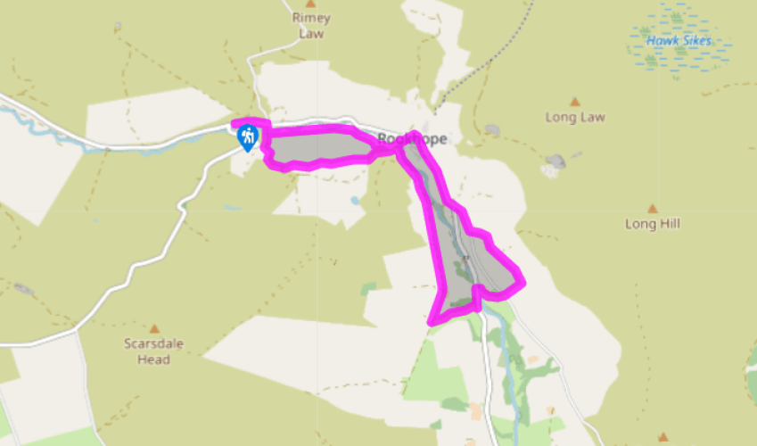
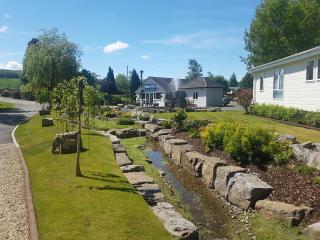
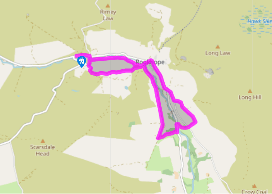
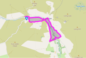
Walk towards Rookhope, leaving at a stile on the right opposite the Blanchland road. Cross a footbridge and climb past a white farmhouse. Swing left beside it and leave right along its drive to a track. Follow the track left. Go through gates and keep left and then right at successive forks to another white cottage (Lintzgarth).
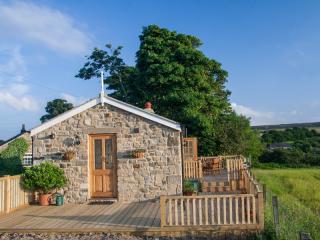
Just beyond, go left through a gate. Descend to the bottom-right field corner and strike across the hillside towards Broad Dale House. Exiting the third field over a stile in the corner, walk past the front of the house to a wooden stile (not a stone stile to the right). Bear left past a derelict cottage, dropping along a slanting trod towards Rookhope.
Over a ladder stile at the bottom, go forward then turn right past an auto-workshop. Ignoring branches off left, follow the ongoing track, the bed of an old railway, for 0.75 miles (1.2km) to Smailsburn Farm. The track rises beyond along an embankment towards the corner of a plantation.
At a junction below the trees, turn off left. Head away paralleling the right-hand wall across rough pasture, a vague trod leading to a ruined building. Continue downhill, mounting a stile at the bottom onto a lane. Go left, leaving just after a small lay-by over a ladder stile on the right. Drop to a footbridge spanning the river, cross a stile and bear right up the opposite hillside. Passing through an old hedge, swing left and climb to a stile onto another lane.
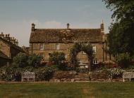
Cross to a kissing gate diagonally opposite and head up beside the right-hand wall. In the next field, curve left towards a gate into Pasture House Farm. Walk ahead between the buildings and leave through another gate.
Following power posts, carry on across the field towards the next farm, Chestergarth House. Walk behind the buildings on a track to adjacent gates at the far end. Take the small left-hand one and continue past a large barn. Angle downfield to a kissing gate in the far-bottom corner to meet a lane. Go right and then keep right at a junction into Rookhope.
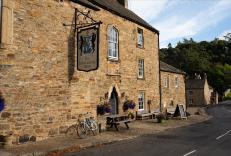
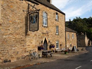
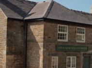
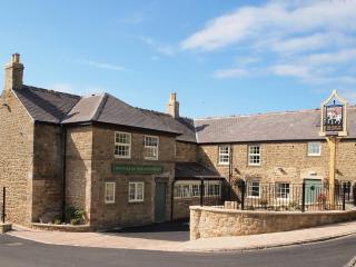
Wind past the Rookhope Inn and over a bridge before turning off left beside a Weardale Way signpost. Follow the track over Rookhope Burn into the yard by the auto-workshop. Now turn right on a signed footpath, following the course of an old railway upstream. Continue past cottages, eventually reaching a stile by the footbridge below Lintzgarth. Cross and turn right to return to the lay-by.
Rookhope – its name means ‘valley of the rooks’ – is today a small, remote Weardale village, but it has a long and fascinating history. By 1153, when King Stephen granted a licence to mine for lead and iron, it was known as Rykhup. In the 14th century the local farmers combined agriculture with... searching out the lead on the stream banks. The Rookhope farmers were generally free from the cattle raids that plagued their counterparts further north, but a famous raid of 1569 into Weardale ended with the raiders cornered in the Rookhope Valley, where a pitched battle resulted in victory for the Weardale men. Their exploits were recorded in the 24-verse ballad Rookhope Ryde. A bustling town Rookhope in the 19th century was a great contrast to the rest of its history. Under the influence of the Blackett family, the Weardale Iron Company, and then the Weardale Lead Company, Rookhope became a bustling, noisy, industrial town, dedicated to winning minerals out of the ground in the surrounding hills. In its heyday its population approached 1,000, with ten shops, several churches and chapels, an Institute and generous-sized sports fields. The mine owners maintained a paternal but benevolent eye on their workforce. There were still mines operating in the Rookhope area into the 1990s, mainly for fluorspar. There are still many reminders of Rookhope’s industrial past in the area – and the most expressive is the great arch near the start of the walk. It is the only surviving fragment of a row of six such arches that carried the 2-mile (3.2km) flue, known as Rookhope Chimney, from the smelt works at Lintzgarth across the valley. After crossing the river, the flue ran for 1 mile (1.6km) underground and 0.5 miles (800m) up the hillside. Its purpose was to cool the gases from the smelting floor, in which there was much vaporised lead. The lead was deposited on the walls of the flue, and was either scraped off or washed away with water flowing along the tunnel into special ‘fume tanks’. The car park is the site of one of them.
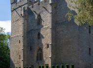
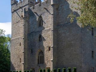
If the Prince-Bishops of Durham had set out to make their cathedral the greatest tourist attraction in the northeast, they could not have done better. In a sense, that is exactly what they did set out to do.
Walk towards Rookhope, leaving at a stile on the right opposite the Blanchland road. Cross a footbridge and climb past a white farmhouse. Swing left beside it and leave right along its drive to a track. Follow the track left. Go through gates and keep left and then right at successive forks to another white cottage (Lintzgarth).
1 of 7
Just beyond, go left through a gate. Descend to the bottom-right field corner and strike across the hillside towards Broad Dale House. Exiting the third field over a stile in the corner, walk past the front of the house to a wooden stile (not a stone stile to the right). Bear left past a derelict cottage, dropping along a slanting trod towards Rookhope.
2 of 7
Over a ladder stile at the bottom, go forward then turn right past an auto-workshop. Ignoring branches off left, follow the ongoing track, the bed of an old railway, for 0.75 miles (1.2km) to Smailsburn Farm. The track rises beyond along an embankment towards the corner of a plantation.
3 of 7
At a junction below the trees, turn off left. Head away paralleling the right-hand wall across rough pasture, a vague trod leading to a ruined building. Continue downhill, mounting a stile at the bottom onto a lane. Go left, leaving just after a small lay-by over a ladder stile on the right. Drop to a footbridge spanning the river, cross a stile and bear right up the opposite hillside. Passing through an old hedge, swing left and climb to a stile onto another lane.
4 of 7
Cross to a kissing gate diagonally opposite and head up beside the right-hand wall. In the next field, curve left towards a gate into Pasture House Farm. Walk ahead between the buildings and leave through another gate.
5 of 7
Following power posts, carry on across the field towards the next farm, Chestergarth House. Walk behind the buildings on a track to adjacent gates at the far end. Take the small left-hand one and continue past a large barn. Angle downfield to a kissing gate in the far-bottom corner to meet a lane. Go right and then keep right at a junction into Rookhope.
6 of 7
Wind past the Rookhope Inn and over a bridge before turning off left beside a Weardale Way signpost. Follow the track over Rookhope Burn into the yard by the auto-workshop. Now turn right on a signed footpath, following the course of an old railway upstream. Continue past cottages, eventually reaching a stile by the footbridge below Lintzgarth. Cross and turn right to return to the lay-by.
Rookhope – its name means ‘valley of the rooks’ – is today a small, remote Weardale village, but it has a long and fascinating history. By 1153, when King Stephen granted a licence to mine for lead and iron, it was known as Rykhup. In the 14th century the local farmers combined agriculture with... searching out the lead on the stream banks. The Rookhope farmers were generally free from the cattle raids that plagued their counterparts further north, but a famous raid of 1569 into Weardale ended with the raiders cornered in the Rookhope Valley, where a pitched battle resulted in victory for the Weardale men. Their exploits were recorded in the 24-verse ballad Rookhope Ryde. A bustling town Rookhope in the 19th century was a great contrast to the rest of its history. Under the influence of the Blackett family, the Weardale Iron Company, and then the Weardale Lead Company, Rookhope became a bustling, noisy, industrial town, dedicated to winning minerals out of the ground in the surrounding hills. In its heyday its population approached 1,000, with ten shops, several churches and chapels, an Institute and generous-sized sports fields. The mine owners maintained a paternal but benevolent eye on their workforce. There were still mines operating in the Rookhope area into the 1990s, mainly for fluorspar. There are still many reminders of Rookhope’s industrial past in the area – and the most expressive is the great arch near the start of the walk. It is the only surviving fragment of a row of six such arches that carried the 2-mile (3.2km) flue, known as Rookhope Chimney, from the smelt works at Lintzgarth across the valley. After crossing the river, the flue ran for 1 mile (1.6km) underground and 0.5 miles (800m) up the hillside. Its purpose was to cool the gases from the smelting floor, in which there was much vaporised lead. The lead was deposited on the walls of the flue, and was either scraped off or washed away with water flowing along the tunnel into special ‘fume tanks’. The car park is the site of one of them.
If the Prince-Bishops of Durham had set out to make their cathedral the greatest tourist attraction in the northeast, they could not have done better. In a sense, that is exactly what they did set out to do.