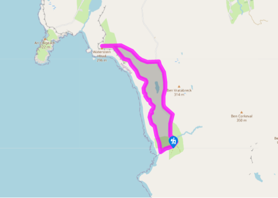
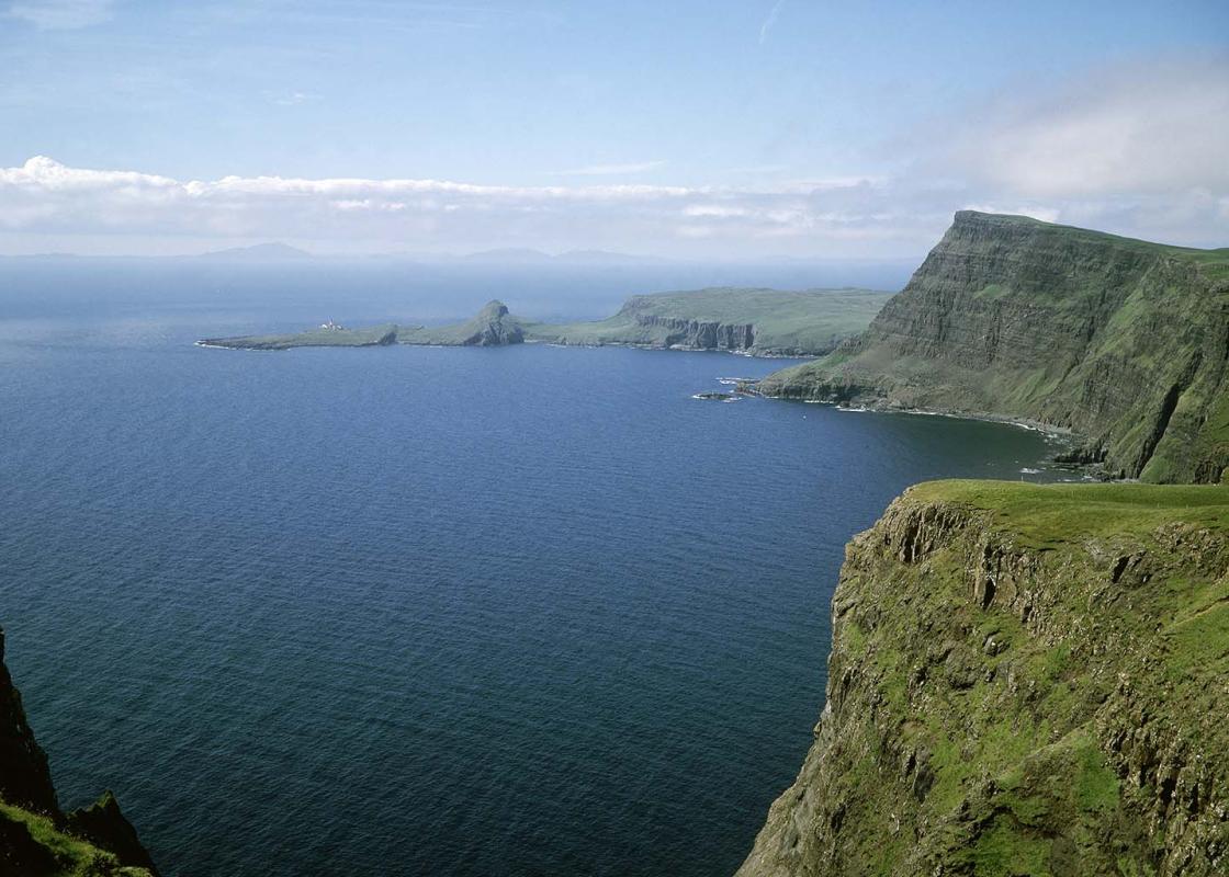
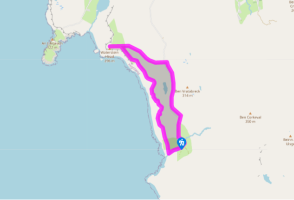
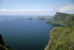
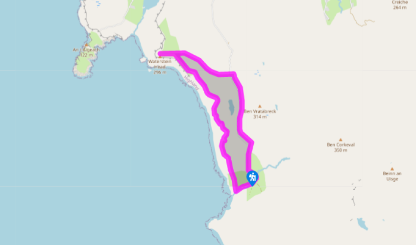
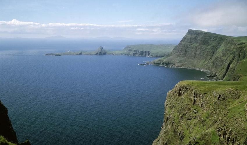
Waterstein Head

Recommended by
Our view
"Through crofting country and peat moors to a 1,000ft (305m) sea cliff."
Walk directions

From the end of the tarmac, the road continues as a track, with a bridge over the Ramasaig Burn. After a gate it reaches a shed with a tin roof. Turn right and follow the left bank of Ramasaig Burn to the shore.

Cross the burn at a ford and head up a very steep meadow beside the fence that protects the cliff edge. There's a rather awkward fence to cross half-way up. At the top, above Ramasaig Cliff, keep following the fence on the left. It cuts across to the right to protect a notch in the cliff edge. From here, you could cut down to the parking areas at the nearby road pass.

View all directions
Location
Additional information
  Terrain  - Grassy clifftops and moorland, 2 fences and 1 gate to climb over
  Landscape  - Cliff tops high above Atlantic Ocean
  Dog friendliness  - On short lead - risk of scaring sheep over cliff edges
  Parking  - Ramasaig road end or pull-ins at pass 0.75 miles (1.2km) north
  Toilets en route  - Glendale village hall
About the walk
After the defeat of Bonnie Prince Charlie's uprising in 1746, the clan system was swept away. But the clansmen were still there, transformed into crofters. Elsewhere, such subsistence smallholders go by the honourable name of 'peasant farmers', with 25 acres (10ha), a kailyard, a cow and some sheep...
Read more
Been on this walk placeholder

Been on this walk?

Send us photos or a comment about this route. Or recommend a route of your own.

Walking in Safety placeholder

Walking in Safety

Read our tips to look after yourself and the environment when following this walk.

Get an AA guide placeholder

Get an AA guide

Explore our range of ‘50 Walks in’ guides - they’re the ideal companion for a ramble.

About the area
Apart from the Orkneys and the Shetlands, Highland is Scotland’s northernmost county. Probably its most famous feature is the mysterious and evocative Loch Ness, allegedly home to an ancient monster that has embedded itself in the world’s modern mythology, and the region’s tourist industry.
Area image

Waterstein Head

Recommended by
Our view
"Through crofting country and peat moors to a 1,000ft (305m) sea cliff."
Location
Nearest postcode:
Additional information
  Terrain - Grassy clifftops and moorland, 2 fences and 1 gate to climb over
  Landscape - Cliff tops high above Atlantic Ocean
  Dog friendliness - On short lead - risk of scaring sheep over cliff edges
  Parking - Ramasaig road end or pull-ins at pass 0.75 miles (1.2km) north
  Toilets en route - Glendale village hall
About the walk
After the defeat of Bonnie Prince Charlie's uprising in 1746, the clan system was swept away. But the clansmen were still there, transformed into crofters. Elsewhere, such subsistence smallholders go by the honourable name of 'peasant farmers', with 25 acres (10ha), a kailyard, a cow and some sheep...
Read more
Been on this walk placeholder

Been on this walk?

Send us photos or a comment about this route. Or recommend a route of your own.

Walking in Safety placeholder

Walking in Safety

Read our tips to look after yourself and the environment when following this walk.

Get an AA guide placeholder

Get an AA guide

Explore our range of ‘50 Walks in’ guides - they’re the ideal companion for a ramble.

About the area
Area image
Highland
Apart from the Orkneys and the Shetlands, Highland is Scotland’s northernmost county. Probably its most famous feature is the mysterious and evocative Loch Ness, allegedly home to an ancient monster that has embedded itself in the world’s modern mythology, and the region’s tourist industry.