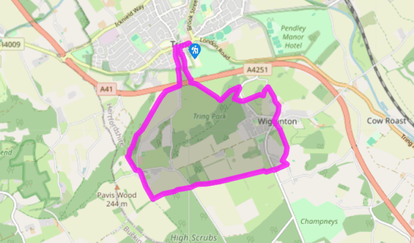
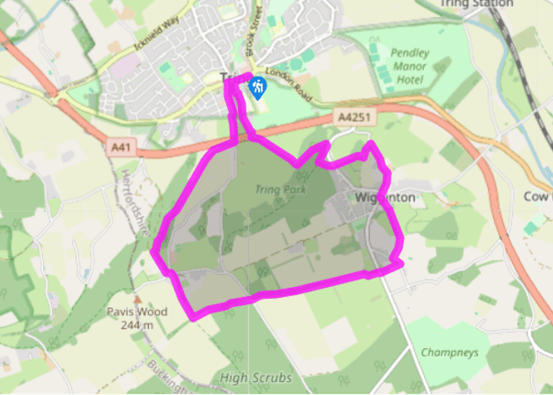
Walk along the High Street from the car park, passing the church, to turn left at the crossroads down Akeman Street to the Natural History Museum at Tring. At Park Street turn right, then go left, up Hastoe Lane, to climb out of Tring and under the A41 bypass.
Just beyond the bridge turn right at a footpath sign, 'Stubbing's Wood', and go through a kissing gate. Beyond the A41 cutting, you bear left to climb the ridge, with a hedge on your left. On reaching Stubbing's Wood, follow its edge initially, then enter it, keeping left. At a path fork bear right – the route is marked by arrows on trees. Keep right at a fork. Pass a footpath sign, 'Shire Lane Pavis Wood', then descend to a sunken way and turn left along it. Climb towards a gateway and out of the woodland. Continue along a metalled lane. At the junction turn left, briefly on to the Ridgeway National Trail along Gadmore Lane. Leaving the Trail at a crossroads, turn right on to Browns Lane, a metalled bridleway.
Turn left at a footpath crossroads on to the Chiltern Way. Follow Grim's Ditch, with its bank and ditch sometimes impressive and sometimes barely discernible. Cross a lane and continue ahead, Grim's Ditch now on your right. After about 1.25 miles (2km) on the Chiltern Way, the path bears right, then left through a kissing gate. Continue ahead to go through a kissing gate on to Chesham Road.
Turn right at the road, then left through a kissing gate, still on the Chiltern Way. When you reach a lane turn left. At a substation turn right. The Chiltern Way veers right but here you leave it, instead following the left-hand hedge, to a field gate and a waymarker post. Cross a dry valley – the church belfry is visible opposite. At the hedge line and through a kissing gate, head diagonally left into pasture. Go through a kissing gate and turn right on to Chesham Road and continue to Wigginton Church.
From the church head north along the Twist, winding downhill as far as the Ridgeway National Trail signs. Turn left through a hand gate to follow this Trail, crossing a road to just beyond a pair of Rothschild estate cottages (Ladderstile and Westwood cottages). Go straight on, into the woods of Tring Park.
At a cross path where the Ridgeway turns left, turn right to the Temple, or Summer Pavilion. Head west to the Obelisk. Still in woodland, continue ahead downhill to a kissing gate. Bear right here into superb cattle-grazed, 18th-century parkland, to head for a footbridge over the A41. Cross the bridge and follow the footpath back into Tring – the route is clear, near the town being mainly between high walls – emerging on the High Street.
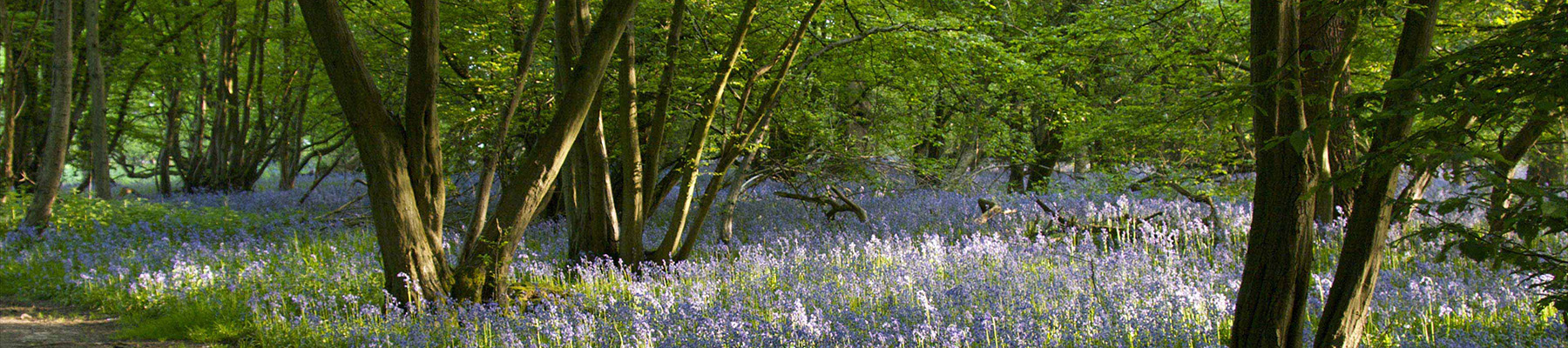
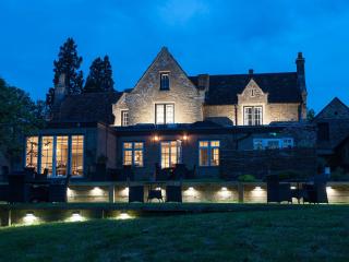
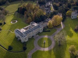
The remarkable historic parkland of Tring Park is the centrepiece of this walk. Even though construction of the A41 Tring bypass in 1974 cut it in two, many of the features shown on a 1729 map of the park have survived. The house on the north side of the bypass dates from the late 1670s. Sir... Christopher Wren designed it for Henry Guy (Groom of the Bedchamber to Charles II). There is now little about it to suggest Wren's contribution because, in the 1870s, Baron Lionel Nathan de Rothschild bought the estate and added the French-style pavilion roofs and other 'enrichments'. Leafy avenues With regards to the parkland, in 1705 Charles Bridgeman, the foremost garden and landscape designer of the day, was called in by the son of the then owner, Sir William Gore. Bridgeman planted formal, double avenues that led slightly east of south from the house towards the escarpment ridge. These have been replaced by less formal, later tree plantings – the delineation of an avenue running southwest from the house survives. The trees themselves are known to have been replanted as a lime avenue in 1836, which is now interrupted by the footbridge over the bypass. Bridgeman's 'wilderness' Your route enters the park from Wigginton, in woodland that is today managed by the Woodland Trust. Here you are in the southeastern corner of the park, Bridgeman's so-called 'Wilderness'. The avenues of yews and limes which were laid out in the 1720s focus on two remarkable structures, both part of the original scheme. The first you see is the Summer Pavilion or Temple. Its architect was probably James Gibbs, whose work included St Martin-in-the-Fields in Trafalgar Square and several garden buildings at Stowe in Buckinghamshire. The Summer Pavilion, or Temple, is just a portico with a pediment – it has no rooms behind the back wall. From here you look down an avenue to the Obelisk, also probably by Gibbs. This is supposed to be a monument to Charles II's celebrated mistress, Nell Gwynn, or possibly her dog. Beyond the 'Wilderness' the route descends to fine parkland before the footbridge over the bypass. Leaving Tring at the start of this walk you pass the former Walter Rothschild Zoological Museum, now a part of the Natural History Museum. A section of the route follows the Grim's Ditch earthwork.
As Hertfordshire is so close to London, many of its towns have become commuter havens. St Albans, less than 19 miles (30km) from the capital, has retained its distinctive character, along with many historic remains.
Walk along the High Street from the car park, passing the church, to turn left at the crossroads down Akeman Street to the Natural History Museum at Tring. At Park Street turn right, then go left, up Hastoe Lane, to climb out of Tring and under the A41 bypass.
1 of 6
Just beyond the bridge turn right at a footpath sign, 'Stubbing's Wood', and go through a kissing gate. Beyond the A41 cutting, you bear left to climb the ridge, with a hedge on your left. On reaching Stubbing's Wood, follow its edge initially, then enter it, keeping left. At a path fork bear right – the route is marked by arrows on trees. Keep right at a fork. Pass a footpath sign, 'Shire Lane Pavis Wood', then descend to a sunken way and turn left along it. Climb towards a gateway and out of the woodland. Continue along a metalled lane. At the junction turn left, briefly on to the Ridgeway National Trail along Gadmore Lane. Leaving the Trail at a crossroads, turn right on to Browns Lane, a metalled bridleway.
2 of 6
Turn left at a footpath crossroads on to the Chiltern Way. Follow Grim's Ditch, with its bank and ditch sometimes impressive and sometimes barely discernible. Cross a lane and continue ahead, Grim's Ditch now on your right. After about 1.25 miles (2km) on the Chiltern Way, the path bears right, then left through a kissing gate. Continue ahead to go through a kissing gate on to Chesham Road.
3 of 6
Turn right at the road, then left through a kissing gate, still on the Chiltern Way. When you reach a lane turn left. At a substation turn right. The Chiltern Way veers right but here you leave it, instead following the left-hand hedge, to a field gate and a waymarker post. Cross a dry valley – the church belfry is visible opposite. At the hedge line and through a kissing gate, head diagonally left into pasture. Go through a kissing gate and turn right on to Chesham Road and continue to Wigginton Church.
4 of 6
From the church head north along the Twist, winding downhill as far as the Ridgeway National Trail signs. Turn left through a hand gate to follow this Trail, crossing a road to just beyond a pair of Rothschild estate cottages (Ladderstile and Westwood cottages). Go straight on, into the woods of Tring Park.
5 of 6
At a cross path where the Ridgeway turns left, turn right to the Temple, or Summer Pavilion. Head west to the Obelisk. Still in woodland, continue ahead downhill to a kissing gate. Bear right here into superb cattle-grazed, 18th-century parkland, to head for a footbridge over the A41. Cross the bridge and follow the footpath back into Tring – the route is clear, near the town being mainly between high walls – emerging on the High Street.
The remarkable historic parkland of Tring Park is the centrepiece of this walk. Even though construction of the A41 Tring bypass in 1974 cut it in two, many of the features shown on a 1729 map of the park have survived. The house on the north side of the bypass dates from the late 1670s. Sir... Christopher Wren designed it for Henry Guy (Groom of the Bedchamber to Charles II). There is now little about it to suggest Wren's contribution because, in the 1870s, Baron Lionel Nathan de Rothschild bought the estate and added the French-style pavilion roofs and other 'enrichments'. Leafy avenues With regards to the parkland, in 1705 Charles Bridgeman, the foremost garden and landscape designer of the day, was called in by the son of the then owner, Sir William Gore. Bridgeman planted formal, double avenues that led slightly east of south from the house towards the escarpment ridge. These have been replaced by less formal, later tree plantings – the delineation of an avenue running southwest from the house survives. The trees themselves are known to have been replanted as a lime avenue in 1836, which is now interrupted by the footbridge over the bypass. Bridgeman's 'wilderness' Your route enters the park from Wigginton, in woodland that is today managed by the Woodland Trust. Here you are in the southeastern corner of the park, Bridgeman's so-called 'Wilderness'. The avenues of yews and limes which were laid out in the 1720s focus on two remarkable structures, both part of the original scheme. The first you see is the Summer Pavilion or Temple. Its architect was probably James Gibbs, whose work included St Martin-in-the-Fields in Trafalgar Square and several garden buildings at Stowe in Buckinghamshire. The Summer Pavilion, or Temple, is just a portico with a pediment – it has no rooms behind the back wall. From here you look down an avenue to the Obelisk, also probably by Gibbs. This is supposed to be a monument to Charles II's celebrated mistress, Nell Gwynn, or possibly her dog. Beyond the 'Wilderness' the route descends to fine parkland before the footbridge over the bypass. Leaving Tring at the start of this walk you pass the former Walter Rothschild Zoological Museum, now a part of the Natural History Museum. A section of the route follows the Grim's Ditch earthwork.
As Hertfordshire is so close to London, many of its towns have become commuter havens. St Albans, less than 19 miles (30km) from the capital, has retained its distinctive character, along with many historic remains.