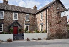
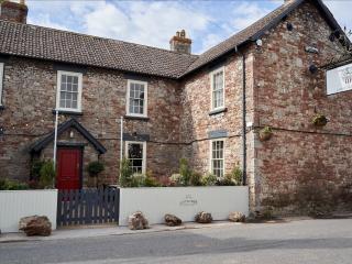
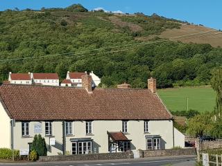
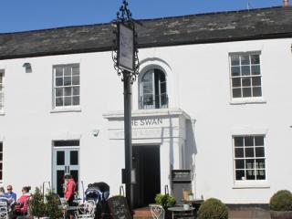
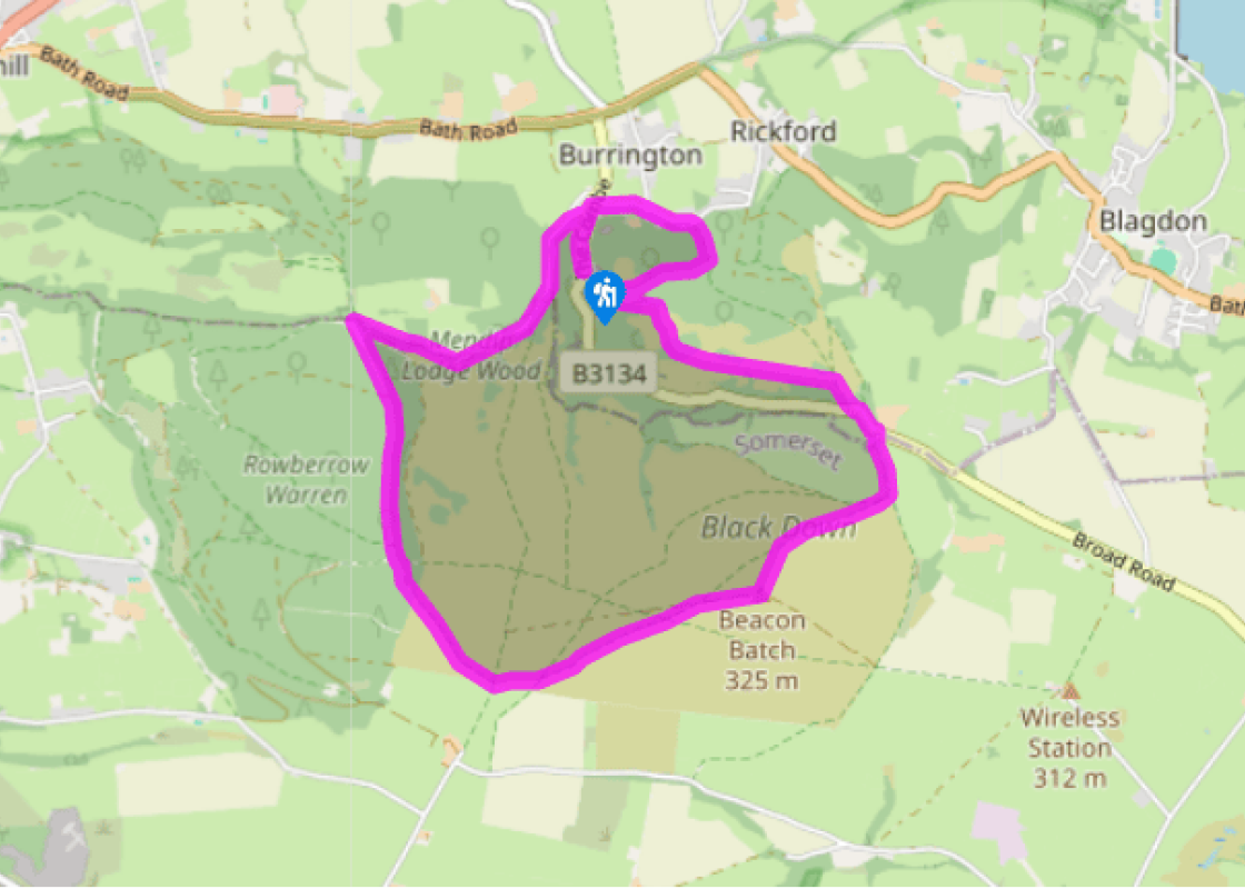
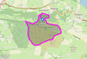
A path leaves the car park by the toilets to The Burrington Inn. Continue briefly on the road then bear off left on a track. Just before a cottage, turn up a steep path marked as a restricted byway. Emerging onto a lane, climb left, shortly passing Link Bungalow. Where the track subsequently swings right, keep forward past a barrier and continue beside a wood. Curve right with the main path alongside a line of swallet holes, later passing through a gate to descend a wooded valley.
After 0.25 mile (400m), at a wayposted junction, turn sharp left onto a broad track. Keep right as it then forks, rising onto Rowberrow Warren towards Black Down. Climb ahead with the main trail for 0.75 mile (1.2km), eventually reaching a crossing track. Go left and immediately right, walking for another 150yds (137m) to a bridle gate on the left. Pass through and bear right on a trod across the open moor, eventually passing a Second World War bunker, part of the Starfish decoy site.
Just beyond the building, go over a track and then bear left, drifting from the right-hand fence. Ignore a later intersection, shortly meeting a waypost at a crossing path, which is distinctly hollowed into the red earth. Follow it right to the summit of Beacon Batch, marked by a trig column perched atop a high cairn.
Bear left (the second exit in roundabout terms), initially descending towards the western end of distant Blagdon Lake. Keep ahead as paths converge near the bottom to leave the open hill through a bridle gate. The onward path drops through scrub, emerging past Ellick House onto the main road.
Cross to a path almost opposite, which parallels the road to a car park. Leave at its far end along a stony track rising through scrub. Ignore a path delving left into the trees and continue onto the open hill. After 200yds (182m), bear left at a fork along the crest above the deepening Burrington Combe. After 0.5 mile (800m) the path curves right, descending across a dip to a limestone outcrop.
Reaching the foot of the outcrop, turn right and keep right again at an immediate fork. The path falls steadily through woodland for almost 0.25 mile (400m), eventually levelling to a waypost. Double back sharp left and continue through the trees, ultimately emerging through a gate onto a narrow lane above Burrington.
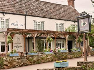
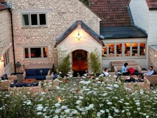
Go left and, at a junction, keep left again, dropping to meet the B3134 at Link. Turn left back to The Burrington Inn and the car park.
Burrington Combe is a classic Mendip gorge, cut through steeply tilted layers of Carboniferous Limestone. Perversely, the rocks on top of Beacon Batch, the highest point of the Mendip Hills, are far older, being Old Red Sandstone. It was laid down during the Devonian Period some 50 million years... earlier, but crumpled upwards during the formation of the Mendip Hills, which were perhaps once as high as Ben Nevis before being eroded by the elements. Impervious to water, the tops retain the rainfall and are covered with gorse, heather and peat, while the valleys below are relatively dry, the water draining through cracks and crevices to run in underground streams. Prehistoric man Lying above the water table, the caves in the combe are now dry and for tens of thousands of years have provided refuges for animals and later, people. In Goatchurch Cavern, the remains of lions, bears, mammoths and hyenas have been found while Aveline's Hole, discovered in 1797 by two men digging for rabbits, gave up flints and human bone fragments of some 20 individuals from over 10,000 years ago, the oldest known cemetery in Britain. Also found were inscribed marks on the walls, a rare example of British Mesolithic rock art. As the walk climbs from Link, the path passes a series of swallets or sink holes in which have been found pottery and bones spanning the Stone Age to the early Iron Age. The surrounding hills are littered with the work of prehistoric man. On the northern point of Burrington Ham overlooking the foot of the gorge is an Iron Age settlement, while the top of Beacon Batch is dotted with several Bronze Age tumuli. Relics of World War II A more recent relic is a Second World War bunker passed on the edge of the Black Down moor. It was one of three control centres for a decoy town known as Starfish, laid out across the hillside to simulate the railway yards and industrial zones of Bristol. Dimmed lights and moving red glows imitated shunting engines, while fires and explosions were designed to mimic buildings already hit by incendiaries and bombs. The intention was to confuse Luftwaffe pilots into thinking they had found their target and thus drop their bombs well away from the city. It was one of over 200 such sites set up during the Blitz and, although no evidence of bombs hitting Beacon Batch has been found, the tactic countrywide is reckoned to have reduced the effect of the blitz on many areas.
Somerset remains rural and unspoiled, and ever popular areas to visit are the limestone and red sandstone Mendip Hills rising to over 1,000 feet, and by complete contrast, to the south and southwest, the flat landscape of the Somerset Levels. Another popular spot, the Quantocks, once the haunt of poets Coleridge and Wordsworth, are noted for their gentle slopes, heather-covered moorland expanses and red deer.
A path leaves the car park by the toilets to The Burrington Inn. Continue briefly on the road then bear off left on a track. Just before a cottage, turn up a steep path marked as a restricted byway. Emerging onto a lane, climb left, shortly passing Link Bungalow. Where the track subsequently swings right, keep forward past a barrier and continue beside a wood. Curve right with the main path alongside a line of swallet holes, later passing through a gate to descend a wooded valley.
1 of 7
After 0.25 mile (400m), at a wayposted junction, turn sharp left onto a broad track. Keep right as it then forks, rising onto Rowberrow Warren towards Black Down. Climb ahead with the main trail for 0.75 mile (1.2km), eventually reaching a crossing track. Go left and immediately right, walking for another 150yds (137m) to a bridle gate on the left. Pass through and bear right on a trod across the open moor, eventually passing a Second World War bunker, part of the Starfish decoy site.
2 of 7
Just beyond the building, go over a track and then bear left, drifting from the right-hand fence. Ignore a later intersection, shortly meeting a waypost at a crossing path, which is distinctly hollowed into the red earth. Follow it right to the summit of Beacon Batch, marked by a trig column perched atop a high cairn.
3 of 7
Bear left (the second exit in roundabout terms), initially descending towards the western end of distant Blagdon Lake. Keep ahead as paths converge near the bottom to leave the open hill through a bridle gate. The onward path drops through scrub, emerging past Ellick House onto the main road.
4 of 7
Cross to a path almost opposite, which parallels the road to a car park. Leave at its far end along a stony track rising through scrub. Ignore a path delving left into the trees and continue onto the open hill. After 200yds (182m), bear left at a fork along the crest above the deepening Burrington Combe. After 0.5 mile (800m) the path curves right, descending across a dip to a limestone outcrop.
5 of 7
Reaching the foot of the outcrop, turn right and keep right again at an immediate fork. The path falls steadily through woodland for almost 0.25 mile (400m), eventually levelling to a waypost. Double back sharp left and continue through the trees, ultimately emerging through a gate onto a narrow lane above Burrington.
6 of 7
Go left and, at a junction, keep left again, dropping to meet the B3134 at Link. Turn left back to The Burrington Inn and the car park.
Burrington Combe is a classic Mendip gorge, cut through steeply tilted layers of Carboniferous Limestone. Perversely, the rocks on top of Beacon Batch, the highest point of the Mendip Hills, are far older, being Old Red Sandstone. It was laid down during the Devonian Period some 50 million years... earlier, but crumpled upwards during the formation of the Mendip Hills, which were perhaps once as high as Ben Nevis before being eroded by the elements. Impervious to water, the tops retain the rainfall and are covered with gorse, heather and peat, while the valleys below are relatively dry, the water draining through cracks and crevices to run in underground streams. Prehistoric man Lying above the water table, the caves in the combe are now dry and for tens of thousands of years have provided refuges for animals and later, people. In Goatchurch Cavern, the remains of lions, bears, mammoths and hyenas have been found while Aveline's Hole, discovered in 1797 by two men digging for rabbits, gave up flints and human bone fragments of some 20 individuals from over 10,000 years ago, the oldest known cemetery in Britain. Also found were inscribed marks on the walls, a rare example of British Mesolithic rock art. As the walk climbs from Link, the path passes a series of swallets or sink holes in which have been found pottery and bones spanning the Stone Age to the early Iron Age. The surrounding hills are littered with the work of prehistoric man. On the northern point of Burrington Ham overlooking the foot of the gorge is an Iron Age settlement, while the top of Beacon Batch is dotted with several Bronze Age tumuli. Relics of World War II A more recent relic is a Second World War bunker passed on the edge of the Black Down moor. It was one of three control centres for a decoy town known as Starfish, laid out across the hillside to simulate the railway yards and industrial zones of Bristol. Dimmed lights and moving red glows imitated shunting engines, while fires and explosions were designed to mimic buildings already hit by incendiaries and bombs. The intention was to confuse Luftwaffe pilots into thinking they had found their target and thus drop their bombs well away from the city. It was one of over 200 such sites set up during the Blitz and, although no evidence of bombs hitting Beacon Batch has been found, the tactic countrywide is reckoned to have reduced the effect of the blitz on many areas.
Somerset remains rural and unspoiled, and ever popular areas to visit are the limestone and red sandstone Mendip Hills rising to over 1,000 feet, and by complete contrast, to the south and southwest, the flat landscape of the Somerset Levels. Another popular spot, the Quantocks, once the haunt of poets Coleridge and Wordsworth, are noted for their gentle slopes, heather-covered moorland expanses and red deer.