"Taking a breather from the hustle and bustle of Southwold in a quiet village amongst the marshes."
Walk directions
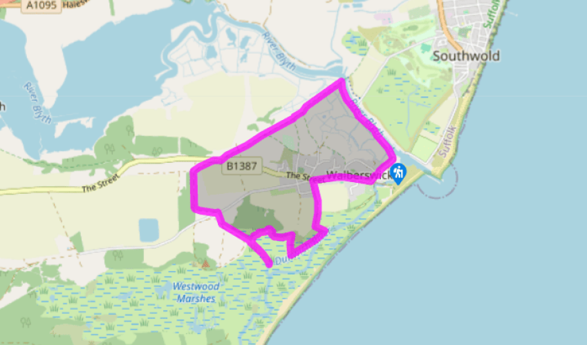
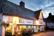
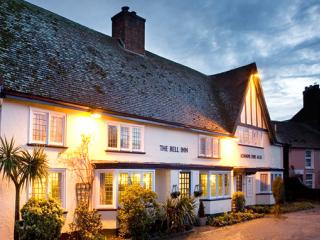
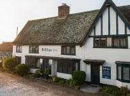
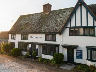
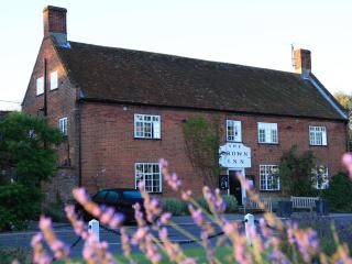
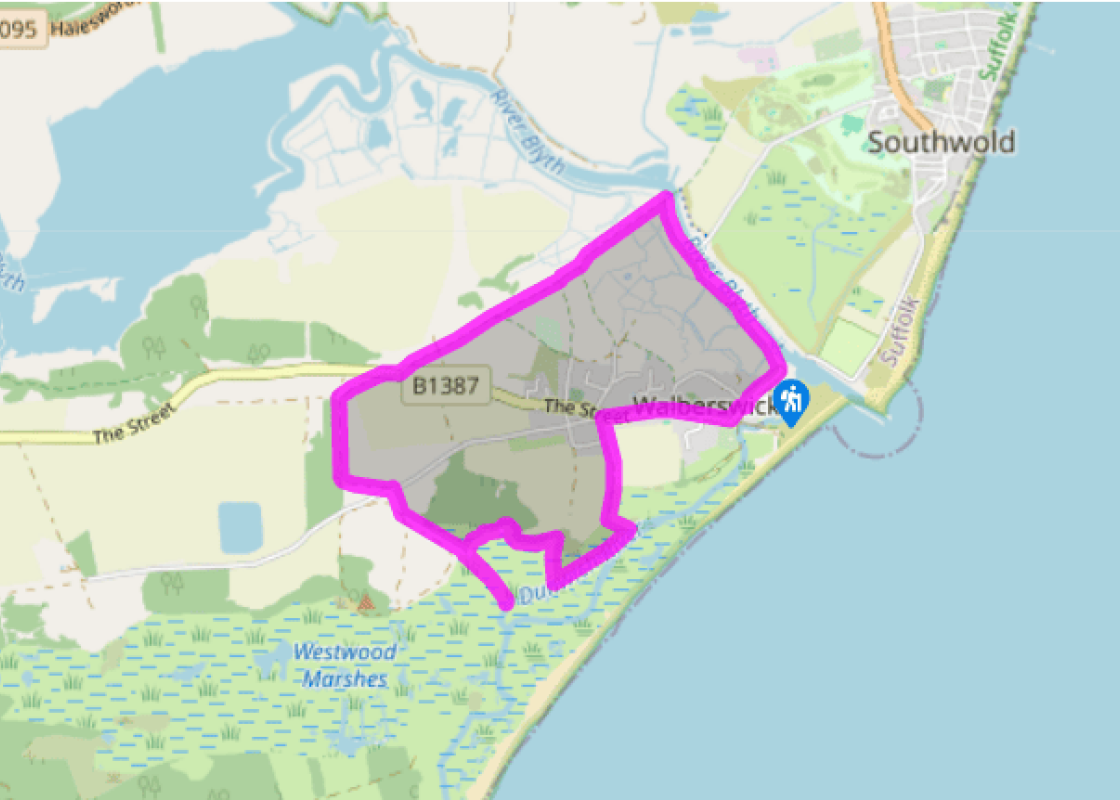
You pass the Bell Inn on your left and come to the village green, where a heritage centre, situated inside an old chapel, features displays on the history of the village. Stay on The Street until it bends right at a junction with a road off to the left. Take this road and then turn immediately left again down the track named Stocks Lane, ignoring the turning off to the right after 100yds (91m). The track forges straight on into a belt of wood and carries on ahead until it comes to a T-junction in front of Corporation Marshes.
Turn right here along the Suffolk Coast Path and follow the grassy track as it climbs slightly among the bracken to give fine views of the sea, the marshes and the giant golf ball of the nuclear reactor dome at Sizewell B, the UK’s only commercial pressurised water reactor. At another T-junction, turn left to continue walking roughly parallel to the sea, passing a WWII air-raid shelter. The path comes out of woods onto a lengthy stretch of boardwalk crossing the reeds of the Old Town Marshes. At the end, turn left and you’ll come shortly to a well-made gravel path.
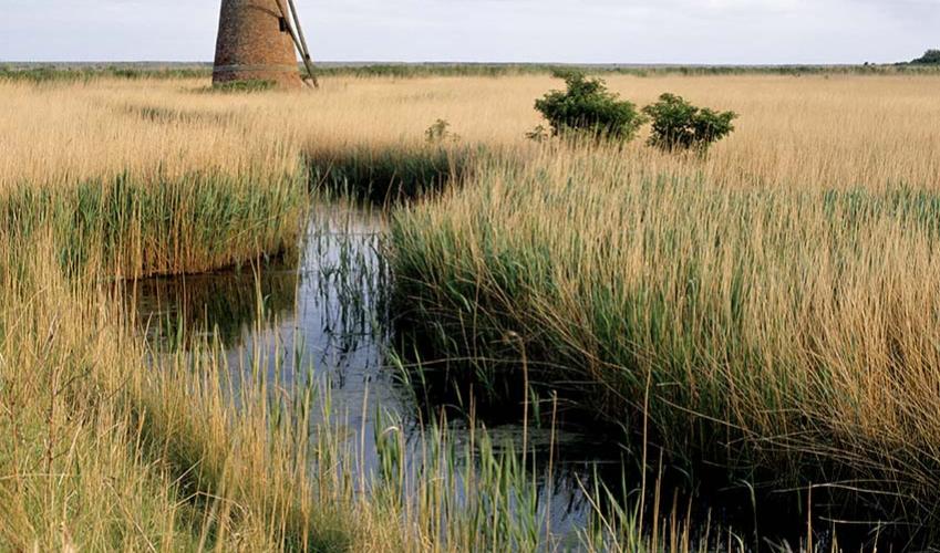
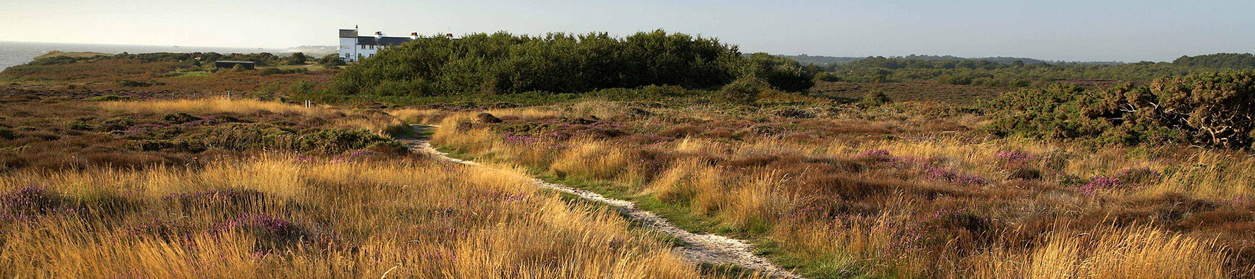
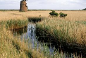
If you fancy a bit of bird spotting, amble down this path to the clearly visible ruined mill and look out over Westwood Marshes to your right. Then retrace your steps to point 3. Otherwise, turn right and keep to this path up East Hill (a slight incline that could only really count as a hill in East Anglia), eschewing all other paths off it until you join a wider farm track, turning right onto it. At a minor road, turn left then immediately right to go through a gate and into the Walberswick National Nature Reserve – an area renowned for its bat population and its internationally important birdlife. Bear half-left along a faint track that passes just to the left of the two solitary bushes. When you reach the trees, follow the path right as it skirts the edge of Sallow Walk Covert. The sandy soil here makes it a very popular spot for rabbits. Fork right at a sign for the Sandlings Walk. Go through a gate shortly afterwards to cross a field with a view of the tower of Walberswick’s St Andrew’s church beyond the trees.
At the B1387 turn right. Cross the road after 100yds (91m) and join a bridleway on the left, passing through a gate and continuing on the Sandlings Walk. Follow the path which is marked by occasional posts as it cuts a purposeful line across Walberswick Common. The War of the Worlds spaceship that you appear to be aiming for is actually a former wind-pumped water tower on Southwold Common which was built in 1886. Go through a gate and take the middle of three paths to pass through a landscape of gorse and heather that swiftly changes to one of bracken, silver birch and rowan trees. Continue straight on, following the Sandlings Walk sign when a path joins from the right.
At a tarmac track turn left, following the bridleway sign, until you reach a bridge over the River Blyth. Do not cross the bridge. Turn right and follow the river back to the car park, passing the ferry dock towards the end.
Walberswick may only be a mile and a brief ferry ride away from Southwold but this little community on the west bank of the River Blyth inhabits a completely different world. The pier, the parades of shops, the ice creams and the tourists are replaced by cottages, a village green, arts and crafts... and, outside the very height of summer, an air of somnolence. With the marshland just outside the village classified an Area of Outstanding Natural Beauty, it’s the perfect place to slip away to if the hurly-burly of Southwold gets too much. Past glories It wasn’t always so. In the 15th century, Walberswick had a thriving harbour with a large fishing fleet. However, when the harbour silted up, the port went into decline. It is only recently that it has discovered a new lease of life as an artists’ colony, though now villagers’ worries do not centre on silt but on whether the existing coastal defences will prove sufficient to prevent a disastrous incursion from the sea. They evidently have no wish for their village to go the same way as nearby Dunwich which was a port similar in size and importance to London until a storm surge swept the greater proportion of the town into the sea in 1286. Its population today is under 100. Evidence of Walberswick’s former prosperity can be clearly witnessed at St Andrew’s Church. Had you passed here in the late 15th century you would have seen one of the grandest parish churches in England, newly completed to replace a smaller church a mile away and with its own chapel of ease. It would have looked very similar to the hugely impressive church still standing at Blythburgh, just a few miles distant. However, only the ruins of Walberswick’s old church remain, the parishioners having been given permission in the 1690s to tear down their church and build one more in keeping with their numbers. The place of worship they built – the current St Andrew’s – nestles modestly in the west end of the south aisle of the former church. Ferry across the Blyth Keep a look out for the landing stage, where a ferryboat shuttles back and forth across the river in summer. At various times this route has been served by a steamboat and a chain ferry, but these days passengers travel in an old-fashioned rowing boat for which a small fee is charged. Two people who never pay a fare are an old man and boy sometimes seen waiting for the last ferry. The spectral couple are the ghosts of a pair who drowned while trying to cross the river.
Suffolk is Constable country, where the county’s crumbling, time-ravaged coastline spreads itself under wide skies to convey a wonderful sense of remoteness and solitude. Highly evocative and atmospheric, this is where rivers wind lazily to the sea and notorious 18th-century smugglers hid from the excise men.
"Taking a breather from the hustle and bustle of Southwold in a quiet village amongst the marshes."
Walk details
2hrs
Difficulty:
Easy
Gradient:
Gentle
Distance:
5 miles (8kms)
Ascent:
92ft (28m)
Walk directions
You pass the Bell Inn on your left and come to the village green, where a heritage centre, situated inside an old chapel, features displays on the history of the village. Stay on The Street until it bends right at a junction with a road off to the left. Take this road and then turn immediately left again down the track named Stocks Lane, ignoring the turning off to the right after 100yds (91m). The track forges straight on into a belt of wood and carries on ahead until it comes to a T-junction in front of Corporation Marshes.
1 of 5
Turn right here along the Suffolk Coast Path and follow the grassy track as it climbs slightly among the bracken to give fine views of the sea, the marshes and the giant golf ball of the nuclear reactor dome at Sizewell B, the UK’s only commercial pressurised water reactor. At another T-junction, turn left to continue walking roughly parallel to the sea, passing a WWII air-raid shelter. The path comes out of woods onto a lengthy stretch of boardwalk crossing the reeds of the Old Town Marshes. At the end, turn left and you’ll come shortly to a well-made gravel path.
2 of 5
If you fancy a bit of bird spotting, amble down this path to the clearly visible ruined mill and look out over Westwood Marshes to your right. Then retrace your steps to point 3. Otherwise, turn right and keep to this path up East Hill (a slight incline that could only really count as a hill in East Anglia), eschewing all other paths off it until you join a wider farm track, turning right onto it. At a minor road, turn left then immediately right to go through a gate and into the Walberswick National Nature Reserve – an area renowned for its bat population and its internationally important birdlife. Bear half-left along a faint track that passes just to the left of the two solitary bushes. When you reach the trees, follow the path right as it skirts the edge of Sallow Walk Covert. The sandy soil here makes it a very popular spot for rabbits. Fork right at a sign for the Sandlings Walk. Go through a gate shortly afterwards to cross a field with a view of the tower of Walberswick’s St Andrew’s church beyond the trees.
3 of 5
At the B1387 turn right. Cross the road after 100yds (91m) and join a bridleway on the left, passing through a gate and continuing on the Sandlings Walk. Follow the path which is marked by occasional posts as it cuts a purposeful line across Walberswick Common. The War of the Worlds spaceship that you appear to be aiming for is actually a former wind-pumped water tower on Southwold Common which was built in 1886. Go through a gate and take the middle of three paths to pass through a landscape of gorse and heather that swiftly changes to one of bracken, silver birch and rowan trees. Continue straight on, following the Sandlings Walk sign when a path joins from the right.
4 of 5
At a tarmac track turn left, following the bridleway sign, until you reach a bridge over the River Blyth. Do not cross the bridge. Turn right and follow the river back to the car park, passing the ferry dock towards the end.
Walberswick may only be a mile and a brief ferry ride away from Southwold but this little community on the west bank of the River Blyth inhabits a completely different world. The pier, the parades of shops, the ice creams and the tourists are replaced by cottages, a village green, arts and crafts... and, outside the very height of summer, an air of somnolence. With the marshland just outside the village classified an Area of Outstanding Natural Beauty, it’s the perfect place to slip away to if the hurly-burly of Southwold gets too much. Past glories It wasn’t always so. In the 15th century, Walberswick had a thriving harbour with a large fishing fleet. However, when the harbour silted up, the port went into decline. It is only recently that it has discovered a new lease of life as an artists’ colony, though now villagers’ worries do not centre on silt but on whether the existing coastal defences will prove sufficient to prevent a disastrous incursion from the sea. They evidently have no wish for their village to go the same way as nearby Dunwich which was a port similar in size and importance to London until a storm surge swept the greater proportion of the town into the sea in 1286. Its population today is under 100. Evidence of Walberswick’s former prosperity can be clearly witnessed at St Andrew’s Church. Had you passed here in the late 15th century you would have seen one of the grandest parish churches in England, newly completed to replace a smaller church a mile away and with its own chapel of ease. It would have looked very similar to the hugely impressive church still standing at Blythburgh, just a few miles distant. However, only the ruins of Walberswick’s old church remain, the parishioners having been given permission in the 1690s to tear down their church and build one more in keeping with their numbers. The place of worship they built – the current St Andrew’s – nestles modestly in the west end of the south aisle of the former church. Ferry across the Blyth Keep a look out for the landing stage, where a ferryboat shuttles back and forth across the river in summer. At various times this route has been served by a steamboat and a chain ferry, but these days passengers travel in an old-fashioned rowing boat for which a small fee is charged. Two people who never pay a fare are an old man and boy sometimes seen waiting for the last ferry. The spectral couple are the ghosts of a pair who drowned while trying to cross the river.
Suffolk is Constable country, where the county’s crumbling, time-ravaged coastline spreads itself under wide skies to convey a wonderful sense of remoteness and solitude. Highly evocative and atmospheric, this is where rivers wind lazily to the sea and notorious 18th-century smugglers hid from the excise men.