"Through the shades of green Sunart to the hillside site of an old lead mine."
Walk directions
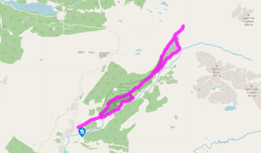
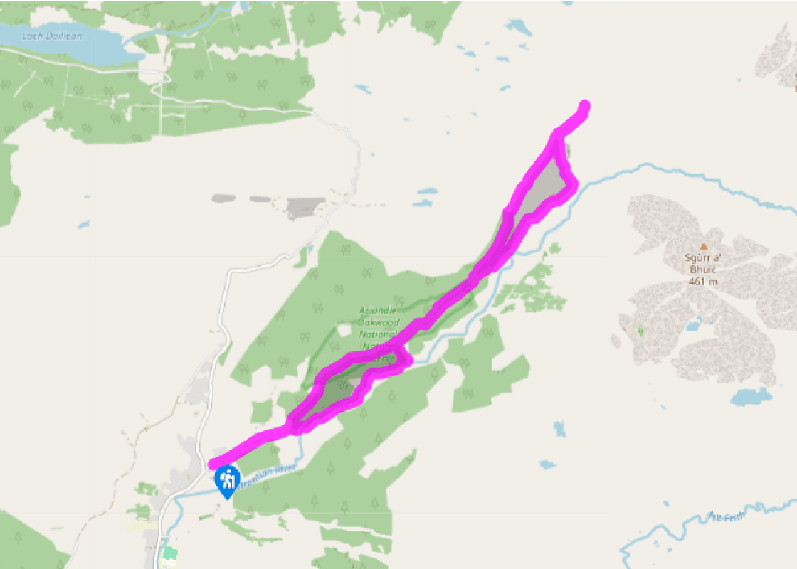
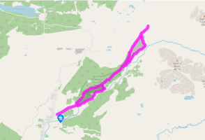
From the car park, continue along the track into oakwoods. After 0.25 miles (400m), ignore a pony path on the right. In another 0.25 miles (400m) a footpath turns off right. It crosses the Strontian River and turns left, upstream. After a pleasant 0.75 miles (1.2km) it recrosses the river, following a duckboard section to rejoin the oakwood track.
Turn right, away from the car park, to reach a high gate in a deer fence. The track immediately forks. Take the downward branch on the right to emerge into open grazings at river level. The track passes through a high gate and ends at a gateway and stream.
Ford the stream onto a rough path. This crosses two more small streams, then forks (small cairn). The lower, right-hand branch continues alongside the Strontian River, but take the left-hand one, which is quite faint. It is marked with small cairns, and you may spot old stone steps in it. From the fork it slants up to the left to a solitary holly tree. Here it turns straight uphill for 50yds (46m), then bends right to slant up as before, passing 200yds (183m) below a bare rock knoll. It steepens slightly to pass below a small crag with three different trees growing out of it – rowan, hazel and oak. With a large stream and waterfalls ahead, the path turns uphill to the brink of the small gorge. Above the waterfalls, the slope eases. Just above, the path reaches the broken dam wall of a former reservoir.
A green path runs across the slope just above. You can turn right on this, heading up beside the stream for about 0.25 miles (400m). Here you will find a spoil heap; a rowan tree on the left marks the entrance to an adit – a mine tunnel running into the hill.
Return along the green path past the earlier junction, with the remains of the Bellsgrove Lead Mines above and below. The path improves into a track, following a stream down a small and slantwise side valley. As this stream turns down to the left, the track contours forward, to cross a wooded stream valley by a high footbridge above a waterfall.
A wide, smooth track continues ahead through a gate. After 0.5 miles (800m) it rejoins the outward route at the edge of the nature reserve. Follow the track back to eventually reach the car park at Ariundle.
What does Strontian have in common with the hamlet of Ytterby in Sweden, with Paris (or Lutetia as the ancient city was called in Latin) and Copenhagen (Hafnia in its latinised form), with the planet Uranus and the Sun (personified as the god Helios in Greek mythology)? Chemical elements – the... fundamental materials of nature. Seventeen of them are named after places, including ytterbium, lutetium, hafnium, uranium, helium – and strontium. Davy the namer A new mineral was discovered in the lead ores of Strontian in 1793, and named strontites. Sir Humphrey Davy visited the mines in 1808 and isolated the new element strontium. Davy is remembered as the inventor of the safety lamp for miners, but he also identified and named the elements calcium, magnesium and chlorine. Strontium (Sr) comes in at number 38 in the list of chemical elements. When heated, its salts burn with a crimson flame, and it is used in making fireworks. The radioactive form strontium 90 does not occur in nature at Strontian or anywhere else, but is produced in nuclear explosions, including the Chernobyl and Fukushima disasters. Because of its chemical similarity to calcium, strontium 90 is absorbed into the bones, where its radioactive breakdown damages the bone marrow. The older New York The lead mines around Strontian, including the Bellsgrove mine reached on this walk, opened in the early 18th century. The villages around them came to be known as New York, after the York Building Company that built them. Some 60 tons of Strontian lead – one tenth of the year's output – went in 1753 to roof the new castle at Inveraray. As the more accessible veins were worked out, these remote mines became uneconomic and eventually closed in 1871. They have been reopened in a small way for the extraction of the mineral barytes. The element barium, a chemical relative of calcium and strontium, is used in drilling muds for the oil industry. Heart of oakwood On its way to the lead mine and the waterfalls of Strontian Glen, the walk passes through the Ariundle National Nature Reserve. In the mountains, the native wild wood of Scotland was the Scots pine. Here on the warm, damp sea coast, the wild wood is of oak. The Ariundle oakwood owes its survival to human interference. The livestock and deer that destroyed Scotland's forest were kept out so that the oaks could be coppiced – harvested on a seven-year cycle. The timber went to the iron smelters of Bonawe on Loch Etive and the bark to the tanners. The wild oakwood is being repaired, with the felling out of commercial spruce. Beneath the dense canopy of leaves, it is carpeted in soft, glossy moss and is rich in ferns and primitive plants called liverworts. While we expect the natural world to be green, it's not often quite so green as Ariundle.
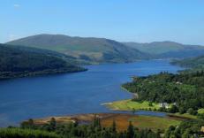
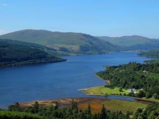
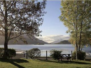
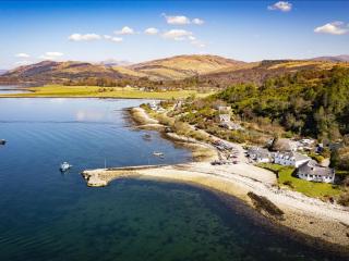
Apart from the Orkneys and the Shetlands, Highland is Scotland’s northernmost county. Probably its most famous feature is the mysterious and evocative Loch Ness, allegedly home to an ancient monster that has embedded itself in the world’s modern mythology, and the region’s tourist industry.
"Through the shades of green Sunart to the hillside site of an old lead mine."
Walk details
3hrs 45min
Difficulty:
Hard
Gradient:
Moderate
Distance:
7 miles (11.3kms)
Ascent:
950ft (290m)
Walk directions
From the car park, continue along the track into oakwoods. After 0.25 miles (400m), ignore a pony path on the right. In another 0.25 miles (400m) a footpath turns off right. It crosses the Strontian River and turns left, upstream. After a pleasant 0.75 miles (1.2km) it recrosses the river, following a duckboard section to rejoin the oakwood track.
1 of 6
Turn right, away from the car park, to reach a high gate in a deer fence. The track immediately forks. Take the downward branch on the right to emerge into open grazings at river level. The track passes through a high gate and ends at a gateway and stream.
2 of 6
Ford the stream onto a rough path. This crosses two more small streams, then forks (small cairn). The lower, right-hand branch continues alongside the Strontian River, but take the left-hand one, which is quite faint. It is marked with small cairns, and you may spot old stone steps in it. From the fork it slants up to the left to a solitary holly tree. Here it turns straight uphill for 50yds (46m), then bends right to slant up as before, passing 200yds (183m) below a bare rock knoll. It steepens slightly to pass below a small crag with three different trees growing out of it – rowan, hazel and oak. With a large stream and waterfalls ahead, the path turns uphill to the brink of the small gorge. Above the waterfalls, the slope eases. Just above, the path reaches the broken dam wall of a former reservoir.
3 of 6
A green path runs across the slope just above. You can turn right on this, heading up beside the stream for about 0.25 miles (400m). Here you will find a spoil heap; a rowan tree on the left marks the entrance to an adit – a mine tunnel running into the hill.
4 of 6
Return along the green path past the earlier junction, with the remains of the Bellsgrove Lead Mines above and below. The path improves into a track, following a stream down a small and slantwise side valley. As this stream turns down to the left, the track contours forward, to cross a wooded stream valley by a high footbridge above a waterfall.
5 of 6
A wide, smooth track continues ahead through a gate. After 0.5 miles (800m) it rejoins the outward route at the edge of the nature reserve. Follow the track back to eventually reach the car park at Ariundle.
What does Strontian have in common with the hamlet of Ytterby in Sweden, with Paris (or Lutetia as the ancient city was called in Latin) and Copenhagen (Hafnia in its latinised form), with the planet Uranus and the Sun (personified as the god Helios in Greek mythology)? Chemical elements – the... fundamental materials of nature. Seventeen of them are named after places, including ytterbium, lutetium, hafnium, uranium, helium – and strontium. Davy the namer A new mineral was discovered in the lead ores of Strontian in 1793, and named strontites. Sir Humphrey Davy visited the mines in 1808 and isolated the new element strontium. Davy is remembered as the inventor of the safety lamp for miners, but he also identified and named the elements calcium, magnesium and chlorine. Strontium (Sr) comes in at number 38 in the list of chemical elements. When heated, its salts burn with a crimson flame, and it is used in making fireworks. The radioactive form strontium 90 does not occur in nature at Strontian or anywhere else, but is produced in nuclear explosions, including the Chernobyl and Fukushima disasters. Because of its chemical similarity to calcium, strontium 90 is absorbed into the bones, where its radioactive breakdown damages the bone marrow. The older New York The lead mines around Strontian, including the Bellsgrove mine reached on this walk, opened in the early 18th century. The villages around them came to be known as New York, after the York Building Company that built them. Some 60 tons of Strontian lead – one tenth of the year's output – went in 1753 to roof the new castle at Inveraray. As the more accessible veins were worked out, these remote mines became uneconomic and eventually closed in 1871. They have been reopened in a small way for the extraction of the mineral barytes. The element barium, a chemical relative of calcium and strontium, is used in drilling muds for the oil industry. Heart of oakwood On its way to the lead mine and the waterfalls of Strontian Glen, the walk passes through the Ariundle National Nature Reserve. In the mountains, the native wild wood of Scotland was the Scots pine. Here on the warm, damp sea coast, the wild wood is of oak. The Ariundle oakwood owes its survival to human interference. The livestock and deer that destroyed Scotland's forest were kept out so that the oaks could be coppiced – harvested on a seven-year cycle. The timber went to the iron smelters of Bonawe on Loch Etive and the bark to the tanners. The wild oakwood is being repaired, with the felling out of commercial spruce. Beneath the dense canopy of leaves, it is carpeted in soft, glossy moss and is rich in ferns and primitive plants called liverworts. While we expect the natural world to be green, it's not often quite so green as Ariundle.
Apart from the Orkneys and the Shetlands, Highland is Scotland’s northernmost county. Probably its most famous feature is the mysterious and evocative Loch Ness, allegedly home to an ancient monster that has embedded itself in the world’s modern mythology, and the region’s tourist industry.