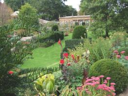

Newlands Holidays
A very smart site with excellent touring facilities, set close to the sea in 23 acres of…

Hardown Hill
5 miles (8kms)
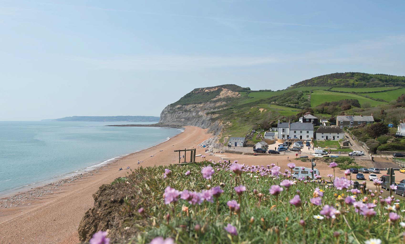
A complex geology, undercut by the sea and lubricated by rainfall seeping through the strata, makes the Jurassic coast either side of Charmouth among the most unstable in England. The area known as Cain’s Folly below Stonebarrow Hill is one of the largest ongoing landslides in the country, and large sections of cliff periodically slump towards the sea. A major slip in 1942 took out a wartime radar station, with subsequent slip events moving the safe line of the coast path ever inland.
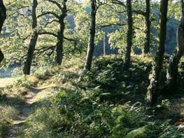
This walk begins from the National Trust information centre on Stonebarrow Hill, housed in a 1950s radar station built in response to the increasing tensions of the Cold War. It follows a rising track that was once the road between Charmouth and Morcombelake, with today’s route taking an easier line along the side of the Char valley. Morcombelake is clustered around Hardown Hill, a prominence whose summit has great views. Like many of Dorset’s hills, it was used as a burial site during the Bronze Age. Among the items unearthed were spearheads, a shield boss, brooches and a knife, artefacts of an early Saxon warrior class.
Capping the hill are beds of greensand, which contain chert, a hard rock akin to flint. Hardown has been quarried since the medieval period, and the overgrown remains of pits and mine adits are scattered around the top. The lumps of chert, called ‘cobs’, were split into building stones.
The hilltop heath is composed mainly of ling and gorse, but includes other heathers and bilberry. Common dodder is prevalent, a vine-like parasitic plant that attaches to the roots of heather and gorse. It appears as a tangle of ruddy-brown stems entwined around its host, producing clusters of tiny pale pink flowers. Lower down you will find heath bedstraw, Devil’s bit scabious, wood sage and masses of bluebells. The hedgerows lining the old tracks can be thick with red campion, foxgloves, herb Robert and vetch. In early summer the flower meadows on Chardown Hill and Stonebarrow attract hundreds of butterflies such as the common blue, pearl-bordered fritillary and marbled white. Among the flowers is the peculiarly named corky-fruited water dropwort, which can grow up to 3ft (1m) high and produces dense pink-tinged flowers. Wildlife to watch for includes the stonechat, whose name describes a song that sounds like two pebbles being knocked together. Kestrels and buzzards patrol the skies, while up on the heath on warm days you could come across an adder or common lizard taking advantage of the sun. At dusk you might spot the rare lesser horeshoe bat, which roosts in the old mine adits.
Climb past the National Trust centre to the top of the car park and continue through a gate at the end along a hedged track towards Chardown Hill and Morcombelake. Beyond the crest, the track gradually falls towards the village, eventually becoming a street meeting the A35.
Walking a short distance to the right will achieve a better sight line to cross the busy road. Go back left past Artwave West Gallery before branching off right towards Whitchurch Canonicorum. Take the first right and then bear left up Pitman’s Lane, continuing around the hill as Taylor’s Lane later joins from the left.
At the high point of the lane, fork off to Ryall along the second of two adjacent paths leaving on the right. After swinging round to the right, watch for a crossing path that climbs very steeply to meet a crossing track. Go right to a junction by a National Trust sign and turn left onto the top of Hardown Hill.
Keep ahead with the main track past a radio mast and over the heathy summit. Beyond a bench, the way begins to fall, opening a grand view to Golden Cap and the coast. The track curves down past old chert workings, shortly descending more steeply to a junction. Take the lane on the left, which leads down to the main road.
Turn left, and then right down Shedbush Lane just before the church. Through a gate at the bottom, continue beside the right-hand hedge down the edge of a field, dropping out at the bottom by Shedbush Farm via the left-hand of the two field gates. Follow the ongoing track to a junction with Muddyford Lane. Turning right, walk to another junction at its end, known locally as Pickaxe Cross.
Following signs to Stonebarrow and Charmouth, take the track ahead, which leads to a farm at Upcot. In the yard, go right, climbing to a junction at the crest of the hill. Keep ahead, shortly passing through a gate to a fork. Bear right with the higher path, which rises around the steep flank of Chardown Hill. Eventually after 0.25 miles (400m), the path passes through a gateway and curves right up to a final gate, exiting onto the top end of the Stonebarrow Hill car park.
Mainly tracks and lanes
Steeply rolling coastal downs
On leads along lanes, near grazing livestock and at Upcot Farm
OS Explorer 116 Lyme Regis & Bridport
Stonebarrow Hill National Trust car park, accessed via steep, narrow lane from eastern end of Charmouth
None on route
Read our tips to look after yourself and the environment when following this walk.
Dorset means rugged varied coastlines and high chalk downlands. Squeezed in among the cliffs and set amid some of Britain’s most beautiful scenery is a chain of picturesque villages and seaside towns. Along the coast you’ll find the Lulworth Ranges, which run from Kimmeridge Bay in the east to Lulworth Cove in the west. Together with a stretch of East Devon, this is Britain’s Jurassic Coast, a UNESCO World Heritage Site and Area of Outstanding Natural Beauty, noted for its layers of shale and numerous fossils embedded in the rock. Among the best-known natural landmarks on this stretch of the Dorset coast is Durdle Door, a rocky arch that has been shaped and sculpted to perfection by the elements. The whole area has the unmistakable stamp of prehistory.
Away from Dorset’s magical coastline lies a landscape with a very different character and atmosphere, but one that is no less appealing. Here, winding, hedge-lined country lanes lead beneath lush, green hilltops to snug, sleepy villages hidden from view and the wider world. The people of Dorset are justifiably proud of the achievements of Thomas Hardy, its most famous son, and much of the county is immortalised in his writing.
Discover more than 15,000 professionally rated places to stay, eat and visit from across the UK and Ireland.
Choose a place to stay safe in the knowledge that it has been expertly assessed by trained assessors.
Search by location or the type of place you're visiting to find your next ideal holiday experience.
Read our articles, city guides and recommended things to do for inspiration. We're here to help you explore the UK.