Bury Ditches hill fort

NEAREST LOCATION

Sunnyhill

RECOMMENDED BY
DISTANCE

5.4 miles (8.7kms)

ASCENT
804ft (245m)
TIME
2hrs
GRADIENT
DIFFICULTY
Medium
STARTING POINT
SO334839

About the walk

It is impossible to spend much time in Shropshire without becoming aware of its hill-forts. The southwest corner of the county is particularly rich in these impressive monuments. The same is true of the neighbouring parts of Herefordshire and Montgomeryshire, so that there is hardly a hilltop in the area that doesn't provide a view of several forts. Some were built in the late Bronze Age, but most were constructed in the Iron Age; that is, after around 600 bc. They were built in stages, often over very long periods of time, possibly as much as 1,000 years in some cases.

Following the Lie of the Land

This walk takes you to one of the finest of all, Bury Ditches, which crowns Sunnyhill (also called Tangley Hill), above the valleys of the Clun and the Kemp. Elliptical in shape, Bury Ditches is an example of a contour fort, which means that its Celtic builders took advantage of the topography, making the ramparts follow the natural contours of the landscape. Such construction wasn't always possible, but where the natural slope was sufficiently steep, it enabled them to get away with fewer ramparts, or even none at all. On the relatively gentle northern slope of Sunnyhill summit, three substantial ramparts were considered necessary, but there are only two on the south side, below which the slope plunges down steeply.

It's possible for archaeologists to tell approximately when a fort was built by the design of the ramparts. Bury Ditches' construction suggests a date somewhere around the 6th century bc (early Iron Age). All the local community would have been involved, including young children. Trees would have to be cleared first, using axes made from flint, stone or bronze, and then the ramparts and ditches would be dug with deer-antler picks and shovels made from the shoulder blades of cattle. Earth, turf and stones would have been carried away in hand baskets. It's a task of almost unimaginable proportions, especially when you consider that Bury Ditches covers a larger area than most hamlets and many villages in Shropshire.

It was thought that hill-forts were used only for defence at times of danger, but excavation and other archaeological techniques have revealed that the larger ones were more like defended villages, where people lived and farmed. Did they also appreciate the view, in purely aesthetic terms? The immense panorama visible from the top of Bury Ditches is one of the finest in Shropshire, but it was lost for several years, after the Forestry Commission planted conifers there. A timely gale in 1978 flattened many of the alien trees and the Commission took the hint, removing the rest.

Walk directions

From the car park at Sunnyhill, walk back to the lane and turn left. Descend through the hamlet of Lower Down. There's access to a Norman motte in a field on the left. Continue down to Brockton. Pass Shropshire Highland Seeds, and some more large sheds, then a stone barn. Turn left immediately on a track (Blue Remembered Hills Bridleway).

Follow the track, climbing steadily at first. It can be a bit overgrown as it descends, but mostly it's just harmless cow-parsley. At a junction go left down an attractive slab by track, then turn right to meet a lane at the hamlet of Acton.

Turn left, pass to the right of a triangular green and join a path running past White House Farm. Frequent waymarkers guide you past the house, across a small field, then left over a stile and along the right-hand edge of another field.

Cross a footbridge and continue straight across the ensuing field towards a building at the far side. Cross a stile in the hedge, turn left for a few paces on a track which passes by a house called Brookbatch. Swing right to a path rising into woodland. When the track eventually bends to the left, go forward over a stile instead and continue climbing.

Emerging on to a track, turn left and pass a pond. Cross a defunct cattle grid and leave the track, turning right on a footpath, scarred by motorbikes, through beechwoods. At an obvious crossroads of tracks turn left, then bear right on a forestry track by a Shropshire Way sign. Ignore all side turnings then keep left at a fork where there are distant views through the trees on the right.

Climb gently for a while. Where the main track levels off and starts to descend, turn right. The path leads to Bury Ditches hill-fort, then cuts through a gap in the ramparts and crosses the interior. At a waymarked post, a path branches left to allow a visit to the summit, with its toposcope and incredible views. Bear right to return to the main path and turn left to follow it to the car park.

Additional information
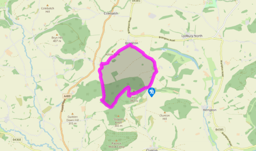
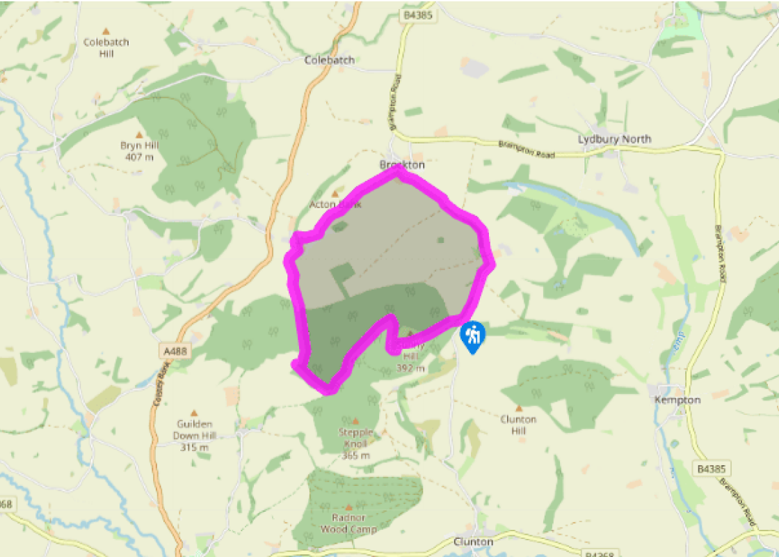
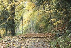
Field and woodland paths, lengthy stretch of quiet lane
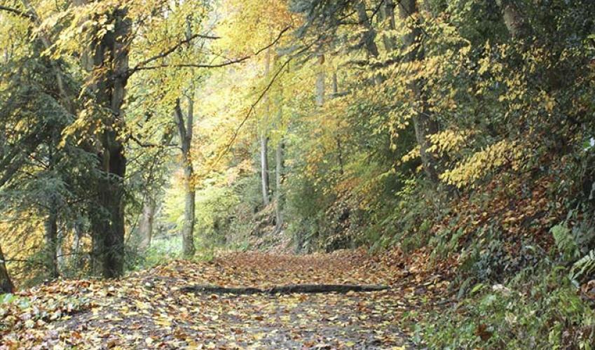
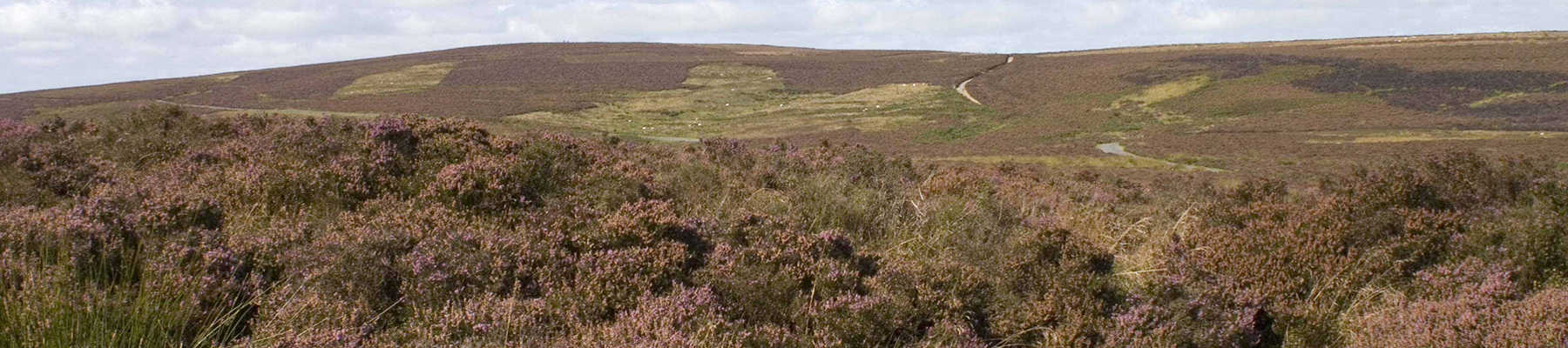
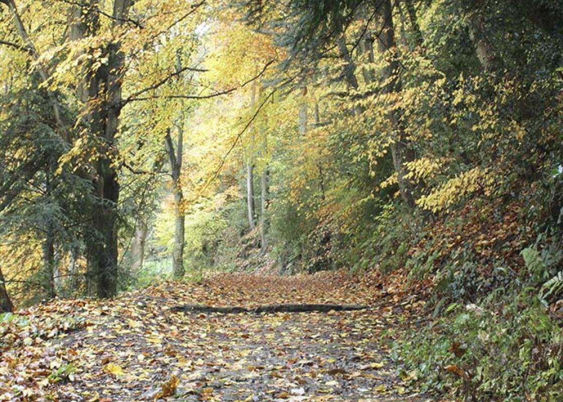
Hilltop woodland and plantation, mixed farmland in valley

Off lead for much of way, but not round Acton
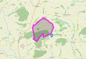
OS Explorer 216 Welshpool & Montgomery

Forestry Commission car park at Bury Ditches off minor road north from Clunton

None on route

Been on this walk?

Send us photos or a comment about this route.

Know a good walk?

Share your route with us.

WALKING IN SAFETY

Read our tips to look after yourself and the environment when following this walk.

Find out more

About the area

Discover Shropshire

Perhaps nowhere else in England will you find a county so deeply rural and with so much variety as Shropshire. Choose a clear day, climb to the top of The Wrekin, and look down on that ‘land of lost content’ so wistfully evoked by A E Housman. Peer through your binoculars and trace the course of Britain’s longest river as the Severn sweeps through the county, from the Breidden Hills to Wyre Forest, slicing Shropshire in two. To the north is a patchwork of dairy fields, hedgerows, copses and crops, broken at intervals by rugged sandstone ridges such as Grinshill or Nesscliffe, and dissected by a complex network of canals.

Spilling over the border into neighbouring Cheshire and North Wales is the unique meres and mosses country, with serenely smooth lakes glinting silver, interspersed with russet-tinged expanses of alder-fringed peat bog, where only the cry of the curlew disturbs the silence. South of the Severn lies the Shropshire Hills AONB. It’s only when you walk Wenlock Edge that you fully discover what a magical place it is – glorious woods and unexpectedly steep slopes plunge to innumerable secret valleys, meadows, streams and farmhouses, all tucked away, invisible from the outside world. 

Why choose Rated Trips?

Your trusted guide to rated places across the UK
icon example
The best coverage

Discover more than 15,000 professionally rated places to stay, eat and visit from across the UK and Ireland.

icon example
Quality assured

Choose a place to stay safe in the knowledge that it has been expertly assessed by trained assessors.

icon example
Plan your next trip

Search by location or the type of place you're visiting to find your next ideal holiday experience.

icon example
Travel inspiration

Read our articles, city guides and recommended things to do for inspiration. We're here to help you explore the UK.