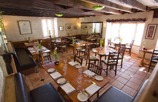
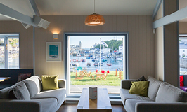

Sea Acres Holiday Park
If you’re looking for the opportunity to relax, Sea Acres is the perfect choice. Spend carefree…

Cadgwith
4.5 miles (7.2kms)
The rock of the Lizard Peninsula is fascinating by name and by nature. Its geological label, serpentinite, is a word that fails to slither quite so easily off the tongue as does its popular usage, ‘serpentine’. The name derives from the sinuous veins of green, red, yellow and white that wriggle across the dark green or brownish-red surface of the rock. The best-quality serpentine is easily carved and shaped, and can be polished to a beautiful sheen. You can admire the rock on this route, where the stiles are built of serpentine slabs – their surfaces are mirror-smooth and slippery from use (take care when wet).
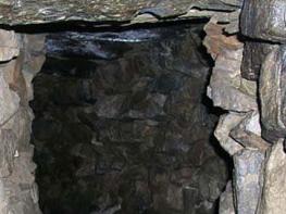
In the 19th century, serpentine furnishings were the height of fashion and the material was used for shopfronts and fireplaces. The industry declined during the 1890s, due partly to the vagaries of fashion but also because the colourful, curdled stone of the Lizard decayed quickly in polluted urban atmospheres. Cheaper, more resilient marble from Italy and Spain began to dominate the market. Today serpentine craftsmen still operate in workshops on the Lizard, and you can buy serpentine souvenirs at Lizard village. At Carleon Cove, halfway through the walk, you’ll find the ruins of waterwheels, steam engines, machine shops, storehouses and a factory where serpentine was processed until the early 1890s. Today Carleon Cove is in the care of the National Trust.
From Carleon Cove the coast path is followed to Cadgwith, an archetypal Cornish fishing village. Cadgwith has a number of thatched cottages, a rare sight in windy Cornwall. The village still supports a fleet of fishing boats, launched from the shingle beach, and is given an enduring identity because of it. Cadgwith’s profile rose even higher after the BBC TV series The Fisherman’s Apprentice (2012), featuring the marine biologist Monty Halls learning the hard skills of small-boat fishing, was filmed here. Beyond the village the coast path leads to the Devil’s Frying Pan, a vast gulf in the cliffs caused by the collapse of a section of coast that had been undermined by the sea.
Leave the car park by the far end following the ‘Footpath to Village’ sign. Immediately after turn left along a grassy ride just below the car park, and follow this along to a stile. Bear right off the track to continue through a gate and then on into woodland. Turn right at a lane, and cross a stream, then on the corner, go up a track and continue along to the main road at Ruan Minor.
Go left and, just beyond the shop, turn left down a surfaced path. Rejoin the main road by a thatched cottage (there are toilets just before the road). Cross diagonally right, then go down a lane next to a school and pass the Church of St Ruan.
In 0.3 miles (500m), just past an old mill and a bridge, go right at a T-junction to reach the car park at Poltesco. Here you may drop into the National Trust’s free exhibition in a converted barn about the local area and the serpentine factory. From the far end of the car park go through a gate and follow a track. Go right at a junction. Look out for a bench covered in bas relief pilchards.
Go over a wooden bridge above the cove, then turn left at a T-junction and again turn left in 0.25 miles (400m) where the path branches. Go through a kissing gate and continue along the cliff-edge path (with care in places) to Cadgwith. At the road, turn left and pass through the commercial hub of the village.
Follow a narrow path next to a house called ‘Long Loft’. By a house gateway, go left up a surfaced path, signposted ‘Devil’s Frying Pan’. At an open area turn left, pass Townplace Cottage, cross a meadow and reach the Devil’s Frying Pan itself. Continue along the coast path for about 0.4 miles (0.6km).
At a junction, by a little stream and stile, follow a path inland and uphill to a T-junction with a rough track. Turn left and then, at a public lane, go left again and after 0.5 miles (800m) turn through a wooden field gate signed ‘St Grada’s Church’ and along a track to St Grade’s (or St Grada’s) church. Follow a short path along the outside of the church wall to reach a wooden stile.
Follow the left-hand field-edge behind the church to the left corner, then go over a stone stile. Go straight across the field and then cross a wooden stile onto a road. St Ruan’s Well is opposite diagonally left. Turn right for 200yds (183m), then branch off right between stone pillars to return to the car park.
Very good, occasionally rocky in places; rocks may be slippery when wet
Landlocked lanes and woodland tracks, coastal footpaths high above the sea
May be off lead on coastal paths, but keep under strict control on field paths
OS Explorer 103 The Lizard
Cadgwith car park, about 350yds (320m) from Cadgwith (busy in summer)
Ruan Minor and Cadgwith
Read our tips to look after yourself and the environment when following this walk.
Cornwall has just about everything – wild moorland landscapes, glorious river valley scenery, picturesque villages and miles of breathtaking coastline. With more than 80 surfing spots, there are plenty of sporting enthusiasts who also make their way here to enjoy wave-surfing, kite surfing and blokarting.
In recent years, new or restored visitor attractions have attracted even more visitors to the region; the Eden Project is famous for its giant geodesic domes housing exotic plants from different parts of the globe, while nearby the Lost Gardens of Heligan has impressive kitchen gardens and a wildlife hide.
Discover more than 15,000 professionally rated places to stay, eat and visit from across the UK and Ireland.
Choose a place to stay safe in the knowledge that it has been expertly assessed by trained assessors.
Search by location or the type of place you're visiting to find your next ideal holiday experience.
Read our articles, city guides and recommended things to do for inspiration. We're here to help you explore the UK.