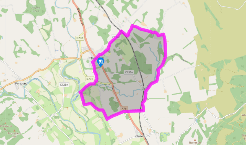
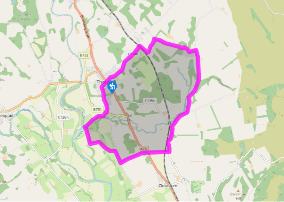
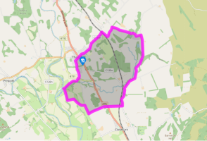
From the Cross at Thornhill, head east along East Morton Street. Follow the road as it bends right and passes Wallace Hall School. Shortly after the school you will see Morton Cemetery on the right. It is worth a look in here at the ancient graves, including one from 1660 with an interesting inscription.
When the road comes to a railway bridge, go under it and turn immediately right past the old station and continue on this winding country road, passing the entrance to Kirkland of Morton on the left. The road winds on through pasturelands and hillsides, passing through the hamlet of Gatelawbridge to a T-junction.
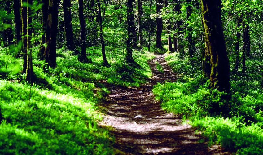
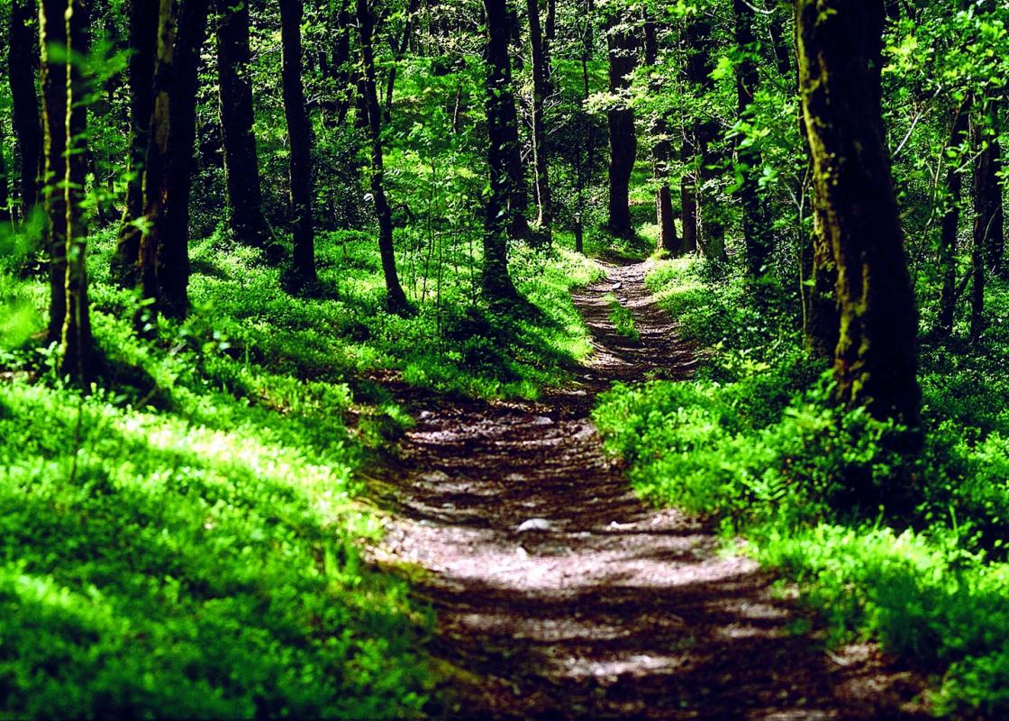
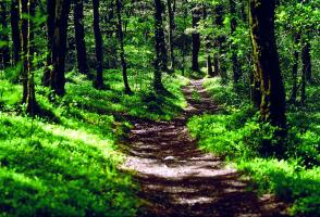
Turn right onto another country road and look out for a finger post on the right pointing to Crichope Linn on the left. Go up some steps and through a gate onto a rough track towards the Crichope Burn. Follow this through woodland above the burn. This path can be very muddy in places and this part of the walk is not advisable in very wet weather.
The path soon enters a woody gorge, which then becomes a rocky gorge. If weather permits and the paths are not too wet continue on the path up to the waterfalls, which are quite spectacular in a miniature way. Look out for the names and initials carved in the rock, dating from the 19th century. Retrace your steps to the road and go on to the village of Cample.
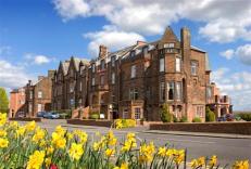
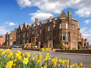
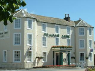
There is a shortcut here, if you want to take it, through the golf course back to the start. To complete the walk, continue straight on the road through Cample and take the next right to the A76. Cross the road and follow a narrow country road past Trigony House Hotel to a T-junction.
Go right and you shortly come to a farm track at a house on the left. Go through the gate here and follow the track to Dalgarnock Cemetery. It is well worth stopping at this old cemetery to see the graves of the Covenanters and the stories on the stones. Look particularly for the grave of Thomas Harkness, who survived a death sentence and 28 years on the run to die in his bed at 72.
From the cemetery continue on the farm road, passing through Kirkbog Farm steading, over a bridge, turning right and then left to emerge at a staggered junction. Cross the road and continue north, passing the hospital and the fire station, turning right at an old church, which is now a shop. This brings you back to the cross.
Crichope Linn became a popular visitor attraction as far back as the early 19th century following the publication of Sir Walter Scott’s novel Old Mortality. Like many of his other novels it featured characters and locations based in Dumfriesshire. Scott used the gorge as the base for his fanatical... Covenanter, Balfour of Burley, the assassin of Archbishop Sharp. The spot near the top, where the gorge narrows, is known as ‘Burley’s Leap’. The gorge was used in fact as well in fiction, as a hiding place by local Covenanters fleeing from persecution in the 17th century. The Covenanters were a group of Scottish Presbyterians who formed together to resist attempts by the Crown to impose a prayer book and bishops on the Scottish church. Unlike the Church of England the Presbyterian Church is a democratic organisation that elects its elders and this form of church governance was eventually enshrined in the Act of Union of 1707 when Scotland and England joined together. The General Assembly in Glasgow in 1638 had abolished the Episcopal system and kicked out the bishops. But after the restoration of the monarchy in 1660 the Catholic Charles II ordered his Privy Council to restore this system of church governance in Scotland. Church ministers had to accept this situation or lose their living. Many abandoned their parishes while others were ejected. They took to the fields and hills to hold services and their congregations followed them, leaving the churches with their government-appointed preachers empty. This mostly happened in the southwest of Scotland and government forces were drafted in to stamp it out. They were under the command of James Graham of Claverhouse, 1st Viscount Dundee, known as ‘Bonnie Dundee’ to his supporters or ‘Bluidy Clavers’ to the Covenanters. During those ‘Killing Times’ his troops were authorised to execute on the spot anyone who would not swear loyalty to the King, was caught bearing arms or preaching at Conventicles. Armed uprisings followed and were swiftly put down but still the Covenanters continued to rebel. Large numbers renounced allegiance to the Crown and the torture and killing continued. It did not end until the Act of Settlement in 1690 following the accession of the Protestant William II (King Billy) in 1688. Scott’s novel was based on Robert Paterson who was the tenant of Gatelawbridge Quarry not far from Crichope Linn. But he left there and spent the later years of his life living in poverty and travelling the country on horseback, carving stones and inscriptions for the unmarked graves of the Covenanting martyrs.
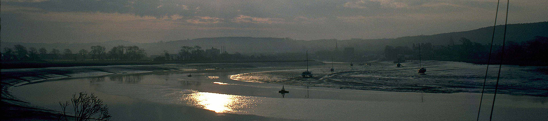
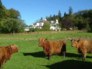
Dumfries and Galloway is a wonderfully undiscovered corner of Scotland – a romantic land of wooded glens, high hills and exposed moorland, haunted by its colourful past and the ghosts of those who fell in fierce and bloody battles. Heading west from Gretna Green you soon reach Dumfries, straddling the River Nith, where you may see red-breasted mergansers in summer.
From the Cross at Thornhill, head east along East Morton Street. Follow the road as it bends right and passes Wallace Hall School. Shortly after the school you will see Morton Cemetery on the right. It is worth a look in here at the ancient graves, including one from 1660 with an interesting inscription.
1 of 7
When the road comes to a railway bridge, go under it and turn immediately right past the old station and continue on this winding country road, passing the entrance to Kirkland of Morton on the left. The road winds on through pasturelands and hillsides, passing through the hamlet of Gatelawbridge to a T-junction.
2 of 7
Turn right onto another country road and look out for a finger post on the right pointing to Crichope Linn on the left. Go up some steps and through a gate onto a rough track towards the Crichope Burn. Follow this through woodland above the burn. This path can be very muddy in places and this part of the walk is not advisable in very wet weather.
3 of 7
The path soon enters a woody gorge, which then becomes a rocky gorge. If weather permits and the paths are not too wet continue on the path up to the waterfalls, which are quite spectacular in a miniature way. Look out for the names and initials carved in the rock, dating from the 19th century. Retrace your steps to the road and go on to the village of Cample.
4 of 7
There is a shortcut here, if you want to take it, through the golf course back to the start. To complete the walk, continue straight on the road through Cample and take the next right to the A76. Cross the road and follow a narrow country road past Trigony House Hotel to a T-junction.
5 of 7
Go right and you shortly come to a farm track at a house on the left. Go through the gate here and follow the track to Dalgarnock Cemetery. It is well worth stopping at this old cemetery to see the graves of the Covenanters and the stories on the stones. Look particularly for the grave of Thomas Harkness, who survived a death sentence and 28 years on the run to die in his bed at 72.
6 of 7
From the cemetery continue on the farm road, passing through Kirkbog Farm steading, over a bridge, turning right and then left to emerge at a staggered junction. Cross the road and continue north, passing the hospital and the fire station, turning right at an old church, which is now a shop. This brings you back to the cross.
Crichope Linn became a popular visitor attraction as far back as the early 19th century following the publication of Sir Walter Scott’s novel Old Mortality. Like many of his other novels it featured characters and locations based in Dumfriesshire. Scott used the gorge as the base for his fanatical... Covenanter, Balfour of Burley, the assassin of Archbishop Sharp. The spot near the top, where the gorge narrows, is known as ‘Burley’s Leap’. The gorge was used in fact as well in fiction, as a hiding place by local Covenanters fleeing from persecution in the 17th century. The Covenanters were a group of Scottish Presbyterians who formed together to resist attempts by the Crown to impose a prayer book and bishops on the Scottish church. Unlike the Church of England the Presbyterian Church is a democratic organisation that elects its elders and this form of church governance was eventually enshrined in the Act of Union of 1707 when Scotland and England joined together. The General Assembly in Glasgow in 1638 had abolished the Episcopal system and kicked out the bishops. But after the restoration of the monarchy in 1660 the Catholic Charles II ordered his Privy Council to restore this system of church governance in Scotland. Church ministers had to accept this situation or lose their living. Many abandoned their parishes while others were ejected. They took to the fields and hills to hold services and their congregations followed them, leaving the churches with their government-appointed preachers empty. This mostly happened in the southwest of Scotland and government forces were drafted in to stamp it out. They were under the command of James Graham of Claverhouse, 1st Viscount Dundee, known as ‘Bonnie Dundee’ to his supporters or ‘Bluidy Clavers’ to the Covenanters. During those ‘Killing Times’ his troops were authorised to execute on the spot anyone who would not swear loyalty to the King, was caught bearing arms or preaching at Conventicles. Armed uprisings followed and were swiftly put down but still the Covenanters continued to rebel. Large numbers renounced allegiance to the Crown and the torture and killing continued. It did not end until the Act of Settlement in 1690 following the accession of the Protestant William II (King Billy) in 1688. Scott’s novel was based on Robert Paterson who was the tenant of Gatelawbridge Quarry not far from Crichope Linn. But he left there and spent the later years of his life living in poverty and travelling the country on horseback, carving stones and inscriptions for the unmarked graves of the Covenanting martyrs.
Dumfries and Galloway is a wonderfully undiscovered corner of Scotland – a romantic land of wooded glens, high hills and exposed moorland, haunted by its colourful past and the ghosts of those who fell in fierce and bloody battles. Heading west from Gretna Green you soon reach Dumfries, straddling the River Nith, where you may see red-breasted mergansers in summer.